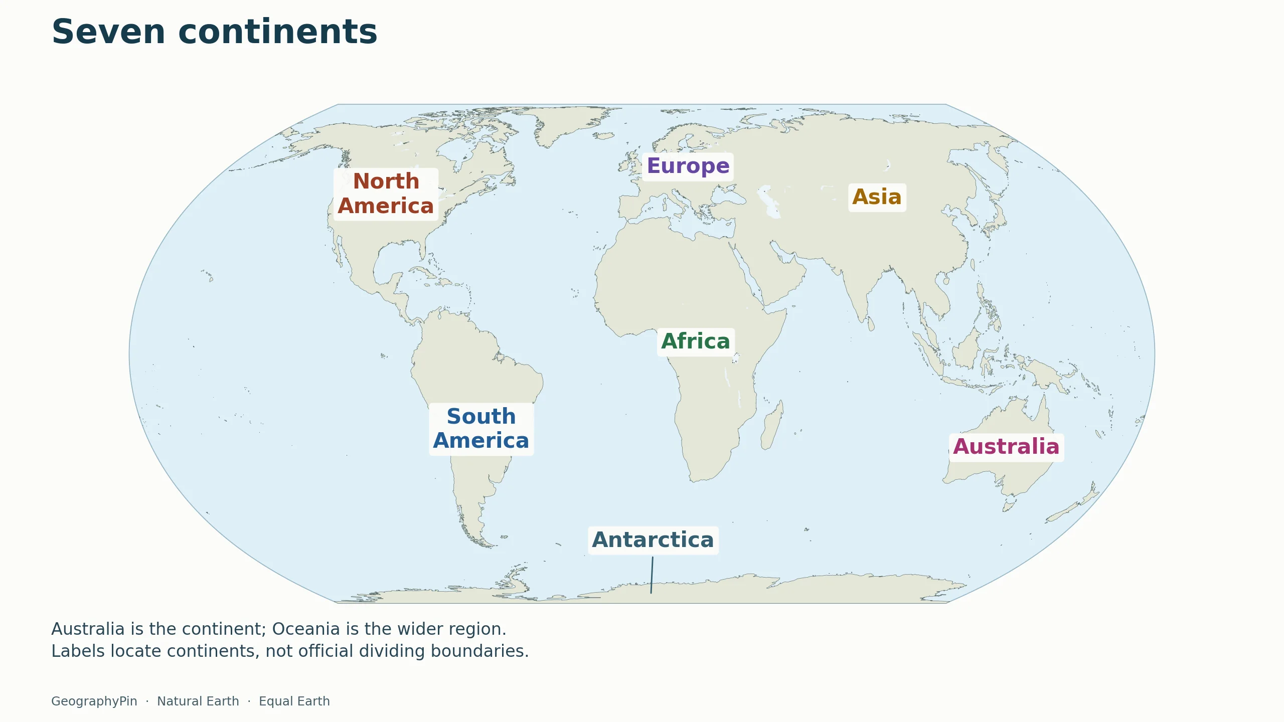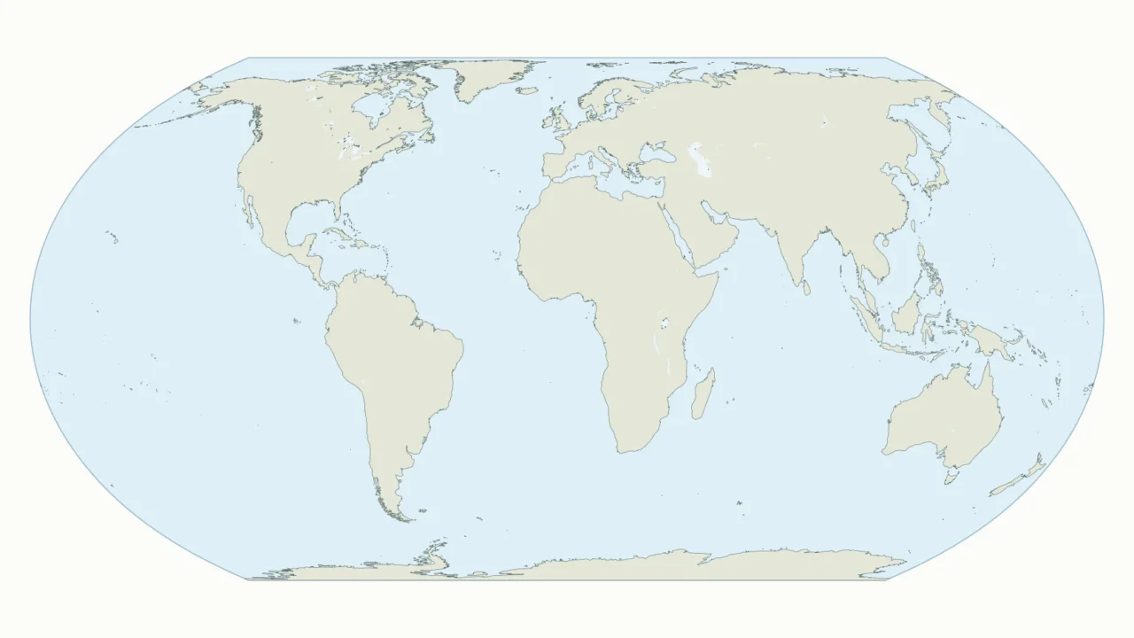
Locate the seven continents, then use the blank map to test yourself. Downloadable files are provided below the answer map.
The seven continents shown here are North America, South America, Europe, Africa, Asia, Australia and Antarctica. Use the labeled map as an answer key and the blank version for practice. Australia is the continent label; Oceania is a wider region. Exact continental divisions depend on the convention used.
1. Labeled World Map of the Seven Continents
Maps fit the screen by default. Select 2× or 4× for details, swipe or scroll within the map, and choose Fit / Reset to restore the full view. Full-size map and PDF links also work without the zoom controls.

Choose the labeled PDF as an answer sheet and the blank PDF for practice. The article uses lightweight WebP images. On phones, large numbered markers match the key immediately below the map; the printable answer sheet uses full names.
These are continent-location maps, not maps of countries, tectonic plates or claims to territory. The world’s coastlines remain visible without national borders. The neutral land fill is deliberate: coloring an entire country as one continent would misrepresent places that cross conventional continental divisions.
How to use this article: Follow the printing steps, check which continent model is used, or clarify Australia and Oceania.
2. Where Are the Seven Continents?
Use this text key alongside the map. The numbering follows the phone image, not a ranking by size.
- North America: the northern part of the Americas, west of the Atlantic Ocean and east of the Pacific.
- South America: the landmass extending south from the narrow connection with North America, between the Atlantic and Pacific.
- Europe: the western part of the continuous Eurasian landmass.
- Africa: south of Europe, with the Atlantic to its west and Indian Ocean to its east.
- Asia: the large eastern part of Eurasia, north of the Indian Ocean and west of the Pacific.
- Australia: the continental landmass southeast of Asia, between the Indian and Pacific oceans.
- Antarctica: the land surrounding the South Pole, along the bottom of this map.
Greenland belongs geographically with North America, although its political relationship is with Denmark. Japan is normally grouped with Asia. Small islands are difficult to identify on a whole-world image, so this map should not be used to infer the continent or statistical region of every island.
3. Blank World Map to Print
Printing the worksheet
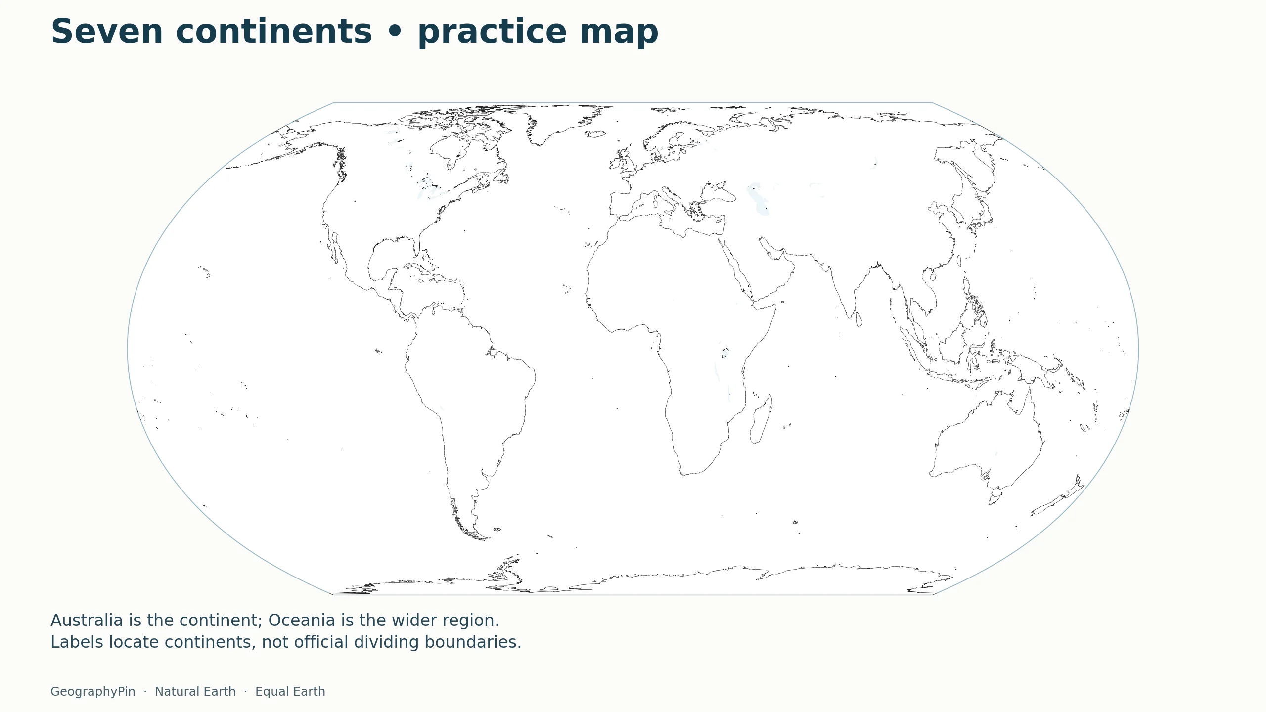
Open the blank PDF, choose landscape orientation, and select “Fit” or “Fit to printable area” in your print dialog. Preview the page before printing so the outline and source credit stay inside the margins. Printer behavior varies; the file is not a guarantee of identical margins on every device.
Write the seven names directly on the large landmasses. On Europe, where space is tight, write the name outside the coastline and add a short pointer. Compare your result with the labeled map, then check whether you have mistaken Greenland for a continent or omitted Antarctica.
For a classroom exercise, ask a learner to locate a continent from an ocean clue before revealing the answer map. For example, the continental landmass south of Asia and between the Indian and Pacific oceans is Australia. Use a separate country-level resource if the task is to memorize national borders.
4. Seven Continents, Six Continents and Oceania
Which model does this map use?
The seven names here follow the familiar school model that separates Europe from Asia and North America from South America. Other conventions combine Europe and Asia as Eurasia or combine the Americas. Those choices change the count, not the coastline. For the full explanation, see our continents guide.
Australia is not a synonym for every Pacific island
This map labels Australia as the continent. Oceania is the wider regional term that also encompasses Pacific island groups. The United Nations M49 system uses Oceania as a statistical region, but it is not an official ruling on how many physical continents Earth has. A map labeled “Oceania” may therefore be using a regional scheme rather than the same seven-landmass model shown here.
5. How to Read Continental Boundaries
A coastline separates land from water; it does not settle every continent boundary. Europe and Asia are joined, and their division is conventional. The North America–South America connection and the Africa–Asia connection also need an agreed definition when assigning exact boundaries.
For that reason, this resource does not trace a supposedly universal border through Eurasia or assign transcontinental countries a single continent color. The labels are location aids. For more detail about continent boundaries, read the linked continents explainer.
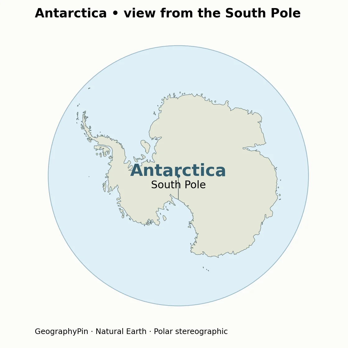
The Equal Earth projection preserves relative areas, but no flat world map preserves every shape, distance and direction. Use a globe or an appropriate regional map for measuring a route. Antarctica is strongly flattened near the bottom; it is not a long, narrow strip in reality.
Frequently Asked Questions
Can I compare continent sizes using the blank map?
The Equal Earth projection preserves relative areas, so it is more suitable for broad area comparisons than for measuring distances. The worksheet does not give numerical continent areas or define every island’s membership; use a consistently defined area dataset for a ranking.
What Did We Learn Today?
A useful continent map makes its model clear before asking readers to memorize labels. This resource uses seven continents, distinguishes Australia from the wider Oceania region, and pairs a labeled answer map with a matching blank worksheet. The polar view also shows why Antarctica’s flattened world-map appearance should not be mistaken for its actual shape.
Sources & Data Notes
Maps prepared from retained Natural Earth 1:50m version 5.1.1 polygon data, with country borders dissolved and geometry generalized for web display. Equal Earth projection. Label positions identify broad regions, not legal boundaries. The basemap data are public domain; no third-party map image has been copied. Major inland waters use Natural Earth 1:10m lake polygons, subtracted from the displayed land. Lake jurisdiction is not represented as dry land.