A river bend is not just a line drawn across a map. Water, sediment and the channel’s banks continually influence one another. Where the banks can move, that interaction can shift an entire channel across its floodplain.
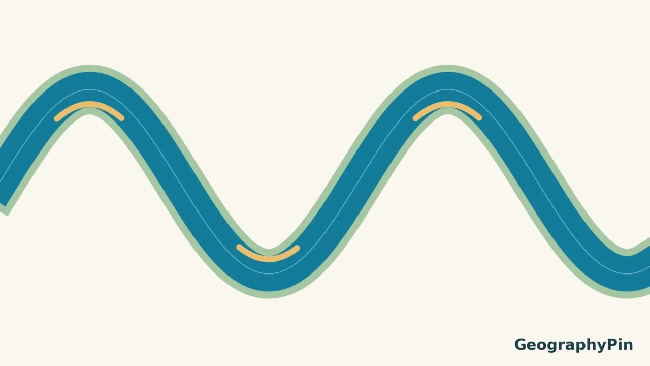
Rivers meander because flow, sediment transport and bank erosion interact unevenly across a channel. In a typical bend, erosion removes material from the outer bank while deposition builds an inner-bank point bar. Repeated changes can enlarge or move the bend. Bank strength, sediment supply and valley conditions influence how freely this happens.
Read the bend: Start with the two-bank diagram, look below the surface, or follow the route to an oxbow lake.
1. How a small bend can become a meander
A meander is a bend in a river channel. A meandering reach follows a winding route rather than a straight line down its valley. The classic moving meanders discussed here occur in alluvial settings, where the river flows through sediment it can erode and redeposit.
There is no need for a single large obstacle to explain every bend. Differences in channel shape, bed material and bank resistance can make flow uneven. Once curvature develops, the bend changes the flow pattern; that altered flow changes the bed and banks in turn. This feedback helps explain why a winding channel can keep changing even after the original irregularity is no longer obvious.
Gravity still carries the water downhill. A sideways bend does not mean the river is flowing uphill or choosing a route. The relevant slope is the changing elevation along the watercourse, not whether its blue line looks straight from above.
Not all winding rivers migrate readily. Bedrock, resistant banks and bank-protection works can restrict movement. The diagrams below explain a common alluvial pattern rather than a universal blueprint for every curved channel. For the wider setting, see our guide to water erosion landforms.
2. Cut bank versus point bar
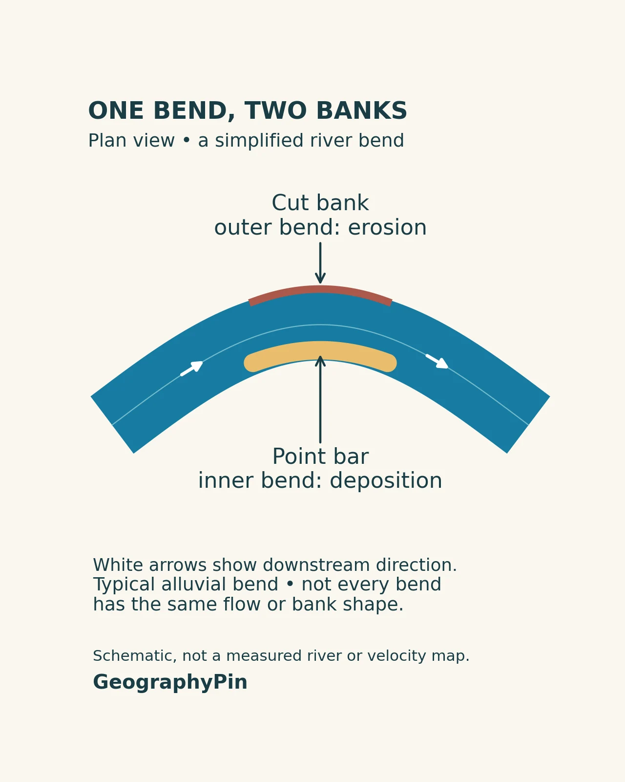
The cut bank is the eroding outer bank. Flow can scour its base, removing support so that material above slumps or collapses into the channel. A steep edge, fresh bank failure or exposed roots can reveal that erosion, although none tells you the future retreat rate on its own.
The point bar is the deposit on the inside of the bend. Sand or gravel can accumulate where transport conditions allow sediment to settle. It is not a separate type of river: it is a landform within the same channel that is eroding the opposite bank.
That pairing is the central idea. A bend can gain land on one side while losing land on the other. Deposition is therefore not evidence that the entire river has stopped eroding. Nor does erosion at a cut bank mean the whole channel must deepen or widen uniformly.
The National Park Service describes both sideways movement and downstream migration of bends. Real changes need not preserve the exact width or shape seen in a textbook drawing. Neighboring bends, floods and local bank conditions can make the pattern much less tidy.
3. What happens below the surface?
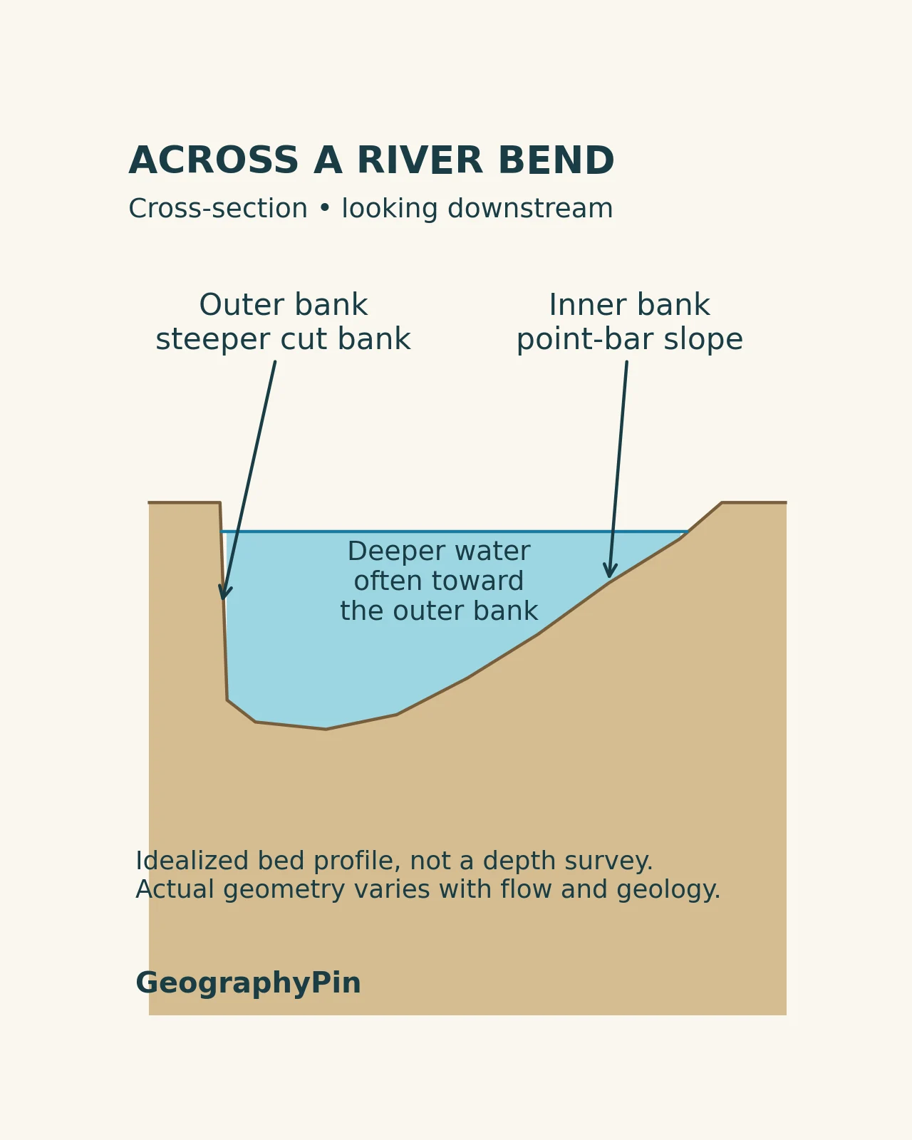
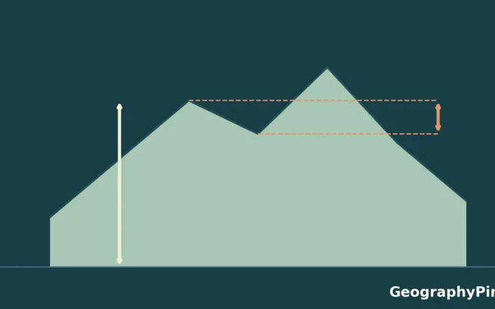
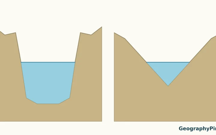
Looking across a typical bend, the inner point bar slopes into the channel while a deeper part often lies toward the outer bank. That uneven bed helps organize the current. Water is not moving as a flat sheet with the same speed everywhere.
“Faster outside, slower inside” is a useful first approximation, not a complete velocity map. The position of stronger flow changes along a bend and with water level. Channel geometry, turbulence and sediment movement interact in three dimensions. You cannot locate a safe crossing or predict swimming conditions simply by identifying the inside curve.
The thalweg is the line following the deepest part of a channel, not a definition of the fastest water at every instant. A depth pattern and a velocity pattern are related, but they are not interchangeable measurements.
4. From migrating bend to oxbow lake
As a loop develops, the strip of land separating two nearby parts of the channel can narrow. If a new route cuts across that neck, flow can bypass the long bend. Sediment may then block the former connections, leaving an oxbow lake in the abandoned channel.
A shortcut and a fully isolated lake are not necessarily the same stage. An abandoned bend may retain a connection for a time, and high water can reconnect floodplain waters. Oxbows can later accumulate sediment and organic matter, become wetlands or leave curved channel scars. Not every bend reaches the same final form.
For a real example, the USGS Earthshots sequence of Bolivia’s Mamoré River shows changing bends and abandoned loops in satellite imagery. The sequence is more informative than a single image because it distinguishes active movement from an old channel shape.
There is no universal countdown from bend to lake. A cutoff can change the route abruptly, while the buildup to it and the later filling of an abandoned channel follow different timescales. Avoid assigning a fixed number of years to the process without evidence for that particular river.
5. How to read a meander without overinterpreting it
- Identify the active channel first. Curved ponds and vegetation traces may mark older routes.
- Find the inside and outside of each bend. They switch sides as the channel curves in the opposite direction.
- Compare multiple dates. A single aerial photograph cannot establish a migration rate.
- Check water level. A bar exposed at low flow may disappear beneath water at a higher stage.
- Separate a landform from a forecast. A cut bank indicates erosion, not the date of its next collapse.
Keep back from undercut or unstable banks. A point bar is not automatically a safe place either: water levels, current and access can change. For measurements rather than landform interpretation, use our explanation of river stage and flow readings.
Frequently Asked Questions
Are all curved rivers actively meandering?
No. A curved course can be constrained by bedrock or other resistant boundaries. The common cut-bank and point-bar model is most useful for an alluvial river whose banks and sediment can move.
Is a point bar the same thing as a river island?
No. A point bar forms along the inside of a bend and is associated with that bank. An island is surrounded by channels or water; its origin and behavior need separate interpretation.
Can an oxbow lake disappear?
Yes. Sediment and organic material can fill an abandoned channel, while changing water supply can alter its extent. A wetland or curved scar may remain where open water once occupied the loop.
What Did We Learn Today?
A meander is the visible result of interactions among flow, sediment and banks. Outer-bank erosion and inner-bank deposition can move a channel, while a cutoff may leave an oxbow. The useful lesson is not that every bend behaves identically, but that a river’s route can be an evolving landform rather than a permanent line.
Sources & Data Notes
The original GeographyPin diagrams illustrate typical alluvial-bend geometry. They are not mapped locations, measured profiles or flow simulations. No migration rate, channel depth or fixed oxbow-formation timescale is inferred from them.