
What Are The Continents?
Continents are Earth’s major landmasses—typically defined as Africa, Antarctica, Asia, Europe, North America, Oceania (or Australia), and South America—though models vary between five, six, and seven depending on geographic, cultural, and tectonic criteria.
Definition of a Continent
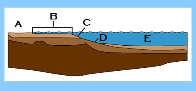
A continent is one of Earth’s large, continuous landmasses, defined by geographic, geological, and cultural factors. Geographically, it refers to a stretch of land largely above sea level, bounded by oceans or major waterways. Geologically, continents rest on the continental crust—a thick, buoyant layer (over 30 km thick) distinct from denser oceanic crust.
Continents often extend underwater across the continental shelf, which slopes gently into the deep ocean. Key characteristics include:
- Crust composition: Light, granitic continental crust vs. dense basaltic oceanic crust.
- Elevation & extent: Areas above sea level, including nearby shelf islands.
- Tectonic setting: Landmasses anchored on major plates (e.g., African, Eurasian).
- Biogeographic zones: Distinct ecosystems and species distributions.
These criteria explain why Greenland is part of North America and why Zealandia—a mostly submerged mass—challenges traditional definitions.
The 7-Continent Model
The most widely taught model in many U.S. schools and Western textbooks identifies seven continents:
| Continent | Area (sq mi / km²) | Population (2025 est.) | Key Feature |
|---|---|---|---|
| Africa | 11,730,000 / 30,370,000 | 1.4 billion | Diverse biomes, Nile River basin |
| Antarctica | 5,400,000 / 14,000,000 | ~1,000 (researchers) | Ice sheet covering 98% |
| Asia | 17,212,000 / 44,579,000 | 4.7 billion | World’s largest and most populous |
| Europe | 3,930,000 / 10,180,000 | 748 million | Cultural and historical crossroads |
| North America | 9,540,000 / 24,709,000 | 600 million | Rocky Mountains, Great Plains |
| Oceania | 3,300,000 / 8,530,000 | 43 million | Australia, Pacific islands |
| South America | 6,890,000 / 17,840,000 | 430 million | Amazon Basin, Andes Cordillera |
Alternative Models
Regional and cultural variations yield other counts:
- Six continents: Merges Europe and Asia into Eurasia.
- Five continents: Treats Americas as one, plus Africa, Eurasia, Australia, Antarctica.
- Four continents: Afro‑Eurasia, America, Antarctica, Australia (used in some educational frameworks).
| Model | Continents |
|---|---|
| 5-Continent | Africa, Eurasia, America, Antarctica, Australia |
| 6-Continent | Africa, Eurasia, North America, South America, Antarctica, Australia |
| 4-Continent | Afro‑Eurasia, America, Antarctica, Australia |
Plate Tectonics & Boundaries
Continental edges correspond roughly to tectonic plate boundaries: the Eurasian, African, North American, South American, Pacific, Australian, and Antarctic plates. Plate interactions—divergent (rifts), convergent (mountain building), and transform (faults)—continually reshape continental outlines. The East African Rift exemplifies an active zone where Africa may eventually split.
Cultural & Educational Perspectives
The way continents are taught and perceived varies worldwide, reflecting history, culture, and curricula:
- U.S. & UK: Seven-continent model (Africa, Antarctica, Asia, Europe, North America, South America, Australia).
- Russia & post-Soviet states: Six-continent view merges Europe and Asia into Eurasia.
- Japan: Four-continent schema (Asia, Europe, Africa, Oceania) in some textbooks.
- China: Six-continent approach combining North and South America in national curricula.
These regional variations illustrate how educational traditions influence our mental maps and highlight the importance of clarity when discussing global regions.
Why It Matters
- Education: Standardized models build solid geographic literacy for students worldwide.
- Geopolitics: Continental definitions guide regional alliances (EU, AU, ASEAN).
- Science & Environment: Understanding tectonic boundaries informs earthquake and climate research.
- Data & Mapping: Governments and businesses rely on clear continental divisions for analysis and planning.
Consistent, well-defined continents ensure we share a common geographic vocabulary—from classrooms to international agreements.
FAQ
Why is Europe not a continent geologically?
Europe sits on the Eurasian plate, making it a subregion rather than a separate tectonic unit.
How many continents are there?
Depending on the model, five to seven continents are recognized.
What defines the boundary between Europe and Asia?
Conventionally the Ural Mountains, Ural River, Caspian Sea, and Caucasus define the Europe‑Asia divide.
Is Zealandia a continent?
Zealandia is a mostly submerged continental mass; some geologists consider it a hidden continent.
Can continents change?
Yes—plate tectonics drive drift, collision, and rifting over millions of years, altering continental shapes.
What Did We Learn Today?
- “Continent” definitions vary: geographic, geological, cultural models co-exist.
- Seven-continent model dominates US education; six- and five-continent views are also valid globally.
- Plate tectonics underpins continental boundaries and future shifts.
- Cultural traditions and curricula shape how continents are taught worldwide.
- Clear continental definitions aid in education, geopolitics, and environmental science.