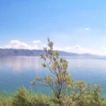
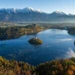
Lake Sevan is Armenia’s largest lake. In Gegharkunik Province, it is much larger than the country’s other lakes and reservoirs. Armenia also has high-mountain lakes, forest lakes and artificial reservoirs that provide habitats, water storage and places for recreation.
Largest lake: Sevan, with a reported surface area of 494 sq mi (1,279 km²) in 2017 Hydromet data.
Lake Arpi: 8.53 sq mi (22.1 km²) average water surface in its 2011 Ramsar information sheet. The separate catchment covers 84.94 sq mi (220 km²).
Lake Lessing: 4.0 acres (0.016 km²) in the Hrazdan basin-management plan adopted in 2022.
Reading the figures: The list includes lakes and reservoirs. Areas come from different dates and methods; they are not a single current survey.
Notable Lakes and Reservoirs
Lake Sevan dominates Armenia’s lake landscape and is an important freshwater resource. The Sevan basin-management summary distinguishes the lake itself from its much larger drainage basin. Changes in water level mean its surface area and water volume must be tied to a reference date.
Lake Arpi in Shirak was a natural lake before it was enlarged into a reservoir in 1950. Its Ramsar information sheet describes both its irrigation role and its importance for wetland birds. Akhurian and Spandaryan are reservoirs, while Yerevan Lake is an artificial reservoir within the capital. The smaller lakes in the list include mountain waters such as Akna, Kari and Lessing, and the Tavush lakes Parz and Gosh.
List of Lakes and Reservoirs
This is a selected list, not a complete inventory or a strict size ranking. The area column refers to water surface, with the source and date explained beside each entry. One hectare equals about 2.47 acres (0.01 km²). Where the evidence conflicts or does not establish a reliable area, that limitation is shown.
On a small screen, swipe the table sideways to see all four columns.
| Name | Water-surface area (U.S. units first) | Province or location | Source and date |
|---|---|---|---|
| Lake Sevan Սևանա լիճ, Sevana lich | 494 sq mi (1,279 km²) | Gegharkunik | Hydromet data for 2017, reported in the 2020 Sevan basin-plan summary. Source. |
| Lake Arpi Արփի լիճ, Arp’i lich | 8.53 sq mi (22.1 km²; reported average) | Shirak | Average water surface in the Ramsar sheet updated in 2011; not the 84.94 sq mi (220 km²) catchment. Source. |
| Akhurian Reservoir Ախուրյանի ջրամբար, Akhuryani jrambar | 16.14 sq mi (41.8 km²) | Shirak, Armenia / Kars, Türkiye | Water surface reported by operator Jrar; page and measurement undated. A shared border reservoir. Source. |
| Spandaryan Reservoir Սպանդարյանի ջրամբար, Spandaryani jrambar | 3.96 sq mi (10.25 km²; reference figure) | Syunik | FAO 2011 inventory: 1,025 ha. Other publications give about 4.17 sq mi (10.8 km²); reference water levels are not specified. Source. |
| Yerevan Lake Երևանյան լիճ, Yerevanyan lich | About 0.25 sq mi (0.65 km²) | Yerevan | Artificial reservoir. Area reported in a 2016 research paper; area-survey date unspecified. Source. |
| Lake Akna Ակնա, Akna | 122.6 acres (0.496 km²) | Kotayk | Digital lake-floor model from July–August 2018 fieldwork, published in 2019. Source. |
| Lake Kari Քարի լիճ, K’ari lich | 36.1 acres (0.146 km²) | Aragatsotn | Digital lake-floor model from July–August 2018 fieldwork, published in 2019. Source. |
| Lake Ayger Այղր, Ayghr | Current area unverified | Armavir | Historical reference: 29.7 acres (12 ha; 0.12 km²) in FAO 2011, under the spelling Aygehr; survey date unspecified. Source. |
| Lake Lessing Լեսինգ | 4.0 acres (0.016 km²) | Aragatsotn | 1.60 ha in Table 9 of the Hrazdan management plan adopted in 2022; survey date unspecified. Source. |
| Lake Parz Պարզ լիճ, Parz lich | Reported figures differ | Tavush | FAO 2004 reports 7.4 acres (3 ha; 0.03 km²); FAO 2011 reports 2.5 acres (1 ha; 0.01 km²). Neither gives a survey date. Source. |
| Lake Gosh Գոշ լիճ, Gosh lich | Not verified | Tavush | A 2007 field-study abstract confirms the province but does not establish a water-surface area. Source. |
How to Read Lake-Area Figures
Water surface, catchment and protected area measure different things. Water surface is the area covered by the lake. A catchment is the surrounding land that drains toward it. A national park or Ramsar wetland can include shores, marshes and other land. Arpi’s 84.94 sq mi (220 km²) catchment should therefore not be listed as its lake surface.
A publication date is not necessarily a survey date. The Akna and Kari values come from a study with fieldwork explicitly dated to July–August 2018. For several other entries, the source reports an area without identifying when or at what water level it was measured. The table retains those qualifications instead of treating every figure as current.
Different sources can disagree. The 2022 Hrazdan plan lists 197.7 acres (0.8 km²) for Akna and 74.1 acres (0.3 km²) for Kari; the 2018 field study gives the smaller, explicitly dated values used here. Spandaryan and Parz also have differing published figures. Those differences alone do not prove that a lake has shrunk, and this list does not calculate a national water-volume total from incompatible reference dates.
Frequently Asked Questions
What is the largest lake in Armenia?
Lake Sevan in Gegharkunik Province. The 2020 Sevan basin-plan summary reports a surface area of 494 sq mi (1,279 km²) using Hydromet data for 2017. That is a dated figure, not a live measurement.
How large are Lake Arpi and its catchment?
Its 2011 Ramsar sheet reports an average water surface of 8.53 sq mi (22.1 km²), often rounded to about 8.5 sq mi (22 km²). The 84.94 sq mi (220 km²) figure describes its catchment, not the lake surface.
How large is Lake Lessing?
The Hrazdan management plan adopted in 2022 lists 4.0 acres (1.60 hectares; 0.016 km²), at an elevation of about 10,500 feet (3,200 meters). The plan does not specify the survey date.
Are all the entries natural lakes?
No. The list includes artificial reservoirs such as Akhurian, Spandaryan and Yerevan Lake. Arpi is a natural lake that was enlarged by a dam.
Why do some entries have no single area figure?
The reviewed sources do not establish a reliable current area for every lake. Ayger has a historical reference figure, Parz has conflicting published estimates, and the verified Gosh source establishes its location but not its area. A missing figure is more useful than unsupported precision.
What Did We Learn Today?
Armenia’s lakes range from large Lake Sevan to small mountain and forest lakes, alongside reservoirs used for water storage. Arpi’s lake surface and catchment are different measurements, and Lessing covers a small fraction of a square kilometre. When comparing sizes, check the source, date and meaning of the area rather than assuming every published number describes today’s water surface.
Sources & Data Notes
Checked November 9, 2026. Areas are published water-surface figures, not measurements made on a common date. Reservoir surfaces vary with operating levels. Source publication years are given separately from observation years where known; an unspecified survey date remains unspecified.
- EUWI+, Sevan basin-management thematic summary, May 2020, p. 7: 494 sq mi (1,279 km²) lake surface using 2017 Hydromet data.
- Armenia’s Lake Arpi Ramsar information sheet, updated May 13, 2011, section 16: 8.53 sq mi (22.1 km²) reported average water surface and a separate catchment of 22,000 hectares.
- Jrar, Akhurian Reservoir: 16.14 sq mi (41.8 km²) water surface, undated. Türkiye’s DSİ operating-facilities inventory places Arpaçay Dam in Kars. These identify the Armenian and Turkish sides of the border reservoir.
- FAO, Review of Fisheries and Aquaculture Development Potentials in Armenia, 2011, tables A2.5 and A2.7, printed pp. 32–34: historical lake and reservoir areas and locations. Spandaryan is listed at 1,025 ha and Aygehr at 12 ha. A 2022 Spandaryan fish study, p. 7, repeats 4.17 sq mi (10.8 km²) from an earlier reference and notes fluctuating surface area; it is not a new area survey.
- Minasyan, phytoplankton study of Yerevan Lake, 2016, p. 79: about 0.25 sq mi (0.65 km²). Its biological sampling dates do not establish when the area was measured.
- Sapelko and colleagues, First Multy-Proxy Studies of High-Mountain Lakes in Armenia, 2019, Table 2, p. 280: Akna 122.6 acres (0.496 km²) and Kari 36.1 acres (0.146 km²) from the 2018 fieldwork and digital lake-floor models.
- Armenian Government Decision N 1909-N, December 8, 2022, Hrazdan 2022–2027 management plan, Table 9: Lessing’s 1.60 ha surface and 3,200 m elevation. Adoption date is not a measurement date.
- FAO Armenia fishery country profile, December 2004, p. 3: Parz 3 ha. The 2011 FAO review gives 1 ha instead; the difference is unresolved here.
- Simonyan, Andreasyan and Mikayelyan, 2007 IAHR field-study abstract: Lake Gosh’s Tavush location. No verified surface-area figure is supplied by that abstract.