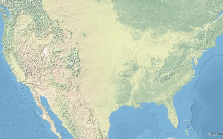
Akhurian Reservoir is an artificial reservoir on the Akhurian River along the border between Armenia and Türkiye (Turkey). It is known as Arpaçay Baraj Gölü in Turkish and Ախուրյանի ջրամբար in Armenian. Its main purpose is to store water for irrigation on both sides of the border.
Armenia’s irrigation operator Jrar lists a water surface of about 16.1 square miles (41.8 km²) and a storage capacity of about 425,600 acre-feet (525 million m³). These are reference figures, not a live water-level reading. Other published area and construction dates differ, as explained below.
Size and Storage Capacity
Jrar’s 41.8 km² water-surface figure is also reported as 4,180 hectares in FAO’s 2011 review of Armenia’s fisheries and aquaculture. A 2020 scientific chapter instead gives about 20.8 square miles (54 km²). Neither source supplies the measurement date or water level needed to explain the difference, so it should not be treated as evidence that the reservoir has shrunk.
The 525 million m³ capacity is supported by both Jrar’s facility profile and the 1973 construction agreement. Capacity is different from the amount of water actually stored on a particular day. Official monitoring bulletins report changing stored volumes separately from this capacity figure.
Foundation and Development
The reservoir developed through Soviet–Turkish cooperation. A joint commission recorded a dam-construction protocol on April 25, 1963. A separate cooperation agreement was signed in Ankara on October 26, 1973, providing for the dam and reservoir, shared costs and joint operation. The signature date should not be confused with the agreement’s entry into force.
Jrar dates the start of reservoir operations to 1980. A DSİ-sourced table in the Turkish Parliament’s January 30, 1990 record lists Arpaçay’s construction period as 1975–1983. The sources do not explain this difference, so a single, undisputed completion date would be misleading.
Agricultural Significance
Irrigation is central to the reservoir’s role. On the Armenian side, Jrar identifies the Armavir and Talin canals as receiving its water. The reservoir also supports irrigation on the Turkish side; historical Turkish planning documents place Arpaçay Dam within the Iğdır project.
The 1973 agreement set out joint operating arrangements and equal water-use rights. That legal arrangement does not mean the reservoir always contains a fixed amount of water or that its current irrigated area can be read from an old project estimate.
Environmental Concerns and Water Quality
Water quality needs a date and a monitoring context. Armenia’s official 2024 annual report rated Akhurian Reservoir “moderate” (Class 3), citing chemical oxygen demand, total phosphorus and suspended solids. Its third-quarter 2025 bulletin rated the reservoir’s water “unsatisfactory” (Class 4) in July 2025. The latter result should not be extended to every month of that quarter or to conditions today.
These findings describe monitored water quality. They do not, by themselves, establish whether a particular crop or fish is unsafe, or whether water is suitable for drinking or swimming. Such conclusions require assessments specific to the intended use and exposure.
A 2009 IWPR report described concerns about heavy metals, but also quoted an official disputing dangerous concentrations. It is historical reporting, not evidence for an undated claim that the reservoir is heavily contaminated and threatens every community using it. The dated official results above provide a firmer basis for discussing its environmental condition.
What Did We Learn Today?
Akhurian is a shared irrigation reservoir on the Armenia–Türkiye border. Its storage capacity is distinct from the water it holds at any given time, while published surface-area and historical dates need source qualifications. Its environmental condition is best described through dated monitoring results rather than blanket claims about contamination or safety.
Sources & Data Notes
Area and capacity are published reference figures, not new measurements. US-unit equivalents are rounded conversions. The sources do not resolve the 41.8 versus 54 km² area difference or the 1980 versus 1983 historical dates. Water-quality classifications apply to the stated monitoring periods, not a present-day health advisory.
- Jrar: Akhurian Reservoir, undated facility profile: 41.8 km² water surface, 525 million m³ capacity, operations from 1980 and the Armavir/Talin canals.
- FAO, Review of Fisheries and Aquaculture Development Potentials in Armenia (2011), Table A2.7: 4,180 hectares. Publication year is not a verified survey date.
- Gevorg Simonyan, Systemic-Entropic Approach for Assessing Water Quality of Rivers, Reservoirs, and Lakes (2020), section 2.1.2: the alternative 54 km² figure.
- Türkiye National Defence University’s border-agreements compilation, printed page 221 onward: the April 25, 1963 joint-commission protocol.
- Turkish Parliament’s reproduction of the October 26, 1973 agreement, Articles 1, 4–5 and 13, with Annex III: capacity, shared arrangements and the distinction between signature and entry into force.
- Turkish Parliament, January 30, 1990, printed page 185: DSİ-sourced construction dates of 1975–1983. The 1973 Investment Programme identifies Arpaçay Dam within the Iğdır project; its planned irrigation acreage is not treated here as current coverage.
- Armenia’s official 2024 surface-water quality report, page 20: Class 3 rating and reported indicators.
- Official third-quarter 2025 monitoring bulletin, page 86: July Class 4 rating and separate stored-volume observations. Page 96 locates monitoring station 110 near the dam.
- IWPR, “Pollution in Border Reservoir Worries Armenia,” May 8, 2009: historical concerns and the disagreement over their implications.