From a rocky headland or a broad beach, Lake Superior can seem almost ocean-sized. Its reputation as the “largest lake” is understandable, but the most interesting part of that claim is the definition behind it: surface area, water volume and connected basins produce different answers.
Lake Superior borders Ontario, Minnesota, Wisconsin and Michigan. It is the largest of the five conventionally named Great Lakes by area and volume, and the deepest. Its world freshwater surface-area claim assumes Michigan and Huron are counted separately; combining those connected basins changes that ranking.
How to use this article: Locate the binational shore, compare reference dimensions, clarify the largest-lake claims, or explore rift and glacial history.
1. Where Is Lake Superior?
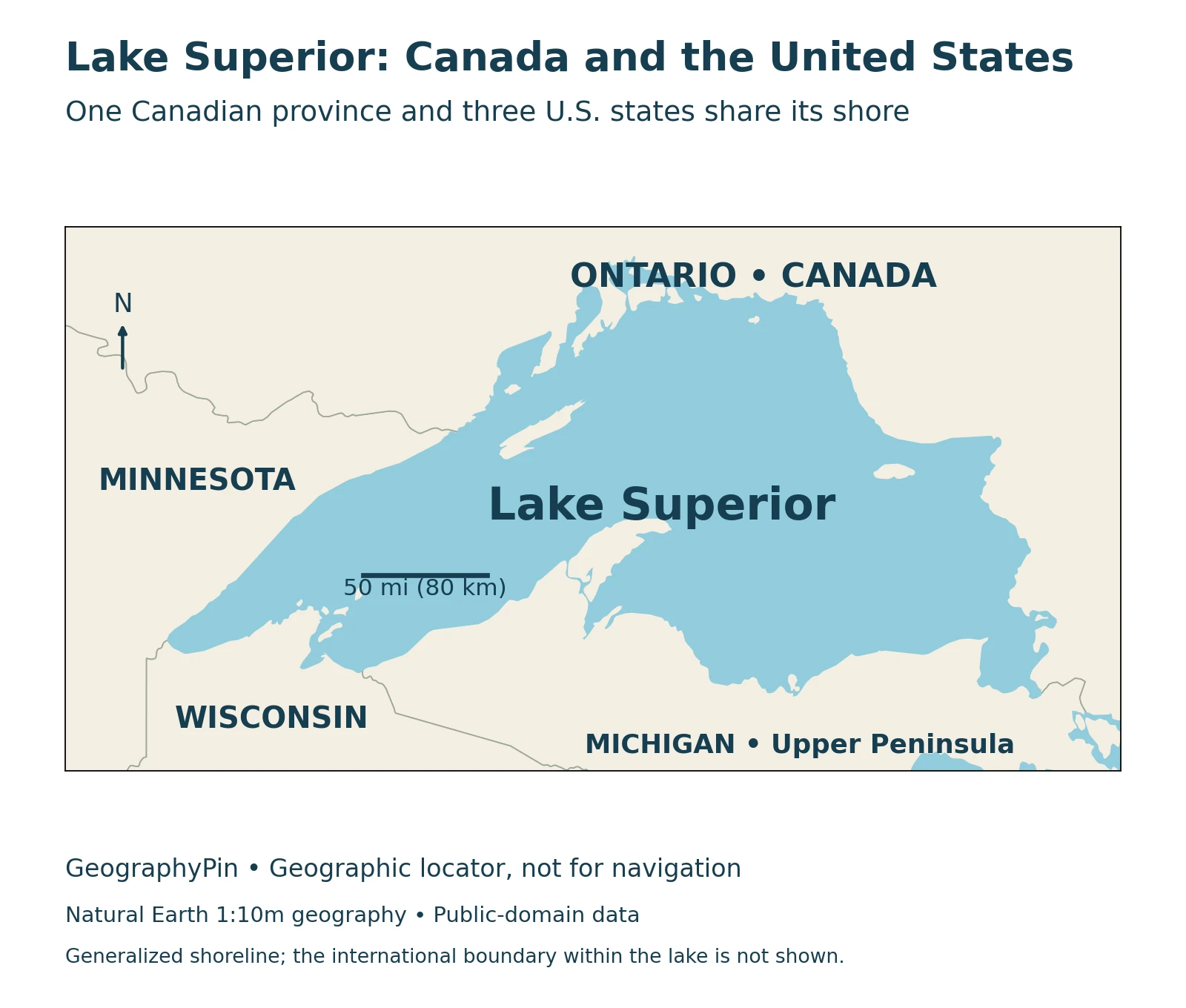
Lake Superior occupies the northwestern end of the Great Lakes system, on the border between Canada and the United States. Ontario borders its northern and eastern sides. Minnesota lies along the western shore, Wisconsin along the southwest, and Michigan’s Upper Peninsula along much of the southern shore.
One province and three states
This is a binational lake, unlike Lake Michigan, which lies entirely within the United States. A view from Minnesota’s North Shore, an Ontario beach and Michigan’s Upper Peninsula can look very different while belonging to the same waterbody. Forested headlands, islands, cliffs and open shorelines occur around its long perimeter.
The map below shows the lake and adjacent jurisdictions, not a travel route or a surveyed national boundary across the water. Our wider Great Lakes map places Superior in relation to the connected lakes farther downstream.
2. Lake Superior’s Area and Depth
Superior is the largest of the five conventionally named Great Lakes by both surface area and water volume. It is also the deepest. These measures describe different properties: area is the water’s footprint, depth measures downward to the bottom, and volume describes the amount of water held in the basin.
A consistent set of reference measurements
This table follows NOAA CoastWatch’s compilation from the 1995 third edition of the Great Lakes Environmental Atlas. Its values are geographical reference figures, not measurements of today’s lake level.
| Measurement | Published reference value |
|---|---|
| Surface area | 31,700 square miles (82,100 km²) |
| Average depth | 483 feet (147 meters) |
| Maximum depth | 1,332 feet (406 meters) |
| Water volume | 2,900 cubic miles (12,100 km³) |
| Length | 350 miles (563 km) |
| Maximum breadth | 160 miles (257 km) |
NOAA identifies depth and volume as measured at Low Water Datum, a reference level. Paired units are retained as published rather than recalculated to suggest greater precision. A maximum depth is not representative of every part of the lake, and a whole-lake mean cannot tell you the depth beside a particular beach or harbor.
The lake’s long axis is also different from its shoreline length. Following the coastline includes bends, bays and, depending on the measurement, island shores. Neither figure is automatically the distance of a drive around the lake or a crossing between two ports.
3. Is Superior the World’s Largest Lake?
The answer depends on what is being compared. “Largest” needs a measurement, a water type and a rule about which connected basins count as one lake. Without those definitions, several accurate statements can appear to contradict one another.
Area, volume and naming conventions
| Comparison | How to interpret it |
|---|---|
| Five conventionally named Great Lakes | Superior has the greatest surface area and volume. |
| Freshwater surface area, Michigan and Huron counted separately | Superior is conventionally described as the world’s largest. |
| Freshwater surface area, Michigan–Huron combined | The connected Michigan–Huron waterbody is larger than Superior. |
| Freshwater volume | Lake Baikal holds more water than Superior and has the world record. |
| All inland lakes by surface area, including saline water | The Caspian Sea is larger; it is not a freshwater lake. |
Environment and Climate Change Canada explicitly discusses the Michigan–Huron qualification in its April 2022 overview. The Straits of Mackinac provide a broad water connection between those two named lakes, so treating them as a single hydrological waterbody changes the area comparison. Our Lake Michigan article explains that connection in more detail.
Volume is a different contest. Lake Baikal has a much smaller surface footprint but a much deeper basin. Guinness World Records identifies it as the freshwater lake with the greatest volume. Superior’s very large area therefore does not make it the world’s deepest lake or the one containing the most freshwater.
These distinctions are more useful than an unqualified ranking. A table of surface areas and a table of volumes need not place the same lakes in the same order.
4. Ancient Rocks and a Much Younger Lake
Lake Superior’s scenery records more than one geological episode. Around 1.1 billion years ago, the Midcontinent Rift began to pull the continent apart. Large volumes of lava and later sediment accumulated in the region, but the rifting stopped without producing a new ocean.
The age of the bedrock is not the age of the lake
The National Park Service describes this ancient structure as a long, largely buried geological scar. Rocks exposed around parts of Superior, including volcanic sequences, preserve its history. That does not mean the modern lake has existed for 1.1 billion years or that the present shoreline marks an actively opening ocean.
Much later, continental glaciers reshaped the landscape and excavated the basin. Glacial erosion and deposits modified the older geological structure, and water occupied the low ground left as the ice withdrew. Ancient rift geology and later glacial action are complementary parts of the explanation, not competing single causes.
The North Shore gives this history a visible coastal setting, but not every cliff around Superior is made of the same rock. The National Park Service’s regional account includes both volcanic and sedimentary landscapes. One shoreline photograph cannot stand for the geology of the entire lake.
Split Rock Lighthouse is a familiar landmark on Minnesota’s rocky coast. The Minnesota Historical Society identifies it as a 1910 light station standing above the lake on a cliff. The lighthouse illustrates how the exposed shore and navigation history meet; its building date says nothing about the age of the underlying rocks.
5. The St. Marys River Outlet
Lake Superior drains from its southeastern end through the St. Marys River to Lake Huron. It is therefore part of a connected freshwater system rather than a closed basin that loses water only through evaporation.
Regulated flow does not mean a fixed lake level
Control structures on the St. Marys River regulate Superior’s outflow. The International Joint Commission explains that precipitation, runoff, evaporation and weather still strongly influence lake levels. Managing the outlet cannot hold such a large lake at one unchanging height.
The usual seasonal pattern includes a summer high and a late-winter or early-spring low, though conditions can shift the timing. Wind can also create temporary differences around the shoreline. A reference elevation, a monthly lake-wide average and an hourly gauge reading at one shore are therefore different kinds of information.
This is why the table above avoids presenting a reference depth as a live observation. Navigation requires current water-level information and suitable charts, while a geographical profile explains the wider shape and connections of the basin.
6. Understanding the Shore Before Visiting
Lake Superior’s shore includes remote stretches, protected landscapes and developed waterfronts. A lake map is a starting point for orientation, not a guarantee that every bay, island or cliff has public access. Use the relevant park or local manager’s guidance for a particular destination.
A warm day can still mean cold water
At Pictured Rocks National Lakeshore, the National Park Service warns that Superior remains cold even in summer and that rip currents, waves and sudden changes in bottom depth can be hazards. Those warnings illustrate why a clear view across the lake should not be mistaken for a swimming-safety assessment.
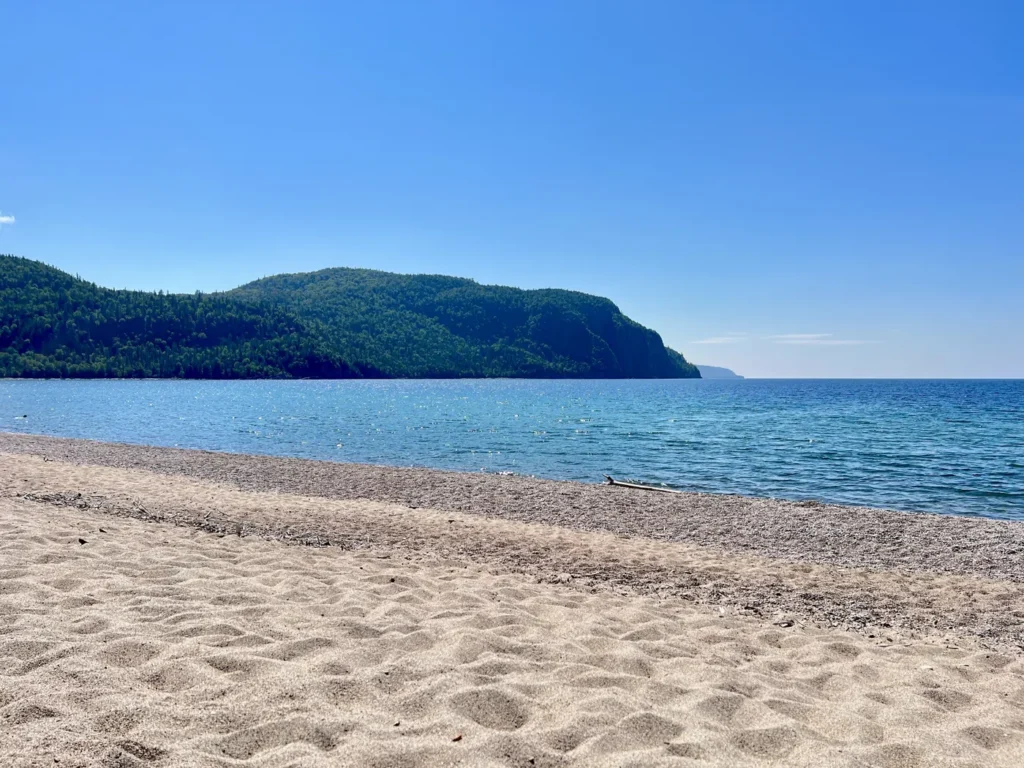
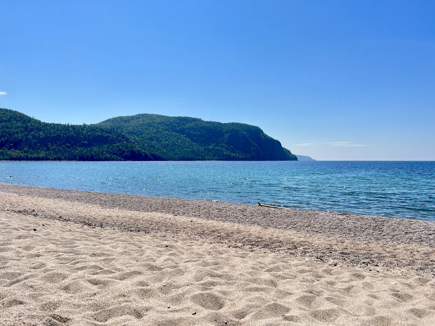
Check current marine or beach forecasts and local notices before entering the water. Conditions at a sheltered beach can differ from an exposed headland. The archival photograph below shows Old Woman Bay on the Ontario shore, not present-day conditions around the entire lake.
What Did We Learn Today?
Superior is a binational Great Lake whose size is best understood through separate measures of area, depth and volume. Combining Michigan and Huron changes the freshwater-area ranking, while Baikal leads by freshwater volume. Superior’s ancient rift rocks, later glacial basin and St. Marys River outlet explain different parts of its landscape and water geography.
Sources & Data Notes
Dimensions use one NOAA atlas-based reference series, with published paired units and the Low Water Datum qualification for depth and volume. Rankings specify their criteria rather than combining incompatible numerical series. The April 2022 Canadian overview is used for the naming-convention comparison, not as a current lake-level report. The locator uses generalized Natural Earth outlines, not bathymetry or a navigation chart.
- Great Lakes Commission: regional setting and lake geography
- NOAA CoastWatch: 1995 atlas-based physical dimensions and datum notes
- Environment and Climate Change Canada, April 2022: Superior and the Michigan–Huron ranking qualification
- Guinness World Records: Lake Baikal’s freshwater-volume record
- NASA Earth Observatory: the Caspian Sea as a saline inland lake
- National Park Service: ancient rift rocks and later glacial shaping
- National Park Service Park Science: interpreting the Midcontinent Rift around Superior
- Minnesota Historical Society: Split Rock Lighthouse history and setting
- International Joint Commission: St. Marys River and limits of water-level regulation
- National Park Service: cold water and local shore hazards at Pictured Rocks
- National Weather Service: Great Lakes beach forecasts