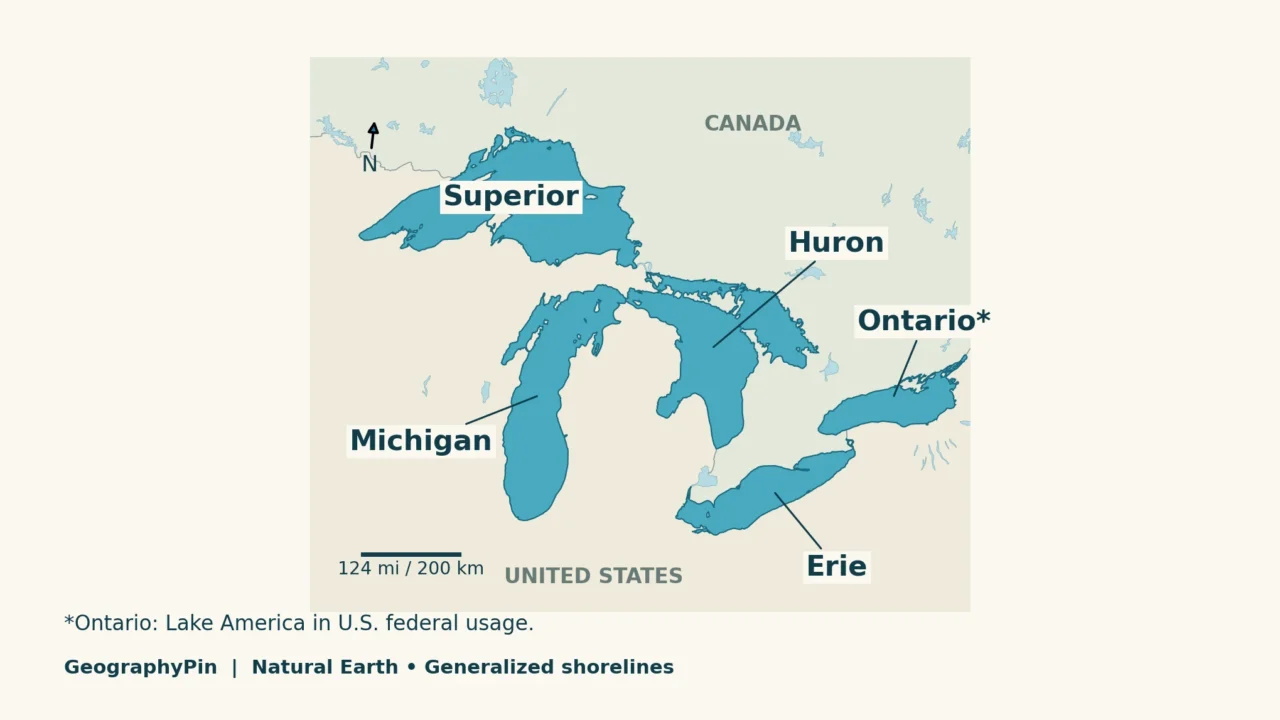
A list of the Great Lakes tells you their names. A map shows how they fit together. Start with the five large water bodies, then follow the rivers and straits that connect them. The shape map and connection diagram below answer those two different questions without squeezing every label into one picture.
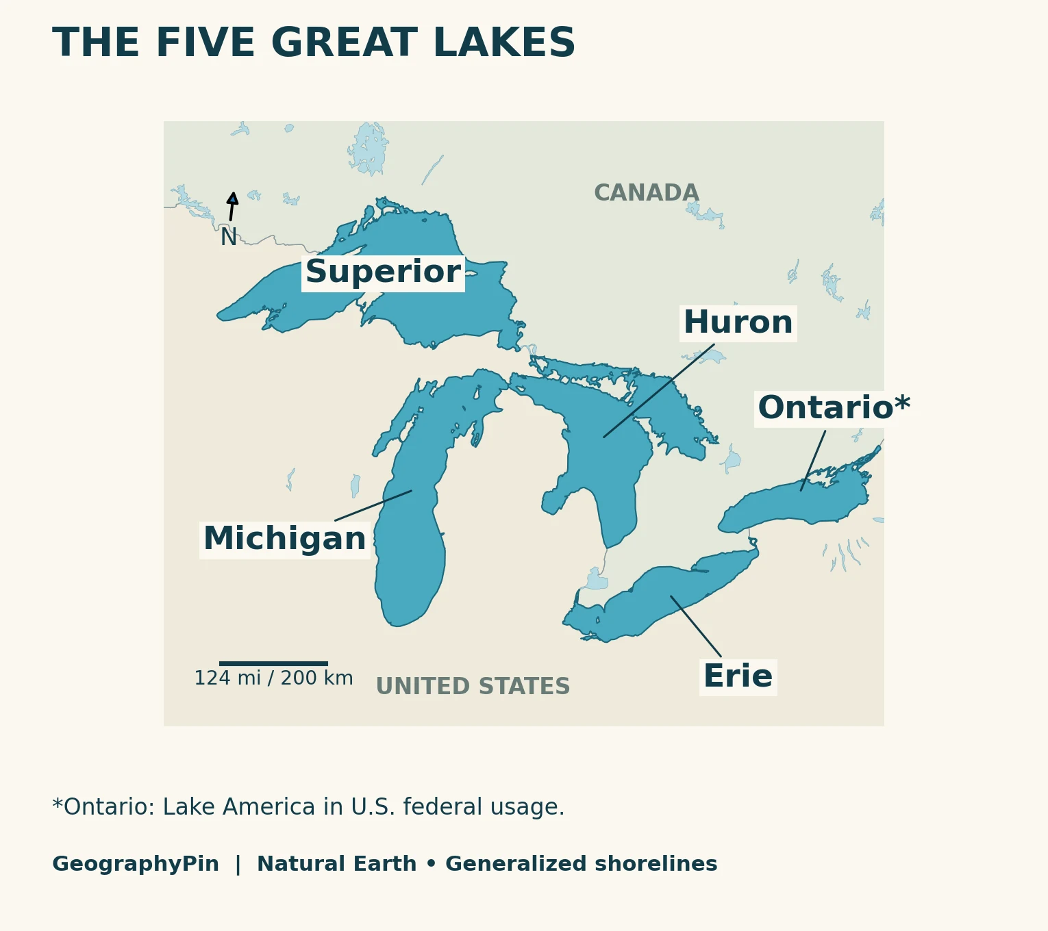
The five Great Lakes are Superior, Michigan, Huron, Erie and Ontario. They form a connected freshwater system in the United States and Canada, draining toward the Atlantic through the St. Lawrence River. Michigan lies entirely within the United States; the other four are shared. U.S. federal usage calls Ontario “Lake America.”
Start here: identify the five lake shapes, trace the water route, or unpack why Michigan and Huron are linked so closely.
1. Great Lakes Map and Names
Recognize each lake by its position
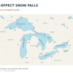
Superior occupies the northwestern end of the group. Michigan extends southward on the western side, while Huron lies to its east. Erie stretches southwest–northeast below Huron, and Ontario sits farther east. That pattern is more useful than imagining five identical lakes arranged in a straight line.
| Lake | Where to look | Connection to remember |
|---|---|---|
| Superior | Northwestern lake | St. Marys River leads to Huron |
| Michigan | Long western lake extending south | Straits of Mackinac join it to Huron |
| Huron | East of Michigan | St. Clair–Detroit system leads to Erie |
| Erie | South of Huron, west of Ontario | Niagara River leads to Ontario |
| Ontario | Easternmost Great Lake | St. Lawrence River is its outlet |
A note on names: the August 27, 2026 U.S. presidential order directed federal adoption of Lake America for Lake Ontario. EPA now uses that name, while current Canadian government material continues to use Lake Ontario. These are different naming conventions for the same lake, not two separate lakes or a new international boundary. Our Lake Ontario profile covers the naming question in more detail.
2. How the Great Lakes Connect
Follow the main natural outlet route
Water from Superior reaches Huron through the St. Marys River. Michigan joins Huron through the Straits of Mackinac. From Huron, the main downstream route is the St. Clair River, Lake St. Clair and the Detroit River to Erie. Erie drains through the Niagara River into Ontario, which drains through the St. Lawrence River toward the Gulf of St. Lawrence and Atlantic Ocean.
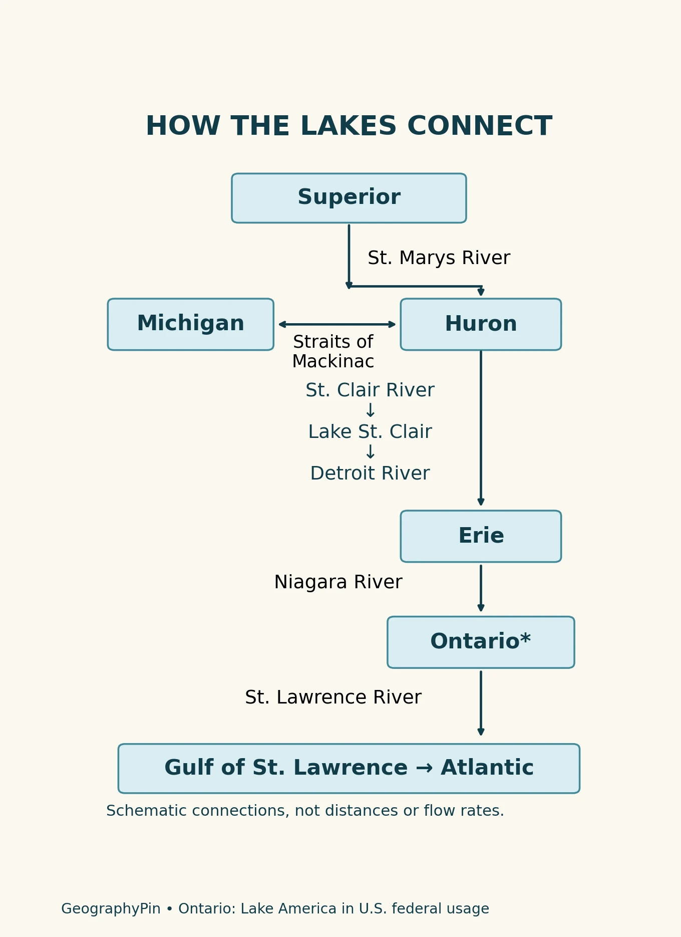
Lake St. Clair is particularly easy to miss on a small overview. It is a real lake between the St. Clair and Detroit rivers, but it is not one of the conventional five Great Lakes. Omitting it from the water route would leave out an important part of the connection.
The route describes the main natural drainage network. It does not mean every drop travels through every lake: rainfall and tributaries add water at many points, and evaporation removes water. Nor is it a ship itinerary. Navigation routes can bypass natural obstacles through engineered channels and locks; a drainage diagram is not a boating chart.
3. Five Names, One Connected System
Michigan–Huron is a special case
Michigan and Huron have separate geographic names, but their broad, deep connection at the Straits of Mackinac allows them to function as one hydraulic water body. Great Lakes water-level reporting therefore often groups them as Michigan–Huron. This does not make a five-name classroom map wrong: it reflects a different purpose for counting.
A useful distinction is to ask whether a source is naming familiar basins or analyzing how water levels behave. Do not simply subtract one from every published Great Lakes statistic when you see Michigan–Huron combined; the source’s definition and measurement method matter.
Shorelines, drainage basins and snowbelts are different maps
The blue areas here represent the lakes themselves. A drainage-basin map includes the surrounding land whose water reaches the lake system, so its colored area is much larger. A snowbelt map answers another question again: where lake moisture repeatedly contributes to snowfall under suitable weather conditions.
For that weather connection, use our Great Lakes lake-effect snowbelt map. Do not treat a snowbelt edge as a watershed boundary or a fixed limit for every storm. Identifying the lake and its orientation is the starting point, not the whole explanation.
Frequently Asked Questions
How can I remember the five Great Lakes?
HOMES stands for Huron, Ontario, Michigan, Erie and Superior. It is a memory aid, not their downstream order. Ontario is the Canadian and longstanding common name; U.S. federal material uses Lake America.
Does Lake Michigan touch Canada?
No. Lake Michigan is entirely within the United States. It connects to the binational system through Lake Huron, but that connection does not make its own shoreline Canadian.
Is the St. Lawrence a sixth Great Lake?
No. The St. Lawrence is a river carrying water out of Lake Ontario toward the Gulf of St. Lawrence. Rivers and smaller connecting lakes belong to the wider system without becoming additional members of the conventional five.
What Did We Learn Today?
The Great Lakes are easiest to understand with two views: a map of their shapes and a diagram of their connections. Superior feeds Huron, Michigan is openly connected to Huron, and the main outlet route continues through Erie and Ontario to the St. Lawrence. Five familiar names do not imply five isolated water bodies.
Sources & Data Notes
The original map uses public-domain Natural Earth 1:10m lake and country polygons in a Lambert conformal conic projection. Shorelines are generalized, not live water-level boundaries. Label anchors were checked against lake polygons. The separate connection graphic is a topological schematic based on USGS and IJC descriptions, not invented river geometry. Its arrows do not measure discharge, travel time or slope.
- Canada Water Agency: Great Lakes drainage basin map, for lake names and regional relationships.
- EPA: Great Lakes facts and figures, including current U.S. federal naming.
- USGS: Great Lakes connecting channels and IJC: connecting waters, for the complete connection sequence.
- IJC connecting-waters report, including the Michigan–Huron hydraulic relationship.
- U.S. presidential order of August 27, 2026 and Canadian Coast Guard November 2026 bulletin, for the scoped naming distinction. No water-level figures are reproduced from that bulletin.
- Natural Earth terms of use.