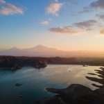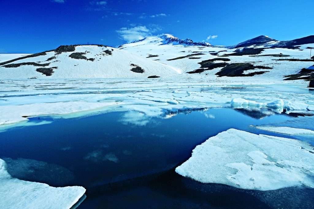
Lake Kari is a small, high-mountain glacial lake on Mount Aragats in Armenia, at roughly 3,185–3,207 meters (10,449–10,522 feet). It spans about 0.12–0.30 km² (0.046–0.116 sq mi), is up to 8–9 meters (26–30 feet) deep, and freezes for 8–9 months each year. A 1943 cosmic-ray research base stands on its shore.
Where Is Lake Kari and Why It Matters
Lake Kari occupies a cirque on the south side of Mount Aragats in Aragatsotn Province, Armenia. Reliable measurements place the lake’s surface at about 3,185 meters (10,449 feet), with other reputable Armenian and Russian sources stating up to 3,207 meters (10,522 feet). The lake’s center sits near 40.47355°N, 44.18109°E.
This alpine pocket is notable for two reasons. First, it’s a natural “classroom” for glacial landforms—an overdeepened bowl bordered by moraines. Second, its southern shore hosts the Aragats Cosmic Ray Research Station, founded in 1943 by the Alikhanyan brothers, which continues to monitor high-energy particles and extreme weather.
Name & Meaning
Locally, the lake is called Քարի լիճ (K’ari lich)—“Stone Lake”—a nod to its rocky rims and scree. You’ll also see “Kari Lake” or “Karigol” in tourism literature; all refer to the same feature.
Origins, Shape & Key Numbers
Lake Kari is classic cirque-lake geomorphology: a U-shaped hollow carved by ice, then dammed by moraines that act as a natural barrier. Core physical stats widely cited in academic and gazetteer sources include surface area ≈0.12 km² (0.046 sq mi), maximum depth up to 8 m (26 ft), perimeter ≈1,150 m (0.71 mi), and volume ≈0.375 million m³.
Some contemporary Armenian/Russian travel guides list a larger surface area of ≈0.30 km² (0.116 sq mi) and depth up to 9 m (30 ft). The variance stems from differing shoreline interpretations and seasonal water levels. For transparency, we present the range that appears in credible sources.
Hydrology at a Glance
Precipitation and snowmelt dominate the lake’s input; there are no large inflowing streams. The lake often remains ice-bound 8–9 months per year. Historically, the outlet connected to different basins: an older flow toward the Geghadzor (Shirak plain) and, by a 17th-century order of Catholicos Pilippos I, a canal redirecting water to the Amberd River (Kasagh tributary). Today, the Arkashen (Arqashen) River is noted as starting near the lake’s western shore.
| Metric | Value (Metric) | Imperial (first mention) |
|---|---|---|
| Surface elevation | 3,185–3,207 m | 10,449–10,522 ft |
| Surface area | 0.12–0.30 km² | 0.046–0.116 sq mi |
| Max depth | 8–9 m | 26–30 ft |
| Shoreline length | ≈1,150 m | ≈0.71 mi |
| Coordinates (center) | 40.47355°N, 44.18109°E | — |
Weather, Seasonality & Safety
Expect true alpine conditions. Multiple sources note the lake is frozen most of the year—8 to 9 months—so snow and ice linger into late spring. Roads may remain blocked by snow until late May; plan accordingly if you’re targeting early-season hikes.
At ~3,200 m (≈10,500 ft), mild altitude effects are common. Walk slowly the first hour, hydrate, and bring layers even in July. Wind can be piercing, and storms build quickly over Aragats. Clear mornings often give the best visibility and road conditions.
Science on the Shore: The Aragats Cosmic Ray Station
Lake Kari’s southern shore hosts the Aragats Cosmic Ray Research Station, established in 1943 by physicists Abraham and Artem Alikhanyan. Today it’s operated by the A. I. Alikhanyan National Science Laboratory’s Cosmic Ray Division, contributing to space-weather monitoring (e.g., SEVAN detectors) and lightning-cosmic ray studies.
History, Culture & Nearby Landmarks
A persistent local account suggests Lake Kari once functioned as a reservoir as far back as the pre-Urartian period. The lake’s outlet history is unusually “engineered”: a 17th-century order by Catholicos Pilippos I reportedly blocked the old Geghadzor outflow and linked the lake to the Amberd River (a Kasagh tributary). The canal later fell into disuse.
In 1963, scientists introduced the gegharkuni strain of Sevan trout (Salmo ischchan) to the lake; the fish grew quickly but did not establish a self-sustaining population. Culturally, the lake is tied to treks toward Aragats’ four summits and sits within a day-trip constellation that includes Amberd Fortress and the Armenian Alphabet Monument.
How to Visit Lake Kari
Distance & access. From central Yerevan to the lake is roughly 60 kilometers (37 miles). Many visitors drive via Byurakan; there’s also a southern approach via Agarak. Allow about 1 hour 15 minutes in light traffic; check conditions, because snow can close the road even in late spring.
On the ground. Park near the shore and stroll the rim, or use the lake as a base for the Southern Peak route of Aragats (bring proper boots). For route descriptions and recent trip notes, see AllTrails’ Southern Peak page. If you’re curious about the research compound, browse the CRD’s station page before you go.
FAQ
How high is Lake Kari?
Most English-language gazetteers list ≈3,185 m (10,449 ft), while Armenian/Russian sources often state ≈3,207 m (10,522 ft). Both describe the same alpine hollow on Aragats.
How big and how deep is it?
Expect ≈0.12–0.30 km² (0.046–0.116 sq mi) surface area and up to 8–9 m (26–30 ft) depth, depending on the source and season.
Is the lake frozen year-round?
Not year-round, but it’s typically ice-covered for 8–9 months. Summer brings open water, though ice and snow can linger on the surrounding slopes. :
Can I hike to Aragats from Lake Kari?
Yes. The lake is a common start for the Southern Peak route. Expect rocky paths and thin air; strong footwear and extra water are essential.
What’s that large facility by the shore?
That is the Aragats Cosmic Ray Research Station (since 1943), part of the A. I. Alikhanyan National Science Laboratory’s Cosmic Ray Division, used for space-weather and high-energy particle research.
Which river starts near the lake?
Tourism and local sources note the Arkashen (Arqashen) River rising near the western shore.
What Did We Learn Today?
- Lake Kari is a small glacial cirque lake at ≈3,185–3,207 m (10,449–10,522 ft) on Mount Aragats.
- Authoritative sources vary on size—≈0.12 vs. ≈0.30 km²—so we present a transparent range.
- It freezes 8–9 months a year; road access may be blocked until late May.
- A 1943 cosmic-ray station on the shore still supports cutting-edge space-weather research.
- The lake has a layered human story—from pre-Urartian irrigation lore to a 17th-century canal toward the Amberd basin.