A country’s territory can straddle the Equator without any of its islands touching the line. That distinction explains why lists of “countries on the Equator” can give different totals. The list below uses one clear rule: the Equator must cross the country’s land.
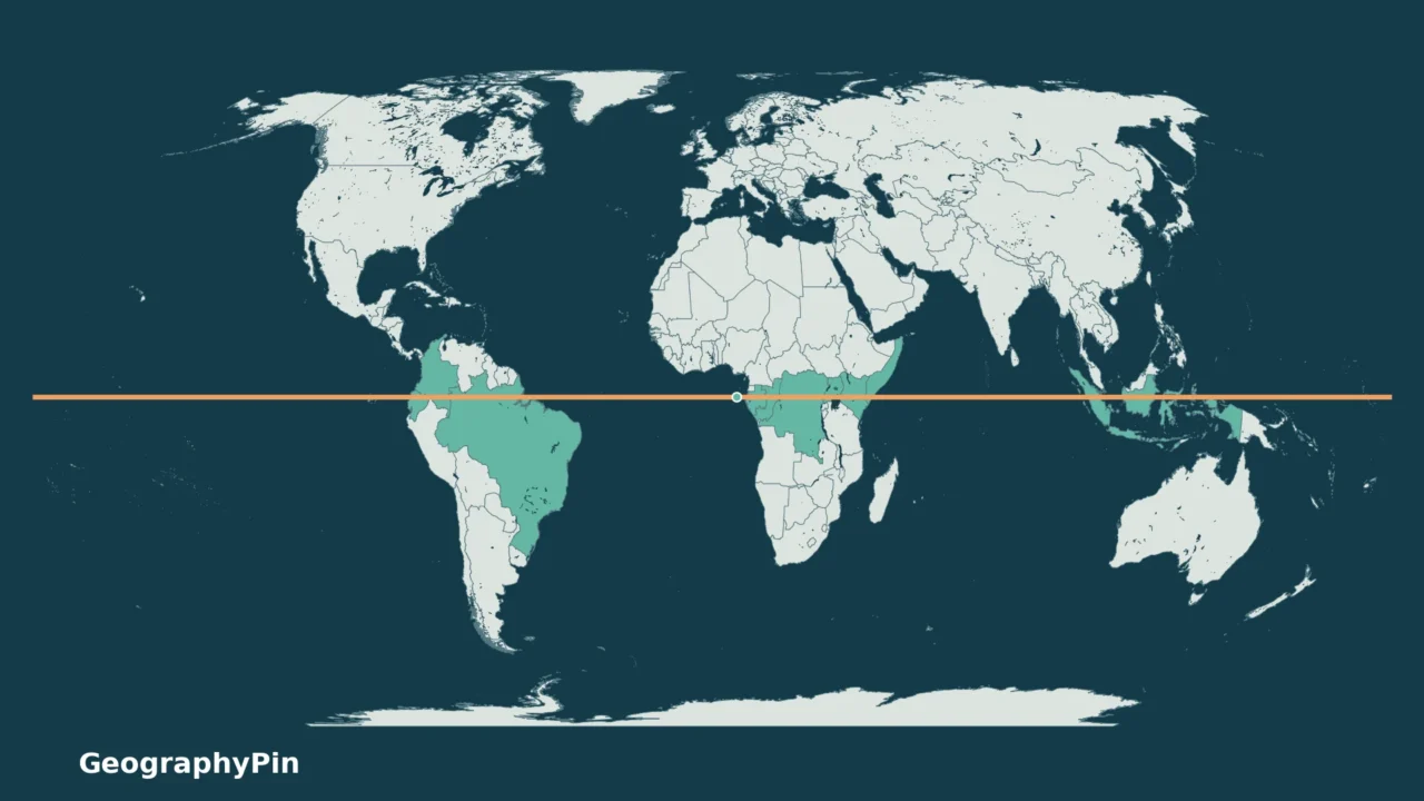
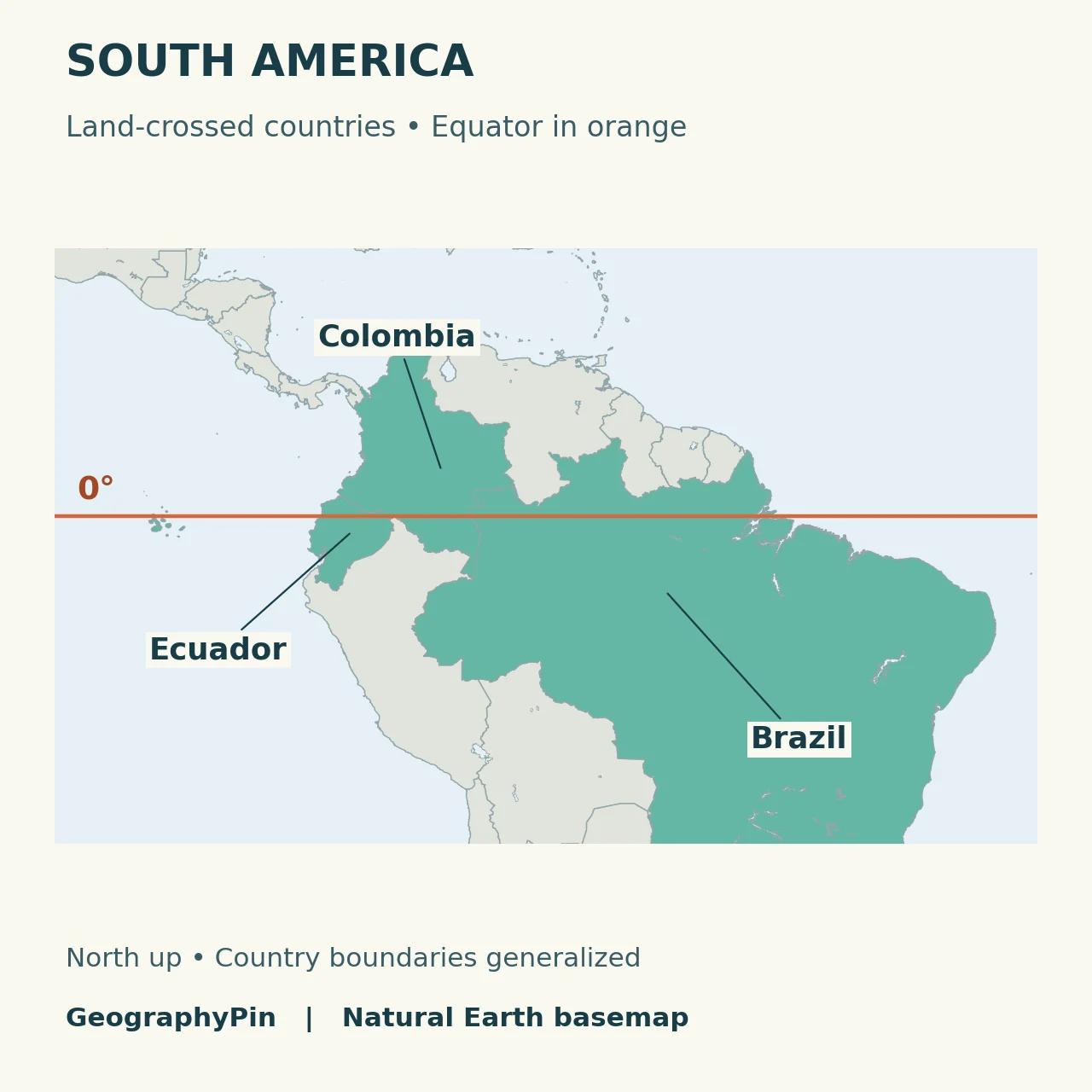
The Equator crosses land in 11 countries: Ecuador, Colombia, Brazil, São Tomé and Príncipe, Gabon, the Republic of the Congo, the Democratic Republic of the Congo, Uganda, Kenya, Somalia and Indonesia. This is a land-only count, not a list of all countries whose maritime zones meet 0° latitude.
How to use this article: Read the complete list, compare the African crossings, or check the small-island exception.
1. The Complete List of 11 Countries
Count each country once
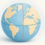
Zero latitude is the reference separating the Northern and Southern Hemispheres. Unlike a broad tropical belt, it is one line. NOAA’s latitude explanation distinguishes this east–west line from the north–south meridians used to measure longitude.
| Country | Regional map |
|---|---|
| Ecuador | South America |
| Colombia | South America |
| Brazil | South America |
| São Tomé and Príncipe | Africa; crossing on Ilhéu das Rolas |
| Gabon | Africa |
| Republic of the Congo | Africa |
| Democratic Republic of the Congo | Africa |
| Uganda | Africa |
| Kenya | Africa |
| Somalia | Africa |
| Indonesia | Indonesia and surrounding islands |
The two Congo entries are different sovereign countries, not alternative names for one state. Conversely, multiple land crossings within an island country do not add extra countries to the total.
Download the country list as a CSV file. The list records membership, not the distance traveled through each country or the number of individual islands crossed.
2. Regional Maps of the Equator
The orange line marks 0° latitude. Green shading identifies countries in the land-only list; it does not mean the Equator crosses every part of a shaded country. All three regional views have north at the top.
The African crossings
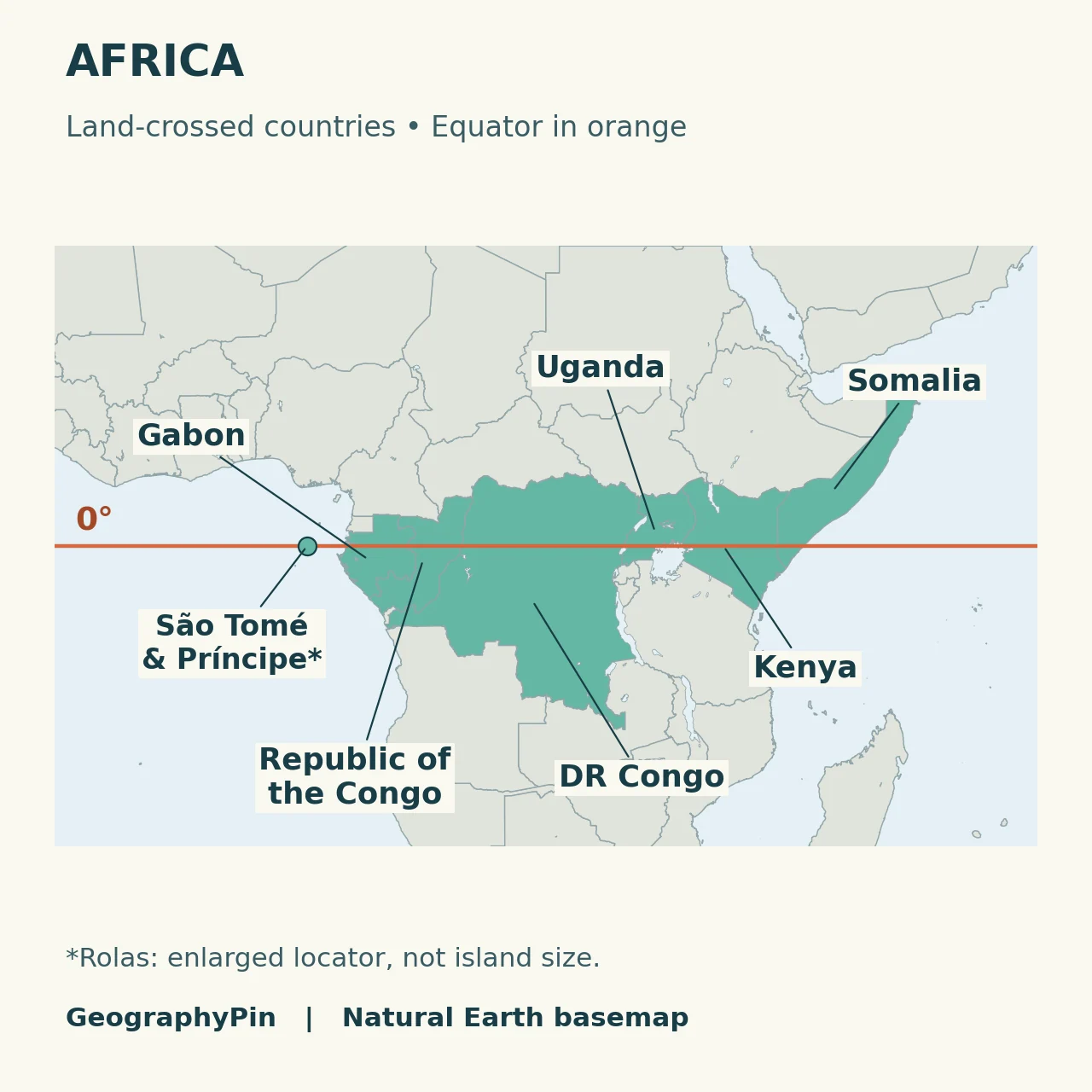
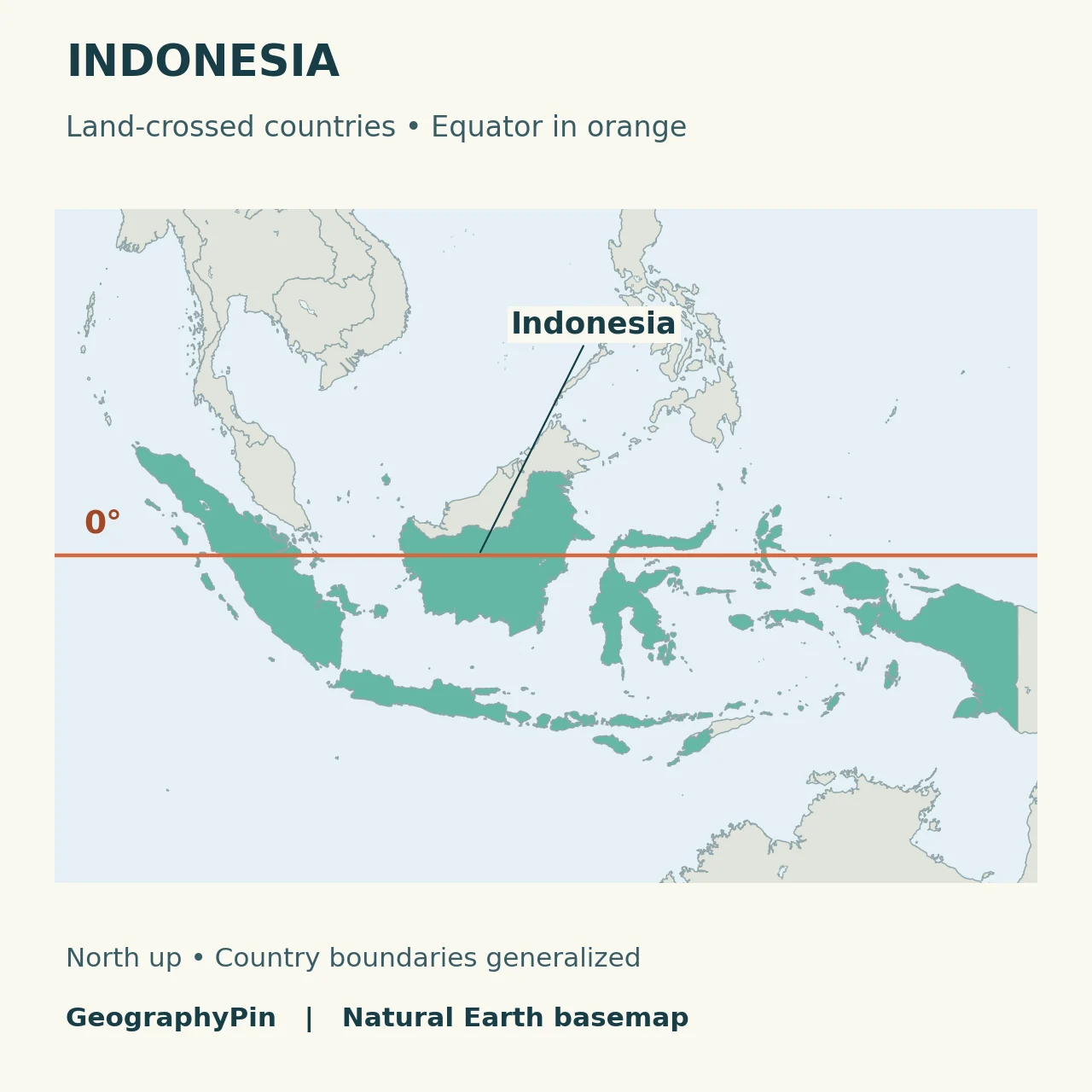
These are regional locator maps, not navigation charts. For broader political context, use the world map with countries. For reading 0° and other coordinate values, use the latitude and longitude guide.
3. Why Land and Water Counts Differ
You may encounter a total of 13. For example, timeanddate’s Equator guide includes the Maldives and Kiribati in its broader list but distinguishes them from the 11 countries with direct land crossings. They are not extra land crossings in the list here.
Do not mix that educational list with a complete legal inventory of maritime jurisdiction. Territorial seas, other maritime zones and land are different categories. This article does not map or count every territorial sea or exclusive economic zone touched by the Equator, and does not label every blue-water segment “international waters.”
For a school exercise or a map comparison, first check the wording of the question. “Which countries have land on 0° latitude?” has a narrower meaning than “Which countries lie on both sides of the Equator?” A scattered archipelago can satisfy the second description without an island intersecting the line.
4. The Small Island a World Map Can Miss
Ilhéu das Rolas matters to the count
São Tomé and Príncipe belongs in the land-only list because the Equator crosses Ilhéu das Rolas. A peer-reviewed geosite study by Henriques and Neto describes that crossing and the island’s equatorial landmark.
Small islands are easy to lose when coastlines are simplified for a world map. The Natural Earth country file used here produces ten country intersections with 0° latitude; it does not preserve this tiny islet as a crossing polygon. Treating that automated result as the final answer would incorrectly omit São Tomé and Príncipe.
The maps therefore use the documented island crossing as a supplement and show an enlarged locator. No island outline has been invented to make the data appear more detailed than it is. This is a useful distinction when reading any small-scale map: absence of a visible island is not evidence that the island does not exist.
Frequently Asked Questions
Does the Equator cross Equatorial Guinea’s land?
No. Despite its name, Equatorial Guinea is not one of the 11 land-crossed countries. A country’s name is not a substitute for checking where its land lies relative to 0° latitude.
Are the Equator and the Prime Meridian the same line?
No. The Equator is 0° latitude and runs east–west. The Prime Meridian is 0° longitude and runs north–south. A coordinate needs both latitude and longitude to identify one place.
What Did We Learn Today?
A reliable country count starts with a clear rule. The land-only answer is 11, with each sovereign country counted once and Ilhéu das Rolas keeping São Tomé and Príncipe in the list. Water-based classifications answer a different question. The regional maps show the broad route, while their small-island limitation explains why a source check matters as much as a colored outline.
Sources & Data Notes
Original GeographyPin maps use public-domain Natural Earth 1:10 million country polygons and a separate lakes layer. Ten country outlines intersect the 0° latitude line in that file; the documented Ilhéu das Rolas crossing supplies the eleventh country. Its marker is an enlarged approximate locator, not a surveyed coastline. Regional maps use a latitude–longitude grid and the featured world view uses Equal Earth. Country shading is categorical. No maritime boundaries, land-crossing distances or exact crossing coordinates are claimed.