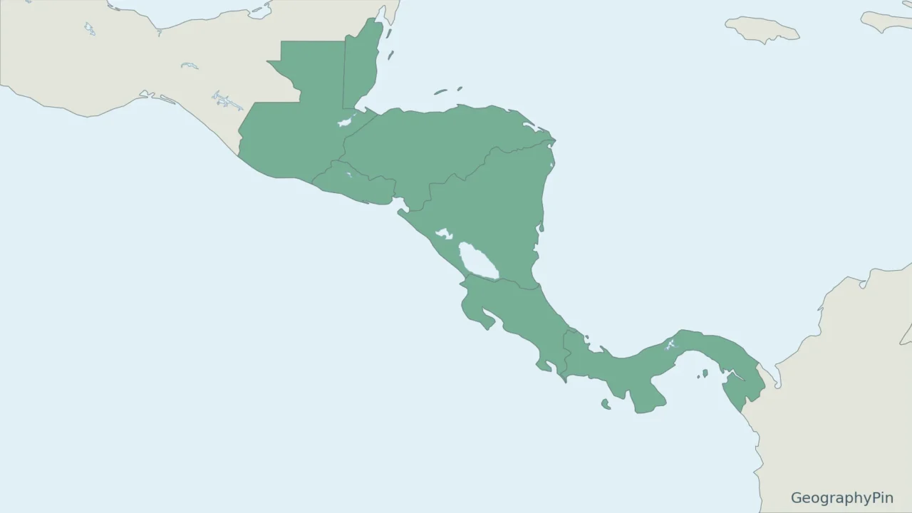
Central America has a familiar seven-country list, but statistical sources can show eight. The paired maps make that difference visible before you compare the totals.
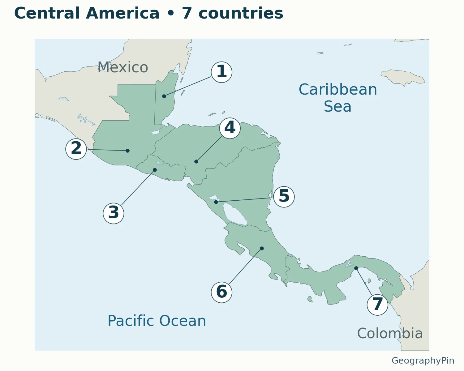
The conventional seven countries of Central America are Belize, Guatemala, El Salvador, Honduras, Nicaragua, Costa Rica and Panama. UN M49 also includes Mexico, producing an eight-country statistical grouping. The main map uses the narrower seven-country convention and locates each capital; the comparison map shows why the counts differ.
How to use this article: Check the seven versus eight, Caribbean distinction, blank-map practice.
Maps fit the screen by default. Select 2× or 4× for details, swipe or scroll within the map, and choose Fit / Reset for the full view.
1. Seven Countries and Capitals on the Map
| Map number | Country | Capital |
|---|---|---|
| 1 | Belize | Belmopan |
| 2 | Guatemala | Guatemala City |
| 3 | El Salvador | San Salvador |
| 4 | Honduras | Tegucigalpa |
| 5 | Nicaragua | Managua |
| 6 | Costa Rica | San José |
| 7 | Panama | Panama City |
The numbers are a reading key, not a ranking. Belize is paired with Belmopan, not Belize City. Guatemala City and Panama City are written out to distinguish the capitals from their countries. The table uses the capital names in the United Nations country profiles, with familiar English country names.
For a phone screen, the map moves long names into a readable key instead of forcing them into small countries. Open the full-size map to inspect coastlines, or use the vector PDF for a larger print. The accessible HTML table is the answer key for all seven numbered markers.
2. Where Is Central America?
Central America is the mainland bridge between Mexico and Colombia. In the conventional seven-country description, it begins with Belize and Guatemala and continues through Honduras, El Salvador, Nicaragua and Costa Rica to Panama. It is a region within North America in the usual seven-continent model, not an additional continent.
The Pacific lies along the region’s western and southern side; the Caribbean Sea lies to the east and north. The countries do not form a perfectly straight north–south line. Panama, in particular, extends largely east–west, so following the map is more reliable than picturing a vertical chain.
Mexico borders Belize and Guatemala at the northern end. Colombia meets Panama at the southern end. These are the two neighboring countries outside the conventional seven-country set. The map includes their names in muted text so readers can see where the regional selection stops without mistaking the map frame for a geographic boundary.
3. Why UN M49 Includes Mexico
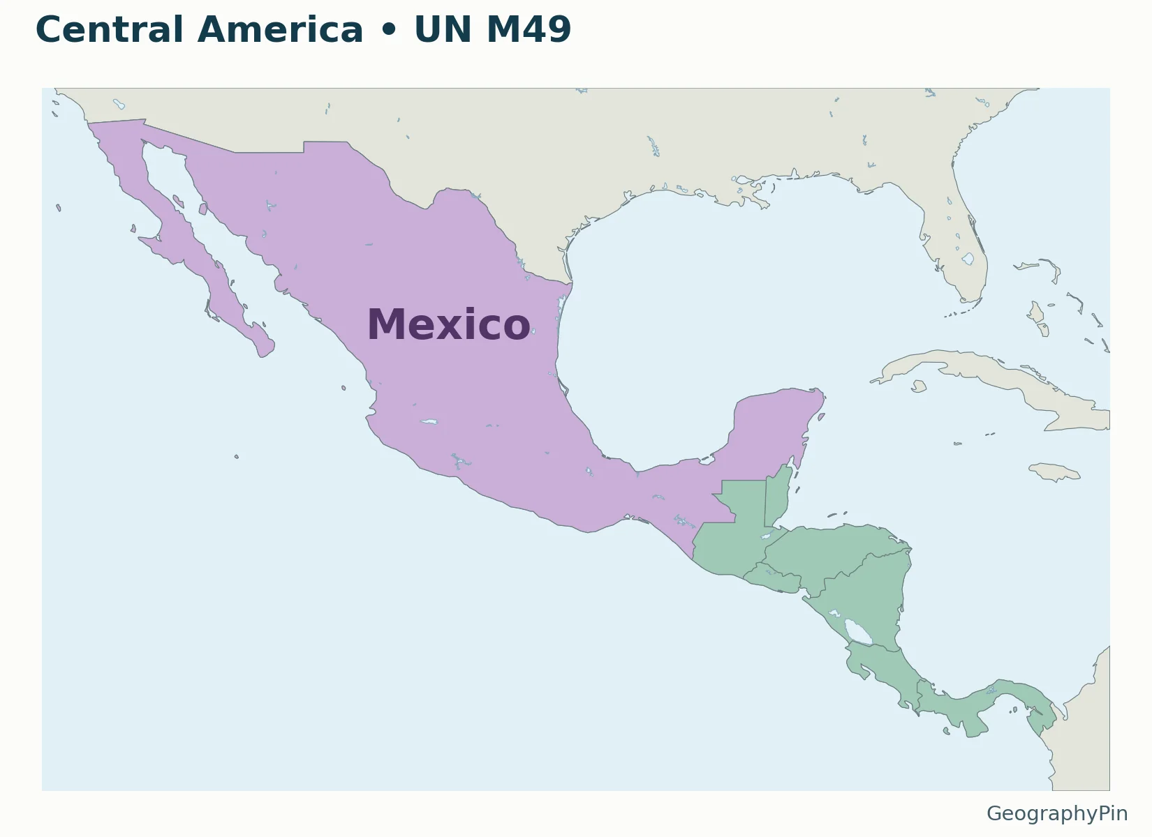
Map key: Green shows Belize, Guatemala, El Salvador, Honduras, Nicaragua, Costa Rica and Panama. Purple adds Mexico. Together these are the eight countries in UN M49’s Central America grouping.
Seven and eight answer different questions
The United Nations M49 classification assigns Mexico to Central America, alongside the seven countries above. Its total is therefore eight. That is a statistical grouping, while the familiar seven-country usage describes the narrower isthmus region.
Neither label moves Mexico out of the continent of North America. M49 distinguishes the wider North America from its narrower subregion called Northern America. Confusing those two names makes otherwise consistent lists appear contradictory.
When using a chart, worksheet or country total, read its grouping note first. For an assignment asking for the seven Central American countries, use the main map and table. For an M49 statistical comparison, include Mexico and state that convention in the heading or caption. Do not silently combine totals calculated using different definitions.
4. Central America and the Caribbean
A mainland region is not the same as an island grouping
The conventional Central American list is not a list of Caribbean islands. Cuba, Jamaica and the Dominican Republic are not additional countries in the seven-country table. They belong to the Caribbean regional grouping in M49.
A country can have a Caribbean coastline without being classified in M49’s Caribbean subregion. Belize is a useful example: it lies on the Caribbean side of the mainland but belongs in the seven-country Central American set. The sea name and the statistical region name answer different questions.
Political organizations, tourism partnerships and cultural regions can use different memberships again. Do not add or remove a country from this geographic list merely because it participates in a regional organization. For the wider continental overview, see the North America countries and capitals guide.
5. Blank Map and a Simple Practice Method
Practice without memorizing a misleading straight line
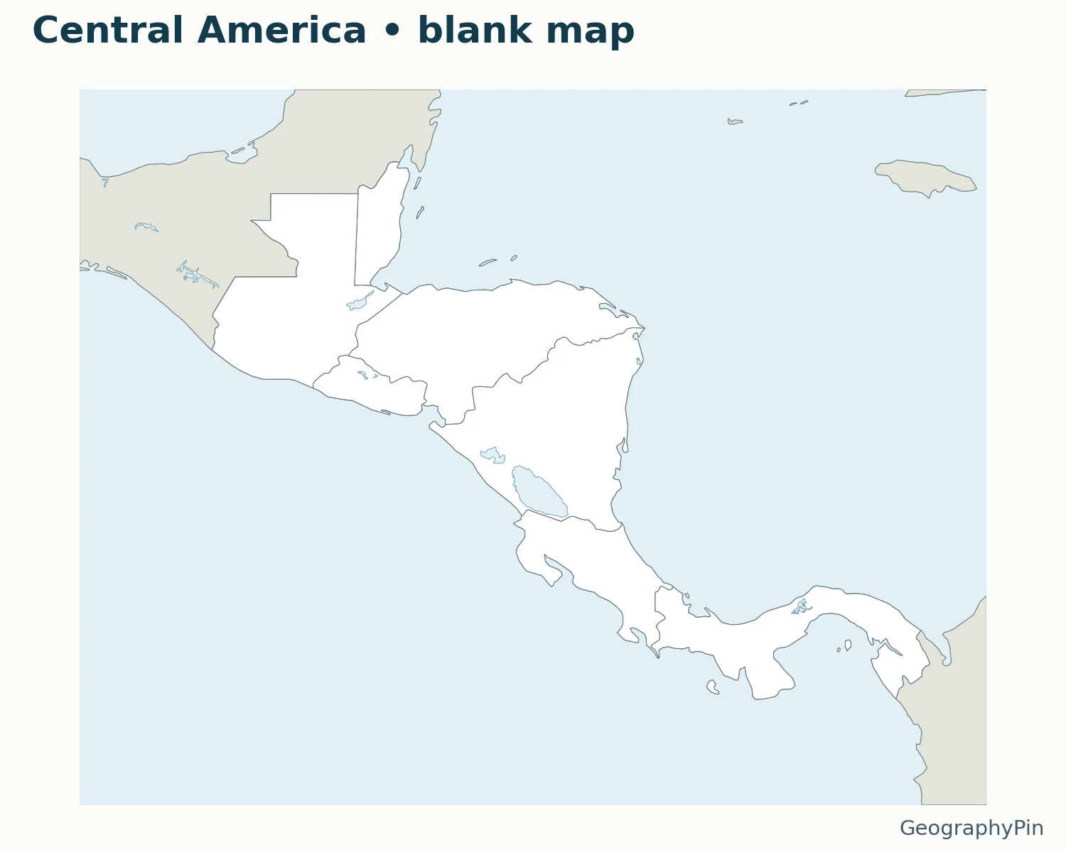
Print the blank PDF, then label Belize and Guatemala first. Add Honduras and El Salvador before continuing to Nicaragua, Costa Rica and Panama. Check the outline against the answer map rather than relying only on a memorized word order.
Next add the capitals using short pointers where space is limited. A country’s capital is a city, not necessarily the center of its territory. The supplied city dots come from a real geographic dataset, not guessed positions chosen to fill the page.
Use landscape orientation for these map files and inspect print preview before printing. The PDF keeps lines sharp for larger prints; the lighter WebP is used in the article. These files are for geographic orientation and study, not boundary surveying or navigation.
What Did We Learn Today?
A clear Central America map names its convention. The main map pairs seven countries with their capitals, while the M49 comparison adds Mexico for statistical purposes. Caribbean coastlines, regional organizations and continent names should not be substituted for that stated membership rule.
Sources & Data Notes
Country membership follows the seven-country convention, compared explicitly with UN M49. Capital names were checked in UNdata profiles. Capital coordinates come from Natural Earth populated places 5.1.2 and were tested against country geometry. Basemap: Natural Earth 1:50m version 5.1.1, public domain. Major lake surfaces use Natural Earth 1:10 million lake polygons; water is not intentionally shaded as land. These lake outlines are generalized, not current water-level measurements.
- UN Statistics Division: M49 regional classification
- Central America Tourism Agency: seven-country regional description
- UNdata country profile: Belize
- UNdata country profile: Guatemala
- UNdata country profile: El Salvador
- UNdata country profile: Honduras
- UNdata country profile: Nicaragua
- UNdata country profile: Costa Rica
- UNdata country profile: Panama
- Natural Earth: populated places, version 5.1.2
- Natural Earth: 1:50m country data, version 5.1.1
- Natural Earth: public-domain terms of use