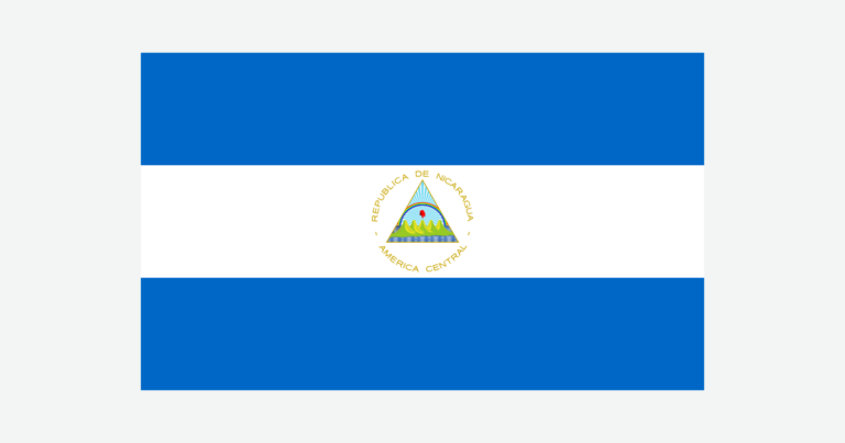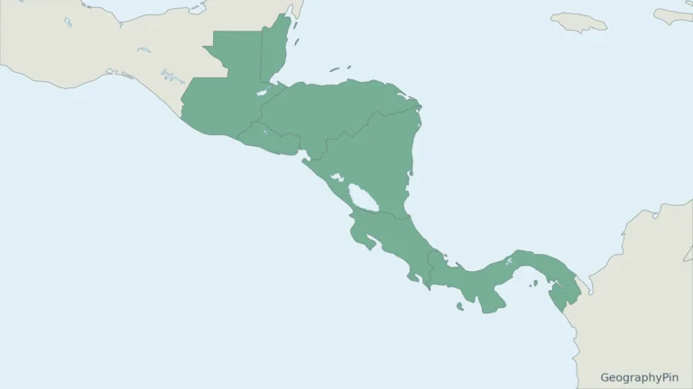
Nicaragua’s map is dominated by a striking contrast: large lakes and a volcanic corridor on the Pacific side, mountains farther inland, and broad lowlands toward the Caribbean. Following the water helps make sense of this landscape, especially where Lake Nicaragua drains east through the San Juan River.
Nicaragua is a Central American country between Honduras and Costa Rica, with a Pacific coast to the west and a Caribbean coast to the east. Managua is the capital. Its main physical settings are the Pacific lowlands and volcanic corridor, northern and central highlands, and Caribbean lowlands.
How to use this article: Locate Nicaragua in the region, compare its main landscapes, understand the lake drainage, or check dated country facts.
1. Where Nicaragua Is: Two Coasts, Two Land Neighbors
Locate Nicaragua within Central America
Honduras borders Nicaragua to the north, while Costa Rica lies to the south. El Salvador faces Nicaragua across part of the Gulf of Fonseca but does not share a mainland land border with it. The Pacific and Caribbean shores place the country in two different marine settings.
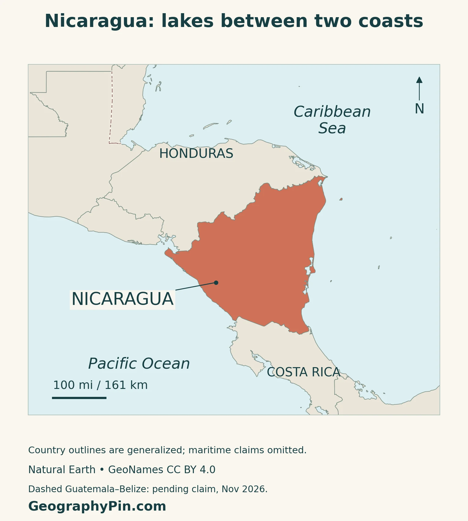
The eastern coast faces the Caribbean Sea, part of the wider Atlantic basin.
The Central America countries map places Nicaragua among its regional neighbors. Under the usual seven-continent convention, Central America belongs to North America; the North America countries and capitals guide shows that broader grouping.
Coastlines, land boundaries and maritime jurisdiction are different things. The maps here provide geographical orientation, not a legal delimitation of territorial seas or offshore claims. In particular, a river symbol near Costa Rica should not be used to infer navigation rights or the precise legal position of a boundary.
2. Three Physical Regions and a Volcanic Island
Read the relief from west to east
The three broad physical regions describe landforms, not departments or autonomous regions.
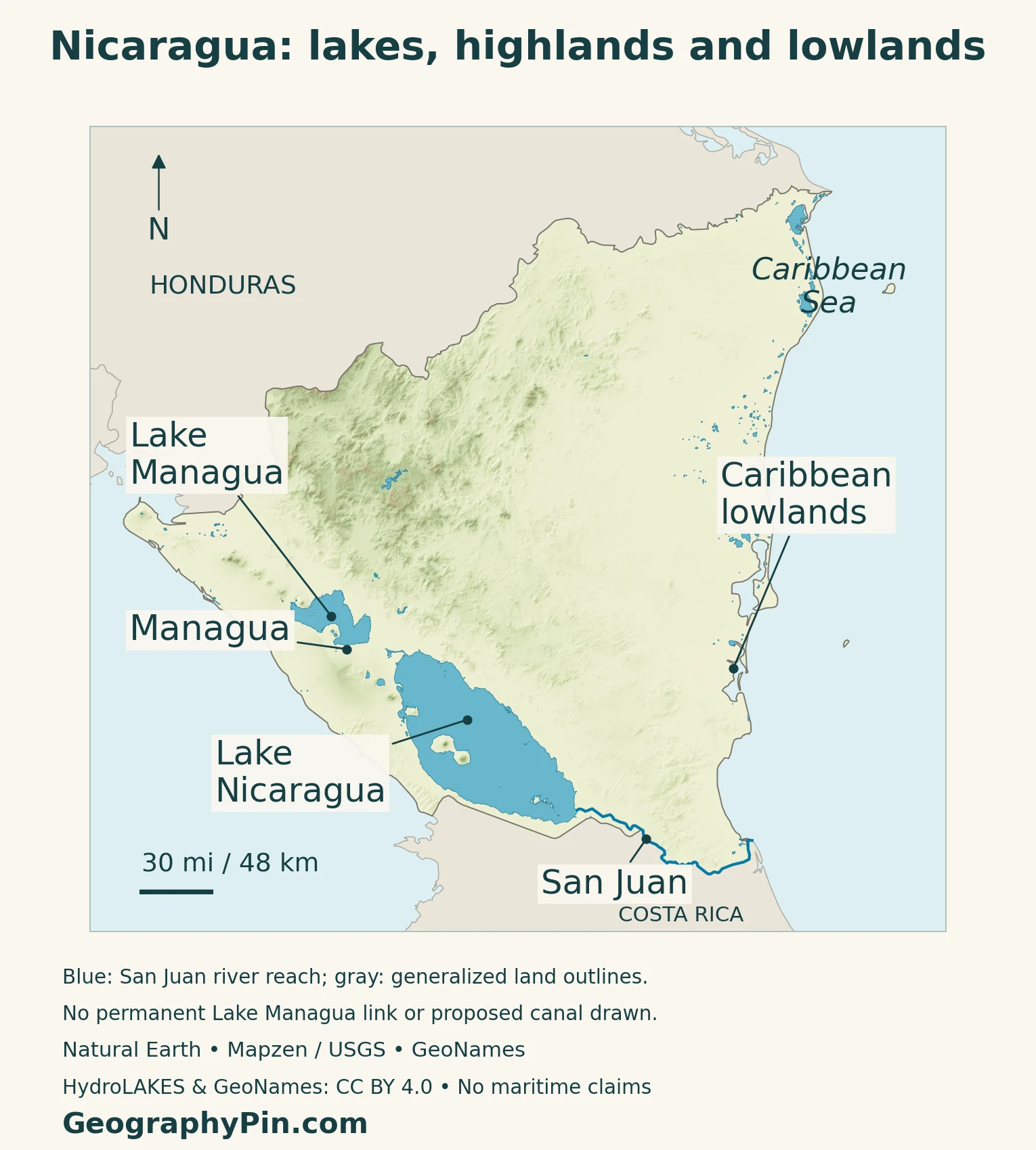
| Setting | What to notice |
|---|---|
| Pacific side | A volcanic corridor and the country’s two prominent inland lakes |
| Northern and central highlands | Higher, dissected terrain contrasting with the coastal plains |
| Caribbean lowlands | Broad lower-elevation country extending toward the eastern coast |
The relief colors show elevation, not forest cover, agricultural productivity or population density. A green area on this map is lower terrain, not a claim that it is intact rainforest. Likewise, the regional labels are orientation aids rather than surveyed boundaries.
Ometepe brings volcanoes into the lake landscape
Ometepe lies within Lake Nicaragua. Its distinctive two-part shape reflects Concepción in the northwest and neighboring Maderas to the southeast, joined by a narrow strip of land. This is a lake island, not an island off the Pacific coast.
The Smithsonian’s Global Volcanism Program identifies Concepción as a stratovolcano in the Central America Volcanic Arc and a subduction-zone setting. Its profile records a May 2024 eruption. That dated observation illustrates continuing geological activity; it is not a live alert or a statement about access today.
Volcanic landforms therefore need to be read at two scales: the wider belt along western Nicaragua and individual cones within it. Ometepe is an especially clear example of how a volcanic landscape and a large freshwater lake can occupy the same part of a country map.
3. Lake Nicaragua, Lake Managua and the San Juan River
Two lakes with different drainage behavior
Lake Nicaragua is also called Cocibolca; Lake Managua is also called Xolotlán. These are alternative names for two separate lakes, not four different water bodies. Lake Managua lies northwest of the larger Lake Nicaragua.
The San Juan River leaves Lake Nicaragua near San Carlos and flows east toward the Caribbean. Although the lake lies relatively close to the Pacific side of the country, its natural outlet is on the other side of the isthmus.
Lake Managua connects with Lake Nicaragua only intermittently through the Tipitapa River; a line between the lakes should not imply continuous flow.
The San Juan drainage basin spans Nicaragua and Costa Rica, receiving tributaries from both countries.
What the map can and cannot tell you
Start at the lake outlet, follow the river line eastward and then compare that route with the surrounding relief. This reading exercise separates the direction of drainage from the shortest apparent distance to the sea.
The lake outlines and river line come from geographical datasets, not freehand sketches. At country scale, a line necessarily simplifies bends and branches. It cannot show every channel, seasonal water-level change or navigable reach.
4. Climate Contrasts and the Forests of Bosawás
Seasonality changes across the country
The Pacific side has a more pronounced wet-and-dry seasonal cycle than the Caribbean side. In the general national climate description, Pacific rains are concentrated broadly from May through October, followed by a drier period from November through April.
Rainfall on the Caribbean side is more persistent through the year. Northern and central uplands introduce additional variation in temperature and rainfall, so a single lowland temperature or rainy-season calendar cannot describe every community.
These are broad climate patterns, not a forecast for a particular place or date.
An inhabited forest landscape in the north
Bosawás spans northern Nicaragua, including parts of Jinotega and the North Caribbean autonomous region. The national tourism institute describes a landscape ranging from tropical forest to cloud forest, with Cerro Saslaya among its prominent upland features.
Mayangna and Miskitu communities have longstanding relationships with this landscape. Forests, rivers and settlements belong in the same geographical picture; treating the reserve as an empty green space would miss its human setting.
UNESCO’s biosphere-reserve profile describes farming, fishing and other local livelihoods, with communities distributed along rivers. The biosphere designation dates to 1997. A biosphere reserve is not the same designation as an inscription on the World Heritage List.
The physical map does not draw a Bosawás protected-area boundary or measure present forest condition. Its elevation shading is useful for understanding terrain, while conservation zoning and forest change require different datasets.
5. Managua, People and Country Facts
Managua is the national capital
The 2025 Constitution names Managua as the national capital. The city appears on the map beside Lake Managua, not beside Lake Nicaragua. Similar lake and city names make this a useful distinction when first learning the country’s geography.
| Item | Reference |
|---|---|
| Capital | Managua |
| Population | 7.008 million, UN medium-fertility projection for 2025 |
| Surface area | About 50,338 square miles (130,374 square kilometers), UN reference for 2023 |
| Official language | Spanish; additional Caribbean Coast language provisions noted below |
| Currency | Córdoba (NIO), divided into 100 centavos |
| Government | Republic with a co-presidency (2025 Constitution) |
| Administrative divisions | 15 departments, two autonomous Caribbean regions and 153 municipalities |
Keep projections and measured counts distinct
The population figure is an explicitly dated UN projection, not a census headcount taken in 2025 or 2026. The Central Bank’s Nicaragua en cifras 2024 publication also uses an INIDE estimate or projection for its population entry, rather than labeling it as a final 2024 census result.
These statistical series should not be mixed to calculate a year-to-year change. Differences can reflect methods and reference dates, not simply births, deaths or migration. This profile uses one clearly identified population series instead of presenting competing estimates as equivalent counts.
The area entry is surface area, including inland water. It should not be relabeled land-only area, nor combined with offshore maritime claims. The large lakes make the distinction particularly relevant in Nicaragua.
Administrative and language geography
The two autonomous regions are the North Caribbean Coast Autonomous Region and the South Caribbean Coast Autonomous Region, commonly abbreviated RACCN and RACCS in Spanish. They are parts of Nicaragua, not separate countries. Physical regions such as the central highlands do not form a parallel set of administrative units.
Article 18 of the 2025 Constitution makes Spanish the State’s official language. It also gives English Creole, Miskitu, Mayagna, Ulwa, Garífuna and Rama community and official use on the Caribbean Coast. That coastal scope matters: the provision is more than simple cultural recognition, but it should not be rewritten as identical nationwide status for every language.
Language, identity and place of residence are related but not interchangeable. An administrative map cannot show every community or tell us which language an individual speaks at home.
6. Economic Connections and a Historic Lake-Side Landscape
Nicaragua’s modern economy cannot be reduced to its volcanoes or forests. The World Bank’s overview, updated in October 2026, identifies services, construction and mining among recent drivers, while remittances connect household consumption with people working abroad.
That overview also identifies exposure to international conditions and natural disasters. Physical geography helps explain the location of settlements and transport challenges, but economic outcomes also depend on investment, public services and connections beyond the national border.
León Viejo offers a different way to read the relationship between settlement and place. UNESCO recognizes the ruins as evidence of a sixteenth-century Spanish colonial settlement. The archaeological site preserves a historical urban layout rather than representing a modern city-population center.
Frequently Asked Questions
Why are Nicaragua’s Pacific and Caribbean sides different?
They differ in terrain and rainfall patterns. The Pacific side contains the major lake-and-volcano corridor and a more marked seasonal dry period; the Caribbean side has broad lowlands and more persistent rainfall.
Does Lake Nicaragua drain to the Pacific Ocean?
No. Its natural outlet follows the San Juan River east to the Caribbean. Proximity to the Pacific coast does not determine the direction of drainage.
What Did We Learn Today?
Nicaragua combines a western lake-and-volcano landscape, interior highlands and eastern lowlands. Reading the lakes separately from their outlets prevents a misleading picture of drainage, while comparing terrain with climate explains why the two coasts are not interchangeable. Dated population figures and carefully scoped language and administrative facts add the human geography without confusing projections, regions and physical landscapes.
Sources & Data Notes
Population is the UN’s 2025 medium-fertility projection, not a reported 2024 census count. Surface area follows the UN’s 2023 reference and includes inland water; it is not maritime jurisdiction. Capital, language and government wording follows the February 2025 Constitution. Older basin studies are used only for stable hydrological context, not current population, legal boundaries or infrastructure status. Climate descriptions are broad patterns, not forecasts.
- PRONicaragua: national location and three broad physical regions
- Smithsonian Global Volcanism Program: Concepción, Ometepe morphology and dated eruption record
- OAS/UNEP San Juan basin study: historical study used for stable lake and river drainage context
- Nicaragua Fourth National Communication (2023), pp.53–54: regional climate and elevation contrasts
- INTUR: Bosawás location, terrain and Mayangna and Miskitu communities
- UNESCO Man and the Biosphere: Bosawás designation and river-linked livelihoods
- UNData: 2025 medium-fertility population projection and 2023 surface area
- Central Bank: Nicaragua en cifras 2024; population-series footnote, not a census total
- Nicaragua Constitution, February 18, 2025: Articles 18, 19 and 121
- MARENA First Biennial Transparency Report (2025): administrative divisions
- Central Bank: currency name and subdivision
- World Bank: economic overview updated October 6, 2026
- UNESCO: Ruins of León Viejo, colonial settlement and archaeological significance
Map method: Original GeographyPin maps use public-domain Natural Earth land and river geometry and GeoNames coordinates under CC BY 4.0, reprojected and labeled. Relief uses Mapzen Terrain Tiles and USGS elevation data. Lake polygons are from HydroLAKES v1, by Messager, Lehner, Grill, Nedeva and Schmitt (2016), under CC BY 4.0; see the dataset publication. Lake geometry has been clipped, reprojected and styled; it does not represent current water levels. The locator’s dashed Guatemala–Belize boundary flags a pending claim as of November 2026; see the Belize UN Mission’s November 2026 statement. No maritime jurisdiction lines or disputed-island claims are drawn. The San Juan line follows the Natural Earth outlet reach; a northern Tipitapa segment and lake centerline are omitted to avoid implying permanent Lake Managua flow. Blue river geometry and gray generalized land outlines are distinct datasets, not a legal boundary survey. The featured flag-filled outline is decorative, not a legal boundary determination.