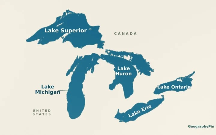
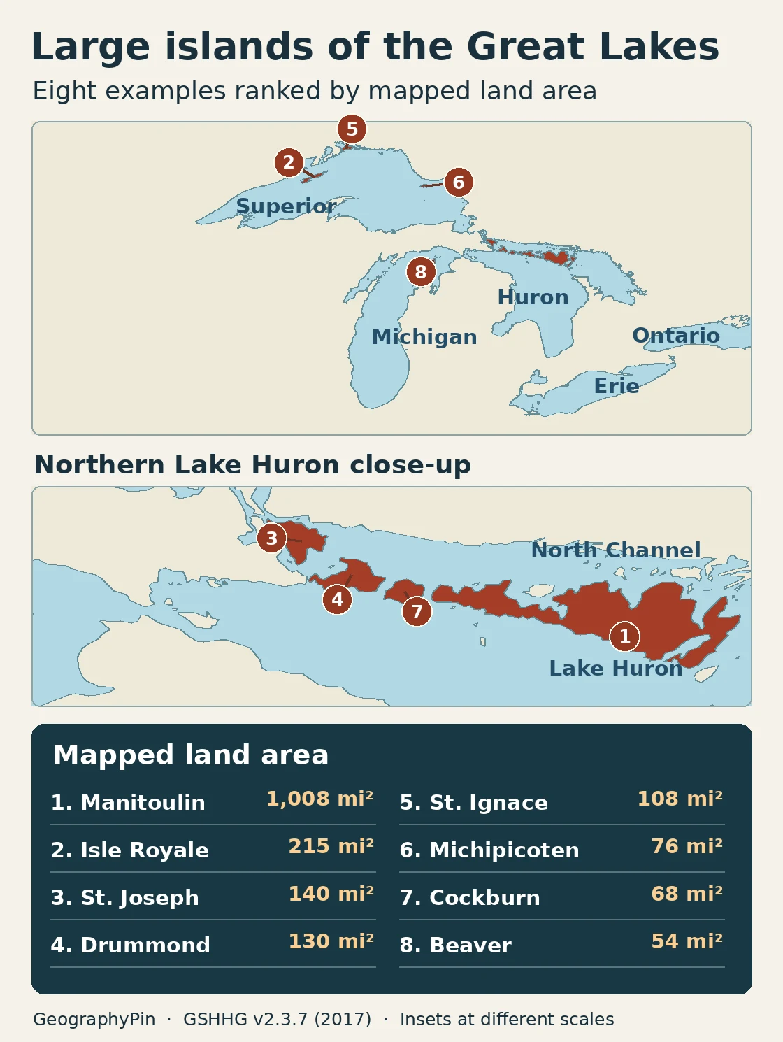
Manitoulin Island in Lake Huron is the largest island in the Great Lakes and is widely recognized as the world’s largest island in a freshwater lake. Isle Royale, in Lake Superior, is the next largest in this comparison. The map compares eight selected islands rather than ranking every island in the lakes. Northern Lake Huron is home to several more large islands, on both sides of the U.S.–Canada border.
One consistent shoreline dataset puts Manitoulin at about 1,008 square miles (2,611 km²) of mapped land, against 215 square miles (556 km²) for Isle Royale. These are modeled estimates of individual islands, not official survey or park acreages.
How to use this comparison: Find each island and its enclosing lake in the map and table. Then check what the island rule excludes or how to reproduce a land-area estimate.
Eight large islands, compared by land area
The eight measured land areas
This is a comparison of eight large, individually named natural islands, not a complete inventory of islands in every Great Lake. It includes examples from Superior, Michigan, and Huron. The map also shows Erie and Ontario for context; the absence of a table row from those lakes does not mean they have no islands.
| Order in this comparison | Island | Great Lake | Location | Land mi² (km²) |
|---|---|---|---|---|
| 1 | Manitoulin Island | Huron | Ontario, Canada | 1,008 (2,611) |
| 2 | Isle Royale | Superior | Michigan, U.S. | 215 (556) |
| 3 | St. Joseph Island | Huron (North Channel approach) | Ontario, Canada | 140 (362) |
| 4 | Drummond Island | Huron | Michigan, U.S. | 130 (338) |
| 5 | St. Ignace Island | Superior | Ontario, Canada | 108 (281) |
| 6 | Michipicoten Island | Superior | Ontario, Canada | 76 (198) |
| 7 | Cockburn Island | Huron | Ontario, Canada | 68 (175) |
| 8 | Beaver Island | Michigan | Michigan, U.S. | 54 (141) |
Download the eight estimates and shoreline polygon IDs (CSV). Values are approximate, and ranks are for this selection only. No pair ties at the displayed precision.
Why the largest islands cluster near northern Lake Huron
The North Channel runs off the north side of Manitoulin, with the main body of Lake Huron to the south. Farther west, Cockburn and Drummond sit across a series of gaps, rather than forming one continuous island with Manitoulin. St. Joseph Island marks a useful edge case: the Canadian Hydrographic Service describes its west-side channels as part of the St. Marys River and the waters around its south end as an approach to Lake Huron’s North Channel. The table keeps it as a named, natural island at that transition and labels the setting, rather than calling it an open-lake island.
Those four islands also show why the country cannot be read from the lake name. Ontario and Michigan share Lake Huron. Manitoulin, Cockburn and St. Joseph are in Canada; Drummond is in the United States. For the wider shapes and connecting waterways, see the map of the five Great Lakes.
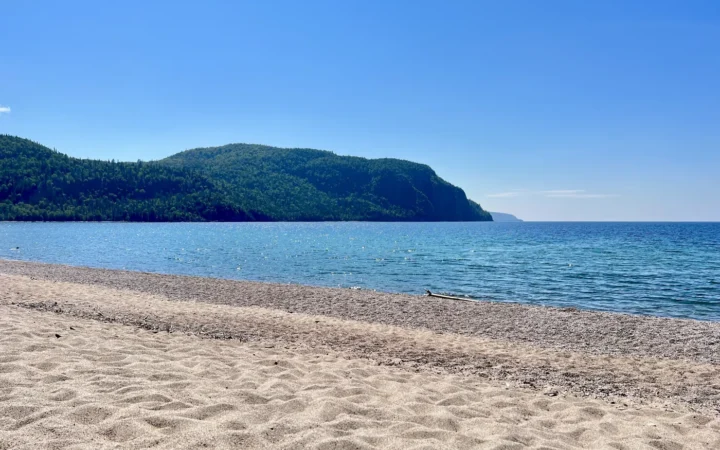
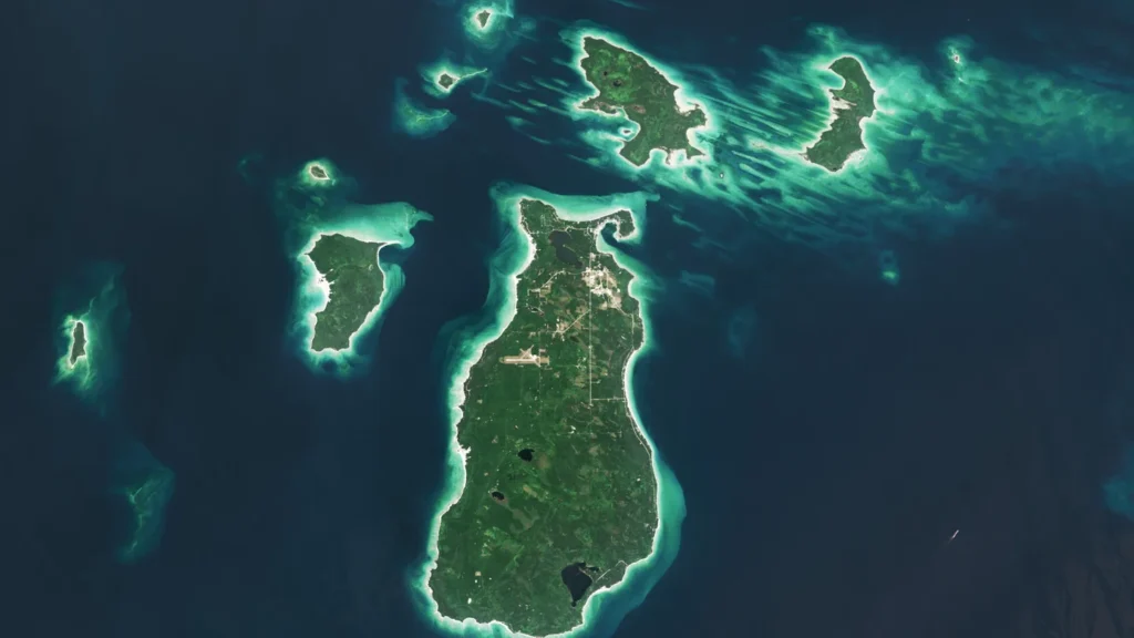
Superior has three examples in the table, including Ontario’s St. Ignace and Michipicoten islands. Michigan’s Isle Royale is a single main island within a park that also protects many other islands and surrounding water. In northern Lake Michigan, Beaver Island is part of the Beaver Archipelago; only Beaver itself supplies the number in the table.
What counts as one Great Lakes island?
Landforms excluded by the island rule
Each row describes one contiguous natural landmass associated directly with a Great Lake or its named bay or lake-facing entrance. Grouping every island in an archipelago would compare different things. A narrower definition that excludes all lake–river transition islands would leave out St. Joseph.
Land made separate only by artificial cuts is also left out. A shoreline dataset can trace land north of the Portage Lake canals as an island-shaped polygon, but the National Park Service identifies it as part of the Keweenaw Peninsula. The same principle excludes the part of Wisconsin’s Door Peninsula cut off by extending a natural bay through to Lake Michigan. River islands upstream or downstream of the lakes are not automatically included merely because the connecting waterway is in the same basin.
Two other islands illustrate the cutoff. Sugar Island sits in the St. Marys River, so it falls outside this comparison. The Canadian Hydrographic Service places Wolfe Island in the broad entrance to the St. Lawrence River at Lake Ontario. In the same shoreline dataset used for the table, Wolfe Island has about 31 square miles (81 km²) of mapped land, less than Beaver Island’s 54 square miles (141 km²). Wolfe is a lake–river edge case, not an extra row in this eight-island selection.
How the areas were measured
Calculating net land area
The release used here is full-resolution GSHHG v2.3.7, dated June 15, 2017. For each named island, the calculation measures its level-3 polygon on the WGS84 ellipsoid, then subtracts level-4 inland-water polygons whose parent ID matches the island. This removes mapped inland water without adding surrounding lake water. Places and map labels were checked against hydrographic, geographical-name and park sources. The release date is not one common survey date for all eight coasts.
Try it with Manitoulin: start with about 2,822 km² inside its outer shoreline, then subtract about 211 km² for the three mapped inland-water polygons. The result is about 2,611 km², or 1,008 square miles. The dataset does not capture every small interior pond, marsh edge or recent coastline change. A zero in the CSV’s number of subtracted polygons means this release did not encode a matching child polygon, not that the island lacks inland water. The figures are not a substitute for a local large-scale survey.
Isle Royale is a reminder to read the measurement label. The National Park Service’s management plan reproduces a historical net-land estimate for the main island of 193 square miles, distinct from the 215 modeled here. Differences in shoreline geometry and inland-water coverage are possible; the sources do not apportion the gap. Neither figure is the acreage of Isle Royale National Park.
Frequently Asked Questions
Does an island inside an inland lake on Manitoulin count?
Not as its own Great Lakes island. Treasure Island sits in Lake Mindemoya, which is on Manitoulin. The water around Treasure Island is Lake Mindemoya, not Lake Huron.
Would an international border split an island into two entries?
No. This comparison’s unit is one physical island. A border would be noted as part of its location; it would not divide the island’s area into separate ranks. None of the eight listed islands straddles the international border.
Are the eight islands a complete ranking?
No. They are eight measured examples, ordered by mapped land area. Some other lists include islands in connecting rivers or at lake outlets. See the landmass and waterbody rule for how Sugar and Wolfe islands differ.
What Did We Learn Today?
Manitoulin is the Great Lakes’ standout island by area, but northern Huron holds several other large islands as well. To compare them, count one landmass at a time, subtract inland water against the same source, and don’t mix park, archipelago or river boundaries into the result.
Sources & Data Notes
Show sources and area method
- NOAA NCEI: Shoreline/Coastline Databases and Wessel and Smith: GSHHG 2.3.7, full resolution, June 15, 2017, source shoreline data distributed under LGPL v3 or later per the release documentation. Version and source download. The CSV holds derived geodesic area estimates, not a copy of the geometry.
- Destination Ontario: Manitoulin freshwater superlative. Destination Northern Ontario: Treasure Island and Lake Mindemoya geography.
- Canadian Hydrographic Service: Lake Huron, St. Marys River, Lake Superior: St. Joseph Island, Sugar Island and nearby named passages. Ontario: Lake Superior island names.
- Canadian Hydrographic Service, Lake Ontario Sailing Directions, CEN 302 for Wolfe Island at the river entrance; U.S. Census Bureau reference map of Sugar Island Township for the St. Marys River setting. Wolfe Island was measured separately with the same GSHHG method (feature 187265).
- National Park Service: Isle Royale General Management Plan. NPS: Keweenaw historical structures and Door Peninsula register documentation confirm the artificial cuts.
- NASA Earth Observatory: America’s Emerald Isle: Beaver Island, the Beaver Archipelago and featured Landsat 9 image. Imagery acquired August 2, 2024, processed by Wanmei Liang using USGS Landsat data, cropped and compressed. U.S. federal public-domain imagery.