Lake Macquarie looks like a lake on a road map, but its narrow connection to the sea changes how it works. Understanding that passage makes the surrounding towns, saltwater, and sheltered basin fit together.
Lake Macquarie is a coastal saltwater lake south of Newcastle in New South Wales, Australia. It is also a barrier estuary, connected to the Pacific Ocean through Swansea Channel. The lake basin, its drainage catchment, and the City of Lake Macquarie are different geographic areas, so their measurements should not be mixed.
How to use this article: Start with the location, compare size and depth, understand the estuary classification, or follow the ocean connection.
1. Where Lake Macquarie Is
Find the waterbody, not just the city
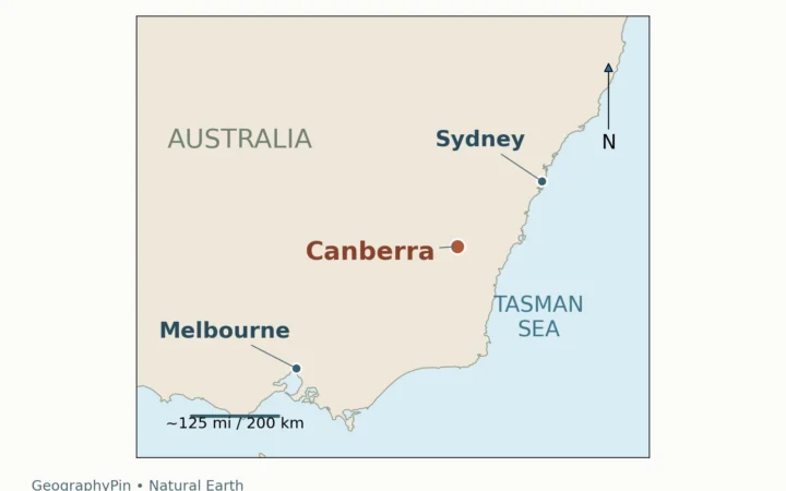
Lake Macquarie lies on the Hunter coast of New South Wales, immediately south of Newcastle. Its ocean connection is on the eastern side, through Swansea Channel. The lake’s irregular shoreline encloses bays and headlands rather than a simple oval basin.
The name also appears on maps for the City of Lake Macquarie. That is a local-government area, not another name for the water surface. A population figure for the city cannot describe the lake, and a municipal boundary cannot substitute for its drainage divide. Central Coast Council also has responsibilities in the southern catchment.
For orientation, follow the shoreline rather than a single town center. Belmont and Swansea are on the eastern side; Toronto and Wangi Wangi help identify the western shore; Mannering Park is toward the south. These are useful place references, not the edges of separate lakes.
The NSW fishing guide describes this network of shoreline settlements and identifies Swansea Channel as the connection to the sea.
2. Size, Depth, and the Map
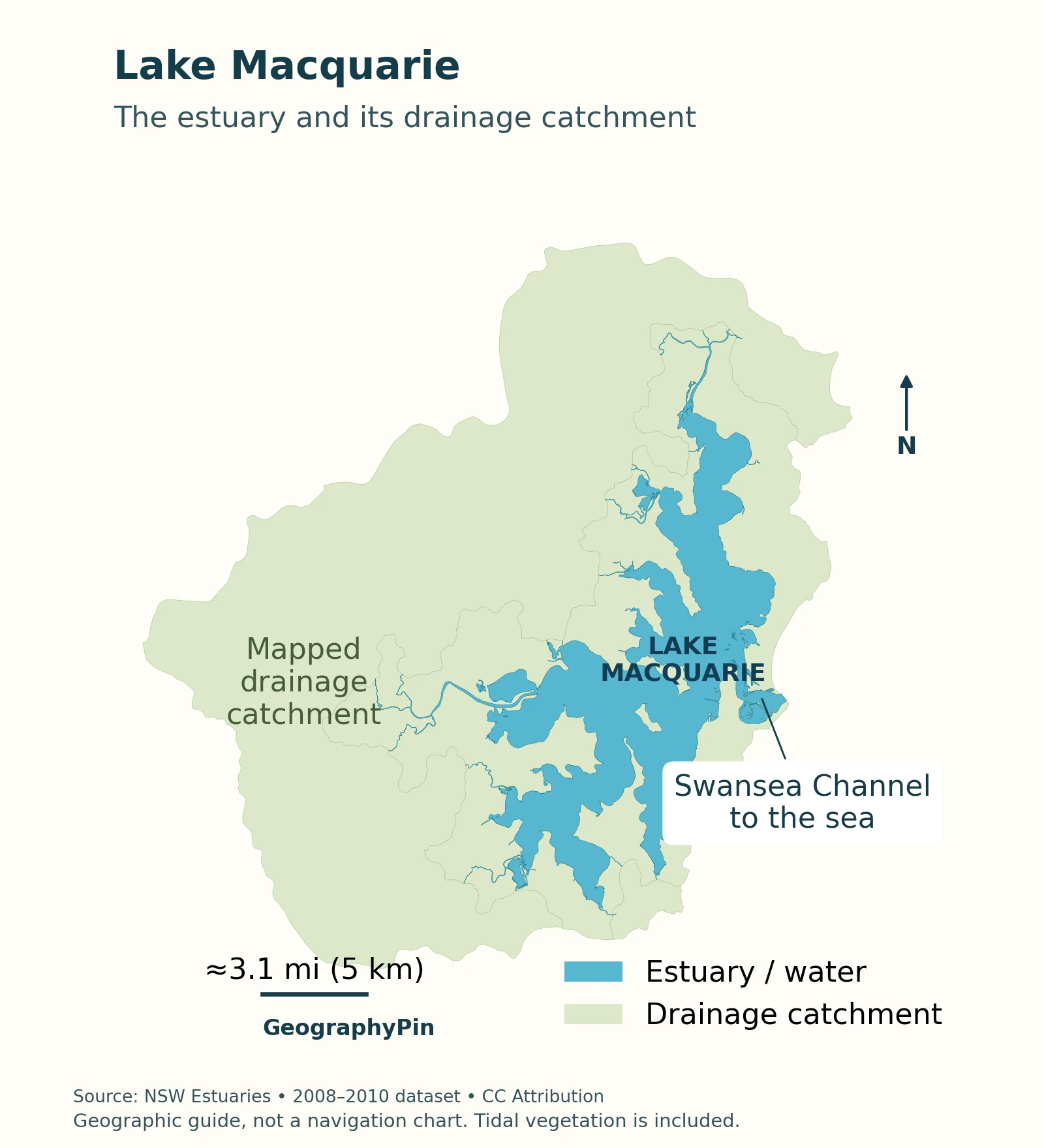
How large and deep is it?
| Measure | Value | What it describes |
|---|---|---|
| Estuary area | About 44.1 square miles (114.1 km²) | The estuary waterbody, not the city |
| Catchment area | About 233.4 square miles (604.4 km²) | The published drainage-area measure |
| Average depth | About 18.7 feet (5.7 m) | A basin average, not the depth at every location |
These figures come from the NSW estuary profile. The physical-data table does not specify a survey year, so they should not be treated as a newly measured shoreline or current navigation soundings. US customary values are rounded conversions.
Read the connection before the labels
Start with the broad lake basin, then trace its narrow eastern passage to the coast. That connection explains why an apparently enclosed “lake” exchanges water with the ocean. The map distinguishes the mapped estuary from its surrounding drainage catchment; it does not show navigation depths.
3. Why a Lake Can Also Be an Estuary
The name and the process describe different things
“Lake Macquarie” is the established place name. Scientifically, the November 2024 DCCEEW synthesis describes it as a wave-dominated barrier estuary. The coastal barrier partly encloses the basin, while the entrance allows exchange with the sea.
An estuary is a partly enclosed coastal waterbody where seawater and freshwater from the land can meet. That definition concerns water exchange, not whether “river,” “bay,” or “lake” appears on the sign. NOAA’s estuary explanation provides that basic distinction.
Lake Macquarie is therefore not a freshwater reservoir and not an isolated inland salt lake. Its coastal-lagoon appearance and estuarine functioning can be discussed together, provided “lagoon” is not used to imply that the entrance closes seasonally. NSW identifies Swansea as permanently open and trained.
For the broader naming problem, see what makes a lake a lake. Names are useful starting points, but water sources, outlets, and basin form explain how an individual waterbody works.
What the coastal barrier tells us
Coastal basins develop through interactions among sea level, sediment, and the shape of the land. Sand accumulation can shelter a basin from the open coast without completely separating it from seawater. The National Park Service’s estuary-landform overview explains why estuaries are sedimentary environments as well as mixing zones.
Here, the useful contrast is between the wide sheltered waterbody and the restricted passage to the sea. “Barrier estuary” does not mean a dammed artificial lake, and it does not imply that every part of the shoreline consists of a beach.
4. Swansea Channel, Tides, and Catchment Water
An open entrance does not mean ocean-sized tides everywhere
Swansea Channel links the basin to the Pacific Ocean. A “trained” entrance is one modified with structures such as breakwaters to help hold its opening in place, as explained in NSW’s guide to estuary entrances.
The 2024 synthesis reports a maximum tidal range in the lake of roughly 12 inches (30 cm). That is not a tide prediction for Swansea’s ocean-facing entrance. The channel and broad basin respond differently, so a tidal figure needs its location attached.
Likewise, a small vertical rise and fall inside the lake does not guarantee weak currents throughout the connecting channel. Water levels, currents, and navigable depths are different measurements. An educational lake map cannot tell a skipper whether a crossing is safe today.
Rainfall connects the surrounding land to the lake
The catchment is the land area that directs water toward the estuary through creeks, runoff, and groundwater. Roads and stormwater drains add routes through built-up areas. The drainage divide follows the terrain, not the city boundary.
The 2024 synthesis identifies Dora and Wyee creeks in the southern system and Cockle and Stony creeks in the north. Freshwater inputs, wind, and the ocean connection all matter to circulation. “Saltwater lake” is a useful description, but not a claim that salinity stays identical at every site and time.
NSW’s estuary guidance also explains why catchment conditions matter: water can carry sediment, nutrients, and pollutants downstream. Protecting a shoreline alone does not address everything arriving from farther inland.
5. Using the Geography When You Visit
The lake supports a mosaic of environments, including seagrass meadows, saltmarsh, mangroves, rocky and oyster reefs, and sand and mud flats. Those habitats make the shore more than a line separating water from land: its shallows and vegetated margins are part of the estuarine system described by NSW’s profile.
Choose a shore and check the right information
A practical visit begins with a specific destination, not merely “Lake Macquarie.” A foreshore stop, an ocean beach near the channel, and a boating trip involve different settings. Use the shoreline towns described above to identify which side you mean before planning the route.
The NSW fishing guide identifies a recreational fishery with sheltered bays, creeks, and headlands. It is a useful starting point for anglers, but an article about physical geography is not a substitute for current fishing restrictions, weather information, or boating notices.
Use the source that matches the activity. Consult official marine information for boating, current local advice for swimming, and the relevant park or council page for a particular access point. Do not infer that every mapped shore is public, that a scenic bay is monitored for swimming, or that a photograph establishes present conditions.
Frequently Asked Questions
Is Lake Macquarie the same place as Macquarie Harbour?
No. Lake Macquarie is in New South Wales. Macquarie Harbour is a different waterbody in western Tasmania; check the state as well as the name when searching for maps.
What Did We Learn Today?
Lake Macquarie is best understood by following the water: from the surrounding catchment into a broad coastal basin, then through Swansea Channel to the ocean. Its lake name does not make it freshwater, its city boundary does not define its catchment, and its average depth does not describe a navigation route. Those distinctions turn a place name into a working geographic picture.
Sources & Data Notes
Area and mean-depth figures use the NSW estuary profile; its physical table supplies no survey year. Conversions are rounded. The tidal description follows the November 2024 DCCEEW synthesis and applies to the lake, not every point in Swansea Channel. No fixed salinity, maximum depth, live water-quality grade, or navigation depth is asserted.
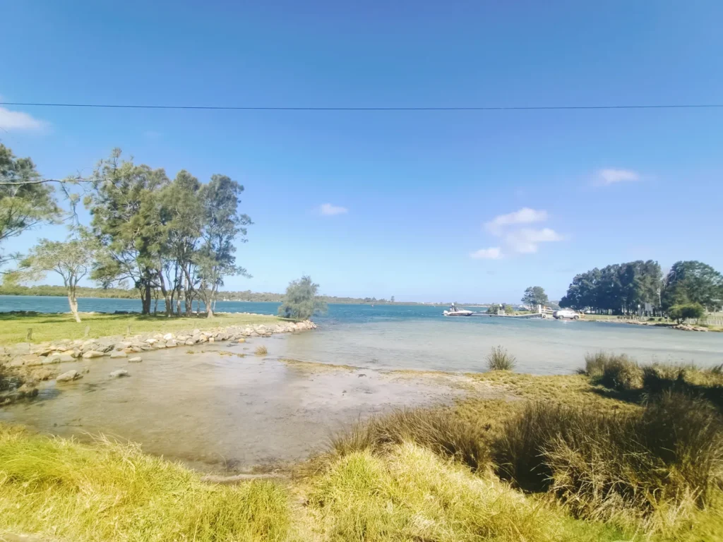
The map uses original NSW dataset geometry with a locally adjusted geographic projection and approximate scale. It is an orientation and catchment guide, not a navigation chart. Featured photograph: JaredMcKenzie / Wikimedia Commons, CC0; resized and compressed, without a watermark.
- NSW Environment and Heritage: Lake Macquarie estuary profile.
- DCCEEW: Lake Macquarie synthesis report, November 2024.
- NSW Environment and Heritage: Types of estuaries.
- NSW DPIRD: Go Fishing, Lake Macquarie.
- NOAA: Where Rivers Meet the Sea.
- National Park Service: Estuary landforms.
- Central Coast Council: Lake Macquarie.