From a beach or city waterfront, Lake Michigan can look more like an inland sea than a lake. Its map reveals a more specific pattern: four states around a long freshwater basin, with a narrow-looking northern connection that is essential to understanding the whole system.
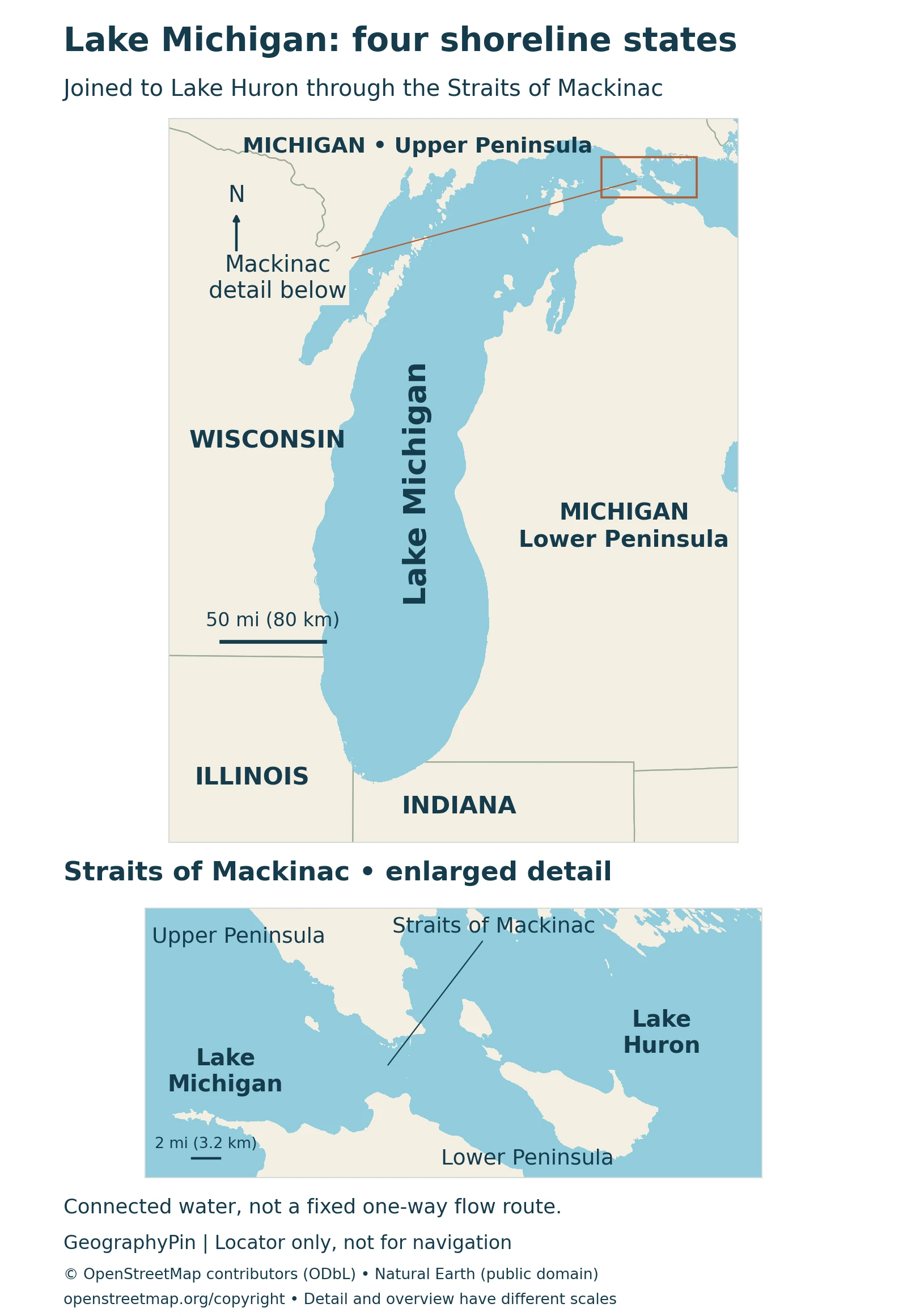
Lake Michigan is the only Great Lake entirely within the United States. Its shores touch Michigan, Wisconsin, Illinois and Indiana. The Straits of Mackinac connect it to Lake Huron, so the two conventionally named lakes function as a connected Michigan–Huron waterbody for hydrological purposes.
How to use this article: Locate the four-state shoreline, compare area and depth, or understand the connection to Huron.
1. Where Is Lake Michigan?
Lake Michigan lies in the north-central United States and belongs to the Great Lakes system. Wisconsin borders its western side, Illinois its southwestern corner, Indiana its southern end and Michigan its eastern and northern shores. It is the only one of the five conventionally named Great Lakes entirely within the United States.
Four states, not just Michigan
The name can obscure the geography: the state of Michigan does not surround the entire lake. Chicago is on the Illinois shore, while Milwaukee is on the Wisconsin shore. Michigan’s Lower Peninsula lies to the east of the water, and its Upper Peninsula borders the north. Indiana’s shoreline connects the Illinois and Michigan sides at the southern end.
Nor does “Great Lake” automatically mean an international shoreline. Canada borders other lakes in the system, but not Lake Michigan itself. Our Great Lakes map places this lake beside Superior, Huron, Erie and Ontario and shows their wider connections.
2. Area, Depth and Shoreline Measurements
Lake dimensions describe different things: surface area is the water’s footprint, depth is the distance to the bottom, and shoreline length follows the edge of the lake and its islands. A large surface area alone does not tell you how much water a basin holds.
A consistent reference table
The table follows NOAA CoastWatch’s physical-characteristics compilation, which identifies the 1995 third edition of The Great Lakes: An Environmental Atlas and Resource Book as its source. These are geographical reference figures, not a new survey or a live lake-level reading.
| Feature | Reference value | What it describes |
|---|---|---|
| Surface area | 22,300 square miles (57,800 km²) | Lake surface, not the surrounding drainage basin |
| Length | 307 miles (494 km) | Overall length, not a shoreline route |
| Maximum breadth | 118 miles (190 km) | Width at the broadest part |
| Average depth | 279 feet (85 meters) | A basin-wide mean, not a typical beach depth |
| Maximum depth | 925 feet (282 meters) | Deepest reference value in this compilation |
| Water volume | 1,180 cubic miles (4,920 km³) | Amount of water held in the basin |
| Shoreline | 1,638 miles (2,633 km) | Includes islands |
NOAA marks its depth and volume figures as measured at Low Water Datum, a reference level. They should not be interpreted as measurements tied to today’s water surface. Other summaries give slightly different values, including Michigan Sea Grant’s maximum of 923 feet (281 meters); the table keeps one attributed series rather than mixing them.
Shoreline length is especially sensitive to what is counted and how the edge is measured. Including island shores makes it a different quantity from driving around the mainland. Neither shoreline length nor the lake’s long axis gives the distance of a particular ferry crossing.
3. Why Michigan and Huron Are Physically Connected
At Lake Michigan’s northeastern end, the Straits of Mackinac connect it to Lake Huron. Unlike two lakes separated by a steep river or waterfall, these basins share a broad water connection and behave as one system for many hydrological purposes. That is why monitoring and forecasting products often use the combined name Lake Michigan–Huron.
A connection with changing currents
NOAA’s Straits research describes an overall transfer from Michigan toward Huron, but the actual exchange is not a permanent one-way current. Wind-driven water movement oscillates, flow can reverse, and surface and deeper water can move in opposite directions during summer. A simple arrow on a small map cannot capture that circulation.
The familiar five-lake naming system remains useful for geography. Calling Michigan and Huron one hydrological lake does not erase their conventional names; it answers a different question about connected water. Likewise, their shared long-term water-level behavior does not mean every point on both lakes has exactly the same instantaneous surface height in wind or waves.
This distinction also matters for comparisons. A ranking that treats Michigan and Huron separately is not directly comparable with one that combines their surface areas. State which convention is being used before calling any lake the largest.
4. Glacial Basins and Coastal Dunes
Lake Michigan’s basin belongs to a landscape repeatedly reshaped by continental ice. Glaciers widened and deepened pre-existing valleys, transported rock and sediment, and left deposits as they retreated. Water then occupied the excavated low ground. This is an example of the glacial processes described in our guide to how lakes form.
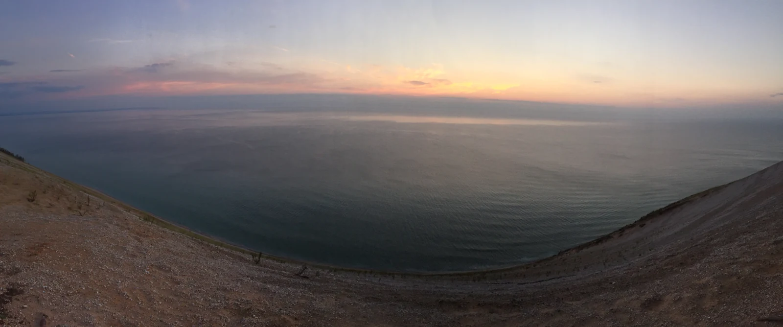
Why a tall sandy bluff is not all dune sand
Along parts of the Michigan shore, waves erode bluffs and redistribute sediment. Wind carries exposed sand inland, building dunes where it slows or meets vegetation. These actions continue to reshape the shore after the glaciers have gone.
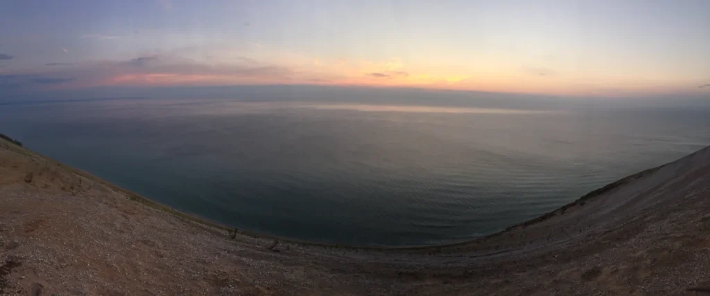
Sleeping Bear Dunes provides a particularly clear example. The National Park Service distinguishes beach dunes near lake level from perched dunes resting on higher glacial moraines. A moraine is a deposit of material left by a glacier. The full height of a perched dune above the lake therefore includes its underlying landform; it is not all a pile of windblown sand.
A single view can combine a glacial headland, wave erosion and mobile sand; not every sandy slope has the same origin.
5. Understanding the Shore Before a Visit
Lake Michigan’s shore ranges from city waterfronts and working harbors to wooded stretches, beaches and dune landscapes. A visit to Chicago’s lakefront and a visit to a dune park are encounters with different parts of the same waterbody, not interchangeable versions of the whole lake.
Freshwater does not mean calm water
Lake Michigan is freshwater, but its size allows substantial wind-driven waves and dangerous currents. The National Weather Service warns about rip currents, currents around structures and river outlets, and breaking waves on Great Lakes beaches. Piers and breakwaters are not automatically sheltered swimming places.
Before entering the water, check the official beach forecast, local warnings and lifeguard advice where available. A photograph taken on a quiet day or a general account of clear lake water cannot establish safe conditions for another date or another shore. Navigation and swimming decisions need current local information, not this locator map.
For shore walks, distinguish a mapped coastline from public access. A lake outline shows where land meets water; it does not identify every permitted path, property boundary or open facility. Follow the relevant park or local manager’s access guidance.
What Did We Learn Today?
Lake Michigan has a four-state shoreline entirely within the United States. Its conventional name describes one Great Lake, while its connection through the Straits of Mackinac explains why Michigan–Huron is often treated as one hydrological system. Reference measurements, glacial landforms and changing coastal conditions each reveal a different part of that geography.
Sources & Data Notes
The locator uses sourced lake polygons and generalized state boundaries. The shared cartographic seam between the Michigan and Huron polygons is not drawn as a barrier. The map does not show depth, current forecasts or public-access boundaries.
The measurement table uses one identified atlas-based reference series. Paired units are reproduced as published rather than independently converted. NOAA’s Low Water Datum note applies to depth and volume; shoreline includes islands. Values are not presented as new survey results or current water conditions. Separate and combined lake rankings require different naming conventions.
- Michigan Sea Grant: location, four states and hydrological connection
- NOAA CoastWatch: physical characteristics, based on the 1995 Environmental Atlas
- NOAA GLERL: research on changing currents in the Straits of Mackinac
- NOAA, 2020: Lake Michigan–Huron Operational Forecast System technical memorandum
- National Park Service: glacial sculpting, moraines and changing shorelines
- National Park Service: glacial landscape, shoreline sediment and dune types
- National Weather Service: Great Lakes waves, currents and beach safety
- National Weather Service: current Great Lakes beach forecasts and hazards