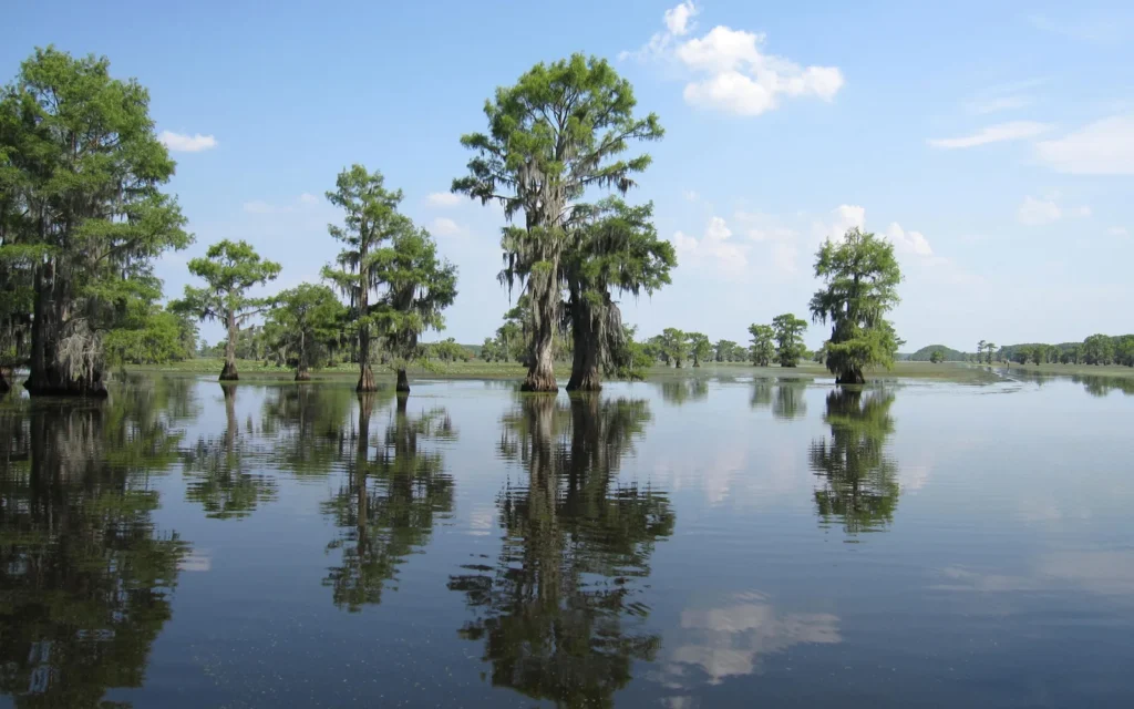
Cypress trees rising out of still water are Caddo Lake’s signature scene. But that view alone does not explain the place: open water, bayous and forested wetlands form a connected landscape across a state boundary.
Caddo Lake is a freshwater lake and wetland system on the Texas–Louisiana border. Its natural development is associated with historic logjams in the Red River system, while later dams helped retain water. The surrounding cypress wetlands are part of a wider landscape, not simply the open lake shown on a map.
How to use this article: Start with the map, compare size and water-level references, separate history from formation stories, or check access planning.
1. Where is Caddo Lake?
Caddo Lake crosses the boundary between northeastern Texas and northwestern Louisiana. Its Texas side lies in Harrison and Marion counties; its Louisiana side is in Caddo Parish. That cross-state setting matters: the name describes one connected lake system, not separate Texas and Louisiana lakes.
Reading the lake map
The map places the mapped waterbody against the state line. It is an orientation map, not a chart of navigable channels. Blue does not delineate every forested wetland connected with Caddo, and it is not the boundary of a park or conservation designation.
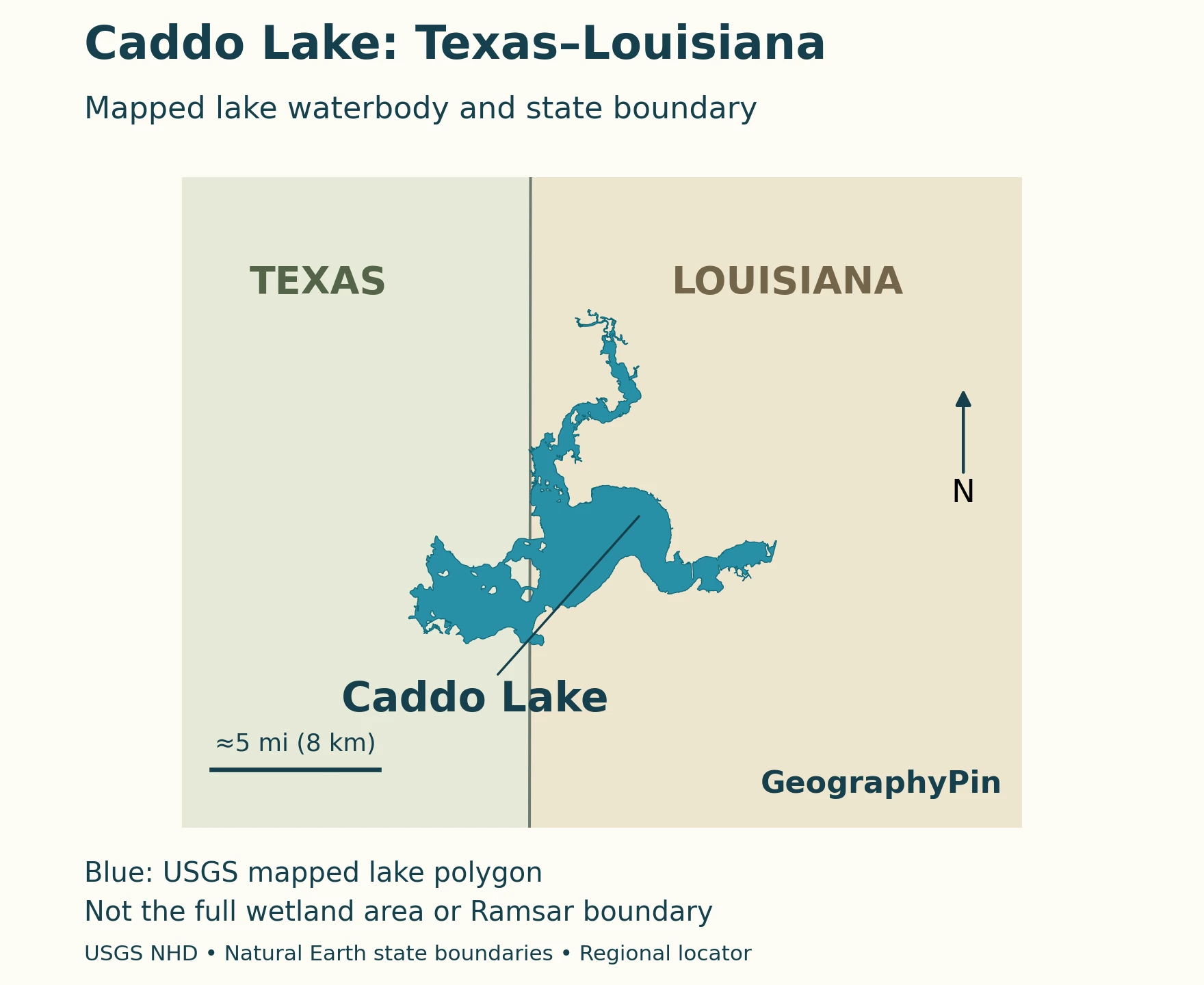
The lake outline comes from a mapped waterbody dataset rather than a recent flood image. It should therefore not be read as the exact shoreline on the day of a visit. A regional locator answers “where?”; a current boating chart and local conditions answer the different question “where can I travel?”
2. How large and deep is the lake?
The Texas Parks and Wildlife Department’s fishing reference lists an area of 26,800 acres, about 108.5 square kilometers, and a maximum depth of 20 feet (6.1 meters). These are reference dimensions, not a statement that all parts of the lake are equally deep or currently at that level.
| Feature | Reference |
|---|---|
| Setting | Texas–Louisiana state line |
| Area | 26,800 acres (about 108.5 km²), TPWD fishing reference |
| Maximum depth | 20 ft (6.1 m), TPWD fishing reference |
| Water type | Freshwater lake connected with forested wetlands and bayous |
| Conservation-pool reference | 168.50 ft (51.36 m), NGVD 29 vertical datum, Water Data for Texas |
Why the numbers need context
A TPWD fisheries survey summary uses a different area, 27,472 acres (about 111.2 square kilometers). The two publications do not establish a single explanation for that difference. Neither should be silently presented as a newly measured, exact shoreline area. The blue polygon in the map is a separate cartographic feature and is not being used to calculate either published figure.
Likewise, the conservation-pool elevation is a reference level, not today’s water surface. Water Data for Texas provides dated observations and identifies their vertical datum. Its capacity accounting uses the Texas share of the reservoir; a percentage shown there should not be interpreted as a simple measurement of how much of the entire cross-state lake is wet.
3. Natural origins, logjams and later dams
Caddo’s history is not adequately explained by calling it either untouched nature or a lake created from scratch by a twentieth-century dam. Natural river processes helped form the lake, while later engineering changed how water was retained.
What is documented, and what is a legend?
TPWD’s history account describes the Great Raft, an extensive accumulation of logs in the Red River system. Such obstructions backed water into surrounding lowlands. The account cites observations of the raft in 1691 and by the Freeman–Custis expedition in 1806. These are records of the river obstruction, not exact dates of Caddo Lake’s birth.
| Claim or event | What the evidence supports |
|---|---|
| Great Raft logjams | TPWD describes backed-up water and records of major river obstructions; a defensible explanation of the lake’s natural development. |
| An earthquake suddenly created the lake | A formation story, not an established explanation demonstrated by the evidence used here. It does not supply a reliable birthday for the lake. |
| 1914 dam | The USACE water-control history documents a dam built to retain the lake and navigable depths after outlet erosion associated with raft removal. |
| 1971 replacement | Documented replacement of the earlier dam, not the origin of the natural lake. |
The useful distinction is between formation and subsequent modification. For the broader terminology, see what makes a body of water a lake. A lake can have a natural origin and still have its later water regime altered by people.
4. Why water levels matter to the wetlands
The USACE’s 1982 water-control plan describes Caddo’s dam as an uncontrolled structure, rather than a set of gates routinely opened to set a chosen lake level. It explains that rainfall, runoff and outlet conditions govern the lake’s changing surface. “There is a dam” therefore does not mean “the water level never changes.”
The importance of a changing water regime
Big Cypress Bayou supplies water to Caddo Lake. The USACE Sustainable Rivers work on Big Cypress examines how upstream management, including releases from Lake O’ the Pines, can better support ecological needs downstream. Those upstream releases should not be confused with opening gates at Caddo itself.
The project emphasizes seasonal variation, including high flows and drier intervals, rather than keeping every wetland continuously flooded to the same depth. Its objectives include forest regeneration and conditions that support fish and other aquatic life. More water at every moment is not a complete ecological prescription: timing and duration matter too.
This is why a photograph of flooded trees captures only one part of the system. The wetland’s functioning depends on changes through time as well as the presence of water in a single image. A locator map cannot show that seasonal history.
5. Cypress forests and the wider wetland mosaic
Bald cypress, water tupelo and Spanish moss help give Caddo its distinctive appearance. TPWD describes not only flooded forest but also bottomland, mixed pine–oak and upland habitats around the park. The landscape is a mosaic, rather than one uniform swamp.
Bald cypress is deciduous, losing its leaves seasonally despite being a conifer. Its familiar “knees” are projections associated with the roots. Tree cavities and fallen wood also provide habitat, so the living forest and its dead wood are both parts of the wetland environment.
Lake, wildlife area and Ramsar site are not synonyms
TPWD’s Caddo Lake Wildlife Management Area account describes a conservation landscape of cypress swamp, bottomland hardwoods and upland forest. It also explains the wetland’s 1993 Ramsar recognition and the involvement of state, federal and private lands. That designation should not be mistaken for a single public park with one entrance or a guarantee of public access everywhere.
Invasive aquatic plants are another management concern. The TPWD survey covering fish sampling in 2021 and 2022 records giant salvinia, water hyacinth, crested floatingheart and hydrilla. This establishes their presence in that survey period; it is not a current map of plant coverage. A green patch in an undated image cannot establish which species is present today.
6. Visiting the lake without confusing it with the park
Caddo Lake State Park is on Big Cypress Bayou, approximately 4 miles (6.4 kilometers) upstream from the lake. The park is a way to experience the connected bayou landscape, not a name for the entire Texas–Louisiana waterbody.
Choose an access point, then check its conditions
The park’s official visitor information describes paddling, fishing, hiking and camping, with access around Saw Mill Pond and Big Cypress Bayou. Check the park’s current alerts and visitor information before setting out. A park map is useful for that park; it is not a substitute for navigation information covering the whole lake.
For fishing, start with the official lake information and linked regulations, paying attention to the state in which you will fish and any applicable consumption advice. The border is a jurisdictional boundary even where the water looks continuous.
Alligators occur in the park, and its visitor page links to safety guidance. Plan around current local advice, weather and the route you actually intend to use rather than treating calm-looking water or a scenic photograph as an assurance of easy access.
What Did We Learn Today?
Caddo is a cross-state lake whose identity includes both open water and a wider wetland landscape. Historic logjams help explain its natural development; later dams altered water retention. Published dimensions need source context, and the lake, state park and protected wetlands have different boundaries. Reading those distinctions correctly makes both the map and a visit more useful.
Sources & Data Notes
The locator uses the USGS National Hydrography Dataset’s Texas–Louisiana Caddo Lake waterbody polygon and Natural Earth state boundaries, both public-domain data. It does not delineate all associated wetlands, the Ramsar site or current inundation. The north-up map has an approximate scale and is not a navigation chart. Dimensions follow the attributed references above; the differing survey area is retained as a source discrepancy, not explained by an assumed cause.
Dam-history note: The table follows the USACE water-control plan’s 1914 completion date. The TPWD 2021 fisheries report instead gives 1912 for an early dam. These accounts disagree; the dates are not treated here as interchangeable or silently reconciled.
- TPWD: Caddo Lake fishing reference, location and dimensions.
- TPWD: Caddo Lake fisheries survey summary, alternative area and survey-period vegetation.
- TPWD: park history, Great Raft and historical development.
- TPWD: park nature, habitats and park location.
- TPWD: Caddo Lake Wildlife Management Area, conservation setting.
- USACE: Caddo Lake Water Control Plan (1982), historical engineering and structure description, not a current operating notice.
- USACE: Big Cypress Sustainable Rivers, environmental-flow objectives.
- Water Data for Texas: Caddo Lake, level reference and current observations.
- USGS NHD waterbody layer and Natural Earth data terms, map sources.
Featured photograph: USFWS, public domain; cropped and resized. Map design: GeographyPin.