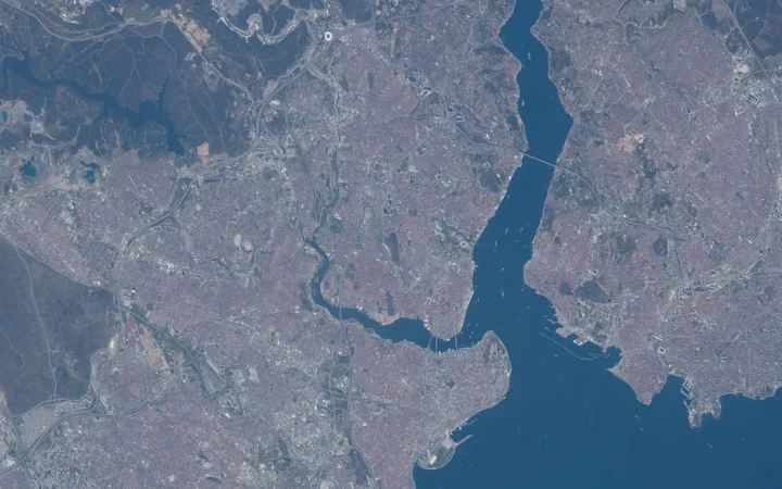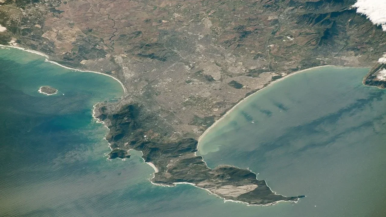
A photograph of Cape Town often shows a mountain rising behind a waterfront. That view is memorable, but it leaves out much of the city’s geography: the low plains beyond the mountain, a second large bay, a long peninsula and a metropolitan municipality extending far beyond the central streets.
Cape Town lies in South Africa’s Western Cape, around the northern end of the Cape Peninsula. Its central area faces Table Bay, while False Bay lies east of the peninsula. Mountains and the low-lying Cape Flats shape the wider city. Africa’s southernmost point is Cape Agulhas, not Cape Town or the Cape of Good Hope.
Find your bearings: Compare the two bays, distinguish the central city from the municipality, and use the regional map to understand Cape Agulhas.
1. Where is Cape Town?
Cape Town occupies the southwestern part of South Africa, in the Western Cape province. It is a coastal city, but its landscape is not simply a flat strip beside the sea. The Cape Peninsula projects southward, with a mountain chain running along it, while the wider urban area spreads across lower ground to the north and east.
The national government identifies Cape Town as South Africa’s legislative capital. Pretoria has the administrative role, and Bloemfontein is traditionally described as the judicial capital, with the Constitutional Court located in Johannesburg. These functions should not be collapsed into a claim that Cape Town is the country’s sole capital. Our guide to countries with more than one capital explains this distinction in a wider context.
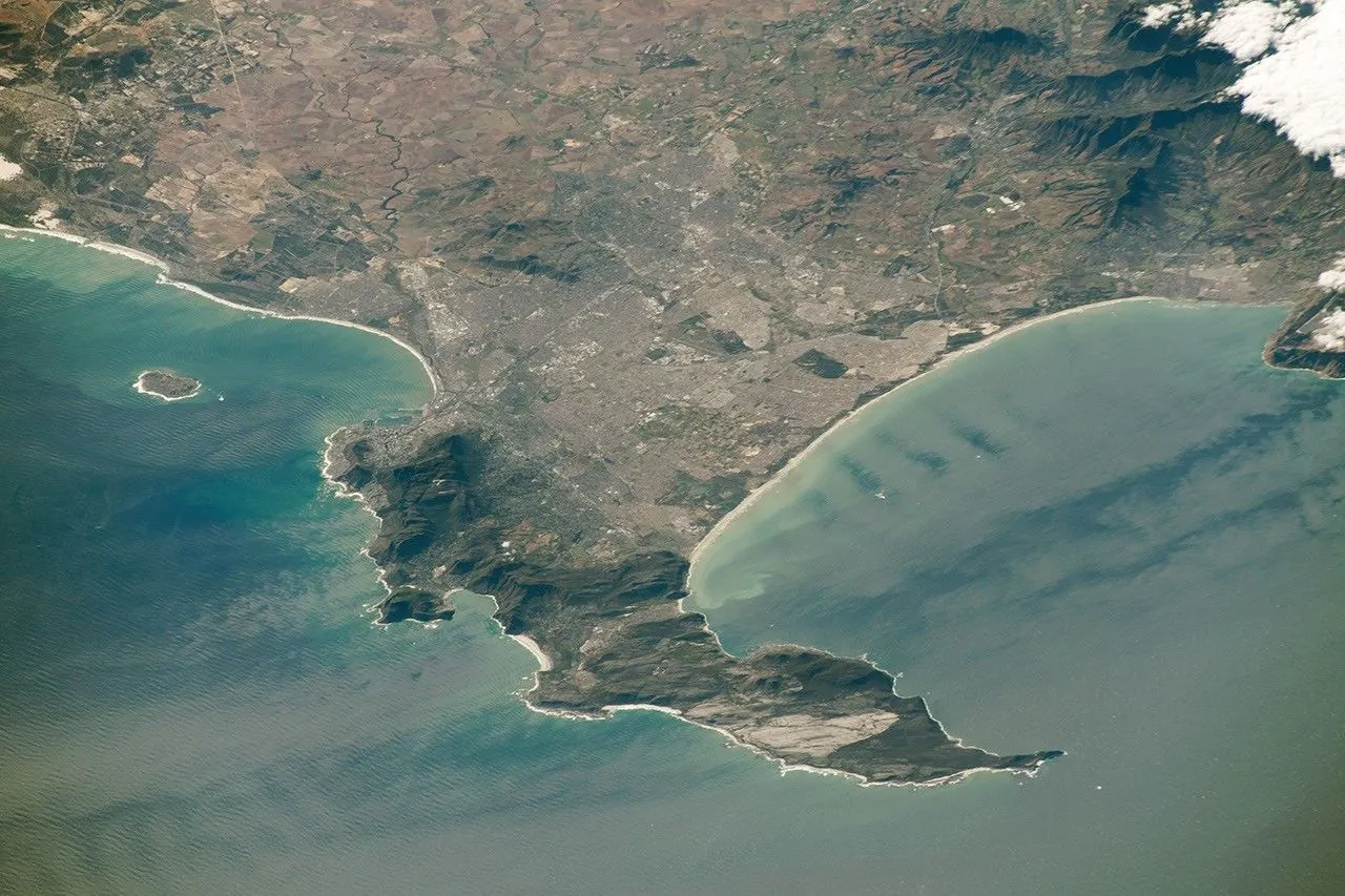
In the photograph, the compact peninsula contrasts with the much broader mainland beyond it. The visible urban fabric also makes an important point: Cape Town is not confined to the small central area immediately below Table Mountain. A city photograph, a municipal boundary and a mountain range describe different kinds of space.
2. Table Bay, False Bay and the Cape Flats
Two bays on different sides of the landscape
Table Bay is the bay beside the historic central city and its main harbor. False Bay is the much larger indentation east of the Cape Peninsula. Looking at an oblique photograph can make the two seem like opposite ends of one harbor, but they are separate coastal features.
The peninsula forms the western side of False Bay. The bay’s northern shore meets the lower mainland landscape, while its eastern side is framed by another stretch of mountainous coast. The Atlantic-facing shore west of the peninsula has a different orientation and exposure from the sheltered recesses within the bays.
| Name | What it describes | Do not confuse it with |
|---|---|---|
| Table Bay | The bay beside central Cape Town and its harbor | False Bay, farther south and east |
| Cape Peninsula | The projecting landform with a mountain chain | The entire metropolitan municipality |
| Cape Flats | Low-lying plains within the wider city | A single neighborhood or all of Cape Town |
The plains matter as much as the mountain
The Cape Flats provide a useful counterpoint to the familiar mountain skyline. These lower areas include sandy ground and former wetland landscapes. They are part of the physical setting across which a much larger urban area has developed, rather than empty space between scenic landmarks.
The City’s explanation of winter flooding highlights the importance of drainage, hardened surfaces, runoff from slopes and low-lying former wetland areas. That is a landscape-level explanation, not a statement that every home on the Flats has the same flood exposure. Local elevation, drainage works and the intensity of a particular storm still matter.
3. Table Mountain and the Cape Peninsula
A mountain landscape within the city
Table Mountain is the best-known part of a longer peninsula landscape. South African National Parks describes Table Mountain National Park as extending from the northern landmarks toward Cape Point in the south. The park, the mountain chain and the municipal area are related, but they are not interchangeable boundaries.
The peninsula’s exposed rocks include the Malmesbury Group, Cape Granite and the Table Mountain Group. Sandstones of the Peninsula Formation form much of Table Mountain, while granite appears in other parts of the landscape. The scenery therefore reflects a geological structure, not a single uniform block of rock.
Different rock types, slopes and exposures help produce the contrasts visible over short distances. A low coastal settlement, an exposed ridge and a valley behind the mountain occupy different settings even when they share the same city name. Assigning one elevation to all of Cape Town would conceal that variety.
Cape Point and the Cape of Good Hope belong to the southern peninsula landscape. They are famous landmarks, but neither supplies the correct answer to “Where is the southernmost point of mainland Africa?” That question requires a wider map, not a closer view of Table Mountain.
4. Cape Town’s population and administrative geography
The central city is not the whole municipality
The City of Cape Town is a metropolitan municipality. Its census population covers that administrative area, not just the waterfront, central business district or neighborhoods around Table Mountain. This is why a population figure can look unexpectedly large when paired with a tightly cropped tourist photograph.
The City reports 4,772,846 residents in the 2022 census. That is a dated census total, not an estimate for the current year. It should not be presented as the population of the Cape Peninsula alone, nor compared casually with another city’s much narrower central-city count.
Administrative statistics can also be subdivided in several ways. The City’s census portal provides material for police precincts, health districts and education districts. These units serve different purposes: a named local area on one map may not have the same boundary as a similarly named statistical or service area on another.
For a fair comparison, ask three questions before quoting a number: which boundary, which year and which measure? Population, households and density are different quantities. A metropolitan municipality can contain dense urban neighborhoods, protected landscapes and less built-up land; its average density does not describe every district.
5. Cape Agulhas, ocean names and currents
Cape Agulhas is farther south
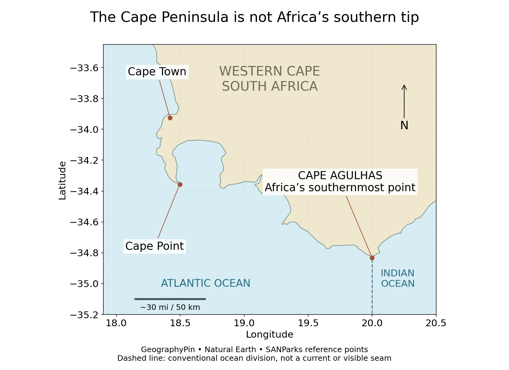
Cape Agulhas, farther east and slightly farther south than the Cape Peninsula, is the southernmost point of the African mainland. SANParks identifies the site beside the Agulhas coastal landscape. The Cape of Good Hope is not another name for it.
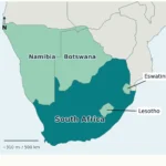
The International Hydrographic Organization’s Limits of Oceans and Seas, third edition of 1953, places the Indian Ocean’s western limit southward from Cape Agulhas along 20° east longitude. The small segment on this map illustrates that named-ocean convention. It is not a line that someone can see floating on the water.
Ocean names and water movement answer different questions
The surrounding ocean environment is influenced by the warm Agulhas system on the eastern side of southern Africa and the cold Benguela system on the western side. The City also describes cold, nutrient-rich upwelling along the west coast during summer. These processes help explain why nearby coasts can have different marine conditions.
Water does not obey a cartographic dividing line. Currents, winds and local circulation move and mix water, while ocean names organize large regions on maps. It is therefore misleading to describe Cape Point as a permanent, sharply visible meeting place of two oceans, or to infer the temperature of a particular beach solely from its ocean label.
6. Why Cape Town has wet winters and dry summers
A Mediterranean-type climate in the Southern Hemisphere
The Cape Peninsula has a Mediterranean-type climate: generally cooler, wetter winters and warmer, drier summers. The name describes a seasonal pattern, not proximity to the Mediterranean Sea. Because Cape Town is in the Southern Hemisphere, those seasons fall at the opposite time of year from northern Mediterranean cities.
SANParks links much of the winter rainfall to frontal weather systems in the westerly circulation. Summer frequently brings southeasterly winds. Mountains influence how moisture-bearing air rises and where rainfall or mist is concentrated, so conditions vary across the peninsula rather than following one uniform city-wide pattern.
“Dry summer” does not mean that summer rain is impossible, just as “wet winter” does not mean continuous rain. A climate description summarizes recurring conditions. It is not a forecast for a particular day, a mountain walk or a boat trip.
The seasonal contrast also helps connect the physical landscape to urban water planning. Rainfall, storage, consumption and distribution operate over different places and times. A coastal location does not by itself guarantee an abundant freshwater supply, and a photograph of a reservoir cannot establish the current status of the entire system.
Seen together, the mountain chain, low plains, bays and seasonal weather explain why Cape Town is more geographically varied than its familiar postcard view suggests. Its identity comes from those relationships, not just from one mountain or one coastal superlative.
Frequently Asked Questions
Is Cape Town at the southernmost point of Africa?
No. Cape Agulhas is the southernmost point of mainland Africa. Cape Town and the Cape Peninsula lie farther west and north.
Are Table Bay and False Bay the same place?
No. Table Bay is beside central Cape Town and its harbor; False Bay is east of the Cape Peninsula.
What was Cape Town’s population in the 2022 census?
The City reports 4,772,846 residents for its metropolitan municipal area. This is not a current-year estimate or a count of the central city alone.
Is Cape Town South Africa’s only capital?
No. It has the legislative role. Pretoria is the administrative capital; Bloemfontein is traditionally described as judicial, while the Constitutional Court is in Johannesburg.
Does Cape Town receive most of its rain in summer?
No. The general pattern is winter rainfall and drier summers, although rain and mountain mist can occur outside winter.
What Did We Learn Today?
Cape Town’s central harbor, the Cape Peninsula and the metropolitan municipality describe different spaces. Table Bay and False Bay sit on different sides of the local landscape, while mountains and lower plains shape both settlement and weather. Cape Agulhas, not the Cape of Good Hope, marks Africa’s southernmost point. Keeping those distinctions clear makes maps, population figures and climate descriptions much easier to read.
Sources & Data Notes
Population is the 2022 municipal census total, not a present-day estimate. Climate statements describe broad seasonal patterns, not current conditions. The original map uses Natural Earth’s generalized shoreline and SANParks location references; it does not show the municipal boundary, current ocean circulation or a navigation route. The ocean division is a named-geography convention from IHO S-23, not a physical seam.
The featured image is a real NASA/JSC astronaut photograph from May 28, 2019. NASA’s published version was cropped and enhanced; GeographyPin converted it to a lightweight format without changing its geographic content. Its oblique viewpoint and historical date should be kept in mind when comparing it with the map.
- City of Cape Town: census and population statistics
- South African Government: capitals
- NASA: Cape Town perspective and geographic context
- NASA: The Cape of Good Hope, astronaut photograph
- SANParks: Table Mountain geology
- SANParks: Table Mountain climate
- SANParks: Table Mountain National Park
- SANParks: southernmost tip of Africa
- SANParks: Cape Point reference waypoint
- IHO: Limits of Oceans and Seas, 1953, p.22
- City of Cape Town: coastal environment
- City of Cape Town: severe storms and flooding
- NASA image use guidelines
- Natural Earth public-domain data