A map labeled “Southern Africa” can cover five countries or a much wider area. The difference usually comes from the definition, not from a disagreement about where South Africa is. Start with the map’s purpose before comparing its country count.
Southern Africa contains Botswana, Eswatini, Lesotho, Namibia and South Africa in the United Nations M49 statistical grouping. South Africa is just one of those countries. Broader uses of the regional name can cover more territory; the Southern African Development Community, or SADC, is a separate organization with 16 member states.
How to use this article: Compare the different meanings, locate Lesotho and Eswatini, or check the wider SADC membership.
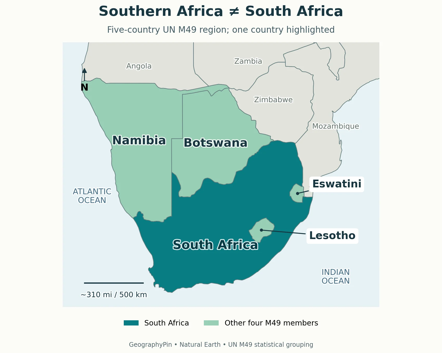
1. Map: The Region and the Country

Read the highlighted outlines as countries, not provinces. South Africa is emphasized within the five-country group so that the country remains visually distinct from the region. Neighboring land is shown for orientation; appearing in the map’s frame does not automatically mean belonging to the highlighted group.
Different names answer different questions
| Term | What it describes | How to use it |
|---|---|---|
| South Africa | One sovereign country | Use for the country’s territory, government and national statistics. |
| Southern Africa, UN M49 | A five-country statistical grouping | Use when comparing regional data that follows M49. |
| Southern Africa, broader usage | A region whose scope depends on the author or subject | Read the stated country list or map legend. |
| SADC | A regional organization with 16 members | Use for membership, cooperation and organizational programmes. |
The UN Statistics Division explains that its groupings serve statistical convenience, not political affiliation. A country assigned elsewhere in that system can still participate in a southern African organization or be included in a wider regional study.
For the surrounding continent, the Africa country-map atlas provides regional sheets. This comparison focuses on what the southern regional label includes and why it changes between sources.
2. Read the Five Countries on the Map
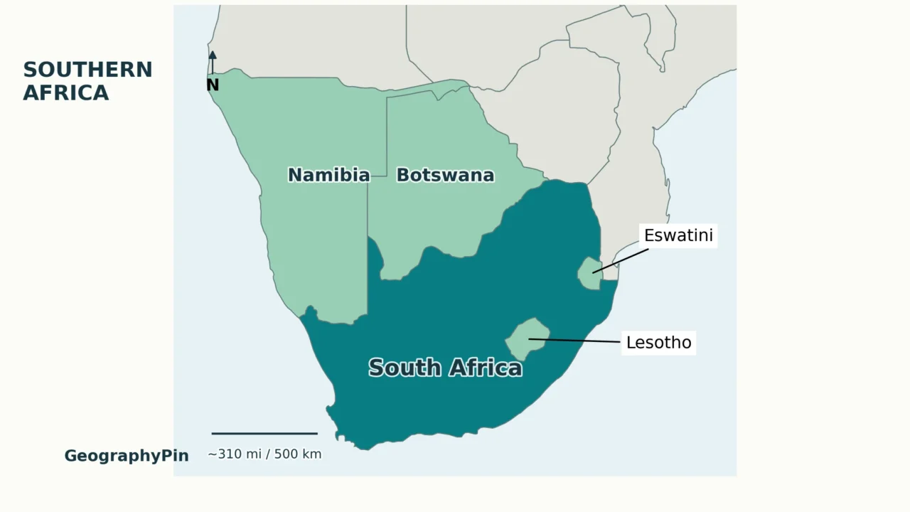
The five-country outline is easiest to learn from the Atlantic coast toward the interior and then the southeast. Namibia forms the western coastal part; Botswana lies inland to its east; South Africa stretches across the southern end. Lesotho and Eswatini are much smaller, so their borders deserve a closer look.
| Country | Position and coastline | A useful distinction |
|---|---|---|
| Namibia | Atlantic coast, northwest of South Africa | Not part of South Africa. |
| Botswana | Inland, north of South Africa | Landlocked, even though the wider region has long coasts. |
| South Africa | Southern tip, with Atlantic and Indian Ocean coasts | The country, not the name of the whole region. |
| Lesotho | Entirely enclosed by South Africa | A separate country inside the surrounding outline. |
| Eswatini | Between South Africa and Mozambique | Landlocked, but not enclosed by South Africa alone. |
Lesotho and Eswatini are not interchangeable
Lesotho’s enclosed position can make it look like a province on a small, poorly labeled map. It is an independent state. Its entire land border is with South Africa, so the outline surrounding Lesotho is an international boundary, not an internal administrative line.
Eswatini sits farther northeast and also borders Mozambique. That second neighbor is the simplest way to avoid confusing the two small countries. Both lack a sea coast, but only Lesotho is completely surrounded by South Africa. The broader landlocked-country reference explains why proximity to the sea is not the same as having a coastline.
The country map uses country labels rather than capital symbols. A label inside a country identifies the territory; it does not mark the seat of government. For that separate task, use the Africa countries and capitals reference, which explains divided capital functions.
3. Why Other Southern Africa Lists Are Longer
A longer list is not automatically wrong. The question is whether it identifies its rule. A statistical table, an economic organization and a physical-geography study need not draw the same regional outline.
SADC is a membership list, not the five-country map
The SADC member-state directory lists 16 countries. Its full membership is Angola, Botswana, Comoros, Democratic Republic of the Congo, Eswatini, Lesotho, Madagascar, Malawi, Mauritius, Mozambique, Namibia, Seychelles, South Africa, Tanzania, Zambia and Zimbabwe.
All five countries highlighted in the first map are members, but membership extends much farther north and includes Indian Ocean island states. Adding SADC countries to the first map without changing its legend would therefore change the subject, not simply make the same map more complete.
Mozambique, Zambia and Zimbabwe illustrate the distinction particularly clearly: each belongs to SADC, while M49 places them in Eastern Africa. Angola and the Democratic Republic of the Congo belong to SADC but fall under Middle Africa in M49. These labels can coexist because they answer different questions.
Broader regional usage needs an explicit scope
A report about a river basin, a transport corridor or a drought can reasonably use a study area that crosses these statistical divisions. The defensible approach is to identify the included countries or the physical boundary. There is no need to force every landscape or organization into one universal Southern Africa polygon.
When comparing two maps, ask whether both show countries, whether islands are included, and whether the colors represent membership or location. A 16-member organization and a five-country statistical region are not competing estimates of the same total.
4. Deserts, Plateaus and Two Ocean Coasts
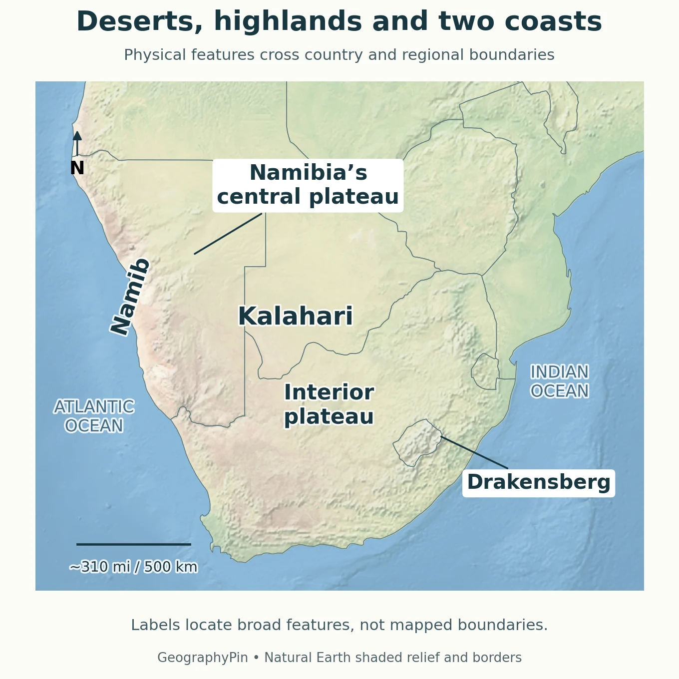
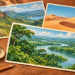
Political membership does not explain the landscape by itself. Read the physical locator from west to east: the coastal Namib, the elevated interior and Kalahari country, and the southeastern highlands. These are broad landform relationships, not an alternative set of international borders.
The Namib and Kalahari are different settings
The Namib is associated with the Atlantic side of southwestern Africa. UNESCO’s Namib Sand Sea description emphasizes its coastal dunes and fog influence. That protected sand-sea property is not a synonym for the whole Namib Desert, and its boundary should not be used as the desert’s complete outline.
The Kalahari lies farther inland across much of Botswana and parts of neighboring countries. NASA’s Kalahari and Okavango account shows marked seasonal vegetation changes. It is misleading to imagine every part as bare dune fields: sandy terrain, vegetation and wetlands can occur within the wider Kalahari setting.
The two desert names therefore teach a geographic relationship: coastal west versus inland basin. They do not divide all of Namibia and Botswana into two perfectly uniform surfaces.
Plateaus and the southeastern highlands
NASA describes Namibia’s Central Plateau between the western coastal desert and the eastern Kalahari. A plateau is elevated land, not necessarily a perfectly flat surface; its landscape can include mountains and valleys. This helps explain why a country described as arid need not look like an uninterrupted low desert plain.
South Africa also has an extensive interior plateau. The South African government’s geography overview distinguishes it from the land between the escarpment and the coast. An escarpment is a marked steep margin or slope: on a regional map it helps explain the transition, rather than marking a political boundary.
The southeastern mountain country includes Lesotho and the Drakensberg. UNESCO’s Maloti-Drakensberg Park spans protected areas in Lesotho and South Africa, a useful example of a landscape shared across an international border. The park is only part of that mountain setting, not the full mountain range.
The Atlantic lies to the west and the Indian Ocean to the east. Namibia and South Africa provide the sea coasts of the five-country grouping; Botswana, Lesotho and Eswatini remain inland. Neither ocean access nor a shared landform turns the five countries into one political unit.
5. Choose the Right Definition for Your Task
For a school map following M49, use the five-country list and say so in the caption. For a SADC project, use the organization’s member list and identify the membership date. For a landscape explanation, define the actual area being discussed rather than borrowing an institutional boundary.
A useful regional caption answers three questions: what is being grouped, which convention is used, and what the colors mean. “Southern Africa: UN M49 grouping” is more precise than “Southern Africa” alone. “SADC member states” is more precise than relabeling that organization’s extent as the only correct geography of the region.
The same discipline applies to numbers. A population, area or economic total for South Africa cannot stand in for the whole region. Before comparing totals, check that both sources include the same territories and time period. A difference in scope can be more important than a difference in the figure itself.
Frequently Asked Questions
Does “South African” mean anyone from Southern Africa?
Normally, “South African” refers to the country South Africa. For a wider regional meaning, “southern African” or an explicit country name avoids ambiguity. Geographic location alone should not be used to assign someone a nationality.
Can I use this regional map to plan a border crossing?
Use it for orientation, not as a road or travel-permission map. It does not show crossings, operating hours, entry rules or current access conditions. Those require the relevant border and immigration authorities.
What Did We Learn Today?
Regional maps become easier to read when their purpose is explicit. A country, a statistical grouping and a regional organization can overlap without being identical. Lesotho’s enclosed position, Eswatini’s two neighbors, and the contrast between coastal deserts and elevated inland terrain also show why a clear map needs more than a broad regional label.
Sources & Data Notes
Country grouping follows UN M49; SADC membership was verified against its directory in November 2026. The original maps use Natural Earth outlines. Physical labels identify broad locations, not measured desert or plateau boundaries. Country outlines are generalized for this scale and are not intended for navigation or boundary adjudication.
- UN Statistics Division: M49 regional groupings
- SADC: member states
- SADC: Lesotho geography
- SADC: Eswatini geography
- South African Government: geography and climate
- NASA Earth Observatory: Contrasting Landscape in Namibia
- NASA Earth Observatory: Kalahari and Okavango Delta
- UNESCO: Namib Sand Sea
- UNESCO: Maloti-Drakensberg Park
- Natural Earth: public-domain cartographic data