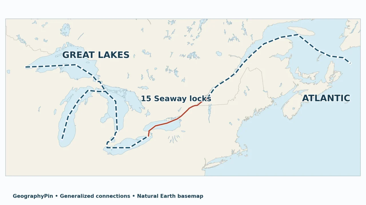
A freighter can travel between the Atlantic and the Great Lakes, but not by following every natural river connection. The missing pieces on a simple lake map are locks, bypass canals and the distinction between the Seaway itself and the larger waterway.
The St. Lawrence Seaway proper connects Montreal with Lake Erie through the Montreal–Lake Ontario section and the Welland Canal. Its 15 locks form part of the wider Great Lakes–Atlantic shipping route. Ships bypass Niagara Falls through Welland; the separate Soo Locks provide access to Lake Superior.
Choose your route: Clarify what the map includes, follow the inland journey, or see why ships avoid Niagara Falls.
1. St. Lawrence Seaway Map: Two Sections, One Wider Route
A ship arriving from the Atlantic approaches the Great Lakes through the Gulf of St. Lawrence and the lower St. Lawrence River. At Montreal, it reaches the eastern end of the Seaway proper. From there, locks and channels lead to Lake Ontario; the Welland Canal then connects Ontario to Lake Erie.

Read the route, not just the name
The word Seaway is sometimes used loosely for the entire Great Lakes–Atlantic shipping system. Here, Seaway proper means the Montreal–Lake Erie waterway defined in the operators’ handbook. Great Lakes Waterway refers to the wider navigable lake-and-channel network; the combined Great Lakes–St. Lawrence system reaches the Atlantic.
The third network is natural drainage: where water flows downhill. It overlaps the shipping route but is not identical to it. A river can connect two lakes while containing a waterfall that ships cannot pass. That distinction explains why a lake map alone cannot tell you how a freighter travels.
For the lake shapes and natural connections, use our Great Lakes map. This page instead follows the engineering that makes a continuous shipping journey possible. Lake Ontario is the name used here and in the Canadian Seaway section guides.
2. Follow a Ship Inland from the Atlantic
The upbound journey
Upbound means toward the inland lakes; downbound means toward the Atlantic. These are route directions, not instructions to travel north or south on a map. A ship sailing upbound turns southwest across Lake Ontario, for example, then south through the Welland Canal.
| Stage | What carries the ship | Key distinction |
|---|---|---|
| Atlantic to Montreal | Gulf and lower St. Lawrence | Ocean approach, outside the Seaway’s two lock sections |
| Montreal to Lake Ontario | St. Lawrence channels and canals | Seven Seaway locks |
| Ontario to Erie | Lake Ontario and Welland Canal | Eight Seaway locks; bypass of Niagara |
| Erie to Huron | Detroit River, Lake St. Clair and St. Clair River | Connecting-waterway route, not another Seaway lock section |
| Huron to Superior | St. Marys River and Soo Locks | Separate lock complex |
| Huron to Michigan | Straits of Mackinac | A branch, not a required step toward Superior |
There is no single itinerary that requires a ship to cross all five lakes. After Huron, the destination determines whether it turns toward Michigan or continues toward Superior. Likewise, a ship bound for an Ontario port does not need to go through Welland.
The Detroit–St. Clair connection is easy to compress too far on a small map. Lake St. Clair sits between two rivers: heading inland from Erie, the order is Detroit River, Lake St. Clair, St. Clair River, then Huron. Reversing the rivers produces a plausible-looking but incorrect route.
3. Where the 15 Seaway Locks Fit
Seven plus eight, not every lock in the region
The operators divide the Seaway into seven locks between Montreal and Lake Ontario and eight on the Welland Canal. Thirteen are Canadian and two are American. This count belongs to those two sections, not to every navigation structure in the Great Lakes basin.
On the Montreal–Ontario section, the Canadian facilities are St. Lambert, Côte Sainte-Catherine, the two Beauharnois locks and Iroquois. Snell and Eisenhower are on the U.S. side. The operators’ canal inventory groups these into the South Shore, Beauharnois, Wiley-Dondero and Iroquois canals.
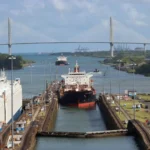
A lock is a chamber with gates that separates different water levels. For an upward passage, the lower gate closes and water enters until the chamber reaches the upper level. For a downward passage, water drains until the lower level is reached. Gravity supplies the filling and emptying process; the ship floats as the level changes.
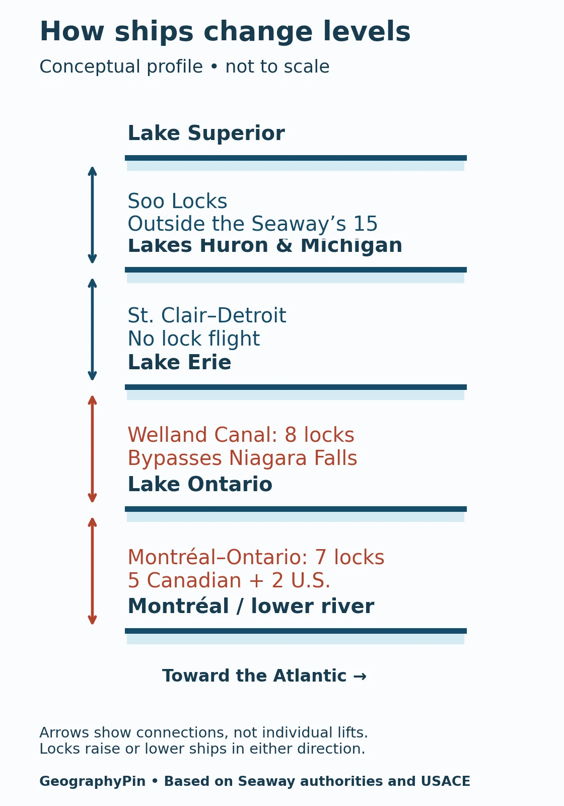
The U.S. Army Corps of Engineers’ Soo Locks overcome the St. Marys River’s approximately 21-foot (6.4-meter) drop. They provide the Superior connection, but adding the whole Soo complex to the Seaway’s 15 would mix two different counting systems. Parallel chambers at a lock complex are alternatives, not necessarily consecutive steps for one ship.
4. Why the Welland Canal Bypasses Niagara Falls
Water takes one route; ships take another
Lake Erie’s natural outlet is the Niagara River, which flows to Lake Ontario. Niagara Falls and the river’s rapids interrupt that natural connection for through-shipping. The Welland Canal crosses the Niagara Peninsula in Ontario, west of the river, to bypass the obstacle.
The Seaway’s Welland section guide describes roughly 326 feet (99.5 meters) of elevation difference between the lakes. That is the lake-to-lake difference, not the height of Niagara Falls. Confusing those measurements gives a waterfall statistic the source never intended.
Seven Welland locks provide the main lifts. Lock 8, near Lake Erie, is a control lock making a smaller adjustment to the lake level. The eight therefore should not be illustrated as eight equal-height stairs. The guide also identifies Locks 4, 5 and 6 as a flight of locks; numbering and parallel chambers do not imply eight identical installations.
Heading inland, a vessel enters from the Lake Ontario end near Port Weller and emerges into Lake Erie at Port Colborne. It does not climb the Niagara River or pass through the falls. A map that draws a shipping arrow along the natural river without showing the bypass teaches the wrong connection.
5. Why a Connected Route Does Not Fit Every Ship
Size limits are not a single clearance number
Locks turn changes in elevation into manageable stages, but they also constrain vessel dimensions. A ship can be too long or too wide for a section, too deep in the water for available clearance, or too tall above the water for an overhead structure. Draft is the underwater part of this question; air draft concerns height above the water.
The March 2026 Seaway Practices and Procedures, section 3, sets ordinary overall-length and extreme-breadth limits of about 730 feet (222.5 meters) and 76 feet (23.2 meters). It provides for consideration of larger vessels up to about 740 feet (225.5 meters) long or 78 feet (23.8 meters) wide after drawings are reviewed and the vessel is accepted. Those larger dimensions are not automatic permission to transit.
Lock-chamber dimensions are different again: the structure must leave room around the vessel. A published chamber depth is not the maximum permitted ship draft. Loading, water level, operating restrictions and vessel-specific conditions matter, so a geography overview cannot calculate clearance for a voyage.
The practical consequence is simple: access to a large freshwater lake does not mean every ocean-going ship can reach it. The narrowest applicable passage and the operating requirements govern the trip, not the amount of open water at the destination.
6. What to Check Before Treating the Map as a Journey
Use official operational information
This is an educational map, not a nautical chart, live traffic display or route-planning service. It does not show channel depths, buoys, bridge clearances, traffic-control instructions or temporary obstructions.
For a real passage, start with the operators’ Seaway Handbook and the relevant Seaway Notices. The notices supplement the handbook and can apply to the whole Seaway or a particular section. Do not substitute a familiar headline maximum for the conditions in force.
Opening and closing arrangements also vary by season and section. The official opening and closing information links to the season’s notices and environmental information. A line remaining visible on a map does not establish that the waterway is open on a particular day.
Recreational boats have their own procedures. The operators’ pleasure-craft guidance covers arrangements that a commercial shipping overview cannot replace. Check eligibility, reservations and current bulletins rather than assuming that a small boat may simply follow a freighter into a lock.
Frequently Asked Questions
Was the entire Seaway built in 1959?
No. The Montreal–Lake Ontario section was completed in 1959, while the present Welland Canal opened in 1932. Earlier navigation works existed before both. The modern connection combines infrastructure from different periods.
What Did We Learn Today?
A useful Seaway map separates three things: natural drainage, the engineered Montreal–Erie connection and the wider Great Lakes–Atlantic route. Locks change a ship’s level; Welland bypasses Niagara; the Soo provides a separate Superior connection. Which locks a vessel needs depends on its destination, and geographic connectivity alone does not establish clearance or permission to travel.
Sources & Data Notes
Seaway means the Montreal–Lake Erie connection unless the wider system is explicitly named. Vessel-dimension examples come from the March 2026 handbook and are not a live clearance assessment. Approximate lifts are rounded reference descriptions, not water-level readings. The original map uses public-domain Natural Earth basemaps and simplified connections; the separate elevation diagram is conceptual, not a measured profile. Neither is suitable for navigation.
- Seaway operators: the two sections and their history
- Seaway operators: locks and channels
- Montreal–Lake Ontario section guide and Welland Canal section guide
- Seaway Handbook and regional guides; operational notices
- USGS: Great Lakes connecting channels
- Great Lakes Commission: St. Lawrence River and Seaway
- U.S. Army Corps of Engineers: Soo Locks
- Natural Earth: public-domain map data