The Suez Canal is easy to recognize as a shortcut on a world map, but a closer view raises better questions. Why does the route widen into lakes? Which gulf leads to the Red Sea? And why can ships cross Egypt here without being lifted through locks?
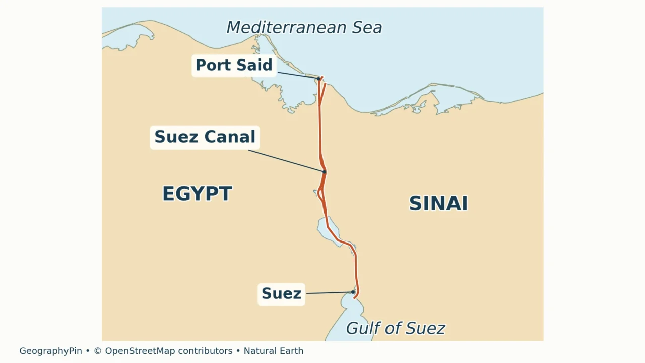
The Suez Canal connects the Mediterranean Sea at Port Said with the Red Sea through the Gulf of Suez. It crosses northeastern Egypt, passing the Lake Timsah and Bitter Lakes areas before reaching Suez. Unlike Panama, it is a sea-level canal: ships do not climb to an elevated lake through locks.
How to use this article: Trace the lakes along the route, compare Suez with a lock canal, or interpret the expansion dates.
1. Find the Suez Canal and its two sea connections
Locate Egypt at the northeastern corner of Africa, then find the Sinai Peninsula. The canal runs along Sinai’s western side, cutting across the Isthmus of Suez. The Mediterranean is at the northern end; the Gulf of Suez is at the southern end. Both banks are Egyptian territory, even though the canal is commonly used as part of the geographic division between Africa and Asia.

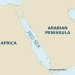
The Gulf of Suez and Gulf of Aqaba are not interchangeable. Suez is the western arm of the northern Red Sea, while Aqaba lies on the other side of Sinai. A ship leaving the canal southbound enters the Gulf of Suez, not Aqaba. Our Red Sea map and gulf comparison shows that wider setting.
The Mediterranean–Red Sea connection is direct in the sense that no third ocean lies between them, but the canal does not open straight onto the Red Sea’s broad main basin. The Gulf of Suez is part of the route. Farther south, the Red Sea connects through Bab el-Mandeb to the Gulf of Aden and then the Indian Ocean.
An isthmus is a land connection; a canal is a constructed waterway cut through land. Keeping those ideas separate explains the map: the Isthmus of Suez names the geographic setting, while the Suez Canal names the engineered passage across it.
2. Follow the route from Port Said to Suez
The lakes are part of the canal corridor
Read the main corridor from north to south rather than treating every wider blue area as a separate destination. Lake Timsah, Great Bitter Lake and Little Bitter Lake belong to the canal’s geographic sequence. Between them are narrower cut channels. A southbound transit follows that overall sequence; a northbound transit reverses it.
| Place or water body | What it tells you on the map |
|---|---|
| Port Said and Port Fuad | The northern entrance area on the Mediterranean. Port Said lies west of the original canal entrance, with Port Fuad to its east. |
| El Qantara and the Ballah area | The northern inland corridor before the route reaches the Ismailia and Lake Timsah area. Qantara also appears as Kantara in English-language sources. |
| Ismailia and Lake Timsah | The central city-and-lake landmark. The canal system includes a route through the lake and an eastern bypass; not every ship must cross the lake itself. |
| Great Bitter Lake | The large lake south of Timsah. Its open water contrasts with the canal’s narrower excavated sections. |
| Little Bitter Lake | The smaller southern continuation of the Bitter Lakes area. It leads toward the southern cut channel. |
| Suez and the Gulf of Suez | The southern entrance area. From here, the sea route continues down the gulf into the Red Sea. |
The table is an orientation sequence, not a list of compulsory port calls. A ship passing Ismailia has not necessarily called at the city, and a line drawn across a lake is not permission to navigate anywhere within that lake. Navigable channels, buoys and traffic instructions matter even where the surrounding water looks broad.
Why maps show more than one line
The canal is not simply one unbroken trench with identical width from end to end. It combines cut channels, lake passages and parallel sections or bypasses. These branches allow traffic to be organized differently from a single narrow channel, but they do not create a second independent sea-to-sea canal along the entire route.
That distinction matters most around the central lakes and newer parallel cuts. A compact classroom map may merge nearby branches into one line to stay readable. It can still explain the geographic connection, but it cannot show which channel a particular vessel will be assigned. The accompanying map is for orientation, not navigation.
Satellite imagery is useful for checking the land-and-water pattern. The European Space Agency’s Suez overview identifies Lake Timsah and the Bitter Lakes along the corridor. Its image predates the 2015 expansion, however, so its appearance should not be used to decide how many navigation lanes exist today.
3. Why Suez has no locks
Sea level is a design description, not perfectly still water
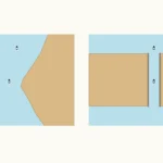
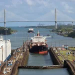
A sea-level canal carries vessels between sea entrances without lifting them to an elevated inland navigation level. That is the central difference at Suez. The route does not have Panama’s climb to Gatun Lake and descent to the opposite ocean.
It is misleading to explain this by saying the Mediterranean and Red Sea are always at exactly the same height. The Suez Canal Authority describes slight differences in water level and tides. Water can move along a sea-level canal; “sea-level” does not mean tide-free or current-free.
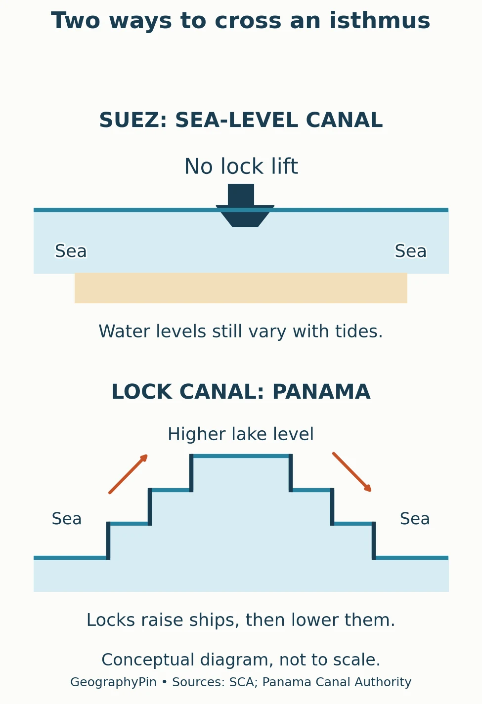
A navigation lock is an enclosed chamber in which the water level is raised or lowered to move a floating ship between different levels. The Panama Canal Authority describes its locks as lifting ships about 85 feet (26 meters) to Gatun Lake and lowering them again. That height illustrates the design, not a promise of an unchanging daily lake level.
| Question | Suez Canal | Panama Canal |
|---|---|---|
| Does a ship climb to an elevated lake? | No lock-assisted climb. | Yes, using navigation locks. |
| What role do lakes play? | Lake passages form part of a sea-level corridor. | Gatun Lake forms the elevated main waterway. |
| Does the presence of lakes prove a canal needs locks? | No. Suez has lakes but no navigation locks. | No. The decisive issue is the water-level change. |
| Does the design remove traffic controls? | No. Transit still requires channel and traffic management. | No. Locks and channels are managed together. |
“Canal” therefore does not mean “waterway with locks.” It describes a constructed passage, while the need for locks depends on its design and terrain. GeographyPin’s strait-versus-canal explanation separates that question from the natural or human-made origin of a waterway. Panama’s separate ownership history is a different topic from this engineering comparison.
4. Read canal dimensions and expansion dates correctly
The Suez Canal Authority’s characteristics table lists an overall length of approximately 120 miles (193.3 kilometers). Treat that as the authority’s canal-system figure, not a distance measured between city-center markers. A short locator map cannot independently establish the official length, especially when its drawing simplifies entrance approaches and branches.
A 2015 project figure is not the whole canal’s length
The authority’s account of the 2015 New Suez Canal project distinguishes about 22 miles (35 kilometers) of new parallel waterway from roughly 23 miles (37 kilometers) of deepening and widening in existing bypass areas. Together they formed a project of about 45 miles (72 kilometers). Neither the new-cut length nor the project length replaces the overall canal length.
The February 3, 2025 chart announcement records another change: a roughly 6.2-mile (10-kilometer) doubled section in the Little Bitter Lakes area and approximately 131 feet (40 meters) of eastward widening in the southern widening project. These are dated, local changes. They should not be read as “the canal is 40 meters wide” or “the whole canal now has two separate lanes.”
The announcement identifies those works using canal kilometer markings: km 122–132 for the doubled section and km 132–162 for the widening. These are official location labels along the waterway, not latitude and longitude and not distances from whichever point a reader chooses on a map. They are retained in metric form because converting the identifiers would make them harder to match to the source.
| Figure | What it describes |
|---|---|
| About 120 miles (193.3 km) | Overall canal length in SCA’s characteristics table and FAQ. |
| About 79 feet (24 m) | Maximum water depth in SCA’s 2015 characteristics column; a dated engineering figure, not a guaranteed depth everywhere. |
| 66 feet (20.1 m) | Ship draft in that same 2015 column, not the depth of the canal bed. |
| About 45 miles (72 km) | The combined scope of the 2015 New Suez Canal project, including new excavation and improvements to existing bypasses. |
Table downloads (3)
- North-to-south guide to the canal corridor (7 × 2)View tableDownload CSV
- Sea-level and lock canals: the physical distinction (5 × 3)View tableDownload CSV
- Examples of different measurements, with their source context (5 × 2)View tableDownload CSV
Draft means the vertical distance from a vessel’s waterline to the bottom of its hull. Channel depth measures the water below the surface to the bed, using a stated reference level. They are different quantities, and a ship needs clearance beneath its hull. Width is equally easy to misread: a water-surface width, a width at a specified depth and a project’s added width are not the same measurement.
5. What a route map cannot tell you
A route map answers “where?” much better than “can this vessel transit today?” Ship dimensions, passage conditions and the authority’s operational instructions determine an actual transit. Historical dimension tables and simplified diagrams should never substitute for the latest official rules, circulars and navigational charts.
The map also cannot provide a dependable queue length, price or arrival time. Time underway in the canal is different from time waiting before entry; tolls are a separate calculation. Those changing details belong to current operator information, not to a permanent geographic label.
For the same reason, there is no single mileage saving that applies to every voyage. The advantage of the Suez route depends on the departure and destination ports and the alternative route being compared. A Mediterranean-to-Indian Ocean journey and a voyage between different Atlantic and Pacific ports are not interchangeable examples.
For ordinary map reading, a simpler checklist is enough: identify the two sea entrances, distinguish Suez from Aqaba, follow the lakes in order and check the map’s date or method note before interpreting parallel channels. That gives a useful geographic picture without turning an educational map into an operating chart.
Frequently Asked Questions
Is the Suez Canal the Nile River?
No. The Nile and the Suez Canal are separate waterways. The canal crosses the isthmus east of the Nile Delta; a map showing irrigation channels nearby does not make the sea-to-sea shipping canal a branch of the Nile.
Are Little Bitter Lake and Small Bitter Lake different places?
In this context, the names refer to the same southern part of the Bitter Lakes system. English sources use both translations. Great Bitter Lake is the larger lake to its north.
What Did We Learn Today?
The canal’s shape makes sense when read as a connected system: Mediterranean entrance, cut channels and lake areas, then the Gulf of Suez. Its lakes do not require locks because the route stays near sea level. Expansion lengths, overall length, channel depth and vessel draft answer different questions; matching each number to its meaning and source date is as important as tracing the blue line.
Sources & Data Notes
Physical design and canal dimensions follow the Suez Canal Authority. The dimensions table deliberately identifies its 2015 column; the southern-sector changes are tied to the February 3, 2025 announcement. These sources describe different project scopes, not one uniform canal cross-section. U.S. unit conversions are rounded. Maps are educational orientation aids, not navigational charts; no live traffic, toll or vessel-admission claim is made.
Original map design by GeographyPin. Canal and Lake Timsah geometry comes from OpenStreetMap relations 7719838 and 5809452, retrieved November 12, 2026, under the Open Database License. Natural Earth provides generalized public-domain coast and Bitter Lakes outlines. The map preserves source geometry in a local UTM projection, exaggerates canal line widths and omits some bypass detail. It does not claim to show every 2025 project alignment. Named locations were checked against NGA’s geographic descriptions and GeoNames for Qantara; the diagram shows a design principle rather than an engineering cross-section.
- Suez Canal Authority: About Suez Canal
- Suez Canal Authority: Canal Nature
- Suez Canal Authority: Canal Characteristics and development table
- Suez Canal Authority: New Suez Canal project
- Suez Canal Authority: February 3, 2025 navigational-chart announcement
- European Space Agency: Earth from Space, Suez Canal (2009)
- Panama Canal Authority: Design of the Locks
- NGA Sailing Directions, Pub. 172 (2020 edition), Sector 1: canal and lake geography