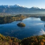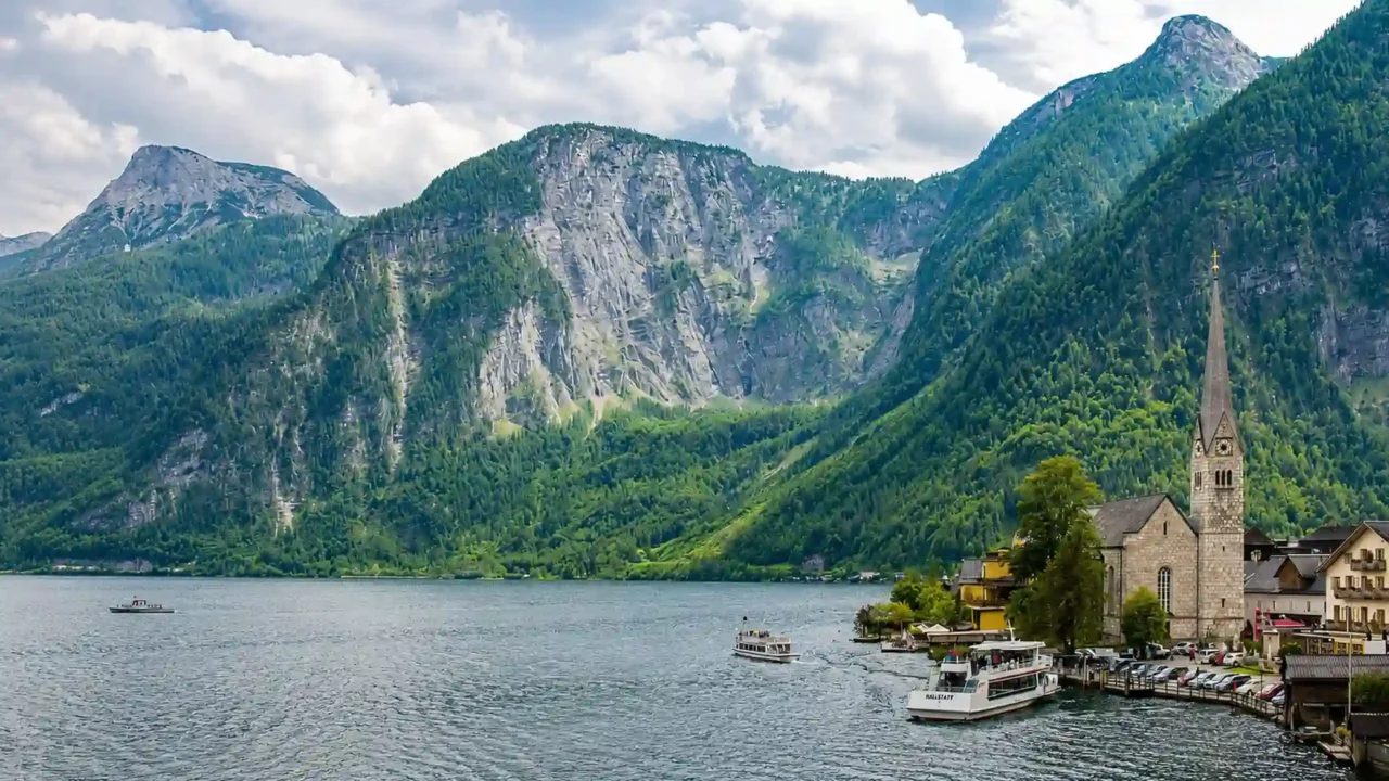
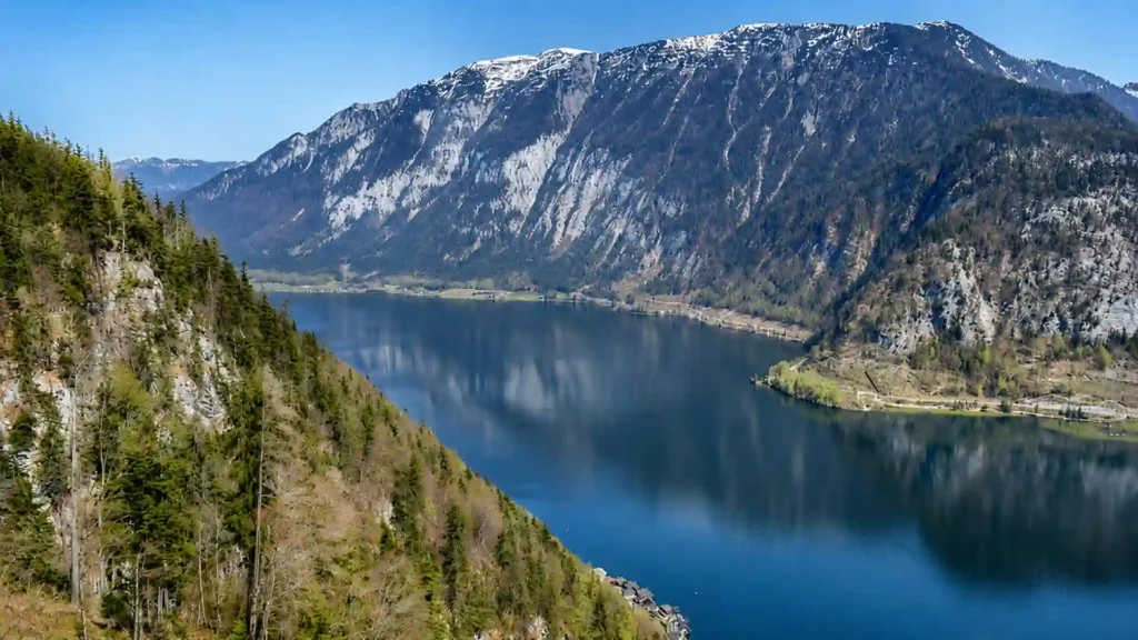
Lake Hallstatt is a deep glacial lake in Upper Austria’s Salzkammergut region, within the Eastern Alps. Its German name is Hallstätter See. Hallstatt village occupies part of the steep western shore, while Obertraun, the east-shore railway station, and the Bad Goisern–Steeg area provide other ways to reach and experience the lake.
How to use this article: Start with the lake–village distinction, compare the four shore areas, understand the train-to-ferry connection, or check where swimming is monitored.
Lake Hallstatt at a Glance
Lake Hallstatt lies in southern Upper Austria in the Salzkammergut, the lake-and-mountain region east of Salzburg. It occupies a narrow north–south basin at the northern foot of the Dachstein massif. The lake is entirely in Austria and drains northward through the Traun river system toward the Danube.
Lake Hallstatt is not the same as Hallstatt village
Hallstatt is the market town on the western shore. Lake Hallstatt is the whole body of water extending north toward Steeg and south toward Obertraun. Searching for “Hallstatt” can therefore return village attractions, while searching for the lake raises different questions about depth, drainage, ferries, trails, and swimming.
The standard German name is Hallstätter See: See means lake, while Hallstätter is the adjectival form associated with Hallstatt. “Lake Hallstatt” is the natural English rendering. The joined spelling Hallstättersee also appears on Austrian government and tourism pages.
Verified quick facts
The main measurements below come from the Province of Upper Austria’s lake dataset. U.S. customary conversions are rounded so they do not imply more precision than the source data.
| Measure | Figure | Meaning |
|---|---|---|
| Surface area | 3.30 sq mi (8.55 km²) | The area of the lake’s water surface |
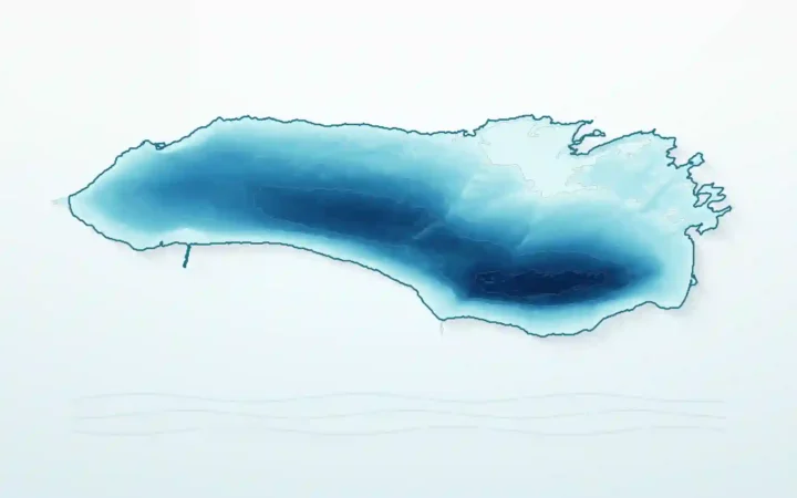
| Maximum depth | About 411 ft (125.2 m) | Found in the deeper southern basin |
| Surface elevation | About 1,667 ft (508 m) | Lake level above sea level |
| Water volume | About 19.7 billion cu ft (557 million m³) | Approximate total water stored |
| Theoretical water-renewal time | 0.49 years, or about six months | Reflects the lake’s strong river throughflow |
| Drainage basin | About 249 sq mi (646 km²) | Land area draining toward the lake |
| Main inflow and outflow | Traun River | Enters at the southern end and leaves in the north |
A single headline length is deliberately omitted. Published figures differ enough that using one without explaining shoreline, centerline, or basin-measurement methods would create false precision.
How Glaciers and the Traun Shaped the Lake
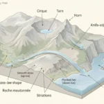
Lake Hallstatt occupies an overdeepened basin carved by repeated glacial erosion. A 2024 peer-reviewed drilling study describes a shallower northern sub-basin, reaching roughly 148 feet (45 meters), and a much deeper southern sub-basin, reaching about 410 feet (125 meters). The study places the retreat of the Traun Glacier at the end of the last glacial cycle at roughly 17,000 years ago.
Ice did not simply leave a neat empty bowl. Glaciers deepened the valley, and later rivers carried sediment into it, building deltas and shallower margins. That is why the northern and southern parts do not have the same depth or form. For the broader process, GeographyPin’s guide to how glacial lakes form explains how ice creates basins that remain water-filled after retreat.
The Traun flows through, not merely into, the lake
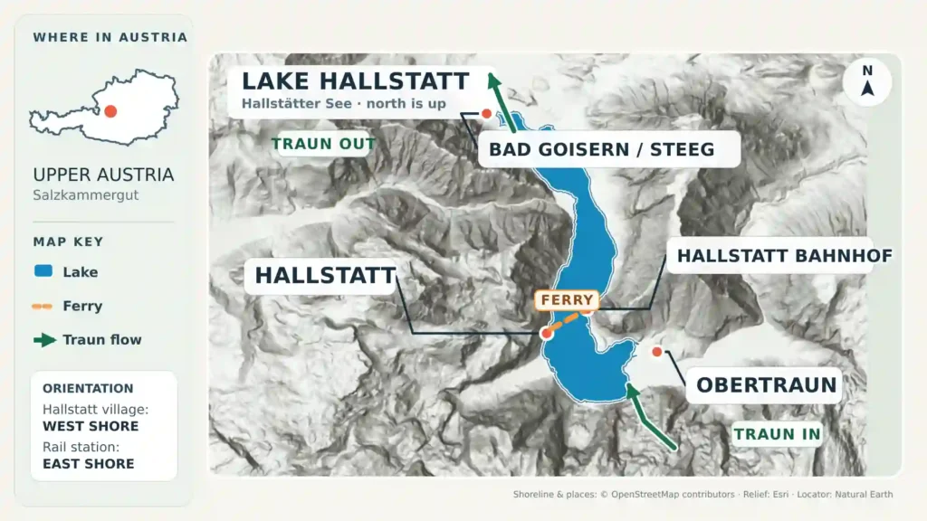
The Traun is both the principal inflow and the outflow. It enters the southern basin from the southeast and leaves the northern end near Steeg. The 2024 study estimates that the river provides about 53% of total inflow. Other notable tributaries include the Waldbach, Gosaubach, and Großer Zlambach.
This strong throughflow helps explain the lake’s comparatively short theoretical water-renewal time and why it does not warm as strongly as many shallower bathing lakes. The Province of Upper Austria notes that the water is generally clear and nutrient-poor, although storms can temporarily add mineral cloudiness.
Why it looks like a fjord but is not one
The steep mountains, narrow basin, and deep southern water produce a strongly fjord-like appearance. A true fjord is a glacial valley flooded by the sea and connected to marine water. Lake Hallstatt is inland freshwater within a river drainage system, so “fjord-like” describes its shape and scenery, not its landform classification.
Which Shore Should You Choose?
There is no single “Lake Hallstatt entrance.” The right shore depends on whether the priority is the village, rail access, swimming, or a long lakeside route.
The four main orientation areas
| Area | Position | Best for | Key point |
|---|---|---|---|
| Hallstatt | Western shore | Village waterfront, classic lake views, ferry landing, small-boat rental | This is one settlement beside the lake, not the whole destination |
| Hallstatt Bahnhof and east shore | Opposite Hallstatt | Rail arrival, cross-lake ferry, east-shore walking and cycling | The railway station is not inside Hallstatt village |
| Obertraun | Southern and southeastern shore | Designated swimming access, open shore space, southern boat route | A practical lake base separate from Hallstatt |
| Bad Goisern, Untersee, and Steeg | Northern basin | Untersee lido, north-shore access, trail and cycle connections | The Traun leaves the lake near Steeg |
Bad Goisern’s main built-up center lies north of the lake rather than directly on Hallstatt’s waterfront. Its municipal lakeside access is better understood through places such as Untersee and Steeg. Obertraun, meanwhile, is a separate municipality at the southern end.
Train, Ferry, and Boat Connections
The train-to-ferry connection
The most important transport fact is easy to miss on a booking screen: Hallstatt railway station is on the east shore, across the lake from Hallstatt village. The connecting ferry runs between the station landing and Hallstatt Markt, the landing in the village center.
Hallstättersee Schifffahrt publishes separate 2026 timetables in each direction and advertises the station line as a 365-day service. Departures are arranged around train movements and may be adjusted when trains are delayed, but travelers should still check both rail and ferry times rather than assume every connection is guaranteed.
As checked in August 2026, the operator says ferry tickets are cash-only. It identifies the regular station vessel Stefanie as wheelchair-accessible, while accessibility differs among its excursion vessels. Anyone who needs step-free boarding, space for a stroller, or bicycle transport should confirm the operating vessel and conditions before travel.
Boat trips and self-drive rentals
Scheduled sightseeing services are more seasonal than the station ferry. The 2026 operator information shows southern round trips linking Hallstatt, Lahn, and Obertraun during the warmer months, while northern services toward Untersee and Steeg run in a shorter seasonal window. Weather can cancel sailings, so the current operator timetable should outrank any static article.
Electric, pedal, and rowing boats are also offered from the Hallstatt waterfront. The regional tourism pages warn that availability depends on weather and that advance reservations may be limited or unavailable. Rental instructions and the orange storm-warning beacons deserve attention: a fast warning signal means boaters should leave the water immediately.
Swimming, Walking, and Cycling Beside the Lake
Where swimming is monitored
Yes, swimming is allowed at established access areas. The Province of Upper Austria’s Hallstättersee monitoring page lists four official bathing-water sampling locations: Strandbad Untersee in Bad Goisern, Hallstatt-Kesselgraben, Seelände Hallstatt, and Strandbad Obertraun. Current sampling results are posted through the AGES bathing-water database during the bathing season.
The lake can remain cool even in summer because of its depth and the strong Traun throughflow. Choose a recognized bathing area, check current water and weather information, and do not treat an attractive but unmarked shoreline as automatic swimming access. Storms can also change visibility and surface conditions quickly.
The east-shore trail
The Ostuferwanderweg, or east-shore trail, gives the clearest long walk beside the water without making Hallstatt village the center of the route. Official tourism route information describes an easy path of about 5.7 miles (9.2 kilometers) between the Steeg area and Obertraun, using a mixture of gravel, natural ground, and asphalt. It passes Hallstatt Bahnhof and includes the suspension-bridge section over the steep eastern shoreline.
The path can be combined with the station ferry or seasonal boats, but the exact combination depends on the day’s timetable. Walkers should also distinguish the east-shore route from the western road and from paths inside Hallstatt village.
Cycling is easiest to understand shore by shore
The east-shore cycle route is the most useful lake-focused option. A complete circuit is less straightforward: the official regional arrival-by-bike guidance warns families against the narrow main-road section on the western shore because of motor traffic. Do not assume the entire loop is a protected lakeside path.
Boat carriage rules also vary. The ferry operator’s 2026 information specifically excludes bicycles from one northern round-trip service, while other routes publish separate bicycle terms. Check the intended sailing before building a cycle plan around a boat transfer.
How the Lake Fits the UNESCO Cultural Landscape
Lake Hallstatt and Hallstatt village sit within the Hallstatt-Dachstein/Salzkammergut Cultural Landscape, inscribed on the UNESCO World Heritage List in 1997. The designation belongs to the broader cultural landscape—not to the lake alone and not to Hallstatt village alone.
UNESCO’s explanation connects the region’s physical setting with long-term human use, especially salt extraction, managed forests, settlement, transport, and Alpine pasture. The lake matters within that story because steep terrain made water transport unusually important and because settlement developed within a narrow corridor between mountains and water.
This is also why the best lake profile cannot separate physical and human geography completely. Glacial topography created the narrow basin; the Traun connected it downstream; and centuries of movement and salt-related activity turned the shore into a cultural route. For a contrasting European Alpine lake at a much larger, cross-border scale, compare Lake Geneva: History, Geography, and Highlights.
Frequently Asked Questions
Can you swim in Lake Hallstatt?
Yes. Officially monitored bathing locations include Untersee, Hallstatt-Kesselgraben, Seelände Hallstatt, and Strandbad Obertraun. The water can be cold, so check current local conditions and use established access points.
How deep is Lake Hallstatt?
Its verified maximum depth is approximately 411 feet (125.2 meters), in the deeper southern basin.
Does Lake Hallstatt freeze in winter?
Complete freezing is rare. A provincial landscape report says the northern Untersee is the part more likely to develop a closed ice cover. Never assume natural ice is safe without current local authorization.
How do you get from Hallstatt railway station to the village?
Take the cross-lake ferry from Hallstatt Bahnhof on the east shore to Hallstatt Markt in the village center. Check the operator’s current timetable alongside the train schedule.
Is Lake Hallstatt a real fjord?
No. It is an inland freshwater glacial lake. Its narrow, deep basin and steep mountain walls look fjord-like, but it is not a marine inlet connected to the sea.
What Did We Learn Today?
Lake Hallstatt is a deep, glacier-carved lake organized by the Traun’s south-to-north flow and by four distinct access areas. Hallstatt village is only one part of its shoreline, the railway station sits across the water, and the wider lake experience includes ferries, seasonal boats, monitored swimming areas, and an east-shore trail within a much larger UNESCO cultural landscape.
Sources & Data Notes
Core lake measurements use the Province of Upper Austria dataset; imperial equivalents are rounded conversions. The 2024 drilling study supplies the basin, catchment, and glacial details. Practical ferry, bathing, rental, and trail information was checked on August 15, 2026, but schedules, fares, operating vessels, and seasonal access can change. Published lake-length figures conflict, so no single length is presented as definitive.
Slug: lake-hallstatt-austria SEO Meta Title (≤60 characters): Lake Hallstatt, Austria: Map, Depth & Ferry Guide Meta Description (145–160 characters): Lake Hallstatt in Austria is a deep Alpine lake, not the village itself. See verified facts, a shore guide, ferry access, swimming and boating basics.