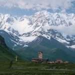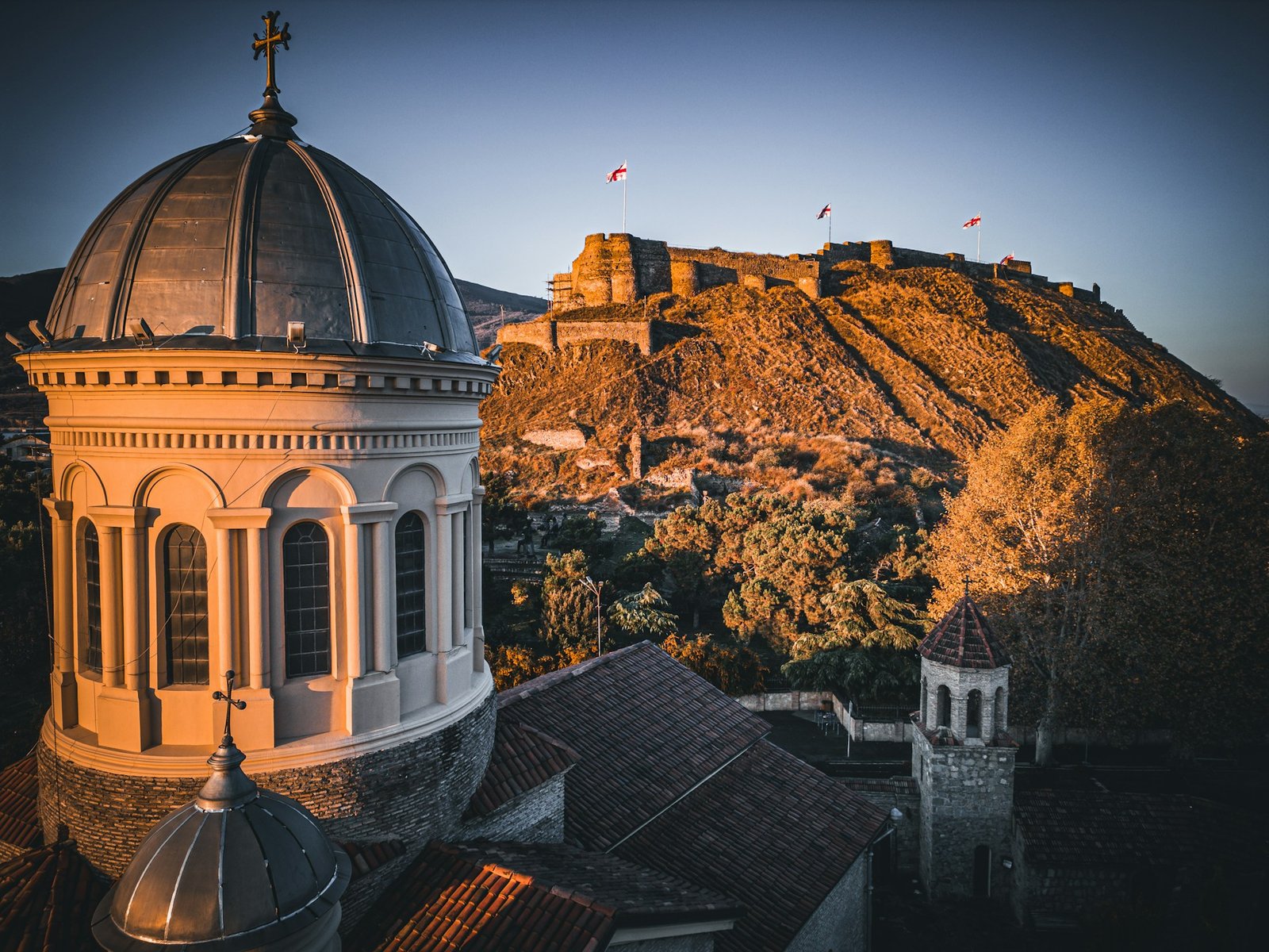
Mestia is a high-altitude townlet (daba) in northwest Georgia and the administrative center of Upper Svaneti. At 4,921 ft (1,500 m), it’s the jumping-off point for treks to Ushguli and ski days at Hatsvali and Tetnuldi, and a gateway to the UNESCO-listed “Upper Svaneti” cultural landscape (inscribed 1996).
Orientation — Where is Mestia, Georgia?
Mestia lies in the Samegrelo–Zemo (Upper) Svaneti region of northwest Georgia, about 279 miles (449 kilometers) by road from Tbilisi and roughly 82 miles (132 kilometers) from Zugdidi. It occupies a broad glacial valley framed by jagged Caucasus peaks, with the Enguri River carving through spruce-lined slopes and meadows. Coordinates for the town center are approximately 43.05° N, 42.73° E.
Although the town itself counted 1,973 residents at the 2014 census, the wider Mestia Municipality spans more than 3,000 km² and—per Georgia’s 2024 census preliminary results—had about 9,800 residents, reflecting the area’s scattered mountain villages. Treat the 2024 figure as preliminary until final results are released (expected 2026).
Mestia at a Glance
| Metric | Value |
|---|---|
| Elevation | 4,921 ft (1,500 m) above sea level. |
| Coordinates (center) | ≈ 43.05° N, 42.73° E. |
| Population | Town: 1,973 (2014); Municipality: ~9,800 (prelim., 2024). |
| Distance from Tbilisi | ~279 mi (449 km) by road. |
| Nearest regional city | Zugdidi — ~82 mi (132 km) by road. |
| Road ID | Sh7: Zugdidi–Jvari–Mestia–Lasdili (193 km, domestic road). |
| Airport | Queen Tamar Airport (UGMS), elevation 4,778 ft (1,457 m). |
| UNESCO area nearby | Upper Svaneti (incl. Ushguli; inscribed 1996). |
| Ski areas | Hatsvali (1,835–2,347 m); Tetnuldi (2,260–3,165 m). |
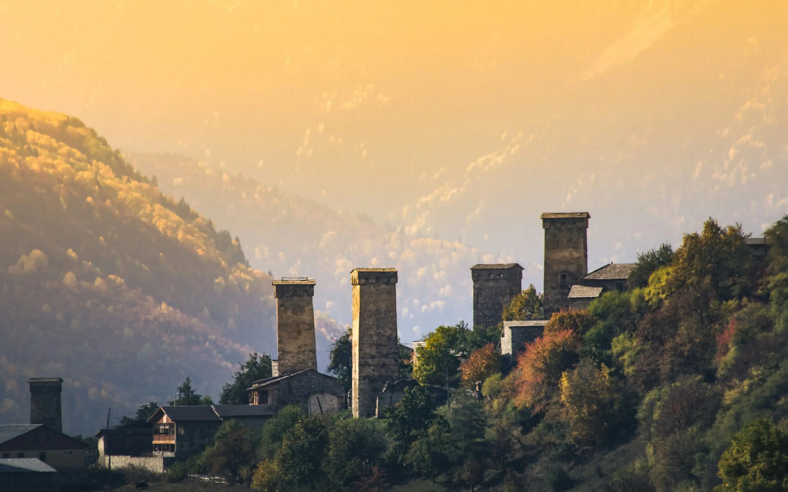
Deep Roots — Svan Towers, Culture & UNESCO Status
Upper Svaneti is famous for its medieval tower-houses (Svan towers), often 3–5 stories high, which doubled as family fortifications and storage. The village of Chazhashi within the Ushguli community preserves more than 200 towers, churches, and fortifications, showcasing continuity of Svan building traditions and mountain life. In 1996 UNESCO inscribed “Upper Svaneti” for its outstanding cultural landscape. See the official UNESCO description of Upper Svaneti.
Mestia itself has long been a cultural hub, home to icons, manuscripts, and ethnographic treasures. The Svaneti Museum of History and Ethnography (part of the Georgian National Museum network) curates thousands of artifacts from the region, including metalwork and religious art, offering a compact primer on Svan identity before you head up-valley.
Getting There — Roads, Flights & Practical Access
Mestia is reachable year-round by road via the Sh7 route from Zugdidi (on Georgia’s west-east trunk corridor). Expect roughly 82 miles (132 kilometers) of mountain driving from Zugdidi with changing conditions; winter brings snow and occasional restrictions, while late spring to early autumn is more predictable. Always check current road advisories when planning travel days.
By air, Mestia is served by Queen Tamar Airport (UGMS). The official Aeronautical Information Publication lists the airfield 2 km northeast of town at 4,778 ft (1,457 m). Seasonal/limited flights are typically operated by regional carrier Vanilla Sky between Natakhtari (near Tbilisi), Kutaisi, and Mestia; schedules vary and are capacity-limited, so verify directly with the airline before travel. Consult the AIP entry for UGMS — Queen Tamar Airport and the carrier’s booking site for updates.
By Road (Sh7 via Zugdidi)
The scenic Sh7 (Zugdidi–Jvari–Mestia–Lasdili) is the primary artery into Upper Svaneti, following the Enguri valley. Drive times vary with weather, works, and traffic. Public minibuses (“marshrutkas”) run from Zugdidi and other cities, but self-drivers should be prepared for mountain curves and occasional repairs.
By Air (Queen Tamar Airport, UGMS)
The runway (02/20) is 1,158 meters (3,800 feet) long and the field is VFR-only, reflecting the valley’s terrain and weather constraints. Flights may be canceled due to conditions—build flexibility into your plan. Use official sources for the latest operational details.
Things to See & Do in and around Mestia
From museums and towers to trails and ski lifts, Mestia packs surprising variety for a small mountain town. You can combine cultural visits with easy ridge walks, or plan multi-day treks into high glacial country—then return for hearty Svan cuisine.
Svaneti Museum of History and Ethnography
A must-stop on day one. Exhibits include archaeological finds, iconography, manuscripts and metalwork from local churches. It’s managed under the Georgian National Museum system; check hours at the official listing for the Svaneti Museum in Mestia.
Mikheil Khergiani House-Museum
Dedicated to the famed alpinist nicknamed the “Tiger of the Cliffs,” the house-museum preserves personal gear, photos, and stories of Georgia’s mountaineering legend. It opened in 1983 and sits within an authentic Svan house-tower ensemble.
Walking & Trekking
The classic four-day Mestia–Ushguli trek threads through villages and meadows to the UNESCO zone at Ushguli (≈2,100 m / 6,890 ft). Day walks to Koruldi Lakes or along the Mulkhura Valley offer big views with less commitment; guided paragliding flights also launch from local ridges such as Zuruldi and Jvari.
Winter Sports: Hatsvali & Tetnuldi
Hatsvali, 5–8 miles (8–13 km) from town, is a forested ski hill with chairs up to the Zuruldi ridge (~2,347 m / 7,700 ft) and a café with sweeping views of Ushba on clear days. Tetnuldi, about 9–10 miles (15–16 km) away, is bigger and higher, topping out near 3,160–3,165 m (10,367–10,384 ft) with wide alpine runs and serious freeride potential.
Seasons, Weather & When to Visit
Late June to September brings the friendliest hiking weather, green valleys, and long daylight. Trails can still hold snow at higher passes in June; by August alpine meadows peak, while September offers crisp air and stable conditions. Winter (December–March/April) is prime for skiing when storms deliver deep snow to Tetnuldi and Hatsvali—always check lift operations and avalanche advisories locally.
Shoulder seasons (April–May, October–November) can be rewarding for culture and photography but come with variable weather, intermittent rain or snow, and occasional road or flight disruptions. For current inspiration and official trip ideas, the national tourism portal provides seasonal overviews for Mestia and Svaneti.
FAQ
Is Mestia part of a UNESCO World Heritage Site?
Mestia is the regional base for visiting the UNESCO-listed “Upper Svaneti,” which includes the Ushguli community upstream. The site was inscribed in 1996 for its preserved tower-house settlements and cultural landscape.
How far is Mestia from Tbilisi and Zugdidi?
It’s roughly 279 miles (449 km) by road from Tbilisi to Mestia, and about 82 miles (132 km) from Zugdidi to Mestia, mostly along the Sh7 valley road.
Can I fly to Mestia?
Yes—Queen Tamar Airport (UGMS) serves Mestia with limited, weather-dependent services typically operated by Vanilla Sky from Natakhtari (near Tbilisi) and sometimes Kutaisi; schedules change, so confirm directly before you travel.
When is the best time to visit?
For hiking, late June–September is ideal; for skiing, December–March/April depending on snowfall at Tetnuldi and Hatsvali.
What Did We Learn Today?
- Mestia sits at 4,921 ft (1,500 m) and anchors Upper Svaneti’s valleys and villages.
- The UNESCO-listed Upper Svaneti showcases towers and medieval settlement patterns (inscribed 1996).
- Access is via the Sh7 road from Zugdidi, or by weather-dependent flights to Queen Tamar Airport (UGMS).
- Top activities range from museums and village walks to the Mestia–Ushguli trek and paragliding.
- Hatsvali and Tetnuldi offer tree-lined pistes and high-alpine terrain up to ~3,165 m (10,384 ft).