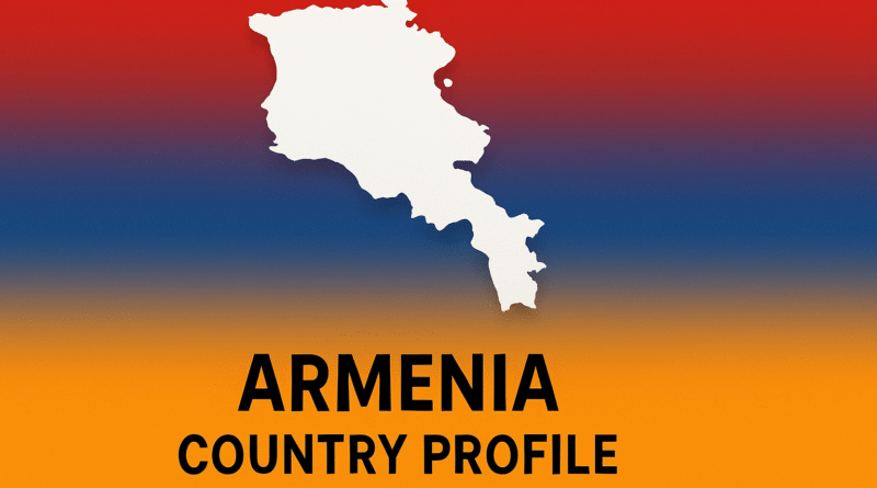
Armenia: Country Profile
Geography & Environment
Located at the crossroads of the Armenian Highlands (Հայկական լեռնաշխարհ), Armenia spans 11,484 sq mi (29,743 km2), with elevations ranging from 1,230 ft (375 m) in the Aras River valley to 13,415 ft (4,090 m) atop Mount Aragats. This rugged terrain arises from the collision of the Arabian and Eurasian tectonic plates, shaping volcanic massifs like the Geghama and Vardenis ranges and fueling regular seismic activity.
Armenia’s water network is anchored by Lake Sevan—the largest high-altitude lake in the Caucasus at 480 sq mi (1,242 km2) and 6,230 ft (1,900 m) above sea level—feeding into the Hrazdan River, while the Aras River delineates much of the southern border.
| Environmental Zone | Elevation | Characteristics |
|---|---|---|
| Semi-desert | 1,230–2,625 ft (375–800 m) | Arid plains with xerophytic shrubs in the Ararat and Sevan basins. |
| Steppe & Forest-steppe | 2,625–5,250 ft (800–1,600 m) | Grasslands and oak/juniper woodlands on plateaus and river valleys. |
| Forest | 5,250–6,560 ft (1,600–2,000 m) | Mixed beech, hornbeam, and Caucasus fir forests in Lori and Tavush regions. |
| Alpine & Subalpine | 6,560–9,840 ft (2,000–3,000 m) | Meadows with endemic flora on high plateaus, used for summer grazing. |
In Yerevan, January daily highs average 37°F (3°C) and lows 19°F (−7°C), while on the high plateaus January averages drop to 17.5°F (−8°C). Summers in the lowlands see July highs of 91°F (33°C) and lows of 67°F (19°C), with highland summer highs around 68°F (20°C). Annual precipitation varies from 250 mm (9.8 in) in the Ararat plain to over 1,000 mm (39.4 in) in the forested north.
History & Indigenous Heritage
The Iron Age Kingdom of Urartu (860–590 BC) left fortress cities like Erebuni (782 BC) atop modern Yerevan. Later, under the Artaxiad Dynasty and Tigranes the Great (95–55 BC), Armenia’s realm stretched from the Mediterranean to the Caspian.
In 301 AD, King Tiridates III and St. Gregory the Illuminator established Armenia as the first Christian state. In 405 AD, linguist Mesrop Mashtots invented the Armenian alphabet in Vagharshapat, catalyzing a golden age of literature.
Demographics & Society
As of early 2025, Armenia’s population stands at 3,075,800, with a density of about 107 /km2. Some 64.6% reside in urban areas—Yerevan alone counts 1.14 million—while 35.4% live in rural mountain villages.
Life expectancy is 74.2 years (72.5 for men; 76.0 for women), and the total fertility rate is 1.6 children per woman, reflecting gradual population aging. The global Armenian diaspora of roughly 7 million remains a cornerstone of remittances and investment.
| Category | Details |
|---|---|
| Ethnic Composition | Armenians 98.1%, Yazidis 1.1%, Russians & Others 0.8% |
| Languages | Armenian (official), Russian, Kurdish; English in business |
| Religious Affiliation | Armenian Apostolic 92.6%, Jehovah’s Witnesses 1.1%, Others 6.3% |
| Urbanization | 64.6% urban; Yerevan metro 36% of population |
Political & Economic Overview
Armenia is a unitary parliamentary republic of 10 provinces plus the capital. Its upper-middle–income economy is driven by IT outsourcing, mining, agriculture, and tourism. In 2025, GDP reached $26.3 billion with per-capita income of $8,857 and 5.9% growth.
Key trade partners are the EU (25%), Russia (22%) and China (6.6%).
Culture & National Identity
Armenian culture blends khachkar stone carvings, the plaintive melodies of the duduk, and the communal warmth of lavash baking into its national tapestry. Literary icons like Sayat-Nova and Hovhannes Tumanyan and the Armenian Apostolic Church shape collective identity.
- Khachkar: Medieval cross-stones emblematic of faith and art.
- Duduk & Tar: Signature woodwind and lute of Caucasus folk music.
- Festivals: Christmas (Jan 6), Easter, and Vardavar water festival celebrating renewal.
- Folk Dance: Kochari and Yarkhushta performed at weddings and gatherings.
Infrastructure & Connectivity
Road Network
The motor-road network spans 7,543 km (4,691 mi), linking Yerevan to the Georgian and Iranian borders via the M1 and M4 highways.
Rail & Metro
The rail network covers 845 km (525 mi), primarily for freight. Yerevan’s Metro has 10 stations over 13.4 km, carrying around 60,000 riders daily.
Air Connectivity
Zvartnots International Airport (EVN) handled 5.25 million passengers in 2024; Shirak Airport in Gyumri served over 100,000.
Digital & Energy
With 80% internet penetration and 95% 4G coverage, Armenia’s digital rollout supports e-Governance. Energy imports via the South Caucasus Pipeline are supplemented by planned solar and wind capacity.
Challenges & Future Outlook
- Nagorno-Karabakh tensions and security risks
- Economic diversification beyond traditional sectors
- Population aging and emigration pressures
- Climate resilience amid water scarcity
FAQ
How many UNESCO World Heritage Sites are in Armenia?
Three: Haghpat & Sanahin; Echmiadzin & Zvartnots; Geghard & Upper Azat Valley.
What is Armenia’s currency?
The Armenian dram (AMD).
When did Armenia adopt Christianity?
301 AD under King Tiridates III.
What languages are spoken in Armenia?
Armenian (official), Russian, Kurdish; English in business.
What Did We Learn Today?
- Landlocked Legacy: A bridge between Europe and Asia with dramatic highlands.
- Cultural Roots: Steward of ancient Christian heritage and folk arts.
- Modern Economy: Led by IT outsourcing, mining and diaspora ties.
- Connectivity: Expanding road, rail, air and digital networks.
- Outlook: Security, demographics and environment shape tomorrow.
Armenia’s tapestry of mountains, history and innovation continues to evolve—its past guiding its path forward.

