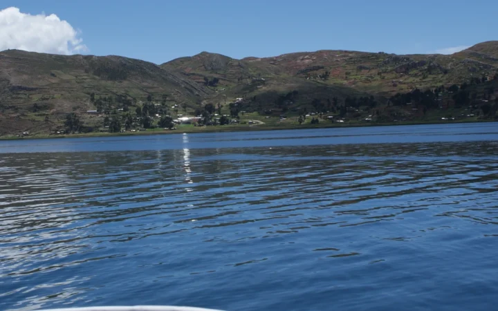
A gray sky, damp pavement and a desert landscape can all belong to the same city. Lima is a useful place to untangle a common climate misunderstanding: moisture in the air is not the same thing as abundant rainfall. Its position beside the Pacific does not guarantee frequent soaking rain, and its tropical latitude does not make its coastal climate resemble the Amazon.
Lima is dry because cool coastal water and stable atmospheric conditions often limit deep rain-cloud development. Descending air and a temperature inversion help maintain that stability, while the Andes shape regional moisture pathways. The shallow marine layer can still produce humidity, low cloud and garúa, so a damp-feeling city can have a desert climate.
How to use this article: Start with Lima’s position, explore the stable layer, and separate humidity from rain.
1. Where Lima sits in Peru’s climate geography
Put the coast beside the Andes
Lima lies on Peru’s central Pacific coast, west of the Andes. That coastal position matters more than the simple statement that Peru is a tropical country. Ocean conditions, the vertical structure of the atmosphere and the mountain barrier combine to create very different environments across the country.
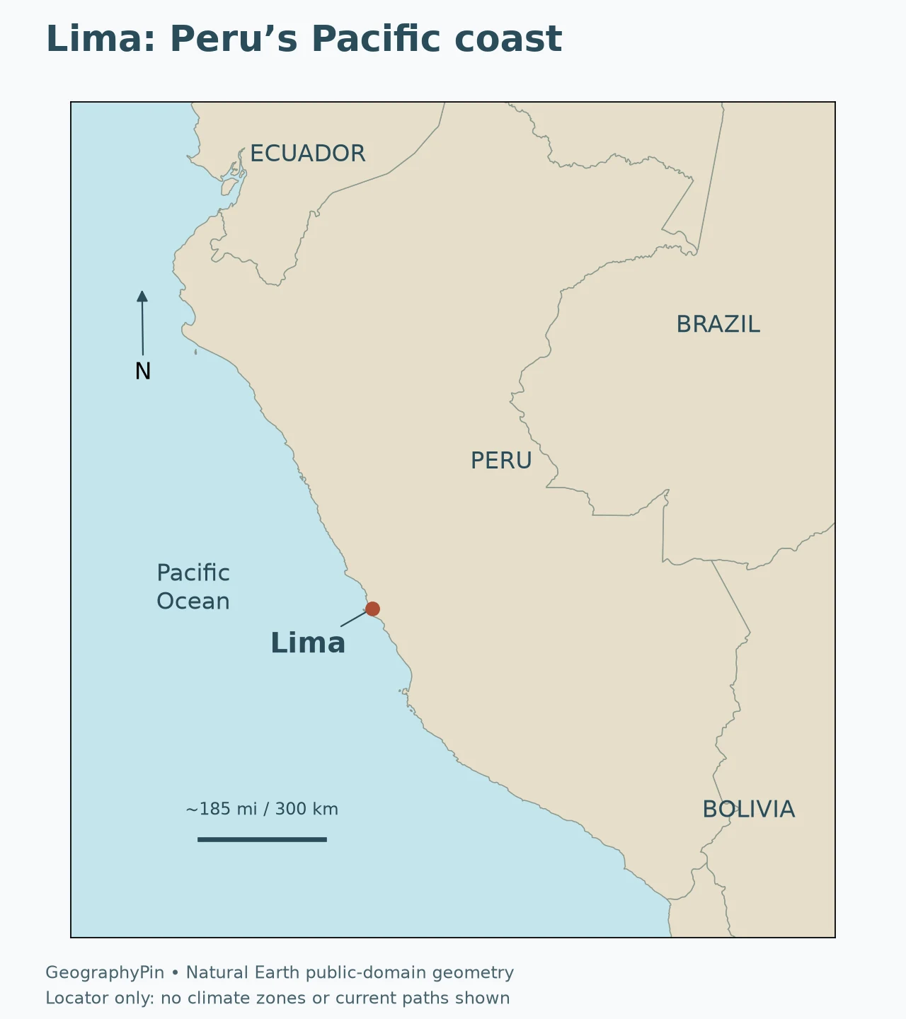
The locator shows position, not a climate boundary. A point marking Lima cannot describe the weather of every coastal district, hillside or inland valley. It also cannot stand in for the wider Lima administrative region, which extends into mountainous country. Keep that distinction in mind when comparing a city forecast with a regional rainfall map.
The key question is not “Why is there no water nearby?” There is an ocean immediately to the west. It is “Why does the atmosphere so often fail to turn available moisture into substantial rain over the coast?” The answer involves both the ocean surface and the air above it.
2. Ocean cooling and stable air work together
Follow the cooling from sea to air
The Humboldt, or Peru–Chile, current system is associated with relatively cool water along this part of South America. Coastal upwelling also helps maintain cool surface conditions. Upwelling occurs when surface water moves away from an area and water from below rises to replace it; it is not simply another name for a horizontal current.
Cool water influences the air in contact with the ocean. But “the current stops rain” is too simple. A cold current is not a wall blocking clouds, and ocean temperature alone does not explain Lima’s whole climate. The important connection is between a cool lower atmosphere, the pressure pattern over the southeast Pacific and the stability of the air column.
Understand the inversion without imagining a solid lid
In a temperature inversion, air temperature increases with height through a layer rather than decreasing in the usual way. This configuration can resist the upward movement and mixing needed for deep cloud growth. Calling it a “lid” is a useful analogy, provided it is not mistaken for a permanent physical ceiling.
SENAMHI’s study of the Chillón, Rímac, Lurín and upper Mantaro basins links coastal inversion conditions with both cold ocean water and descending air associated with the South Pacific high-pressure system. These processes help explain how a humid lower layer can coexist with an atmosphere unfavorable for widespread deep rain clouds.
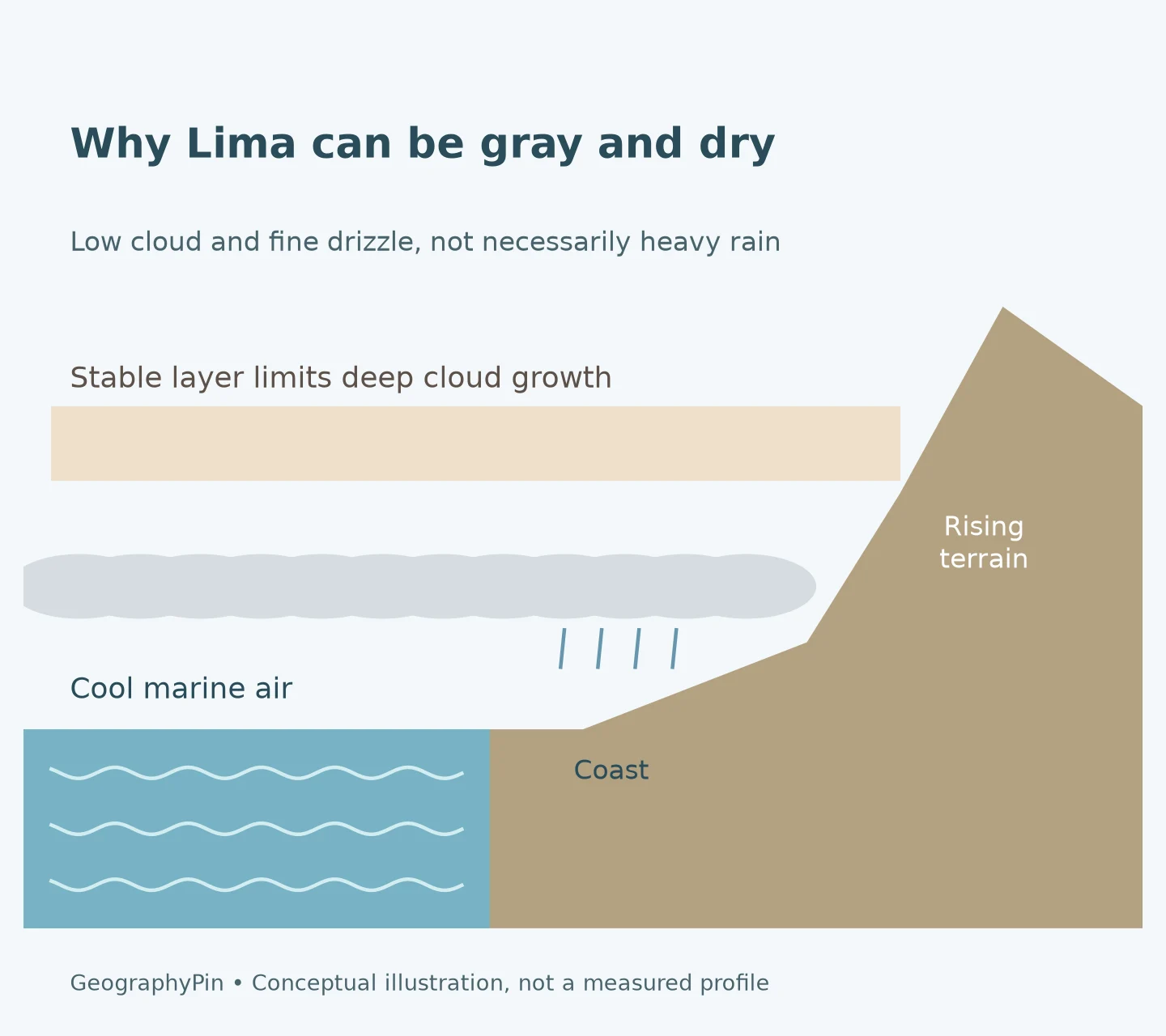
The diagram separates processes that happen together. The cool marine layer is not moisture-free; the air above it can limit its vertical development. Clouds can therefore spread horizontally without growing into towering rain-producing systems. The inversion’s height and strength vary, so the illustration is a conceptual explanation, not a measured atmospheric profile for a particular day.
For a wider introduction to water movement along coasts, see our ocean currents explanation. A current map and a weather map answer different questions, even when the processes shown on them interact.
3. Why fog, humidity and drizzle do not contradict a desert
Separate water vapor from falling water
Relative humidity describes how close the air is to saturation at its current temperature. It is not a measurement of how much rain has fallen. Cooling air can raise its relative humidity even without adding more water vapor. When condensation occurs, tiny liquid droplets may form a cloud or fog, but those droplets do not automatically become a heavy shower.
Fog is cloud at the surface. Low cloud sits above the ground. Drizzle consists of small falling droplets. These conditions can overlap, but they are not interchangeable measurements. A day with many hours of mist or cloud can contribute very little to a rainfall total compared with a short, intense storm elsewhere.
| What you notice | What it tells you | What it does not establish |
|---|---|---|
| High relative humidity | Air is close to saturation for its temperature | That heavy rain is falling or imminent |
| Low gray cloud | Condensed droplets occupy a low atmospheric layer | That the cloud is deep enough to produce a downpour |
| Fog | Cloud droplets are present near the surface | A large accumulated rainfall amount |
| Fine drizzle | Small droplets are reaching the ground | A wet climate with frequent soaking rainfall |
The word garúa is commonly associated with Lima’s fine drizzle and the cool, misty coastal conditions around it. SENAMHI distinguishes the small droplets and often prolonged winter drizzle from some summer rainfall arriving through different moisture pathways. This is more precise than saying that Lima “never gets rain.”
NASA’s explanation of marine clouds over coastal Peru describes shallow stratocumulus that may produce light drizzle or no rain. Its satellite example shows cloud extending onto the coastal plain while terrain shapes where it can move inland. The useful lesson is the contrast between cloud cover and rainfall, not a claim that one satellite image represents every season.
4. The Andes matter, but not as a complete answer
Do not reduce Lima to one rain-shadow slogan
Mountains influence atmospheric circulation and the movement of moisture between Peru’s eastern interior and its western coast. They also shape local valleys, slopes and the inland reach of low marine cloud. Yet “the Andes block all the rain” misses the independent importance of coastal ocean cooling and atmospheric stability.
A rain shadow is a useful general concept, but it is not a substitute for checking which air flows and cloud layers are involved. Moist air approaching a mountain at one level may behave differently from a shallow marine cloud layer approaching from the opposite side. A single west-to-east arrow cannot summarize all of Peru’s weather.
Lima’s coastal setting is best understood as a combination of processes operating at different heights and scales.
Distinguish the city from its upstream landscape
Rainfall over the coast and rainfall in the Andes need not happen together. The Rímac basin extends from high mountain terrain toward the Pacific, and SENAMHI examines the coastal and upper-basin environments separately. That is why a dry-looking city scene cannot tell you what is happening across the whole watershed.
This distinction is especially important when reading news. “Rain in Lima” may refer to the city, an inland part of the region, or a river basin affecting the city. Check the named district, station or basin before assuming that a report describes the place you are standing. Geographic precision avoids the apparent contradiction of a dry coast connected to a wetter upstream landscape.
5. A dry climate does not mean identical weather every day
Read winter drizzle and summer rain separately
Lima’s familiar winter cloud and drizzle pattern does not mean that all precipitation has the same origin. SENAMHI describes some summer coastal rainfall in connection with moisture transported from the Andes. The droplets and weather setting can differ from the fine, persistent drizzle associated with the cool season.
For that reason, an explanation of the typical climate must leave room for unusual events and changing circulation. “It rarely rains substantially” is a different claim from “a heavy shower is impossible.” Neither a dry long-term climate nor a gray morning should replace the current forecast and official warnings.
Conditions also vary within the urban area and toward inland slopes. A coastal observation is not automatically representative of every district. If you are comparing records, use the same station and a stated period rather than combining unrelated figures into one citywide average.
Treat rainfall numbers as measurements with a location
A rainfall figure for Lima needs a station name and reference period. A coastal station and an inland station may represent different conditions; a long-term average and an exceptional year answer different questions. Compare records only after identifying those details, rather than treating one number as a measurement for the entire city.
Units matter too. A rainfall total is a depth accumulated over a stated time, not a percentage of humidity or a count of cloudy days. A station can record many cloudy mornings and little accumulated precipitation without either observation being wrong. If a chart mixes these measures, read its labels before comparing the values.
6. Lomas show why coastal fog still matters
Look for seasonal vegetation on fog-facing hills
Lima’s coastal lomas offer a visible example of moisture doing useful ecological work without frequent heavy rain. These are seasonal vegetation communities associated with fog-influenced hillsides. SERFOR’s Guía de Flora de las Lomas de Lima describes their development particularly on slopes facing the sea, where marine moisture can reach the terrain.
The guide explains that vegetation greens during the wetter part of the seasonal cycle, while some plants become dormant during the drier period. That change is not evidence that the entire surrounding desert has become a rainy climate. It reflects the local interaction of moisture, exposure and plant adaptations.
A green slope and a barren-looking slope can therefore tell different stories even within the same coastal landscape. Fog exposure is uneven. These ecosystems are a reminder that “little rainfall” does not mean “no ecologically important water,” and that the shape and orientation of a hillside can matter as much as its place on a broad regional climate map.
Frequently Asked Questions
Does it ever rain in Lima?
Yes. Fine drizzle is common in the cool-season coastal pattern, and other rainfall can occur under different circulation conditions. A dry climate does not mean that rain is impossible.
Why can Lima feel humid if it is a desert?
Relative humidity describes the air’s closeness to saturation at its temperature, not accumulated rainfall. Cool marine air can be humid and cloudy while a stable atmosphere limits deep rain-cloud growth.
Is the Humboldt Current the only reason Lima is dry?
No. Cool coastal water is part of a connected system involving descending air, temperature inversions, regional circulation and the Andes. Explaining the climate with only a current or only a mountain barrier leaves important processes out.
What Did We Learn Today?
Lima shows why a wet-looking sky does not always indicate a wet climate. Cool marine air, atmospheric stability and regional geography can support low cloud and drizzle while limiting deeper rain-producing development. Distinguishing humidity, precipitation, location and timescale explains the apparent contradiction without claiming that the city never receives rain.
Sources & Data Notes
This article explains typical processes rather than giving a current forecast. No single unqualified rainfall average is assigned to all of Lima. SENAMHI basin research supports the inversion and regional context; its historical event statistics and projections are not presented as current observations. The locator uses Natural Earth geographic data. The original atmospheric illustration is conceptual, not a measured cloud-height or temperature profile.
- SERFOR: Guía de Flora de las Lomas de Lima (2015), introduction
- SENAMHI / SEDAPAL: climate vulnerability of the Chillón–Rímac–Lurín and upper Mantaro basins, sections 3.1–3.2
- SENAMHI: Lima drizzle and summer rainfall explanation
- NASA Earth Observatory: Ocean Clouds Meet Peru
- NOAA: What is upwelling?
- National Weather Service: Discussion on Humidity
- National Weather Service: Weather Terms
- Natural Earth: public-domain data terms