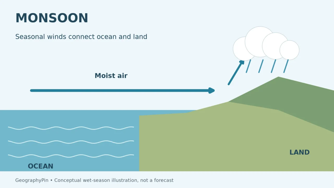
A downpour can last an hour; a monsoon describes a seasonal change in atmospheric circulation. Confusing the two makes a wet-season map look like a storm forecast and can hide the dry phase of the same regional wind system. Start with the winds, then ask how they change the supply of moisture.
A monsoon is a seasonal change in prevailing winds, often accompanied by a shift between wetter and drier conditions. It describes regional circulation, not an individual rainstorm. Land–ocean heating contrasts help drive the change, while pressure systems, terrain and moisture pathways shape its effects. Monsoon systems occur beyond Asia, including northern Australia and North America.
How to use this article: Separate winds from storms, compare regional examples, and check what onset means.
1. A monsoon is a seasonal circulation change
Follow the prevailing winds, not one rainstorm
A monsoon is a seasonal shift or reversal in prevailing winds, commonly associated with a marked change between wetter and drier conditions. The word does not mean “an especially large rainstorm.” NOAA’s educational explanation explicitly notes that a monsoon wind change can bring a rainy season or a dry season.
“Prevailing” describes a pattern over time, not the direction of every gust. An afternoon thunderstorm can temporarily produce winds different from the broader circulation around it. Conversely, a season can retain its monsoon character through several rain-free days. The atmospheric background and the individual weather event operate on different timescales.
That distinction is similar to the broader difference between weather and climate. A photograph of a flooded street documents conditions at a particular place and moment; it does not, by itself, establish the seasonal wind pattern. To identify a monsoon, meteorologists examine circulation and its seasonal evolution alongside rainfall.
Three terms that answer different questions
| Term | Main question it answers | What it does not mean |
|---|---|---|
| Monsoon circulation | How does the regional wind pattern change with the season? | A single storm of a particular size |
| Wet season | When is rainfall generally concentrated? | Rain falls continuously every day |
| Thunderstorm | What is happening in this individual convective weather system? | The storm itself defines a regional monsoon |
These categories can overlap without becoming synonyms. Thunderstorms may occur during a monsoon wet season, but thunderstorms also occur outside monsoon climates. A wet season may involve several kinds of weather systems, and an individual storm does not need to match a textbook circulation diagram exactly.
2. Why the circulation changes with the season
Land and ocean respond differently to heating
Land and water do not heat and cool at the same rate. Their seasonal temperature contrasts influence pressure patterns and air movement. In a simplified warm-season case, stronger heating over land helps favor lower pressure and the movement of moist air inland from nearby seas. In the cooler part of the year, the contrast and prevailing flow can change.
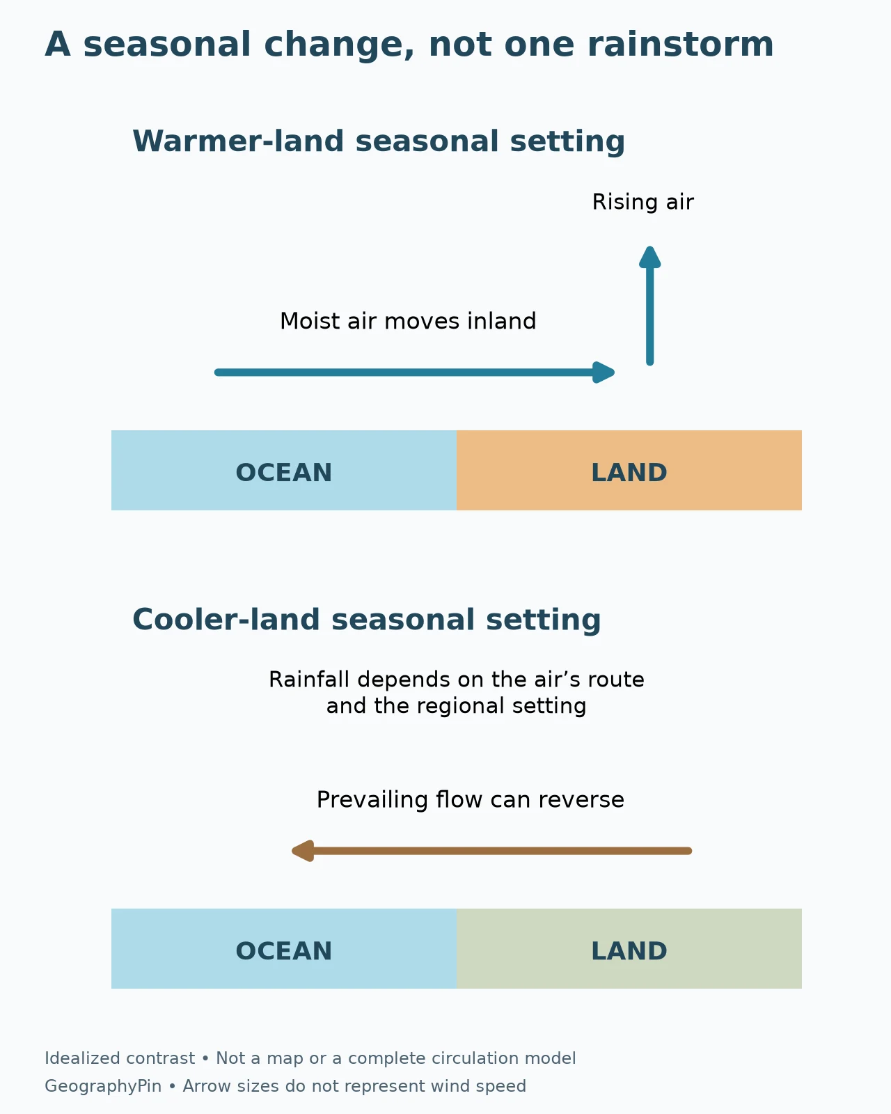
This is a useful starting model, not a complete explanation of every monsoon. The seasonal movement of large-scale pressure systems, tropical convergence, mountains, ocean conditions and atmospheric feedbacks also shape regional circulation. Winds are influenced by Earth’s rotation and need not travel along a straight line from the sea to the middle of a continent.
The National Weather Service’s North American account illustrates why the added complexity matters. It emphasizes the position and strength of the subtropical high, moisture transport at different levels, and terrain. Simply labeling a continent “hot” cannot tell you which valley will receive a thunderstorm tomorrow.
Moisture needs a way to rise and condense
A change in wind can deliver humid air, but moisture supply alone is not the whole rain-making process. Air must also be lifted and cooled sufficiently for condensation and cloud development. Convergence, heating, terrain and weather disturbances can contribute, depending on the region and day.
Mountains can enhance rainfall on exposed slopes while leaving other places relatively dry. Our rain-shadow explanation shows why wind direction and terrain must be considered together. The same mountain range can interact differently with winds arriving from different directions in different seasons.
3. Monsoons are not confined to India
Compare regions without assuming identical mechanisms
South Asia provides familiar examples, but monsoon systems also occur in other regions, including northern Australia and North America. The National Weather Service additionally recognizes systems in Africa and South America. Sharing the name does not make their circulation, rainfall intensity or annual timing identical.
| Example | Useful geographic distinction | Common mistake to avoid |
|---|---|---|
| South Asia | Summer and later-season wind regimes affect different parts of the region differently | Treating all of India as having one identical rainy season |
| Northern Australia | Active monsoon periods are part of the tropical wet season | Applying northern Australia’s timing to the entire continent |
| Northwest Mexico and the southwestern United States | Seasonal circulation and moisture changes support summer rainfall | Treating every southwestern thunderstorm as a separate “monsoon” |
These are selected examples, not a complete classification or a boundary map. Monsoon influence does not stop at a perfectly sharp line drawn around a country, and a national average can hide substantial regional differences.
The northeast monsoon is not dry everywhere
A simplistic summer-wet, winter-dry diagram becomes misleading when applied indiscriminately to South Asia. The India Meteorological Department identifies October–December as the northeast monsoon season for parts of southern peninsular India. It is the chief rainy season for the Tamil Nadu, Puducherry and Karaikal meteorological subdivision.
This is an important counterexample to “winds from the continent always mean dry weather everywhere.” Air trajectories can cross water, and coastal orientation, terrain and weather systems influence rainfall. A broad continental circulation label does not tell the entire story for every coast.
The IMD subdivision is a defined meteorological reporting area, not a claim that every station receives the same rain. The lesson is about geographic scope: identify the particular region and season before making a statement about a monsoon’s effects.
Australia’s calendar follows its own seasons
The Bureau of Meteorology describes northern Australia’s active monsoon as a shift toward moist northwesterly winds during the wet season, contrasting with the easterly or southeasterly flow prevalent for much of the year. Its explanation connects this change with the monsoon trough, a zone of low pressure and rising air.
Southern Hemisphere summer does not coincide with Northern Hemisphere summer. A diagram labeled only “summer monsoon” therefore needs its hemisphere or region identified. Australia also spans several climate settings; a statement about the tropical north is not a statement about conditions in Melbourne or southern Tasmania.
North America has its own moisture pathways
For the North American monsoon, the National Weather Service highlights the Gulf of California and eastern Pacific as important low-level moisture sources. Changes in the subtropical ridge help organize the broader pattern, while upper-level flow, terrain and disturbances influence where storms develop.
This is not simply the South Asian monsoon reproduced at a smaller scale. Its moisture pathways and circulation setting must be understood on their own terms. Even within the region, mountainous and desert locations can experience different storm frequency, timing and rainfall amounts.
4. Active periods and breaks are part of the system
A break does not necessarily mean the season is over
A monsoon season can contain wetter active phases and quieter breaks. The Bureau of Meteorology describes widespread cloud and rain during active phases in northern Australia, followed by breaks when isolated showers and thunderstorms may occur instead. A break is not necessarily complete dryness.
The distinction matters when interpreting a weekly weather report. Several days with less widespread rainfall do not automatically establish that the seasonal circulation has permanently withdrawn. Equally, one exceptionally wet day does not prove that every part of the region has entered an active phase.
A useful comparison separates the background circulation from the daily weather occurring within it.
“Onset” must come with a definition
Different onset products can measure different things. The Bureau of Meteorology explicitly distinguishes northern rainfall onset from Australian monsoon onset. A rainfall-based threshold tells you when a specified amount of rain has accumulated; a monsoon-onset definition concerns the circulation change and associated conditions.
It is therefore possible for seasonal rains to begin before the formal monsoon onset used by a meteorological service. That is not necessarily a contradiction. Before comparing dates, check whether both sources are identifying the same event in the same place using the same criteria.
The same principle applies to seasonal totals. An above-average rainfall total can include long dry gaps and a few very wet episodes. The total alone cannot describe how rainfall was distributed through the season.
5. A monsoon is not a tropical cyclone or a sea breeze
Compare the scale and the process
A tropical cyclone is an individual organized rotating storm system. A monsoon is a broader seasonal circulation pattern. The two can interact, but calling them the same thing erases the difference between a weather system and its surrounding seasonal environment.
A sea breeze is also different. It is a local circulation associated with daily contrasts between land and nearby water, whereas a monsoon involves regional seasonal changes. Both make land–water contrasts relevant, but sharing one physical influence does not make the phenomena interchangeable.
For an analogy, both a daily temperature cycle and the annual seasons involve changing solar heating, but sunrise is not the start of summer. Likewise, a change in coastal wind during an afternoon does not by itself establish a monsoon’s seasonal onset.
Rainfall amount alone cannot identify the cause
Imagine two stations that each record the same monthly rainfall total. One receives repeated showers within a monsoon circulation; the other receives rain mainly from passing fronts. The equal total does not mean that the atmospheric processes were the same. This is a hypothetical comparison, not an observation from named stations.
A climograph can reveal a seasonal concentration of rainfall, but its monthly bars do not show wind direction, individual storm tracks or every dry interval. To explain a monsoon, combine the rainfall pattern with circulation evidence rather than asking the bar chart to prove more than it contains.
6. Read a monsoon forecast at the right scale
Season, region and date all matter
A seasonal outlook concerns probabilities across an extended period and geographic area. A short-range forecast addresses nearer-term conditions, and a warning identifies an immediate or developing hazard. None should be silently substituted for another.
For practical decisions, identify the exact place and time you care about. A regional wet-season description cannot establish whether a road, trail or river crossing is safe today. Use the relevant meteorological service’s current forecasts and warnings, together with local access information, rather than the general seasonal pattern alone.
The most reliable interpretation keeps three questions separate: has the seasonal circulation changed, what weather is happening within it, and what impacts matter locally? That approach preserves the useful meaning of “monsoon” without reducing it to either endless rain or a single dramatic storm.
Frequently Asked Questions
Can a monsoon bring dry weather?
Yes. A seasonal wind shift may bring wetter or drier conditions, depending on the region and the path of the air. The northeast monsoon is an important rainy season in parts of southern India, so no single wet–dry rule applies everywhere.
Does a monsoon break mean there cannot be thunderstorms?
No. A break is a quieter phase of the broader circulation, not necessarily the absence of all rain. Northern Australia can experience isolated showers and thunderstorms during break conditions.
Is the first heavy rain the official monsoon onset?
Not necessarily. A rainfall-onset product and a circulation-based monsoon-onset definition can identify different events. Check the meteorological service’s criteria, location and reference period before comparing dates.
What Did We Learn Today?
A monsoon is a seasonal circulation change whose rainfall effects depend on region, moisture supply and terrain. Individual storms, wet seasons and active or break phases describe different parts of that system. Reading the location, timescale and definition behind a statement helps explain why a dry interval does not necessarily end a monsoon and why one downpour does not define its onset.
Sources & Data Notes
This is a process explanation, not a current monsoon outlook. Regional examples retain their geographic scope; the IMD report supports the northeast-monsoon seasonal distinction, not a forecast for the coming year. The original diagrams show idealized coastal contrasts, not observed wind vectors, measured rainfall or fixed phase durations. Hypothetical station comparisons contain no real observations.
- NOAA / NESDIS: What Is a Monsoon?
- National Weather Service Tucson: Monsoon Information
- Bureau of Meteorology: Australian monsoon and its phases
- Bureau of Meteorology: northern rainfall-onset definition
- India Meteorological Department: Report on Northeast Monsoon 2025, background section
- NOAA: tropical cyclone definition
- National Weather Service glossary: sea breeze