The Tropic of Cancer and Tropic of Capricorn are a matched pair of latitude lines on opposite sides of the equator. Their significance comes from sunlight and Earth’s tilt, not from national borders or a single kind of landscape.
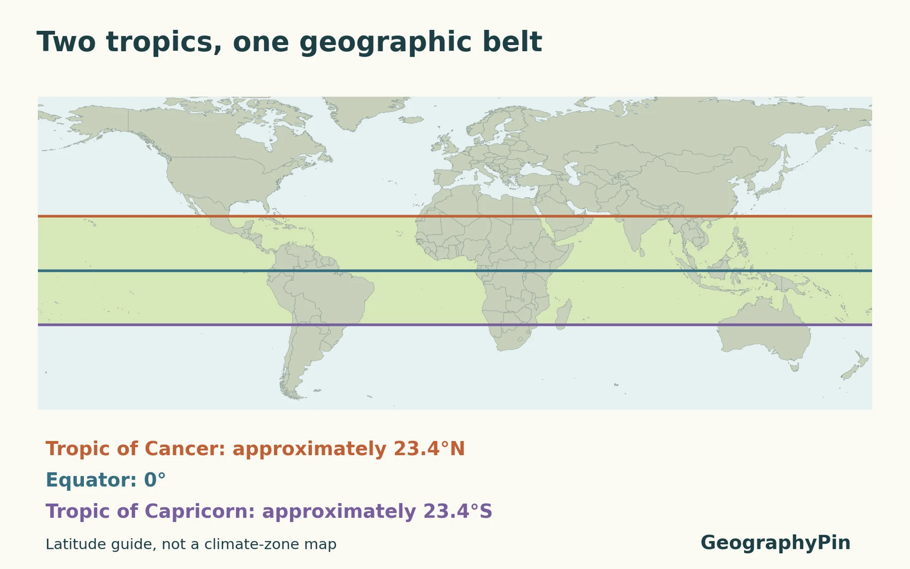
The Tropic of Cancer lies about 23.4° north of the equator; the Tropic of Capricorn lies about 23.4° south. They mark the approximate northern and southern limits where the Sun can be directly overhead at solar noon. The belt between them is the geographic tropics, but its climates are not all alike.
How to use this article: Connect the lines to Earth’s tilt, understand the overhead Sun, or separate geographic and climatic boundaries.
1. Where the two tropics are on a map
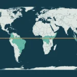
Both tropics are parallels of latitude: they circle Earth east–west and remain on their own side of the equator. Cancer is the northern line and Capricorn the southern line. Neither is a meridian of longitude or a boundary separating east from west.
| Feature | Tropic of Cancer | Tropic of Capricorn |
|---|---|---|
| Hemisphere | Northern | Southern |
| Approximate latitude | 23.4°N | 23.4°S |
| Overhead Sun at the boundary | June solstice | December solstice |
| Geographic role | Northern edge of the tropics | Southern edge of the tropics |
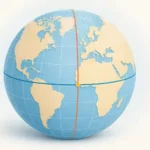
The numbers indicate angular distance north or south of the equator, not distance along a road or the width of a country. The map’s straight horizontal lines are a consequence of the chosen latitude–longitude layout. On a globe they are circles around Earth.
2. Why these latitudes are special
Earth’s tilt sets the solar limits
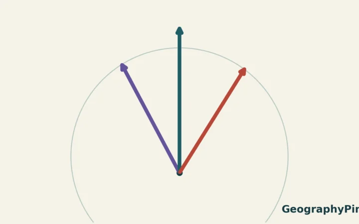
Earth’s rotational axis is tilted about 23.4° away from a line perpendicular to its orbital plane. As Earth travels around the Sun, that orientation produces a yearly shift in the latitude receiving the overhead Sun. The northern extreme occurs at the June solstice; the southern extreme occurs at the December solstice.
The same geometry explains the tropics’ matching approximate latitudes. They are not two arbitrary circles chosen because particular countries or deserts happen to lie there. In a simplified spherical model, the magnitude of the tilt sets how far north and south the overhead-Sun latitude reaches.
It is important to name the reference for the tilt: roughly 23.4° from perpendicular to the orbital plane, not 23.4° from the plane itself. A diagram that confuses those two angles would describe a very different orientation.
These are rounded values, not permanent survey coordinates. Earth’s obliquity, the angle of its axial tilt, changes slowly over long timescales. The corresponding tropic latitudes therefore change too. A global educational map does not need to display a falsely precise seconds-of-arc value to explain the relationship.
Our explanation of the change of seasons develops the wider tilt-and-orbit story. Here the focus is the geographic meaning of the two limits rather than the entire annual climate cycle.
3. When the Sun can be directly overhead
Overhead means at the zenith, not merely high in the sky
A directly overhead Sun is at the zenith: vertically above the observer. That is more specific than saying the Sun feels strong or looks high. In the usual solar-geometry explanation, this happens when the observer’s latitude matches the Sun’s declination at local solar noon.
At the Tropic of Cancer, the annual northern limit is reached around the June solstice. At the Tropic of Capricorn, the corresponding southern limit occurs around the December solstice. “June” and “December” avoid a common hemisphere problem: the June solstice is the Northern Hemisphere’s summer solstice but the Southern Hemisphere’s winter solstice.
Locations strictly between the two tropics generally have two overhead-Sun passages each year, as the latitude of the overhead Sun moves north and then south. At the equator, those passages occur around the March and September equinoxes. At the limiting tropics, the two passages meet at the relevant solstice. Outside the tropical belt, the Sun does not reach the zenith in this standard geometric model.
NASA describes the associated “zero-shadow” days: an upright object’s shadow falls very close to its base when the Sun is overhead. This does not mean that every object, tree or building has no shaded surface. It is a useful geometric observation, not a claim that all shadows disappear from the landscape.
The tropic line also does not receive the overhead Sun everywhere at the same instant. Longitude changes the time of local solar noon. The map marks the latitude limit; it is not a clock showing when a particular place reaches noon.
4. The geographic tropics are not one uniform climate
A latitude belt is not a climate classification
Calling a place geographically tropical tells you where it lies relative to the two tropics. It does not by itself tell you how much rain falls, whether the landscape is rainforest or desert, or how temperature changes with elevation.
Climate classifications use information such as temperature, precipitation and seasonal rainfall patterns. NOAA’s climate overview also emphasizes that distance from the equator is only one influence, with ocean circulation and mountain settings contributing to regional differences. The same latitude can therefore cross environments that feel very different on the ground.
That is why the latitude band on our map should not be read as a uniform weather zone. The lines are astronomically meaningful geographic references. A climate map answers a different question and needs its own data, definitions and legend.
Nor does a hot day north of Cancer move the geographic tropics northward, or a cold mountain south of the equator move Capricorn. Weather and local climate do not redraw these solar-geometry limits. Keep the definition attached to the map before making conclusions about a place.
Frequently Asked Questions
Why do some sources give 23.5° instead of 23.4°?
Educational sources commonly use the simplified value 23.5°, while a present-day tilt is about 23.4°. Neither rounded figure is an exact surveyed latitude for all dates. Our map consistently uses ±23.4° as an approximate teaching convention.
Are the tropics the same as the Arctic and Antarctic circles?
No. The tropics mark the overhead-Sun limits near the equator. The polar circles lie much farther poleward and relate to the limits of continuous summer daylight and winter darkness in the idealized geometric explanation.
What Did We Learn Today?
Cancer and Capricorn are northern and southern partners, defining a belt whose meaning comes from Earth–Sun geometry. Their approximate latitudes reflect axial tilt, and the relevant solstices occur six months apart. The map locates those limits, while the solar-noon explanation tells us what they mean. Neither the lines nor the word “tropical” replace evidence about a place’s actual climate.
Sources & Data Notes
The original GeographyPin map uses public-domain Natural Earth 1:50 million outlines in an equirectangular latitude–longitude view, clipped at 60°S and 75°N. The two reference lines are deliberately rounded to ±23.4°, not calculated from an ephemeris for a specific date. Coastlines and borders are generalized context, not a country-crossing inventory or territorial ruling. Solar explanations use the standard idealized geometry; atmospheric effects and exact local transit calculations are outside this guide.
- NASA: Tropical Solstice Shadows — overhead Sun and tropical shadow observations.
- NOAA/NESDIS: What Is a Solstice? — tropical and polar latitude limits.
- NASA: Milankovitch Cycles and Their Role in Earth’s Climate — obliquity and its slow variation.
- NOAA/NESDIS: What Are the Different Climate Types? — climate categories and regional influences.
- Natural Earth: Terms of use — public-domain map data.