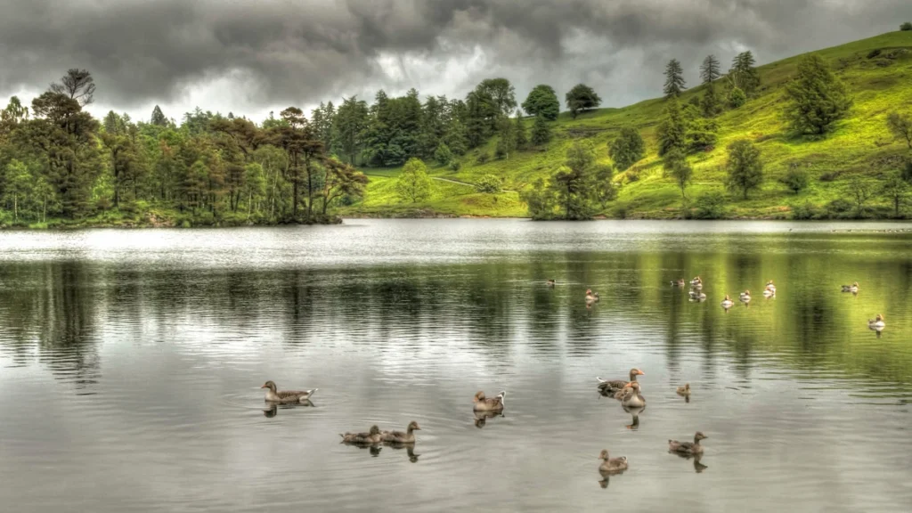
Tarn Hows looks like a quiet lake framed by trees and low hills. Yet the view combines several different stories: older rocks shaped by ice, three natural tarns joined by a dam, and a wooded estate landscape still being managed for nature and visitors.
Tarn Hows is a small freshwater lake and surrounding landscape in England’s Lake District, near Coniston and Hawkshead. Its present waterbody was enlarged by damming an outlet to join three natural tarns in the nineteenth century. Woodland planting and ongoing conservation make it a landscape shaped by both natural processes and people.
How to use this article: Understand how the dam joined the tarns, distinguish depth from shoreline measurements, or compare the different approaches on foot.
1. Where Is Tarn Hows?
Tarn Hows lies in the southern Lake District National Park, in Cumbria, England, north of Coniston and Hawkshead. It occupies a small basin among low wooded hills, with higher Lake District fells beyond. The national park authority explains that the “Hows” are the surrounding hills.
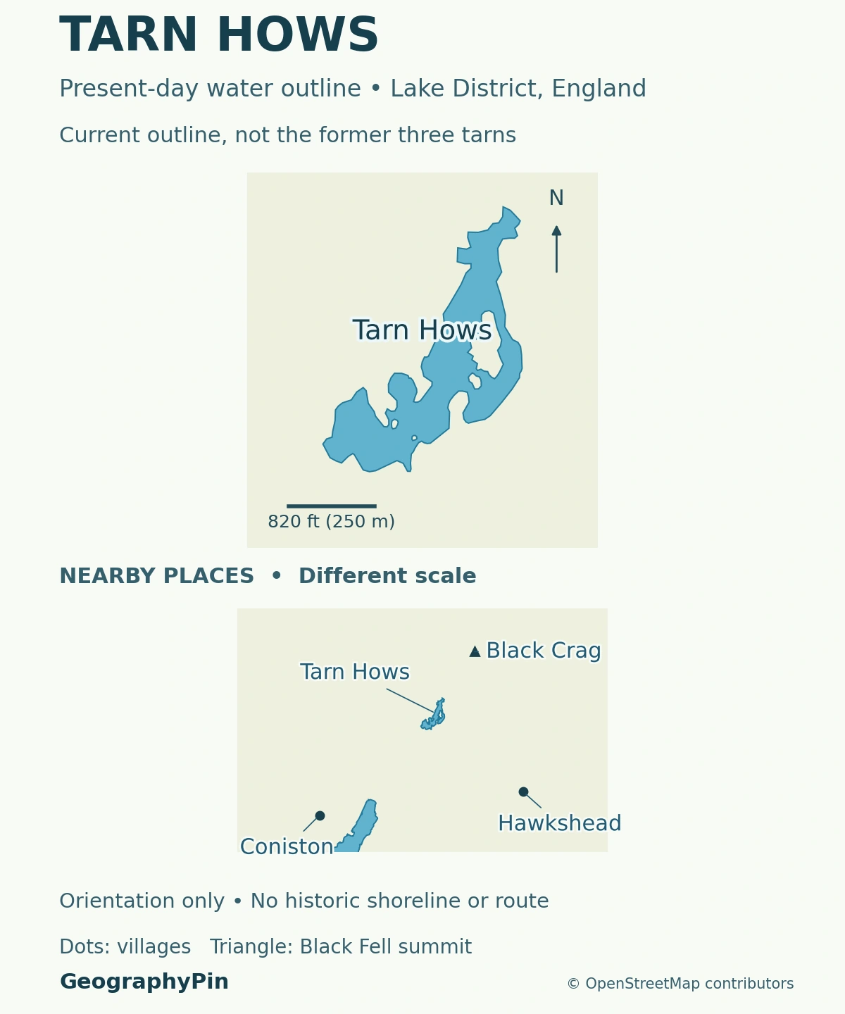
Tarn Hows, Coniston Water and Black Crag are separate features
Tarn Hows is not an arm of Coniston Water, the much larger lake to its southwest. Nor is it another name for Black Crag, the summit on Black Fell to the north. They belong to the same local landscape but require different map references and, for walkers, different routes.
The locator separates a close view of the tarn from its wider setting. That distinction matters: the small lake’s islands and irregular shoreline are easiest to see at one scale, while nearby villages and fells need a broader view. Neither panel is a walking-route map.
2. A Small Lake: What the Reference Figures Describe
UKCEH’s UK Lakes Portal identifies Tarn Hows as a small freshwater lake. Its record gives the following reference values. The page does not attach an individual survey date to these measurements, so they should not be read as a new survey or a live water-level report.
| Measurement | Reported value, converted and rounded |
|---|---|
| Surface area | About 35 acres (14 hectares) |
| Mean depth | About 18 feet (5.4 meters) |
| Lake elevation | About 617 feet (188 meters) above Ordnance Datum |
| Catchment area | About 274 acres (111 hectares) |
| Shoreline perimeter | About 1.9 miles (3 kilometers) |
Mean depth is not maximum depth
The portal reports mean depth, not a deepest-point measurement for this article. A mean summarizes the waterbody; it does not tell you the depth beside a particular bank. Likewise, shoreline perimeter is not the distance of a maintained walking route, which may run away from the water.
The catchment is the surrounding land draining toward the lake, not the water surface itself. These distinctions are useful for understanding how lakes and their basins work, even at a small site such as Tarn Hows.
3. From Three Tarns to One Designed Landscape
The National Trust describes three natural tarns here before James Garth Marshall’s nineteenth-century alterations. In the 1860s, he enlarged the waterbody as part of the Monk Coniston estate, combining an ornamental landscape with a water supply for his sawmill.
The dam changed the water level, not the age of the rocks
The Trust’s circular-walk account identifies a dam at the outflow of one of the three tarns. Holding back water joined the smaller pools into a larger waterbody. This is why describing the scene as either wholly natural or wholly artificial misses something important: natural hollows existed before people changed how water occupied them.
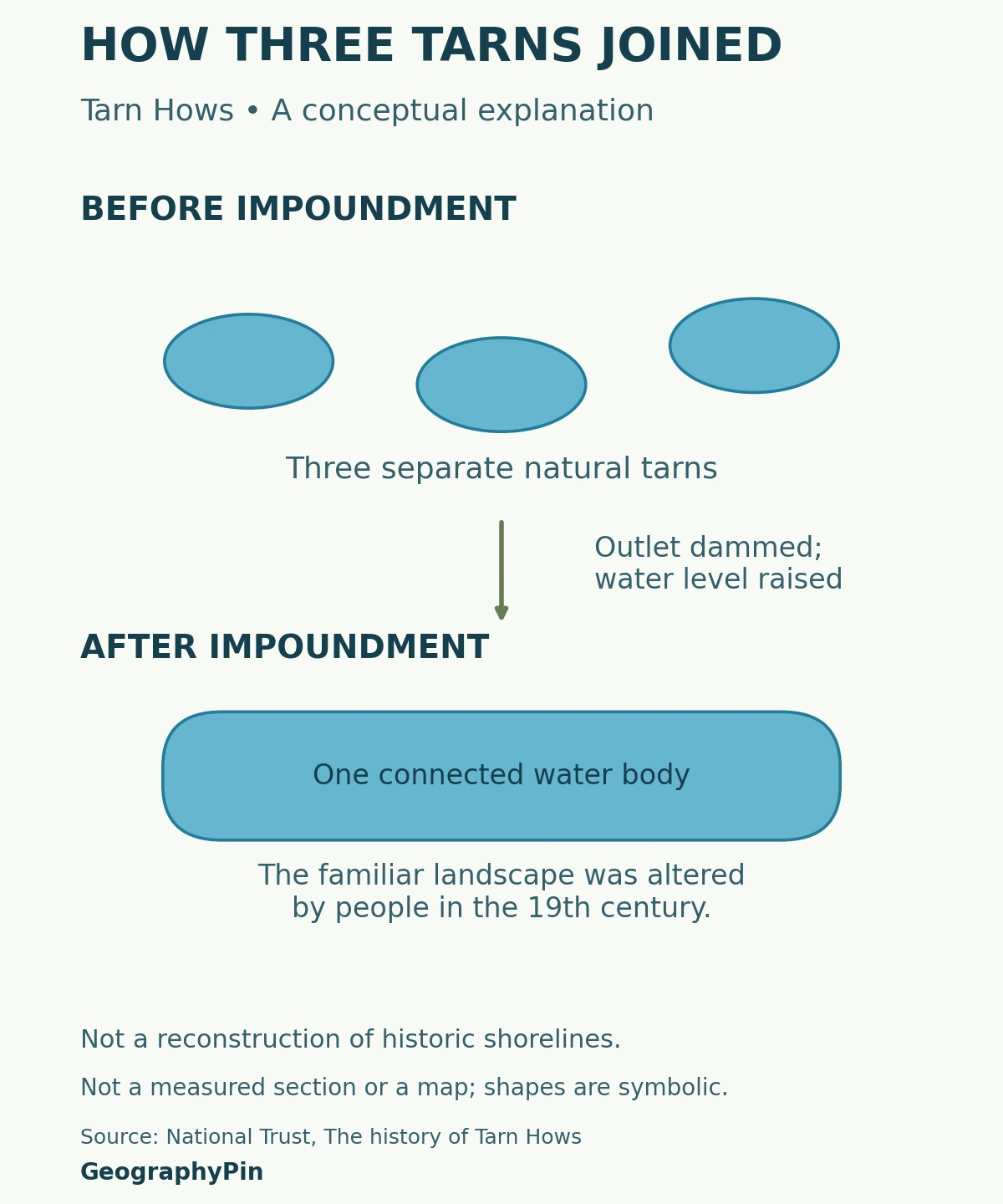
The diagram illustrates that mechanism, not the actual outlines of the three former tarns. It should not be used to identify an old bank, calculate an increase in depth or locate the dam on the ground.
Marshall also arranged tree planting to frame views and emphasize rocky knolls. Conifers sheltered young broadleaf trees, but the planned removal of those protective trees did not happen after his death. The woodland that developed was therefore not simply an untouched forest, nor a perfectly completed version of his original design.
4. Older Rocks and Ice-Shaped Ground
The managed lake sits within a much older geological landscape. Cumbria GeoConservation’s local trail, prepared with support from the National Trust and Westmorland Geological Society, identifies both volcanic and sedimentary rocks around Tarn Hows.
Some exposures belong to the Borrowdale Volcanic Group, including rocks made from ancient volcanic ash and fragments. Other exposures are sedimentary rocks associated with the Windermere Supergroup. That rock-group name is a geological classification, not a statement that modern Windermere lake once extended across Tarn Hows.
Small rock outcrops preserve evidence of moving ice
The trail describes glacially shaped outcrops called roches moutonnées. Moving ice smoothed one side of these rocks while removing pieces from the other, leaving contrasting surfaces. Such features help explain the inherited ground beneath the later estate landscape.
The timescales should remain separate. Ancient volcanism and sedimentation formed the rocks; later earth movements and erosion changed them; glaciers shaped the landscape; nineteenth-century engineering altered the waterbody. The dam did not create the hills or turn the lake into a volcanic crater.
Observe the exposures without damaging them. The local geology guide expressly prohibits hammering rocks at the site.
5. Why Conservation Changes the View
A managed landscape is not necessarily a landscape kept visually identical forever. The National Trust describes work to protect habitats and mire systems alongside elements of the designed scenery. Woodland growth, grazing and tree health all influence what visitors see.
Conservation grazing is one tool. The Trust explains that cattle graze and disturb vegetation differently from sheep, creating varied conditions for plants and other wildlife. That does not mean every open patch or animal seen nearby has the same management purpose.
Tree removal can be part of protecting the woodland
The Trust has reported felling diseased larch at Tarn Hows to control Phytophthora ramorum. Forest Research identifies this organism as a water mould that causes ramorum disease; it is not a virus. Larch is particularly susceptible.
Changes in tree cover can therefore reflect disease management rather than an attempt to remove the site’s scenic character. A photograph from an earlier year may show a different wooded outline without either image being false.
Forest Research notes that the organism can spread through contaminated material on footwear, paws and equipment, as well as through water and air. Follow site biosecurity guidance and clean mud and plant debris from boots and equipment. The Trust also asks visitors to keep to marked paths.
6. The Lakeside Circuit Is Not Every Route to Tarn Hows
The national park grades its Tarn Hows circuit as suitable “for some” users, not universally accessible. Although much of the surface is compacted stone, it reports rougher sections and slopes reaching 1:5 in places. A generally surfaced route should not be described as completely flat.
Separate the circuit, the waterfall approach and the fell walk
The park’s current route description is the right place to check the circuit’s detailed access information. Its former short upper linear walk is no longer included as a Miles Without Stiles route because it does not meet the scheme’s standards.
The National Trust’s Tom Gill approach starts lower down at Glen Mary Bridge and climbs through woodland beside waterfalls. The Trust classifies it as challenging. It is not the same outing as arriving at the main Tarn Hows car park and following the lakeside circuit.
Similarly, continuing to Black Crag adds a fell route rather than extending an accessible lakeside path on identical terrain. Choose the description for the route you actually intend to take, and check local notices before setting off.
Our wider Lake District geography guide places these small-scale differences within the region’s larger pattern of lakes, valleys and fells.
What Did We Learn Today?
Tarn Hows combines an inherited geological landscape with a deliberately enlarged lake and planted woodland. Reference measurements describe the waterbody, not today’s access or water conditions. Conservation can change the view, and the lakeside circuit, Tom Gill approach and Black Crag walk are different routes with different demands.
Sources & Data Notes
The measurement table uses the UK Lakes Portal’s reference record, with rounded unit conversions. No individual survey date or maximum depth is supplied here; the portal’s 2007 land-cover label is not a date for its lake measurements. The National Trust supplies the nineteenth-century alteration history. The geology leaflet is used for local rock exposures and glacial landforms, not for its conflicting historical date. Forest Research supplies the correct classification of the tree pathogen. Route details are source-specific and may change.
- UKCEH UK Lakes Portal: Tarn Hows, waterbody 29275
- UKCEH: origins and scope of the lake inventory
- National Trust: history and landscape design
- National Trust: circular walk and the historic dam
- Cumbria GeoConservation: Tarn Hows geology trail, 2022
- National Trust: conservation work at Tarn Hows and Coniston
- Forest Research: ramorum disease and its causal organism
- Lake District National Park: Tarn Hows route and access conditions
Featured photograph: “Watchful tarn, your mirrored eye” (Tarn Hows) by sagesolar, via Wikimedia Commons, CC BY 2.0. The photographer’s original HDR photograph was resized and converted to WebP. HDR is photographic tonal processing; this is a real scene, not an AI-generated location.
Map methods: OpenStreetMap provides the present lake polygon with its mapped islands and the surrounding place locations. British National Grid projection and equal axis scaling preserve geographic relationships within each panel; the context panel deliberately uses a different scale. The northern portion of Coniston Water appears for orientation. No former shoreline, precise dam position, historic depth or walking route has been inferred.
Conceptual illustration: The before-and-after pools are abstract symbols used to explain impoundment, not evidence of the original tarns’ sizes, arrangement or water levels.