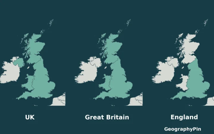
The Lake District’s lakes sit in separate valleys around a mountain core, so nearby names on a map do not always mean an easy journey between them. Understanding those valleys also clears up three common confusions: Windermere the town versus the lake, a “water” versus a lake, and the National Park versus the World Heritage Site.
The Lake District is a mountainous region in northwest England, known for lakes occupying glaciated valleys. Windermere and Coniston Water lie in its southern part, Derwentwater near Keswick to the north, and Ullswater to the east. Its National Park and UNESCO World Heritage property have different boundaries.
How to use this article: Start with the lakes and towns on the map, follow how glaciers reshaped the valleys, or check the distinction between Windermere town and its lakeshore.
1. Where Is the Lake District?
The English Lake District is in northwest England, south of Carlisle and west of the main north–south transport corridor through Penrith and Kendal. It is a region of lakes, valleys and uplands, not a town. “Lakeland” and “the Lakes” are common names for the same broad landscape.
The National Park Authority gives the park’s area as about 912 square miles (2,362 square kilometers), making it England’s largest national park. That boundary is useful for a map and an area figure, but the everyday regional name, the protected park and the UNESCO property are not interchangeable definitions.
Reading the lakes and towns on the map
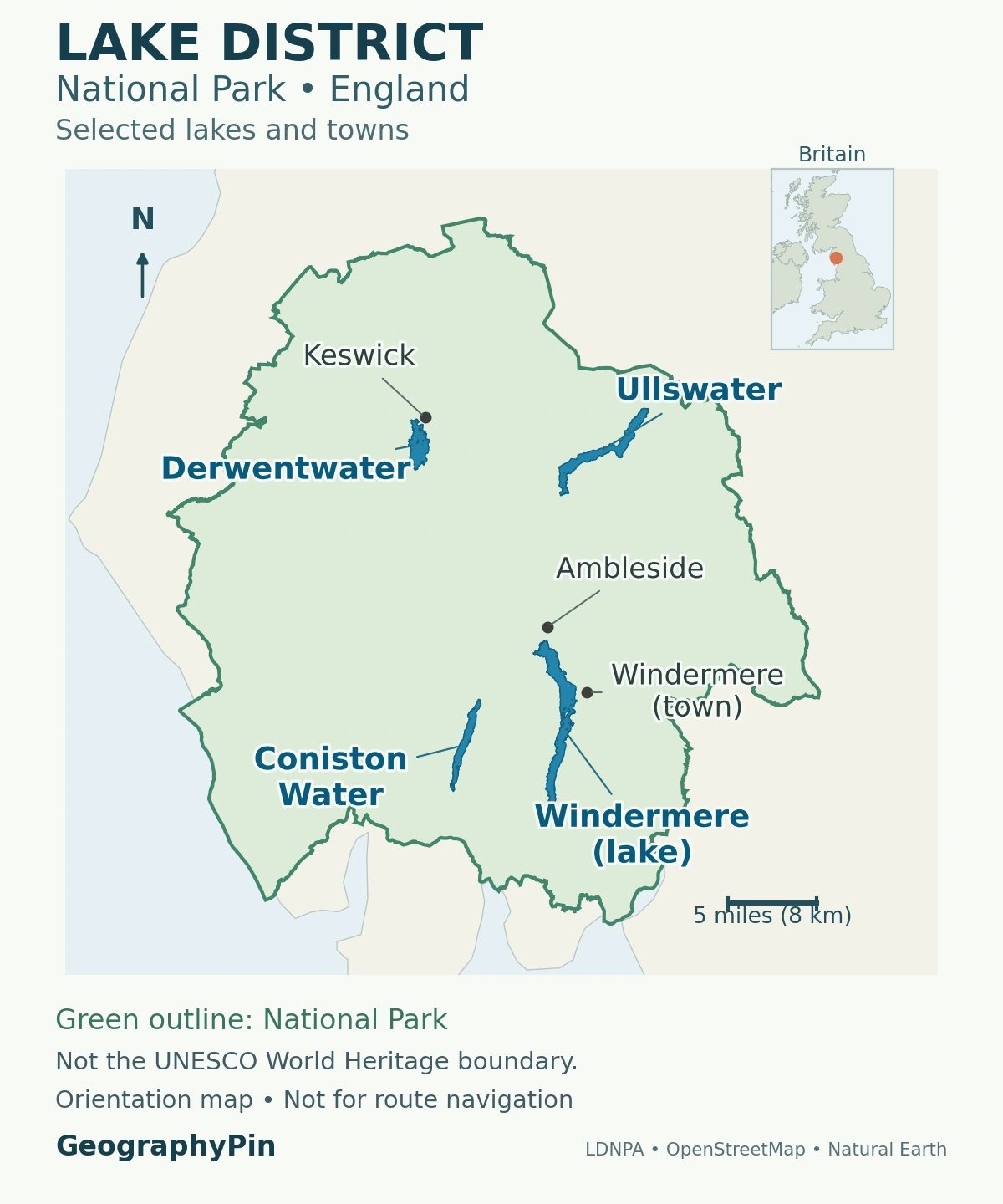
Start with the southern pair: Windermere and Coniston Water. Farther north, Derwentwater lies immediately south of Keswick, while Ullswater occupies a separate valley to the east. Ambleside is near the northern end of Windermere. These relationships make more sense than treating every lakeside destination as part of one continuous shoreline.
The regional map is for orientation, not for navigating a mountain route. Lakes separated by a short straight-line distance may sit across a ridge or in different valleys; the practical journey follows roads, paths or a pass rather than the shortest line on the image.
Why maps and addresses still say Cumbria
Cumbria remains a familiar geographic label, but older references to Cumbria County Council are outdated. On April 1, 2023, that council and the six district councils were replaced by the unitary authorities of Cumberland and Westmorland and Furness. Neither of those council areas is another name for the National Park.
For a visitor, a town name locates a destination; for a planning or access question, the relevant authority and the precise boundary matter. Avoid assuming that a tourism business using “Lake District” in its address must lie inside the park.
2. Comparing the Main Lakes
Windermere, Ullswater, Derwentwater and Coniston Water provide four useful starting points for understanding the region. The table uses the lake characteristics in UKCEH’s Lakes Tour 2021 report, published in 2023. These are reference surface areas, not catchment areas or a new shoreline survey; Windermere’s two basin areas are added together.
| Lake | Surface area | Orientation |
|---|---|---|
| Windermere | 5.7 sq mi (14.8 km²) | Southern Lakes; Ambleside near its northern end |
| Ullswater | 3.4 sq mi (8.9 km²) | Eastern Lakes; Glenridding and Pooley Bridge at opposite ends |
| Derwentwater | 2.1 sq mi (5.4 km²) | Northern Lakes; immediately south of Keswick |
| Coniston Water | 1.9 sq mi (4.9 km²) | West of Windermere; Coniston village near its northern end |
Surface area does not tell you depth. Windermere has the greatest surface area of any lake in England, whereas Wastwater holds the distinction of England’s deepest. UKCEH’s table gives Wastwater a maximum depth of about 249 feet (76 meters). Other public references give different depths, so that figure should be read with its source rather than as a uniquely agreed measurement. Nor does a lake’s size tell you whether its shoreline is accessible or whether an activity is permitted there.
Mere, water and tarn are names, not exclusions
The often-repeated “only one lake” claim is a naming joke. Bassenthwaite Lake carries the word “Lake,” while many other major water bodies have names ending in “mere” or “water.” Windermere and Ullswater are still lakes in the geographic sense. A tarn generally means a smaller upland lake or pool, but the name is not a universal size threshold.
Similarly, the familiar list of 16 main lakes is not an inventory of every pool and tarn. The useful question is what a list includes, rather than whether a water body happens to contain a particular word. The broader definition and formation of a lake explains that distinction.
Water storage adds another layer. Thirlmere occupies a glaciated valley, but its present form was created by damming earlier waters for supply. A natural landscape can contain a heavily modified water body; “glacial valley” and “reservoir” therefore do not contradict each other.
3. How Rock and Ice Shaped the Fells
The fells are the region’s hills and mountains. Scafell Pike rises to about 3,209 feet (978 meters), the highest summit in England. The terrain did not begin with the most recent ice: its bedrock records much older sedimentation, volcanism, deformation and erosion.
The main rock groups help explain differences in appearance. Skiddaw Group sedimentary rocks dominate much of the north; the resistant Borrowdale volcanic rocks contribute to the rugged central mountains; and Windermere Group sedimentary rocks underlie much of the gentler southern landscape. The surviving volcanic rocks do not mean that today’s peaks preserve the original shapes of volcanoes.
From river valleys to glacial troughs
During successive cold periods, ice moved outward through valleys from the central uplands. It deepened and widened pre-existing valleys, leaving broad troughs with steep sides. Long lakes occupying these troughs are often described as ribbon lakes. Their shapes are part of a larger valley system, not isolated basins scattered randomly across a flat plain.
The Royal Geographical Society describes this outward-radiating pattern. The British Geological Survey also records glacial deposits and landforms around Keswick: unsorted material left by ice, streamlined mounds called drumlins, and bowl-shaped hollows at valley heads. Ice both eroded the bedrock and deposited material elsewhere.
That distinction helps when reading the landscape. A steep-sided valley shows the large-scale effect of erosion; a low mound of mixed sediment may record deposition. A photograph of a lake alone cannot establish which process created every part of its shoreline.
After the glaciers retreated, rain and streams continued to feed the basins. Much of the bedrock allows little water to pass through it, helping surface water collect. Rivers still transport sediment into lakes, so the landscape is not frozen at the moment when the ice disappeared.
4. National Park and World Heritage Are Different Boundaries
The Lake District became a national park in 1951. Its boundary was extended on August 1, 2016. The English Lake District entered UNESCO’s World Heritage List in 2017, but that inscription follows the park’s pre-extension boundary rather than the whole enlarged park.
UNESCO records a property of roughly 885 square miles (2,292 square kilometers). The difference from the modern National Park’s area is not simply a conflicting estimate: the two designations cover different extents. Use the official UNESCO property maps when that particular boundary matters.
The World Heritage designation is cultural. It recognizes the relationship between mountain scenery, farming, settlement, artistic appreciation and conservation. The area is not being described as a landscape untouched by people. Stone-walled fields and farm buildings are part of the story, alongside lakes and fells.
Our Lake District dry-stone walls article looks more closely at one visible part of that working landscape.
National park status also does not mean that every acre belongs to the park authority. Its land-ownership account explains that most land is privately owned or held by other organizations. Protection, ownership and public access are different questions; a protected boundary is not blanket permission to cross any field, camp anywhere or launch a boat from any shore.
5. Understanding the Towns Before Choosing a Base
Choose a base by the valley you want to spend time in and the transport you will use, rather than by a single “best town” ranking. The following distinctions are geographic, not hotel recommendations.
Windermere town is not the lakeshore
Windermere railway station is in Windermere town, inland from the lake. Bowness-on-Windermere is the separate lakeside settlement downhill from it. Farther north, Ambleside’s center is inland from Waterhead, where boats serve the northern end of the lake. Booking somewhere called Windermere does not automatically put you beside the water.
That makes the southern cluster useful to understand as several linked places, not one large resort. Check the actual address and your onward connection before assuming a rail arrival or boat landing is a short walk from your destination.
Keswick suits a focus on Derwentwater and Borrowdale. The town lies north of the lake; Borrowdale continues beyond its southern end toward the central fells. Coniston offers a different southern valley, associated with its lake and a settlement shaped by farming and mining.
For Ullswater, distinguish Pooley Bridge at the northeast end from Glenridding toward the southwest. They are not interchangeable arrival points. The National Park’s Ullswater information identifies boat and public-transport connections around the lake, but a connection’s existence is not a guarantee of a departure at the time you need.
As a planning rule, group places in the same valley before adding a destination across the fells. This follows the geography rather than an assumed driving time and leaves room for the shoreline or settlement you actually came to see.
6. Rainfall, Access and Practical Checks
Moist air arriving from the west is forced upward by the mountains. As it rises and cools, cloud and rainfall can increase: the Met Office calls this orographic enhancement. It helps explain why the Lake District is wet, but a regional climate pattern is not a forecast for a particular valley or day.
The terrain also makes a single town forecast an incomplete basis for a mountain outing. Use an appropriate mountain forecast and current local access information, rather than judging conditions only from the lakeshore.
Rail gateways include Oxenholme and Penrith, with the Windermere branch serving the southern Lakes. Buses connect important settlements and valleys, and passenger boats operate on the four lakes compared above. For an actual trip, use the National Park’s transport information and operator links to check the date, last return connection and seasonal service pattern.
Access needs the same place-specific approach. A route advertised as lakeside may still include uneven ground, steps or stretches away from the water. The park’s Miles Without Stiles information describes individual accessible routes; use those descriptions instead of assuming that every shore path is level.
Swimming and boating rules differ between waters. Before entering, check permission, local notices and the relevant safety guidance. The National Park warns about cold water, other craft and blue-green algae, and identifies waters where swimming is not allowed. A clear-looking surface is not proof of safe conditions.
Finally, separate a regional orientation map from a navigation map. The map here helps locate the lakes and towns; it is not a substitute for detailed mapping, route knowledge or a check of changing conditions.
What Did We Learn Today?
The Lake District makes sense as a set of glaciated valleys around upland fells, with towns and transport arranged around that terrain. Lake names do not determine whether a water body is scientifically a lake, and national park status does not make every shore publicly accessible. Reading the right boundary and locating the actual town, landing or valley is more useful than treating the whole region as one destination.
Sources & Data Notes
Park and World Heritage areas refer to different designated boundaries. Lake areas and the Wastwater depth follow Table 1 of UKCEH’s 2023 report; square-mile conversions are rounded to one decimal place. Published references differ, including the National Park Authority’s 74-meter Wastwater depth, and the table is not a new bathymetric survey. Transport and activity permissions should be checked for the particular trip.
- UK Centre for Ecology & Hydrology: Lakes Tour 2021 (2023), Table 1
- Lake District National Park: facts and figures
- Lake District National Park: geology and geomorphology
- British Geological Survey: geology of the Keswick district
- Lake District National Park: water and Thirlmere
- UNESCO: The English Lake District
- Defra: National Park extensions effective in 2016
- Lake District National Park: land ownership
- Met Office: rainfall and mountain uplift
- Lake District National Park: swimming rules and safety
- Cumbria Observatory: unitary local authorities from April 2023
- Royal Geographical Society: Lake District glacial valleys
Map sources and method: GeographyPin map using the Lake District National Park Authority boundary dataset in British National Grid, with selected lake outlines and settlement locations from © OpenStreetMap contributors (ODbL 1.0) and public-domain Natural Earth coastline data. Contains public sector information licensed under the Open Government Licence v3.0. Contains OS data © Crown copyright and database right 2026. The map preserves lake islands and shows only four selected lakes; it does not depict the UNESCO boundary. The north arrow follows grid north, and the scale bar’s metric equivalent is rounded.
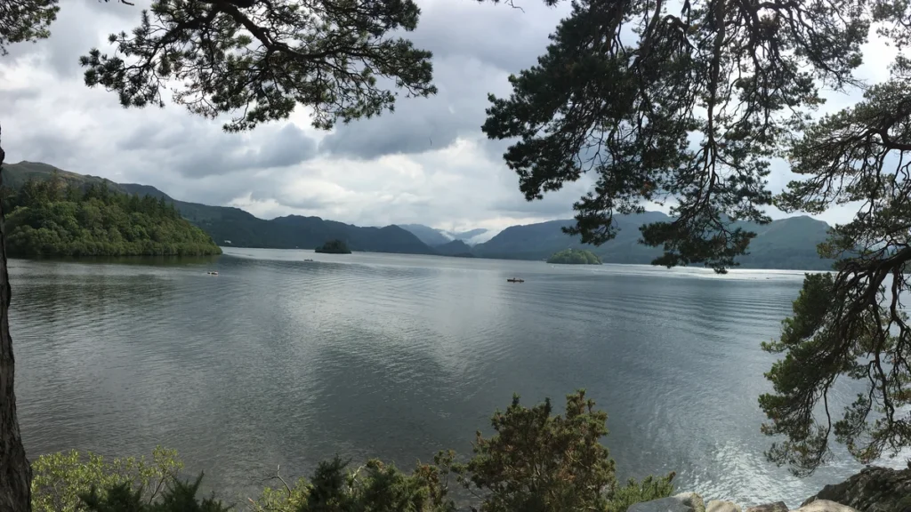
Featured photograph: Derwentwater near Keswick. Photo: Dahlfred, via Wikimedia Commons, CC BY-SA 4.0. Cropped, resized and converted to WebP; the adapted photograph remains under the same license.