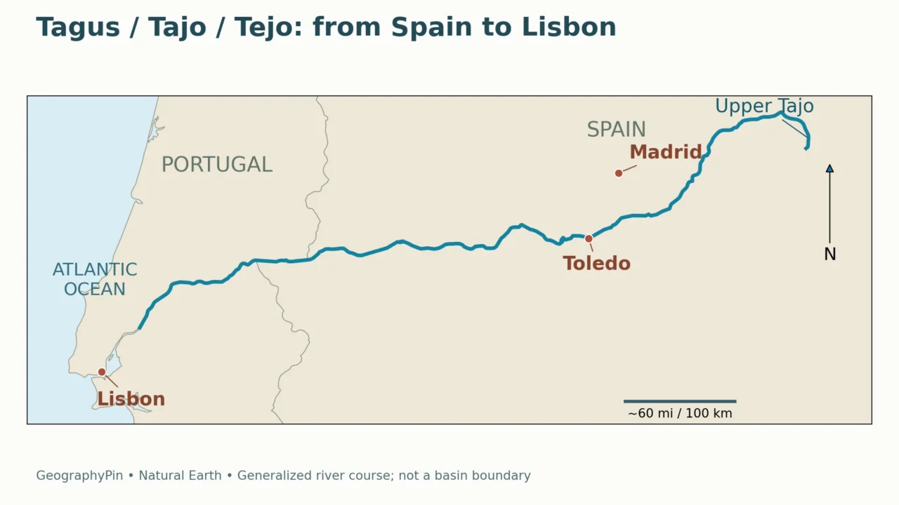
The river beside Lisbon has already crossed a large part of Spain before it reaches Portugal. Its changing name can hide that continuity: the Spanish Tajo, Portuguese Tejo and English Tagus are the same river, not three neighboring waterways.
The Tagus River rises in Spain’s Sierra de Albarracín and runs generally westward into Portugal, reaching the Atlantic through the estuary beside Lisbon. Called Tajo in Spanish and Tejo in Portuguese, it links inland valleys, historic river cities and a tidal coastal landscape. Madrid lies away from its main channel.
How to use this article: Compare the river names, follow the lower course, or separate length from basin size.
1. Where is the Tagus River?
The Tagus crosses the central part of the Iberian Peninsula, the landmass occupied mainly by Spain and Portugal. Its headwaters lie inland in Spain; its outlet is on Portugal’s Atlantic side. The broad direction is east to west, although individual bends and reaches do not follow a straight line.
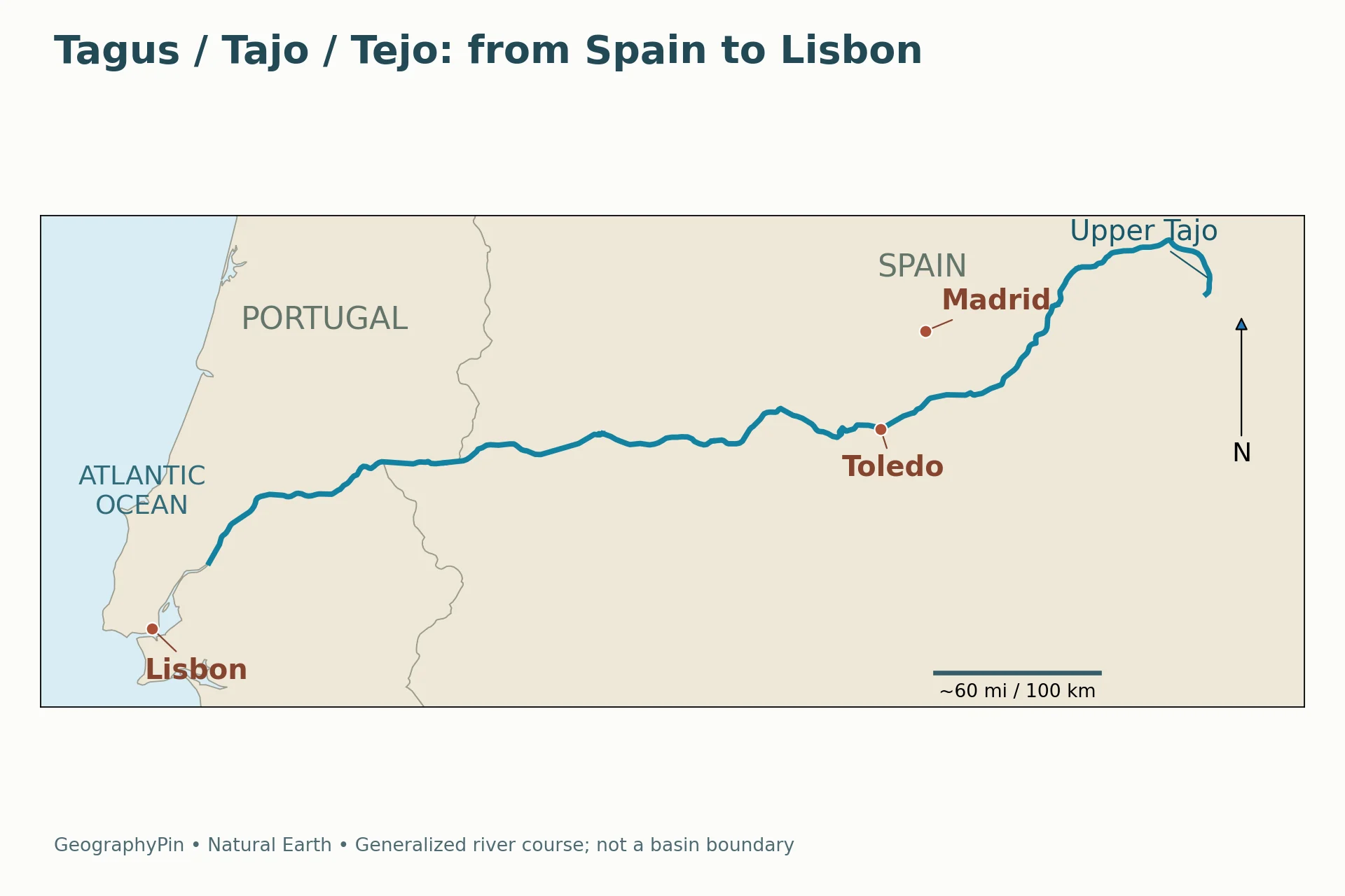
The map highlights the main river, rather than every tributary or the edge of its drainage basin. The city points help distinguish Toledo, which stands beside the Tagus, from Madrid, which does not sit on its main channel. Lisbon is beside the estuary at the river’s downstream end.
Reading the names on different maps
Tagus is the conventional English name. Tajo is the Spanish name, and Tejo is the Portuguese name. A map can change the label at the national border without indicating a new river or a confluence.
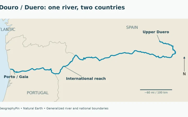
The naming pattern resembles the Douro and Duero, but the Douro is a separate river farther north. Both cross from Spain toward Portugal’s Atlantic coast. They should not be combined into one river system simply because both have familiar Spanish and Portuguese names.
| Name | Where you are likely to encounter it | What it identifies |
|---|---|---|
| Tagus | English-language geography and international discussion | The river as a whole |
| Tajo | Spanish maps and the Spanish basin authority | The same river in Spanish usage |
| Tejo | Portuguese maps and places along the lower river | The same river in Portuguese usage |
2. Follow the course from the upper river to Lisbon
A useful way to read the river is to move through three broad settings: its Spanish headwaters and inland course, the transboundary connection, and the Portuguese lower valley and estuary. These are reading aids, not official hydrological zones with boundaries drawn on the map.
The inland Spanish course
The source region is the Sierra de Albarracín. Farther downstream, the Tagus becomes part of several well-known cultural landscapes. At Aranjuez, UNESCO identifies the Tagus and Jarama rivers as the two principal waterways shaping the listed cultural landscape. Water, gardens and settlement belong to the same geographic story there.
At Toledo, the relationship is different. UNESCO describes the historic city as standing on a steep rock skirted by the Tagus. The river bend and elevated city are therefore not incidental scenery: they are central to understanding the setting. The map’s city marker indicates a reference location, not the outline of the historic quarter.
These examples also show why a river profile should not treat every town as interchangeable. Aranjuez illustrates a landscape organized around rivers and managed grounds; Toledo illustrates a compact city strongly related to its rocky riverside position. Neither example represents the entire upper or middle river.
The connection between Spain and Portugal
The Tagus is an international river system, with Spain upstream and Portugal downstream. Its basin crosses the national boundary, so a country-by-country account leaves out part of the physical connection. Rain and tributary inflows in upstream areas help determine what eventually moves into the lower river.
The main river also has a border reach, but this is not the same as saying that the whole river is the Spain–Portugal boundary. Most of the course lies within one country or the other. The generalized map is useful for seeing that relationship, not for locating a legal boundary on a particular bank or island. It is not a navigation chart: it does not show navigability, locks, dams, depths, currents or access restrictions.
The lower valley and estuary
In Portugal, the river leads toward the broad lower Tagus valley and the estuary beside Lisbon. A 2024 study in Natural Hazards and Earth System Sciences examines lower-valley flooding around places including Santarém, Golegã and Vila Franca de Xira. This is a wider landscape than the waterfront most visitors associate with Lisbon.
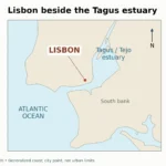
At the coast, the river enters an estuary: a water body connected to the sea where river inflow and marine influence interact. Lisbon is on its northern side. For the closer city-scale setting, see Lisbon’s position beside the Tagus estuary.
3. How long is the Tagus, and why do figures differ?
The Spanish Tagus basin authority, the Confederación Hidrográfica del Tajo, gives a total length of about 679 miles (1,092 kilometers) in its basin overview. That is the attributed reference figure used here, rather than a measurement calculated from this article’s small-scale map.
Other publications report different totals. The 2024 lower-Tagus flood study describes a length of approximately 684 miles (1,100 kilometers). Older Spanish environmental reporting gives 625 miles (1,006 kilometers). Those values should not be silently blended into a new number or presented as identical measurements.
The consulted sources do not provide enough common measurement detail to reconstruct exactly why all their totals differ. The honest conclusion is that a length figure needs an accompanying source. Differences in mapped course, endpoints or measurement conventions can matter in river measurement generally, but assigning a particular cause to these Tagus figures would require further evidence.
What a river-length number does not measure
The length of the main river is not the total length of all streams in its basin. A drainage basin is an area: the land whose runoff reaches a common river system. River length is a distance along a selected channel. Confusing the two can turn a valid number into an invalid comparison.
Nor does a long river automatically have the greatest flow or the largest basin. Those are separate questions requiring separate measurements. The Tagus is identified as the Iberian Peninsula’s longest river by its Spanish basin authority; that statement does not make it first in every hydrological category.
For the same reason, the river’s map should not be used as a ruler for a precise total. Generalized geometry smooths bends and reduces detail. Its strength is orientation: showing where the river runs, which countries it connects and where selected places lie relative to it.
4. The river, its basin and the estuary are different places
A main-channel map answers “Where does the Tagus run?” A basin map answers “Which surrounding land drains toward it?” An estuary map answers a more local coastal question. A city may belong to the wider drainage system without sitting on the main river.
| Geographic feature | What it means | What not to assume |
|---|---|---|
| Main river | The channel followed from the upper course toward the outlet | Every basin city stands on this channel |
| Drainage basin | Land connected by runoff and tributaries to the river system | Its boundary follows the national border |
| Lower valley | The downstream river landscape before and toward the estuary | It is identical to central Lisbon |
| Estuary | The coastal water body where river and sea interact | The water behaves like an upstream freshwater reach |
Table downloads (2)
- Names used for the same Tagus River (4 × 3)View tableDownload CSV
- River, basin, valley and estuary: different geographic units (5 × 3)View tableDownload CSV
The estuary distinction matters when interpreting a photograph. A broad expanse of water beside Lisbon is not evidence that the Tagus maintains that width all the way across Spain. A distant upstream valley cannot be inferred from the appearance of the tidal outlet, either.
Why Madrid is not a Tagus-bank city
The regional map places Madrid north of the main Tagus line. That is deliberate. Describing the Tagus as a river of central Spain, or connecting Madrid to the wider basin, does not make the Tagus the river running through the city center.
Toledo and Lisbon provide clearer examples of direct relationships to the main river and its estuary. Aranjuez adds another: UNESCO’s description explicitly ties its landscape to both the Tagus and Jarama. A map that distinguishes a main channel from a tributary network prevents these relationships from being flattened into a misleading list of “cities on the river.”
5. Why the amount of water changes
The Tagus is not a fixed-volume line flowing across the map. The 2024 lower-valley study describes a rainfall-dominated regime with higher discharges in winter and lower ones in summer. That seasonal pattern is a broad description, not a promise about the river on any particular date.
Reservoirs have also substantially modified the natural flow regime. Storing water and releasing it later changes the timing of downstream flow. The same study examines how reservoir operation and flood-management measures could influence events comparable to the major lower-Tagus flood of 1979.
Regulation does not remove flood risk
A regulated river can still flood. Large inflows, storage conditions, tributaries and the shape of the valley all matter. The 1979 event is a historical case used to evaluate modeling and mitigation, not a forecast that an identical flood is due to happen again.
There is also an important difference between a map showing the river’s location and a flood-hazard map. This article’s line does not show inundation depth, flood probability, evacuation routes or safe building sites. Local planning decisions require the responsible authorities’ detailed hazard information, not a general geography illustration.
The upstream–downstream relationship explains why the Tagus cannot be understood solely from a viewpoint in Lisbon. Water reaching the lower valley reflects processes across a much larger area, including rainfall and reservoir management upstream. The estuary then adds coastal influences to that river signal.
Frequently Asked Questions
Is the Tagus the same river as the Douro?
No. The Tagus, Tajo and Tejo are names for one river; the Douro and Duero are names for another. Both connect Spain and Portugal, but they have different courses and outlets. The Douro reaches the Atlantic by Porto and Vila Nova de Gaia, north of Lisbon.
What Did We Learn Today?
The Tagus is best understood as one connected river with three familiar names and several different landscapes. Its Spanish inland course, international connection, Portuguese lower valley and Lisbon estuary are related but not interchangeable. An attributed length, a clear distinction between channel and basin, and a map that separates city points from river lines make that geography easier to read without claiming more precision than the evidence supports.
Sources & Data Notes
The length reference follows the Spanish basin authority’s overview; other published totals are attributed separately, not averaged. Miles are rounded conversions. The original map uses public-domain Natural Earth river, country and city geometry in a regional equal-area projection. It preserves generalized source lines without extending them through the estuary or inventing tributaries. Neither basin boundaries nor flood zones are represented.
- Confederación Hidrográfica del Tajo: La cuenca del Tajo
- How to mitigate flood events similar to the 1979 catastrophic floods in the lower Tagus (2024)
- Environmental Profile of Spain 2007: general framework and river table
- UNESCO: Historic City of Toledo
- UNESCO: Aranjuez Cultural Landscape
- Natural Earth: public-domain data and reuse terms