The Ebro begins close to Spain’s northern coast but does not take the short route to the Bay of Biscay. Its course leads inland and southeast to the Mediterranean, connecting a northern headwater landscape, cities such as Zaragoza and a delta whose shape depends on far more than the water arriving at its mouth.
The Ebro River runs across northern and northeastern Spain to the Mediterranean Sea. The Ebro basin authority identifies Fontibre as its source. Downstream, the river passes Logroño and Zaragoza before reaching the Ebro Delta in Catalonia. Its main channel, surrounding drainage basin and coastal delta are different geographic features.
How to use this article: Compare the source and outlet, follow the delta landscape, or separate water from sediment.
1. Read the Ebro River map from northwest to southeast
The main course runs from northern Spain toward the Mediterranean coast south of Barcelona. The source area is in Cantabria, while the delta lies in southern Catalonia. That broad northwest-to-southeast relationship is more useful for first orientation than trying to memorize every bend.
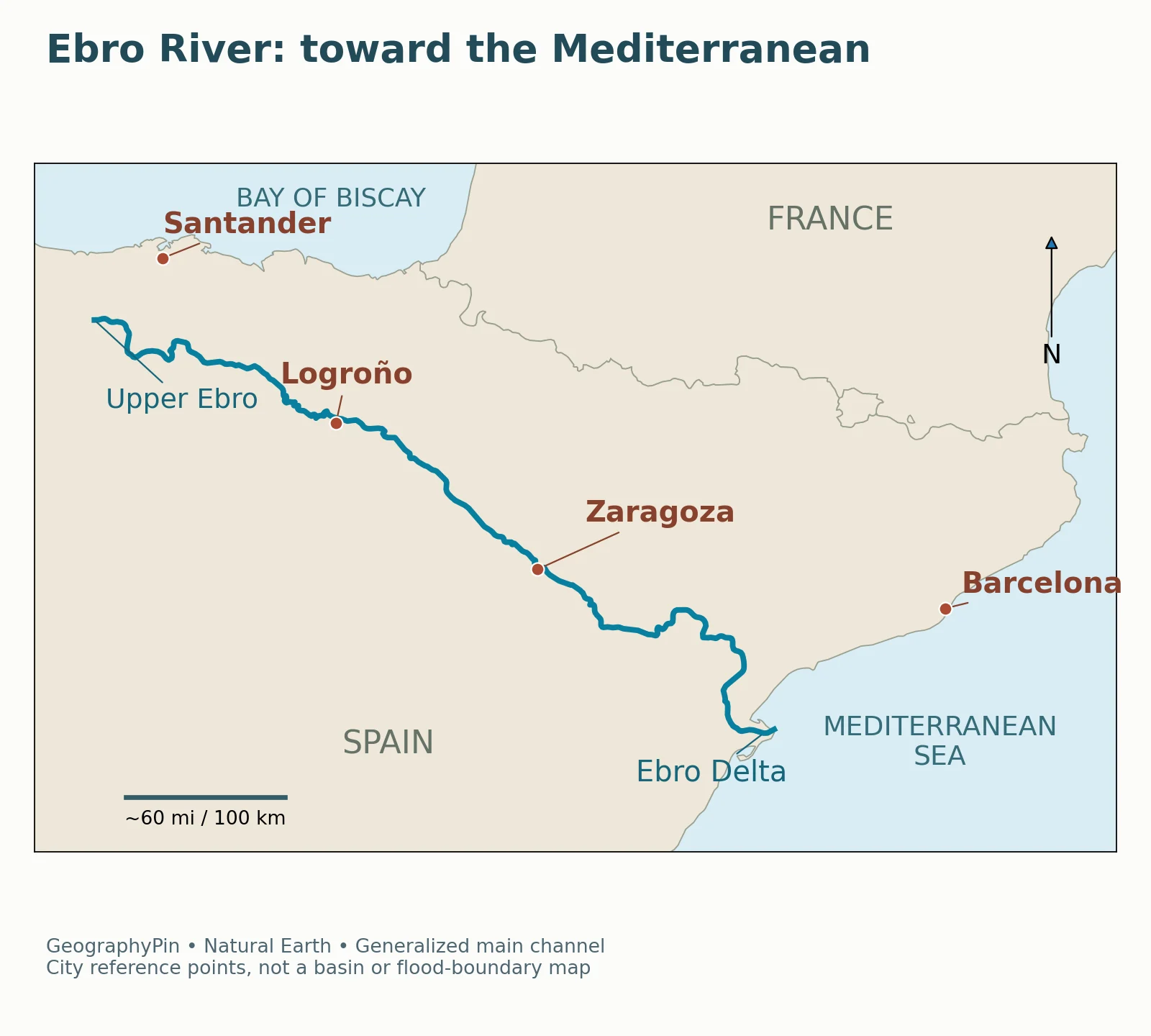
The highlighted line follows generalized main-river geometry. Logroño and Zaragoza help locate the inland course; Santander and Barcelona are coastal reference points, not cities on the Ebro. The map deliberately omits tributaries rather than drawing a drainage network that has not been independently checked.
A northern source is not a northern outlet
The Ebro basin authority’s headwaters description places the source at Fontibre and describes the Híjar as a tributary rising higher in the mountain system. The named source convention should therefore not be confused with a claim that every upstream stream begins at Fontibre, or that Fontibre is the highest point in the drainage network.
The nearby northern coast can make the river’s destination seem surprising on a small map. Water follows the connected drainage system, not simply the shortest horizontal distance to the sea. In this case the main river ultimately reaches the Mediterranean rather than the Bay of Biscay.
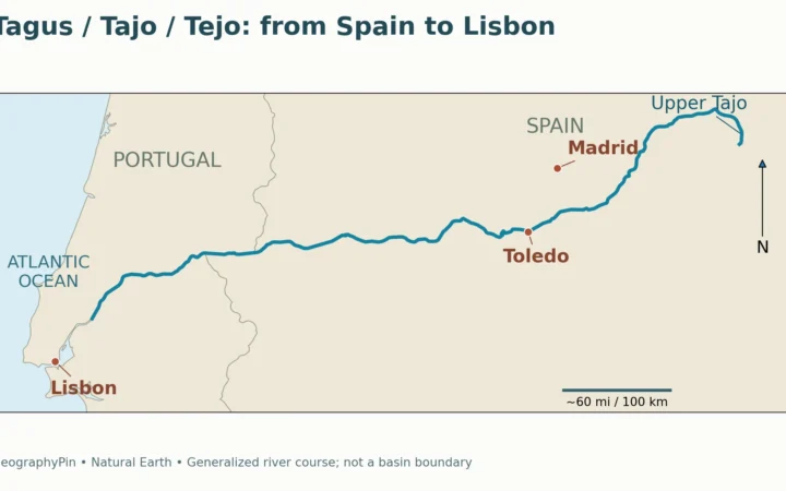
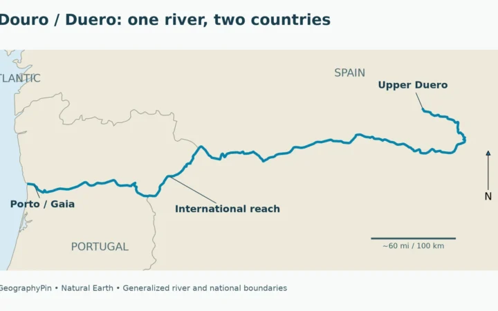
The Ebro contrasts with the Douro and Duero, which flow toward Portugal and the Atlantic. The two illustrate why “a river in Spain” does not by itself identify an outlet. Iberian rivers drain toward different coasts.
River length depends on the mapped course
Spain’s Environmental Profile 2007 lists an Ebro length of about 565 miles (910 kilometers). A separate basin-authority hydrogeomorphological report gives about 591 miles (951 kilometers), explicitly based on digitizing 2006 aerial orthophotography. These are source-specific figures, not distances measured from the map above. The route and outlet are the central facts here; a precise length comparison requires a consistent measurement method.
2. Zaragoza is on the river; Barcelona is not
Zaragoza provides a clear urban reference point on the middle Ebro. The municipal tourism authority describes roughly 6 miles (10 kilometers) of river through the city, with public riverbanks on both sides. The river is part of the city’s actual layout, not merely a nearby feature assigned to it on a regional tourism map.
The city’s two banks
Zaragoza’s account describes landmarks and public spaces on both banks and identifies the riverside renewal associated with Expo 2008. For a geographic reader, the important point is the relationship: the Ebro divides and connects urban spaces through riverbanks and crossings.
The local view is different from the scale of the whole river. A waterfront photograph shows a particular reach, with its bridges, bank works and buildings. It cannot show how much land supplies the river upstream, how all its tributaries connect, or how the delta responds to sediment farther downstream.
Barcelona serves a different purpose on the map. It is a recognizable Mediterranean city north of the delta, but the Ebro does not flow through it. Santander likewise helps orient the northern coastline without being the river’s outlet. Including those places as reference points should never turn them into an inaccurate list of riverbank cities.
| Place or feature | Relationship to the Ebro | What the map helps distinguish |
|---|---|---|
| Fontibre | Named source in the basin authority’s headwaters account | A source convention, not the highest point of the entire basin |
| Logroño | City on the main river | An inland reference along the course |
| Zaragoza | City crossed by the Ebro | A direct urban relationship to the channel |
| Barcelona | Coastal reference north of the delta | Not a city on the Ebro |
| Ebro Delta | Coastal sedimentary landform at the outlet | Not the whole river basin |
3. What the delta image actually shows
The lower Ebro builds a different kind of landscape from the inland river. A delta forms as sediment delivered by a river accumulates near its outlet, while waves, currents and other processes redistribute that material. The result is not a fixed triangle drawn once and left unchanged.
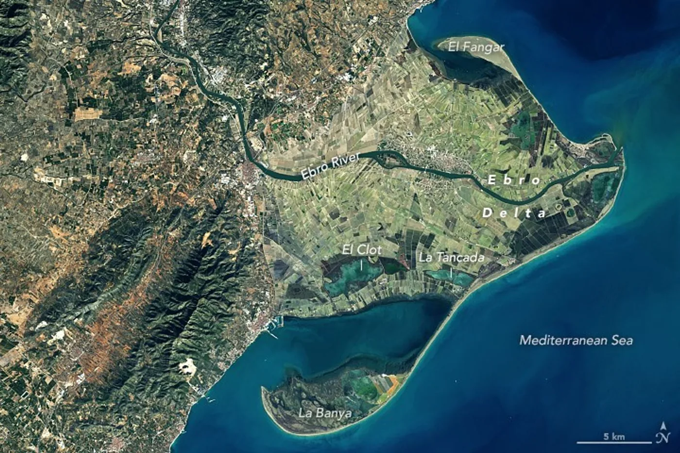
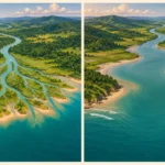
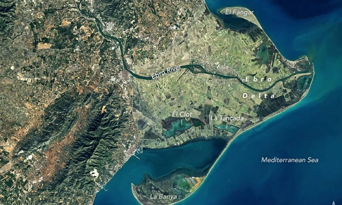
This Landsat scene shows the delta on January 31, 2018, not its exact present-day coastline. The river crosses a patchwork of cultivated land before reaching the sea. Sand spits extend around the coastal margins, and lagoons appear within the delta plain.
The two spits and the bays behind them
NASA’s explanation identifies El Fangar on the northern side and La Banya on the southern side. The natural park’s habitat account distinguishes open Mediterranean water from the more sheltered bays of El Fangar and Els Alfacs. A spit, a bay and a lagoon are related coastal features, but they are not interchangeable names.
A spit is an elongated accumulation of sediment extending from the coast. A bay is an indentation or partly enclosed area of coastal water. The satellite view makes their relationship clearer than a list of definitions: the curving sandy forms help enclose water behind them.
The image should also be read as a dated observation. A sediment plume near the mouth indicates material suspended in the water at that moment; its appearance does not supply a yearly sediment budget. Likewise, differences in water color are not a ready-made map of salinity or depth.
A delta is more than the active river mouth
The river mouth is where the channel meets the sea. The delta includes a much wider sedimentary landscape built and reworked over time. Older river courses and abandoned lobes help explain why land extends away from the mouth’s present position.
NASA’s 2018 account describes changes in river course and the subsequent reworking of older lobes by waves. The useful conclusion is not that every curve can be dated by eye, but that the delta records more than the location of today’s channel. Its outline contains the consequences of both river delivery and coastal redistribution.
4. Why upstream dams matter at the coast
A river carries sediment as well as water. Sediment includes particles such as sand and finer material moved from the catchment and channel. When that material reaches the coast, it can help replenish a delta; when it settles in reservoirs, it is no longer immediately available to the river mouth.
NASA’s December 2021 explanation of the Ebro coast describes dams on the river and its tributaries trapping much of the sediment that would otherwise move downstream. It connects this sediment shortage with coastal erosion and land subsidence, alongside rising seas and storm effects.
Water delivery and sediment delivery are not the same
A river can continue carrying water past a dam while its sediment transport changes substantially. This is why the presence of flowing water at the mouth does not, by itself, show that a delta is receiving enough material to maintain its shape or elevation.
There are two separate directions to consider. Along the coast, waves can move sediment from one place to another, causing one shoreline segment to retreat while another changes differently. Vertically, the delta plain needs enough material to offset processes that lower the land relative to the sea. Subsidence means land sinking; it is not simply another word for erosion.
The park’s geology account also describes this distinction between sediment shortages near the active mouth and shortages across the delta plain. It is therefore too simple to describe the entire delta as moving uniformly inland at one fixed rate.
| Process | What changes | Why it matters for the delta |
|---|---|---|
| Sediment delivery | Material reaching the lower river and coast | Helps replenish the coastal landform |
| Coastal redistribution | Where waves and currents move sediment | Can reshape spits and shift shoreline positions |
| Subsidence | The elevation of the land | Changes the land’s height relative to the sea |
| Sea-level rise | The water level relative to coastal land | Adds pressure to low-lying areas |
Table downloads (2)
- Places and their relationship to the Ebro River (6 × 3)View tableDownload CSV
- Processes that shape the Ebro Delta (5 × 3)View tableDownload CSV
5. A working landscape, not an untouched wetland
The satellite image contains both natural habitats and cultivated fields. The Ebro Delta’s ecological value does not mean that people are absent from it. NASA and the natural park describe a landscape in which agriculture, freshwater channels, coastal water bodies and wildlife habitats exist together.
The park’s habitat account identifies the river and irrigation network as freshwater environments and distinguishes them from marine bays, dunes, saline areas and lagoons. These differences matter because a plant or animal adapted to one setting cannot automatically use all the others in the same way.
Freshwater and seawater meet, but not uniformly
Near the outlet, river water meets Mediterranean water. The natural park describes that mixing at the mouth, while also identifying separate freshwater and marine habitats across the delta. It would be misleading to assign one salinity value to the river, its irrigation channels, every lagoon and the open sea.
For the larger marine setting, why the Mediterranean Sea is relatively salty explains the basin-wide water balance. That does not replace local measurements at the Ebro mouth: conditions there also depend on river discharge, mixing and where the sample is taken.
The distinction is useful when looking at maps. A river-course map provides orientation. A habitat map classifies environments. A coastal-change study compares shorelines using specified dates and methods. None of those products can be substituted for the others merely because all show the same delta.
Frequently Asked Questions
Are Ebro and Ebre different rivers?
No. Ebro is the Spanish name and the usual English form; Ebre is the Catalan name. The Catalan natural park is called Parc Natural del Delta de l’Ebre. A change of spelling does not indicate another river.
Is the entire Ebro Delta inside the natural park?
No. The delta is the larger landform, whereas the natural park protects designated areas within it. The broader delta also includes settlements and agricultural land. Use the park’s official map for protected-area limits rather than assuming the whole visible delta has the same designation.
What Did We Learn Today?
The Ebro connects northern Spanish headwaters with a Mediterranean outlet, passing through inland river cities rather than Barcelona. Its delta is a wider, changing landform shaped by sediment supply, waves, human land use and changes in land and sea level. Reading the original course map alongside a dated satellite image helps separate the main channel, the urban river, the delta plain and the active mouth without treating them as the same geographic unit.
Sources & Data Notes
River lengths are attributed to their original reports; miles are rounded conversions, not a new measurement. The original regional map uses public-domain Natural Earth geometry and retains its generalization. NASA’s satellite scene dates to January 31, 2018 and is used with its original credit and no GeographyPin watermark. No current dam total, inundation projection or present-day shoreline position is inferred from these historical sources.
- Ebro basin authority: Ebro en Cabecera
- Ebro basin authority: hydrogeomorphological assessment of the Ebro, section 52.2
- Environmental Profile of Spain 2007: river table
- Zaragoza City Council: Riberas del Ebro
- NASA Earth Observatory: The Sculpting of Ebro Delta (2018)
- NASA Earth Observatory: Spain’s Changing Mediterranean Coastline (2021)
- Delta de l’Ebre Natural Park: Habitats
- Delta de l’Ebre Natural Park: Hydrology and geology
- Delta de l’Ebre Natural Park: official visitor map
- Natural Earth: map-data reuse terms