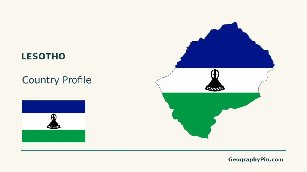
Lesotho’s outline sits entirely inside South Africa, but it marks a separate country. Its mountain landscape also makes a familiar term misleading: even the western “lowlands” are high above sea level.
Lesotho is an independent, landlocked kingdom entirely surrounded by South Africa, with Maseru as its capital. Its geography combines western lowlands, foothills, high mountains and the Senqu River Valley. “Lowlands” is a relative term within an elevated country. The Senqu connects its mountains to the wider Orange-Senqu basin and regional water projects.
How to use this article: Understand the enclave, compare physical settings, or follow the Senqu river system.
1. Locate an Independent Country Inside South Africa
Enclave and landlocked describe different things

Lesotho is an independent kingdom entirely surrounded by South Africa. It is landlocked because it has no coastline, and an enclave because a single other country surrounds all of it. The line around Lesotho is an international border, not the boundary of a South African province.
Why the enclosed territory remained a separate country
The outline reflects a separate political history. The Basotho kingdom associated with Moshoeshoe I came under British rule in 1868. Known as Basutoland before independence, it became Lesotho on October 4, 1966. Its enclosed position therefore does not mean that it is governed as part of South Africa.
The Southern Africa regional guide places Lesotho alongside neighboring countries and distinguishes the region from South Africa itself.
2. Read the Mountain Kingdom’s Relative Lowlands
Lowland does not mean close to sea level
| Setting | Geographic contrast |
|---|---|
| Western lowlands | Lower terrain within a country that is already elevated. |
| Foothills | A transition between lower country and the mountain interior. |
| Highlands | The rugged uplands, including the Maloti mountain landscape. |
| Senqu River Valley | A river-valley setting within the wider mountain country. |
The 2019 government environmental framework places the lowlands broadly at about 4,600–5,900 ft (1,400–1,800 m) above sea level. These are regional classification bands, not a precise national minimum or a survey of every valley.
Physical regions help explain settlement patterns
The UN’s November 2024 country analysis identifies the lowlands and foothills as the main concentration of socioeconomic activity. It contrasts these with mountain and Senqu Valley settings where livestock grazing and water-resource projects are important.
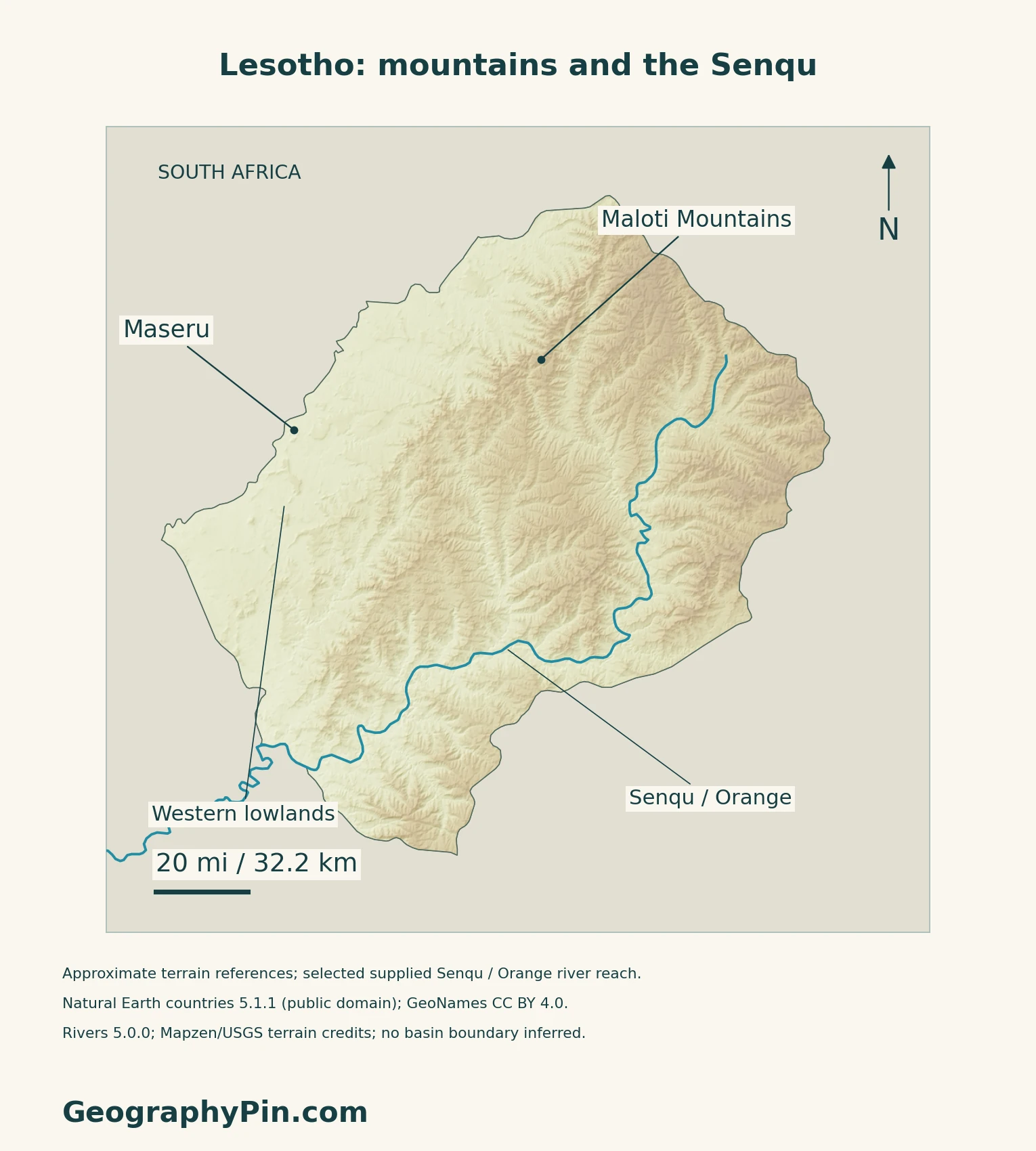
A regional label describes a broad landscape, not an administrative district. The terrain map preserves that distinction: it shows relief and selected references rather than inventing surveyed boundaries between the physical regions.
3. Follow the Senqu Beyond the National Border
The Senqu belongs to the Orange-Senqu system
The Senqu rises in Lesotho’s mountains and continues into the wider Orange-Senqu river system. Downstream, that system crosses South Africa and reaches the Atlantic on the South Africa–Namibia coast. The international border does not end the catchment.
The country map shows supplied river segments within its frame, not the entire basin or every tributary. ORASECOM’s basin materials provide the wider downstream context.
Water transfers connect the highlands with South Africa
The Lesotho Highlands Water Project was established by the two governments’ 1986 treaty. Its purposes include supplying water to South Africa’s Gauteng region and generating hydroelectricity for Lesotho.
LHDA reports that Phase I was completed in 2003 and inaugurated in 2004. Phase II remained under way when checked in November 2026. The project therefore combines operating infrastructure with further construction; planned components should not automatically be described as finished.
4. Understand Snow, Rainfall and Rural Exposure
Snow cover is seasonal and uneven
A 2017 study used satellite observations from 2003–2016 to examine snow in the Lesotho Highlands. Snow persisted longest on high south-facing slopes during June–August, while its loss varied with temperature, wind and local setting.
Those observations show why a mountain photograph cannot establish year-round snow cover. They describe a historical study period, not current conditions on a particular pass or a travel forecast.
Mountain water resources do not remove drought risk
At the March 2026 launch of a government–WFP adaptation project, the UN identified drought, erosion and erratic rainfall as pressures on targeted rural communities. The programme covers Mafeteng, Mohale’s Hoek, Quthing and Thaba-Tseka, spanning southern lowland and highland settings.
Rain-fed farming, land condition and access to services shape how households experience climate shocks. The launch describes planned adaptation work, not proof that all measures have already been completed.
5. Check the Capital and Dated Country Facts
| Item | Reference |
|---|---|
| Capital | Maseru |
| Population reference | 2,140,884; national medium-variant projection for midyear 2026, published in 2019 |
| Surface area | About 11,720 sq mi (30,355 km²); UNData’s 2023 reference |
| Official languages | Sesotho, English, isiXhosa, isiPhuthi and sign language, listed in Act 2 of 2025 |
| Currency | Loti (LSL); plural maloti |
| Government | Constitutional monarchy |
| Districts | Ten; distinct from the broad physical regions |
The projection and the 2026 census are different sources
The Bureau of Statistics’ September 2019 report projects population from an adjusted 2016 census base, moved to July 1, 2016. The figure above is its medium scenario, not a count made in 2026. The new census used the night of April 11, 2026 as its reference. The bureau’s census page reports enumeration and verification complete but data processing ongoing; a new national total was not verified for this profile.
The language list changed in 2025
Section 2 of the Tenth Amendment to the Constitution Act added isiXhosa, isiPhuthi and sign language to Sesotho and English. The enacted Gazette text, published on August 13, 2025, differs from older country pages that still list only two official languages. Lesotho’s delegation reiterated the change at the UN in September 2026.
What Did We Learn Today?
Lesotho is independent despite being enclosed by South Africa. Its lowlands are relative to higher mountain terrain, and the Senqu links that landscape to a larger international river system.
Sources & Data Notes
Sources, dates and map conventions
Population is the 2026 medium projection in the original September 2019 Bureau of Statistics report, not the result of the 2026 census. Census processing status was checked on the bureau’s page in November 2026. Language provisions follow the enacted August 2025 Gazette reproduced by a law firm, corroborated by the state delegation’s September 2026 UN statement, not the earlier parliamentary bill. Area is UNData’s 2023 surface reference. Sources checked in November 2026. The 2019 framework supplies broad terrain bands, not its inconsistent area totals. No elevation-based world record is asserted. Historical snow observations are not a current weather report. LHDA phase status was checked in November 2026; construction percentages and reservoir levels are deliberately omitted. The March 2026 adaptation launch describes intended work, not completed outcomes.
- Bureau of Statistics: Population Projections 2016–2036, September 2019, Table 3.1 (original report ZIP)
- Bureau of Statistics: 2026 census reference night and processing status
- UNData: Lesotho surface area, capital and currency
- Government Gazette, August 13, 2025: Act 2 of 2025, sections 1–2 (law-firm-hosted original)
- UN Geneva, September 2, 2026: Lesotho delegation on official languages and ten districts
- Lesotho state report to the African Commission: constitutional monarchy and historical identity
- SADC: Lesotho capital, enclosure, currency and independence date
- Lesotho Defence Force: national historical background
- U.S. historical recognition record: independence in 1966
- Government environmental framework, October 2019, geographic baseline
- UN Lesotho: Common Country Analysis, November 2024
- ORASECOM: Orange-Senqu River Learning Box
- LHDA: project purpose and phase status
- Original 2017 snow study: 2003–2016 observations
- UN Lesotho: adaptation project launch, March 2, 2026
Map method: Original maps use public-domain Natural Earth countries 5.1.1 and rivers 5.0.0, GeoNames coordinates under CC BY 4.0, and Mapzen terrain with Mapzen/USGS upstream credits. The country outline is retained. The Senqu label follows the supplied Orange river record; the map shows selected reaches, not its complete headwaters, tributaries or basin. Maloti and western-lowland labels are approximate references, not mapped region boundaries. Terrain is qualitative, with source elevations unchanged; no negative samples occur within the country mask. Scales use local WGS84 distances. The complete flag and continuous decorative outline fill use the Commons public-domain rendition, including its black mokorotlo and 3:2 proportions.

