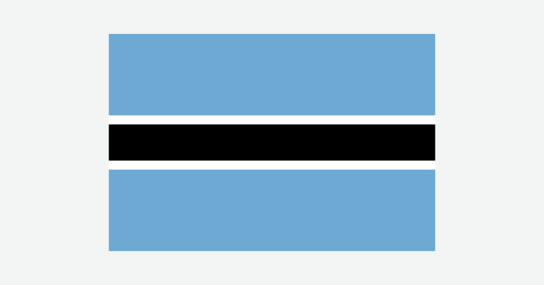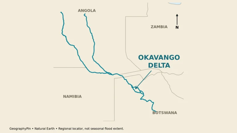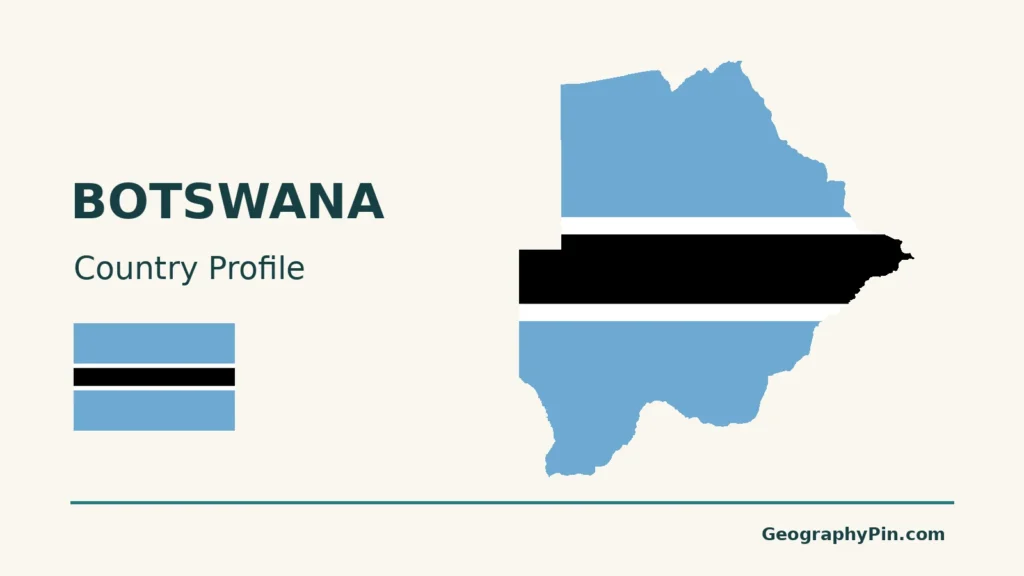
Botswana brings together two landscapes that can seem contradictory: the dry Kalahari interior and the water-rich Okavango Delta. Its population is concentrated farther east, so understanding the country also means looking beyond its famous wetlands to Gaborone and the eastern settlement corridor.
A dryland country with an inland delta
Botswana is a landlocked country in Southern Africa, bordered by Namibia, South Africa, Zimbabwe and Zambia. Gaborone is its capital. Kalahari landscapes dominate much of the interior, while the northwest contains the Okavango Delta, where river water spreads through inland wetlands rather than reaching the sea. Much of the population lives in the east.
How to use this article: Explore the Kalahari landscape, compare the Makgadikgadi pans, understand the inland delta, or follow its delayed flood pulse.
1. Locate Botswana in the interior of Southern Africa
Botswana is a landlocked country in Southern Africa. Namibia lies to its west and north, South Africa to its south and southeast, Zimbabwe to its northeast and Zambia across a short northern border near Kazungula. Gaborone, the national capital, is in the southeast.
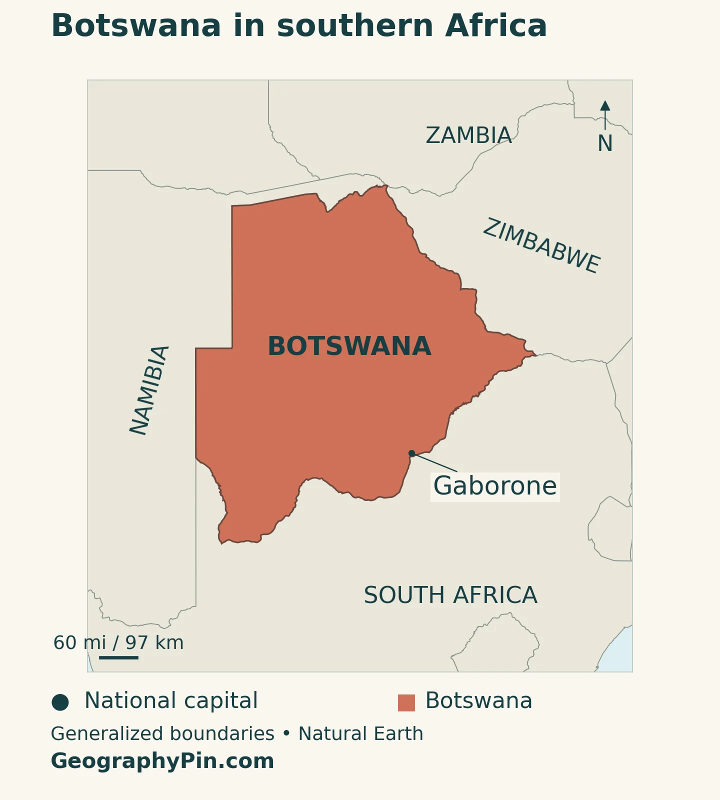
The country has no ocean coast, but that does not make it a country without important wetlands or rivers. The Okavango Delta lies in the northwest, the Chobe river environment in the north and the Makgadikgadi pans farther east. Their relationship with the broad Kalahari landscape is central to understanding Botswana.
Our Southern Africa countries map places Botswana in its regional setting and distinguishes Southern Africa, the region, from South Africa, its neighboring country. Botswana is a separate sovereign state, not a province of South Africa.
Start with three reference points on the country map: Gaborone in the southeast, the Okavango in the northwest and the northern border near Chobe. This triangle helps separate the main settlement corridor from the wetland landscapes that dominate many visitor photographs.
2. Country facts and dated population figures
| Fact | Reference |
|---|---|
| Official name | Republic of Botswana |
| Capital and government center | Gaborone, in southeastern Botswana. |
| Population projection | 2,515,633 in 2026, Statistics Botswana medium-variant projection. |
| Census reference | 2,359,609 people in the final 2022 Population and Housing Census count. |
| Surface area | About 224,711 square miles (582,000 square kilometers), UNData reference year 2023; not land area alone. |
| Languages | English is used as the official language; Setswana is the national language. Other languages are also spoken. |
| Currency | Pula (BWP). |
| Government setting | A republic with national government and local councils. |
The census and projection are separate kinds of evidence. The 2022 count records people enumerated in the census; the 2026 figure comes from Statistics Botswana’s medium-variant demographic model, published in its 2022–2038 projection report. It is not a new census or a live population counter.
Using the national statistical series consistently also avoids mixing it with a UN estimate produced on different assumptions.
3. Kalahari landscapes, salt pans and northern wetlands
Botswana’s interior is strongly associated with the Kalahari, but a picture of continuous bare dunes gives the wrong impression. Sandy landscapes support grassland, shrubs and woodland as well as pans and occasional dunes. Wetlands in the north add a contrasting water-rich environment within this broader dryland setting.

| Setting | Map reference | What makes it distinct |
|---|---|---|
| Kalahari interior | Central and western Botswana | Extensive sandy landscapes with grassland, scrub, woodland and pans, not uninterrupted dunes. |
| Okavango Delta | Northwest | An inland alluvial fan with permanent and seasonal wetlands. |
| Chobe | North | Riverfront, floodplain and woodland environments near the northern border. |
| Makgadikgadi | Northeast of the central Kalahari | A system of salt pans and surrounding grasslands that changes after rainfall. |
| Eastern settlement corridor | East and southeast, including Gaborone | A more concentrated pattern of towns and population than in the west. |
Why “Kalahari” does not mean a sea of bare sand
The Central Kalahari Game Reserve provides a useful example. Botswana Tourism describes a landscape of grasses, scattered trees, shrubs, pans and old river valleys, with occasional dunes. After good summer rains, grazing conditions change and wildlife gathers in productive grassland areas.
The reserve is only one part of the wider Kalahari. Its protected boundary is not the outer edge of the physical region, and the region itself extends beyond Botswana. Likewise, sparse settlement should not be confused with an absence of people, livelihoods or cultural history.
Makgadikgadi is a changing pan system, not a permanent lake
Makgadikgadi includes several salt pans, with Sowa and Ntwetwe among the largest. Dry surfaces can dominate the view for much of the year, but wetter conditions can transform parts of the system. Water and wildlife respond to rainfall and inflow rather than to a fixed calendar applied everywhere.
The pans are remnants of a much larger former lake environment. Their salty surfaces differ from the surrounding grasslands, so a single pale patch on a small map conceals several habitats. Botswana Tourism notes that exceptional wet conditions can also bring water through the Boteti system from the west; that is not a permanent connection carrying the same flow every year.
4. Why the Okavango forms a delta inland
Water spreads across a low-gradient inland basin
The Okavango reaches northwestern Botswana and spreads into a low-gradient alluvial fan within the Kalahari Basin. Channels divide among islands, marshes and floodplains rather than continuing as a single river to an ocean coast. This is why it is called an inland delta.
UNESCO describes the system as endorheic: its drainage does not have an outlet to the sea. That does not mean every drop immediately sinks into sand, nor that no water can leave a particular wetland channel. Water can move into floodplains, shallow groundwater and downstream inland channels without establishing an ocean outlet.
Evaporation and water use by plants are central to the delta’s water balance. Research on riparian woodland documents the importance of transpiration, the release of water through vegetation, alongside evaporation. Together these processes return much of the incoming water to the atmosphere. “The river disappears into the desert” is therefore a memorable phrase, but an incomplete physical explanation.
The flood pulse can arrive during Botswana’s dry season
Much of the flood pulse originates from rainfall upstream in Angola. Water takes time to move through the river system and spread across the delta, so local rainfall and the arrival of floodwater are not synchronized. The wetlands can expand during Botswana’s dry winter season.
This timing helps explain the striking contrast between wet floodplains and dry surrounding country. It also means that a weather report for Botswana alone cannot explain the delta’s water level. Upstream rainfall, river inflow, the branching channels and earlier water conditions all matter.
Not every part of the delta floods equally. Some wetlands retain water, others flood seasonally and marginal areas may be inundated only in high-flow years. The outer wetland edge is not a permanent line, and a map of the World Heritage property is not the same as a map of the water present on a particular day.
5. Climate and water contrasts beyond the delta
Botswana has a generally semi-arid climate, with most rain associated with the warmer summer season. The dry winter can bring warm or mild days but cold nights. Being in southern Africa does not mean every night remains hot throughout the year.
Rainfall is variable and often localized. A storm may wet one area while leaving nearby ground dry, so a national seasonal description is only an orientation. Farming, grazing and water storage depend on the distribution and reliability of rain as well as the annual total.
The Botswana Tourism climate guide places the main summer season in November–March and the core winter period in May–August. Transitional months and regional differences complicate those ranges. They should not be treated as exact wet-season start and finish dates for every locality.
Chobe provides another northern water landscape, distinct from the Okavango Delta. The riverfront and adjacent floodplains occur alongside woodland and other environments. Chobe National Park includes more than its famous riverbank, so “Chobe” on a broad map should not be read as a claim that the whole area is wetland.
The wider contrast is between reliable or seasonally replenished surface water in particular northern settings and limited permanent surface water across much of the interior. A river line on a map does not by itself establish that a channel flows throughout the year. Dry channels, pans and groundwater can all be important parts of an arid or semi-arid water system.
6. Gaborone, eastern settlement and languages
Gaborone is both Botswana’s capital and a major southeastern urban center. The east contains a much larger share of the national population than the west, a pattern documented by Statistics Botswana’s 2022 census analysis. Francistown is another important eastern urban reference point.
This settlement pattern is different from the geography of the best-known wildlife destinations. A country profile focused only on the Okavango and Chobe would miss where many people live, work and use public services. Conversely, the capital cannot stand in for rural Botswana or the northern wetland communities.
Population comparisons also depend on boundaries. A city census district, a surrounding settlement and a wider urban area are not automatically the same unit. The national count above should not be used to infer a precise city ranking or a metropolitan population without the relevant local definitions.
English is used as the official language, while Setswana has national-language status. Other languages are part of Botswana’s multilingual society. A government parliamentary report in 2023 explained that English’s official role was adopted in practice rather than stated as an official-language declaration in the Constitution. It is therefore misleading to claim that the Constitution simply names English and Setswana as two co-official languages.
For comparison with the region’s other capitals, see our African countries and capitals reference. Botswana’s capital is Gaborone.
7. Government, diamonds and regional connections
Botswana is a republic. Gaborone is the national government center and also hosts the headquarters of the Southern African Development Community, connecting the city’s domestic administrative role with regional cooperation.
Local councils organize services and development within their jurisdictions. These administrative boundaries should not be confused with the Okavango drainage system, the Kalahari or a national park. A physical region can cross several governmental boundaries, and a council area can contain more than one kind of landscape.
Diamonds have been central to Botswana’s export economy and public finances. The World Bank notes that dependence on this sector also creates exposure to changes in world demand and competition from synthetic stones. Mineral wealth does not remove the need for other sources of employment, investment and revenue.
Tourism gives wetlands and wildlife landscapes another economic role, while services, agriculture and other activities connect urban and rural areas. Those uses can depend on the same limited resources: water, land, transport and functioning ecosystems. Conservation is consequently part of the country’s development geography, not simply scenery around the economy.
Being landlocked makes cross-border connections important. Botswana’s relationship with its neighbors includes routes to external markets as well as shared rivers and regional institutions. The national boundary encloses a state, but it does not enclose all the systems on which that state depends.
Frequently Asked Questions
Why does the Okavango River form a delta inland?
It spreads across a low-gradient inland basin rather than reaching an ocean coast. Channels, wetlands and floodplains distribute the water, with evaporation and plant transpiration returning much of it to the atmosphere.
Is Botswana entirely desert?
No. Its Kalahari landscapes include vegetation, grasslands and pans, while the north contains important wetlands and river environments. Treating the entire country as bare sand hides these differences.
Why can the Okavango flood during the dry season?
The flood pulse is strongly influenced by rain upstream in Angola. Its travel through the river and delta delays the arrival of water, allowing flooding to expand during Botswana’s dry winter season.
What Did We Learn Today?
Botswana’s geography connects Kalahari drylands, salt pans, northern wetlands and an eastern population corridor. The Okavango is an inland delta without an ocean outlet, and its delayed flood pulse can arrive during the local dry season. Gaborone and the eastern settlements add the human geography that wildlife photographs alone cannot show.
Sources & Data Notes
Population uses Statistics Botswana’s final 2022 census and its medium-variant 2026 projection; these are not interchangeable. Surface area follows UNData’s 2023 reference, converted to rounded square miles. Wetland extent and flooding vary over time: no map here represents a current flood observation. World Heritage boundaries, drainage basins, council areas and physical regions describe different geographical units. Language status follows the government’s explanation rather than an unsupported constitutional declaration.
- NASA Earth Observatory: upstream flood timing and limited inland outflow
- Statistics Botswana: Population Projections 2022–2038, Volume 1, Appendix 12A, medium variant
- Statistics Botswana: 2022 census population distribution, structure and density
- UNData: surface area, capital, currency and reference-year notes
- SADC: Botswana’s neighbors and Gaborone headquarters
- UNESCO: Okavango Delta, inland drainage and seasonal wetlands
- Lubinda et al.: sap flow in Okavango riparian woodland and the role of evapotranspiration
- Botswana Tourism Organisation: Central Kalahari landscape
- Botswana Tourism Organisation: Makgadikgadi pan system and seasonal water
- Botswana Tourism Organisation: Chobe riverfront and other park environments
- Botswana Tourism Organisation: broad climate and seasonal context
- Botswana Press Agency: parliamentary explanation of language status, January 2023
- Botswana Press Agency: local-government restructuring context, February 2026
- World Bank: diamond-sector exposure and economic diversification
Map method: Original GeographyPin maps use public-domain Natural Earth boundaries, Gaborone’s location, the Chobe River line and selected Makgadikgadi salt-pan polygons. Shaded relief uses Mapzen Terrain Tiles with USGS SRTM and GMTED2010 data. Terrain colors show elevation, not vegetation. The Okavango marker follows UNESCO’s reference location, not a flood perimeter. Tan hatching shows generalized pan surfaces, not permanent lakes. Kalahari is a broad regional label. Web Mercator scale varies with latitude. The source geometry does not resolve the very short Botswana–Zambia boundary at Kazungula; enlarging it does not recover that missing detail or establish a four-country meeting point. The cover is an original flag-and-outline design.