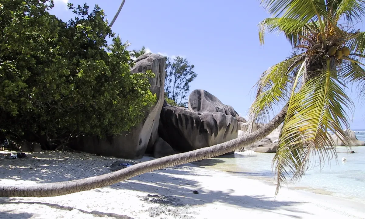
Seychelles is an African island country in the western Indian Ocean, northeast of Madagascar. Its geography contrasts the steep granitic landscapes of islands such as Mahé and Praslin with more distant coral islands and atolls, including Aldabra. Victoria, the capital, is on Mahé. Its small island surface area must not be confused with its much larger maritime setting.
The most useful way to understand Seychelles is to look beyond the beach. A mountainous granite island, a low coral cay and a raised limestone atoll do not have the same geology, water resources or exposure to coastal hazards. Nor does a map of the main tourist islands show the whole country.
Start with the regional locator, then examine the elevation map of Mahé. Together they explain two different scales: the wide separation between island groups and the steep terrain within one of the principal islands.
1. Where is Seychelles?
Seychelles lies south of the equator in the western Indian Ocean. The main granitic islands are northeast of Madagascar, while the outer groups extend far to their southwest. The country has no land border with another state. Ocean distances, rather than roads across an international frontier, connect it with the surrounding region.
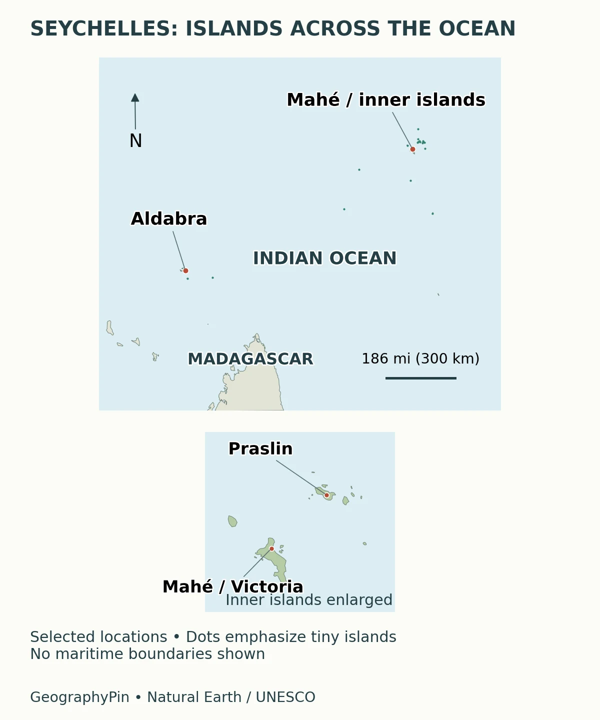
The distance between Mahé and Aldabra is a useful corrective to the idea that all Seychelles islands sit close together. The main inhabited granitic group is relatively compact, but it is only part of the national geography. A trip between nearby inner islands and a journey to a remote outer atoll are very different undertakings.
“Seychelles” names the country, not one island. Mahé is an island, Victoria is its capital city, and Praslin is another island. Keeping those levels separate helps when reading maps, accommodation descriptions and population statistics.
2. Country facts and dated statistics
| Fact | Value or description | Scope and source |
|---|---|---|
| Capital | Victoria, on Mahé | National capital, not the name of the island |
| National languages | Creole, English and French | Constitution, Article 4 |
| Resident population | 122,038 | End-2024 estimate, reported in the government’s 2025 Voluntary National Review, citing NBS |
| Island surface area | About 176 square miles (457 square kilometers) | UNData country profile, reference year 2023; not maritime area |
| Highest mountain | Morne Seychellois, about 2,969 feet (905 meters) | Seychelles Parks and Gardens Authority; on Mahé |
| Main geographic contrast | Predominantly granitic inner islands and coral outer islands | A useful regional distinction, with exceptions explained below |
The population figure includes Seychellois and non-Seychellois residents. It is an estimate for the end of 2024, not a census count or a live headcount. Newer statistical releases exist, so the date belongs beside the number rather than disappearing into a footnote.
The area figure describes the islands’ surface, not the sea between them. An exclusive economic zone concerns specified maritime rights and jurisdiction; it is not additional dry land. A calculation of settlement density needs a land-area denominator, not the vast ocean area shown on a regional map.
Island totals also require care. The environment ministry commonly describes an archipelago of 115 islands, while other official documents use different totals. Without a common inventory and counting method, those numbers should not be forced into a story about newly formed or vanished islands. The regional contrast matters more than presenting a disputed total as a precise, timeless fact.
3. Granitic and coral islands
Mahé, Praslin and La Digue are granitic islands. Their exposed rock, steep slopes and substantial hills distinguish them from the low sandy-island image often associated with tropical archipelagos. The granitic group represents a continental geological inheritance rather than simply a chain of young volcanic cones.
“Inner” and “granitic” are useful shorthand, but they are not perfect synonyms. The environment ministry specifically identifies Bird and Denis as coralline exceptions within the central archipelago. An island’s regional grouping and its rock type answer different questions.
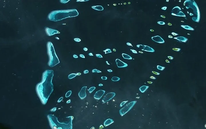
The outer islands include coral-derived islands, cays and atolls. Some consist of low accumulations of sand and reef material; others contain raised coral limestone. Aldabra illustrates the latter. It should not be imagined as four smooth sandbanks arranged around a swimming-pool-shaped lagoon: its limestone surface is rugged and supports varied habitats.
A reef is also not the same thing as an island. Much reef structure remains submerged, while the exposed island may occupy only part of it. On a small-scale map, a dot can identify an island group without showing its full reef-and-lagoon arrangement. That is a limitation of map scale, not evidence that the surrounding habitats are absent.
4. Mahé, Victoria and the mountain interior
Mahé is the largest island in Seychelles. Victoria lies on its northeastern side, beside a much steeper interior than many visitors expect. The Parks and Gardens Authority identifies Morne Seychellois as the highest mountain at about 2,969 feet (905 meters).
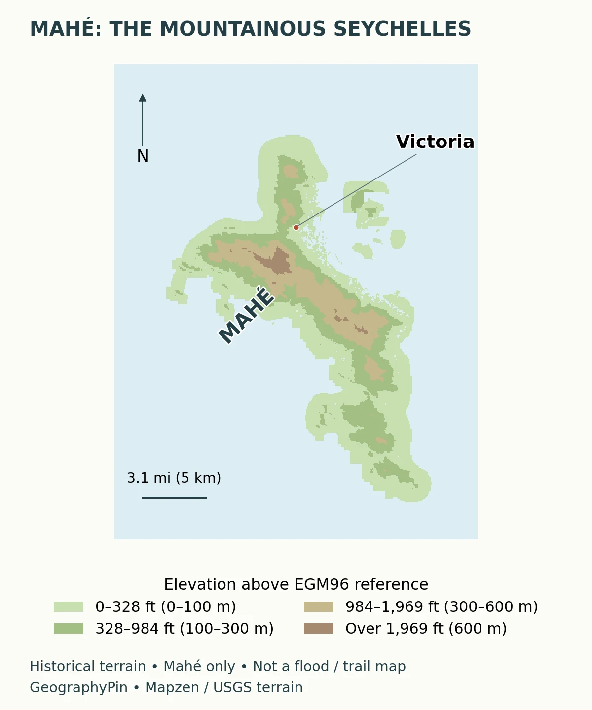
Elevation creates a different set of geographic questions from those on a low coral island. A coastal settlement, a mountain slope and a valley bottom cannot be treated as one flat surface. The island’s interior also contains important forest habitat, protected in part by Morne Seychellois National Park.
The colored map shows height, not a detailed geological survey. It does not establish where every granite outcrop occurs, how deep a soil is or whether a particular slope is safe to build on. Nor should a low coastal color be interpreted as a forecast of flooding. Those questions require additional local evidence.
Victoria’s role as a capital is separate from the physical extent of Mahé. A city population should not be presented as the island population, and a country total should not be attached to the capital. Our world capital cities reference places Victoria in its national context.
5. Praslin and Aldabra: contrasting landscapes
Praslin and the Vallée de Mai
Praslin is part of the granitic inner group. Its Vallée de Mai Nature Reserve, inscribed on the UNESCO World Heritage List in 1983, protects a distinctive palm-forest ecosystem. The property covers about 48 acres (19.5 hectares), not the whole island.
The coco de mer palm is famous for producing the largest seed in the plant kingdom. The reserve’s significance is broader than one spectacular seed, however: its palm community and associated wildlife show how isolation and habitat history shape island biodiversity. UNESCO also describes active conservation needs, so “ancient forest” should not be read as “a place that needs no management.”
Aldabra and raised coral limestone
Aldabra lies far southwest of the main granitic group. Inscribed on the World Heritage List in 1982, it comprises four main coral-limestone islands surrounding a shallow lagoon, with smaller islands and an outer reef. Its surface records a different geological history from the granite hills of Mahé.
The atoll is renowned for giant tortoises and its relatively intact ecological processes. Isolation has helped limit human disturbance, but remoteness is not absolute protection from environmental pressures. Aldabra is also an important reminder that “coral island” can mean exposed, weathered limestone terrain rather than only loose sand.
These two World Heritage sites therefore represent contrasting settings: a palm forest on a granitic island and an extensive raised coral atoll. A country profile that treats all Seychelles islands as interchangeable misses that contrast.
6. Climate, coasts and vulnerability
Seychelles has a tropical maritime climate, with seasonal changes in wind and rainfall. The Seychelles Meteorological Authority describes a wetter northwest-monsoon period and a generally cooler, drier period associated with southeast trade winds. April is a transition month; the southeast trades strengthen through the middle of the year, while rainfall increases again toward the end of the year.
Seasonal averages are not a guarantee of daily weather. Even the wetter season contains dry spells, and wind exposure can make opposite shores of the same island feel very different. The authority notes that tropical cyclones rarely affect the main granitic islands, not that the entire country is immune from storms or their effects.
Coastal vulnerability is equally uneven. Mahé’s mountain interior and a low coral cay do not face the same physical constraints. Yet high terrain somewhere on an island does not protect every coastal road, building or ecosystem. Conversely, an island’s low elevation alone is not enough to calculate the risk at a particular site.
Maps of height, habitat, waves and settlement answer different questions. The relief map above is useful for orientation; it cannot replace a coastal-risk assessment. Protecting island environments requires attention to both the land and the surrounding marine systems, rather than treating the shoreline as a boundary between unrelated worlds.
7. People, languages and the economy
The constitution identifies Creole, English and French as national languages and defines Seychelles as a sovereign democratic republic. These national characteristics belong to an inhabited society, not merely a collection of tourism destinations.
Tourism is central to the economy: the government’s account of the Central Bank’s 2025 annual report identifies the sector as a major driver of economic performance. Its geography combines beaches, marine environments, forest landscapes and the transport links that allow people to reach them. A country’s tourism dependence should not be confused with a claim that every island has the same visitor facilities or accessibility.
Fisheries provide another connection between the islands and the wider ocean. The Seychelles Fisheries Authority describes industrial purse-seine and longline fisheries targeting tuna, with canned tuna an important export product. Fishing activity and associated processing make the maritime setting economically significant even where little land appears on a map.
For readers comparing island countries, Seychelles offers a useful lesson: small land area does not imply a simple landscape. The mountainous inner islands, remote coral groups, urban functions of Victoria and ocean-based industries belong to one country, but each needs to be understood at the right geographic scale.
What Did We Learn Today?
Seychelles combines steep granitic islands with distant coral islands and atolls. Mahé’s relief, Praslin’s palm forest and Aldabra’s limestone landscape show why one beach photograph cannot represent the whole country. Bird and Denis also demonstrate that the inner-island label does not guarantee granite geology. Population and area figures need dates and territorial scope, while maritime jurisdiction must remain distinct from dry land.
Sources & Data Notes
- Government of Seychelles: Voluntary National Review 2025, population discussion on printed page 43. Reports the end-2024 estimated resident population, citing NBS; not a census or the latest estimate.
- UNData: Seychelles. Surface-area figure carries a 2023 reference year. Its separately modeled population series is not substituted for the government-reported resident estimate.
- Environment ministry: species and island settings and ecosystems. Granitic/coralline distinctions, including Bird and Denis; background island totals are not treated as a new survey. The National Biodiversity Strategy and Action Plan 2015–2020, introduction page 4, gives a historical alternative island total; its upload date is not a new inventory date.
- Seychelles Parks and Gardens Authority: Morne Seychellois. Mahé, the national park and the stated 905-meter summit height.
- UNESCO: Vallée de Mai and Aldabra Atoll. Physical setting, conservation significance, inscription dates and map reference coordinates. No undated tortoise count is presented as a current census.
- Seychelles Meteorological Authority: climate guide. Seasonal context, not a forecast for a specific day.
- Constitution, Articles 1 and 4. Republic and national languages.
- State House: 2025 Central Bank report and Seychelles Fisheries Authority: industrial fisheries. Tourism and tuna-industry context; no unverified current vessel total or GDP share is used.
Cartographic method: GeographyPin’s locator combines public-domain Natural Earth outlines and Victoria’s point with UNESCO site coordinates. The Mahé map uses Mapzen Terrain Tiles, courtesy of USGS global terrain sources. The one-degree HGT tile is sampled from one to three arc-seconds and displayed without inventing peaks or drainage lines. Heights use the EGM96 reference; historical terrain and coastal masking do not capture every modern shoreline change. Neither map depicts maritime legal boundaries.
Featured photograph: Granite rocks and a sandy beach on Praslin, by guillom, Wikimedia Commons, CC BY-SA 3.0. The photograph is dated March 29, 2000 in its metadata; it is not a current shoreline survey. Cropped, resized and converted to WebP; the adapted image remains under CC BY-SA 3.0.