The Okavango Delta can be flooded when the surrounding country is in its dry season. That is not a contradiction: the rain feeding the river falls far upstream, and the flood pulse takes time to move through the system. Its location, water cycle and changing edges explain why this is a delta without a coast.
The Okavango Delta is an inland wetland in northwestern Botswana. Water from the Cubango and Cuito headwaters in Angola reaches it through the Okavango river system and Namibia. Instead of continuing to an ocean, the river spreads across a low-gradient fan of channels, islands and floodplains, with flooding often extending into Botswana’s dry season.
Follow the water: Compare river names along the route, understand the two seasonal signals, and distinguish the World Heritage property from the basin.
1. From Angolan headwaters to Botswana
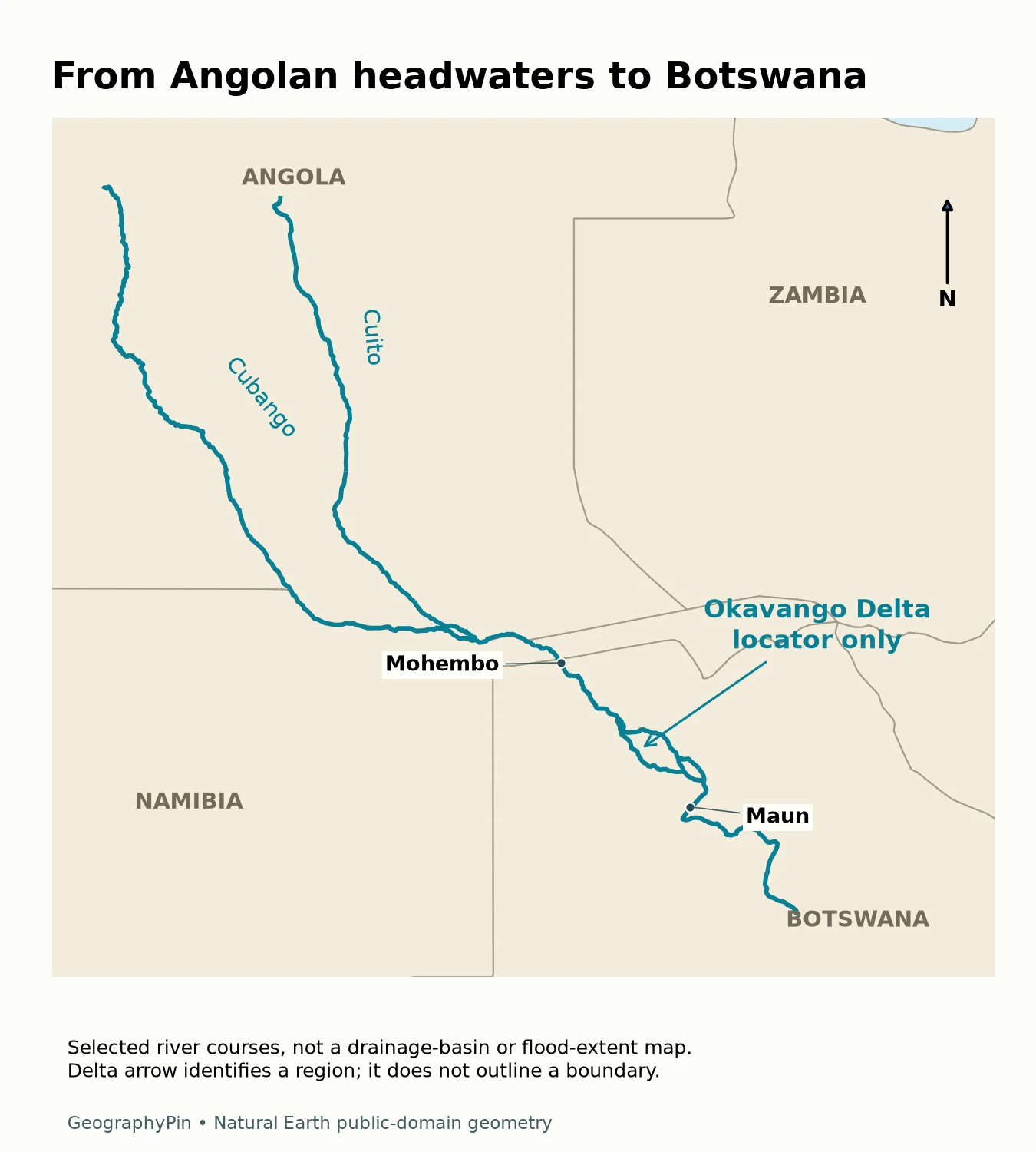
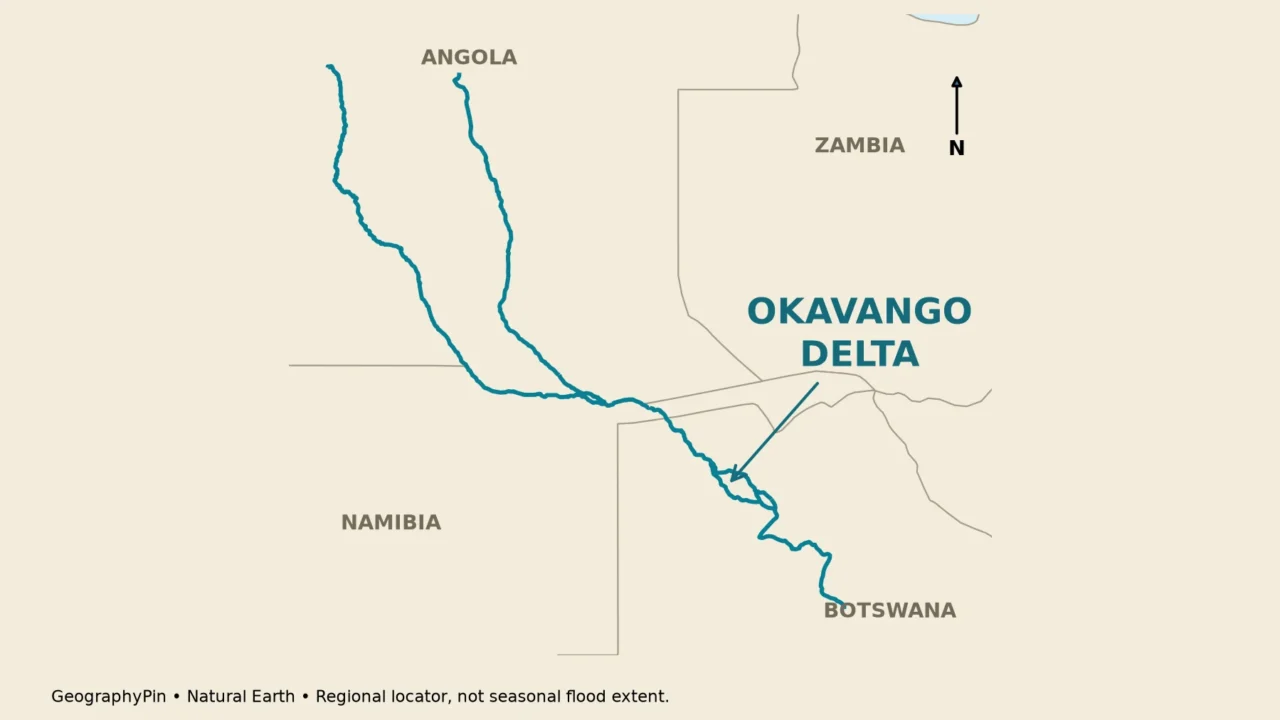
The delta itself lies in Botswana, but its water supply cannot be understood using a Botswana-only map. The Cubango and Cuito drain parts of the Angolan highlands. Their waters join a connected river corridor that follows part of the Angola–Namibia border, crosses northeastern Namibia and enters Botswana near Mohembo.
Inside Botswana, the narrow upstream corridor is commonly called the Panhandle. Farther downstream, near the Seronga area, water spreads through branching channels and floodplains across the delta fan. Maun lies near the southern side of this wider wetland landscape, rather than at the river’s Angolan source.
Cubango, Kavango and Okavango
Maps and sources use different names along the connected system. Cubango is used in Angola, Kavango in Namibia and Okavango in Botswana. The Cuito is a separate major headwater tributary, not another spelling of Cubango. A name change at a border does not mean that the water has entered an unrelated basin.
The 2021–2028 management plan distinguishes the northern headwater catchments, the middle river reaches and the delta. This sequence is more informative than describing the whole system as a swamp: the contributing highlands, the main river corridor and the spreading terminal wetland perform different hydrological roles.
A tributary adds water to a river. A distributary carries water away from a main channel as the flow divides. Both relationships occur in this system, but at different stages. Our explanation of rivers, tributaries and drainage basins gives the terminology behind these connections.
2. Why the flood arrives during the dry season
Local rain and upstream river inflow are different signals
Rain falling directly on the delta adds water locally. Rain falling in the Angolan headwaters first has to move through catchments, channels and floodplains before its effects reach the lower system. Temporary storage and slow propagation spread the pulse over time; the delta does not respond to distant rainfall as if a tap had been opened beside it.
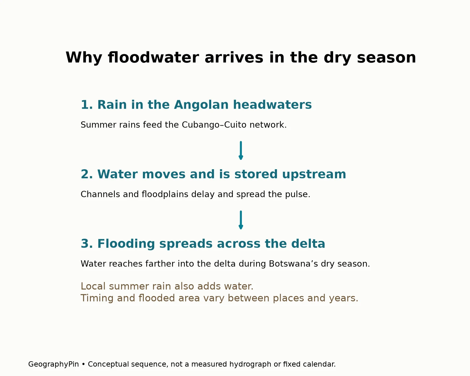
The World Heritage nomination describes an illustrative progression: rain in Angola during November and December contributes to water arriving at the Panhandle in February and March, with the flood advancing toward more distant parts of the delta into July. These months describe a seasonal pattern, not a guaranteed annual timetable.
The management plan places local rainfall mainly in the summer months and describes inflow peaks near Mohembo around April. Farther into the delta, the inundation maximum can occur later. Comparing an upstream inflow peak with the date of maximum flooded area downstream therefore does not measure the same thing.
This distinction also explains why “wet season” can be ambiguous. It may mean the period of local rain, the period of high river inflow or the period when a particular floodplain is underwater. For an accurate statement, identify the place and the variable instead of treating one calendar month as the peak everywhere.
Flood magnitude and timing vary among years. Local rainfall, previous wetness, channel conditions and the incoming pulse all affect how water spreads. A photograph from one July cannot establish the full extent of the delta, nor can a dry-season label tell you whether a particular channel currently holds water.
3. Where the water goes without an ocean outlet
The delta is commonly described as endorheic: it belongs to an internally draining system rather than a river corridor that carries its water onward to the sea. The water spreads over a low-gradient alluvial fan, a landform built from sediment deposited as flow disperses.
Most water leaving the wetland system returns to the atmosphere through evaporation and plant transpiration. Together these processes are called evapotranspiration. Water also moves into and through the ground, and some flows onward through lower channels and depressions. “No outlet to the ocean” is not the same as “no water ever leaves a particular part of the delta.”
The management plan’s estimated water balance identifies evapotranspiration as the dominant loss. That is a better explanation than saying the entire river simply disappears into sand. The published balance is a rounded long-term estimate, not a measurement of today’s flows or a rule assigning a fixed percentage to every flood.
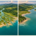
Permanent wetlands coexist with seasonally flooded and occasionally flooded areas. As water rises and recedes, habitats change across the fan. Islands, channels, lagoons and floodplains form a connected mosaic rather than a single open lake with a permanent shoreline.
The channel network also changes over longer periods. Sediment deposition, vegetation and small differences in ground elevation influence where water travels. A branch can become more or less important without the entire river system moving to a new country or acquiring a coastal outlet.
4. Three boundaries that should not be confused
World Heritage property versus hydrological basin
The Okavango Delta World Heritage property is a designated conservation area in Botswana. The river basin is the contributing drainage system extending upstream across national borders. Seasonal inundation is the area actually covered by water during a specified period. These are three different geographic objects.
| Mapped area | What it represents | What it does not show |
|---|---|---|
| River basin | Land draining toward the connected river system | The area currently underwater |
| Seasonal flood extent | Inundated land for a specified date or period and method | A permanent conservation boundary |
| World Heritage property | The area inscribed by UNESCO | The entire upstream catchment |
| Buffer zone | A surrounding area supporting protection of the property | An additional measurement of flooded wetland |
The inscribed property covers about 7,813 square miles (20,236 square kilometers), converted from UNESCO’s listed 2,023,590 hectares. That is an administrative designation area, not a claim that this much land is permanently submerged. The buffer zone is recorded separately and should not be added to the property to create a larger “delta size.”
A measured wetland area needs a definition as well as a number. Does it include permanent water, seasonally flooded grassland, islands inside a wetland envelope or only water detected on one satellite image? Two plausible figures can differ because they are describing different categories, dates or mapping methods.
The same caution applies to international recognition. A proposed extension on a UNESCO Tentative List is not an already inscribed extension. Upstream ecological connections matter whether or not the heritage boundary changes; conservation status and hydrological connection answer different questions.
5. Why upstream geography matters
Because the river crosses three countries, managing the delta involves more than protecting land inside Botswana. Activities affecting water quantity, timing, sediment or quality upstream can influence conditions downstream. The Permanent Okavango River Basin Water Commission, known as OKACOM, provides a framework for cooperation among Angola, Namibia and Botswana.
The management plan identifies variability of inflow as a major driver of habitats and biological production. A long-term annual average alone cannot describe this pattern. The arrival, duration and recession of a flood can matter alongside its total volume, especially for vegetation and animals adapted to seasonal water availability.
The delta is also a lived-in landscape with communities, resource use and tourism, not an empty patch on a wildlife map. Decisions about water and conservation have social as well as ecological consequences. A useful geographic account separates those realities from a simple label such as “untouched wilderness.”
For readers comparing places, the key distinction is between a river-fed inland wetland and a coastal river mouth. The Okavango shows that a delta need not meet an ocean. For a broader regional knowledge check, the Africa geography quiz places this example alongside other African landforms and rivers.
Frequently Asked Questions
Is the Okavango Delta one large lake?
No. It is a wetland landscape with channels, floodplains, islands and lagoons. Permanent water and seasonal inundation coexist, so a single lake outline would misrepresent it.
Can a dry-season photograph show the whole delta?
Not reliably. Conditions vary by location and year, and much of the river-fed flooding occurs during the local dry season. A photograph also records only its own field of view and date.
Does an upstream flood peak mean the entire delta peaks that day?
No. Flow at an upstream gauge and the area flooded farther downstream are different measurements. The flood pulse takes time to spread through the wetland.
Is a UNESCO buffer zone part of the inscribed property?
It is designated separately to help protect the property. Its area should not be counted as additional inscribed land or automatically treated as flooded wetland.
What Did We Learn Today?
The Okavango is best understood as a connected sequence: Angolan headwaters, a cross-border river corridor and an inland delta in Botswana. Local rain and delayed river inflow produce different seasonal signals, while evaporation, plants and groundwater help explain the water balance. A basin boundary, a seasonal flood edge and a World Heritage boundary describe different parts of that story.
Sources & Data Notes
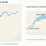
Seasonal timing is illustrative, not a forecast. Property area follows UNESCO and is converted and rounded; it is not a flood-area estimate. The locator uses generalized river and country geometry, with no invented inundation polygon. The flood sequence is conceptual, not a measured time series.
- UNESCO: Okavango Delta World Heritage property: location, inscription area and inland-delta setting.
- Okavango Delta Management Plan 2021–2028, Ministry of Environment, Natural Resources, Conservation and Tourism: regional setting, hydrology, water balance and management context.
- Okavango Delta World Heritage nomination dossier: flood propagation and local-rainfall distinction.
- Natural Earth rivers, country polygons and public-domain terms: source geometry for original GeographyPin mapping.