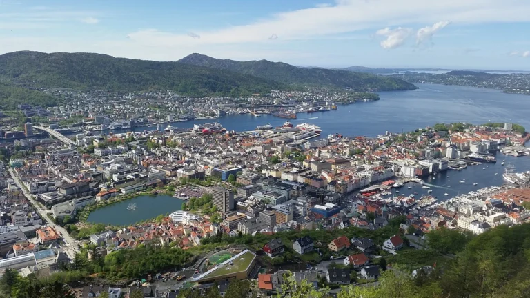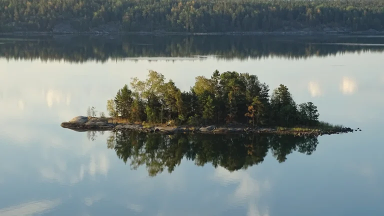
Norway’s shape can make the country look like a narrow strip beside the sea. Its geography is more intricate: fjords reach into mountain country, islands extend the coast, and valleys connect populated lowlands with an upland interior. Farther north, Svalbard and Jan Mayen add distinct Arctic settings to the kingdom.
Norway is a Northern European country with Oslo as its capital. Mainland Norway occupies the western and northern side of the Scandinavian Peninsula, with a deeply indented fjord coast and extensive mountains. The kingdom also includes Svalbard and Jan Mayen. Population and transport concentrate in lowlands, valleys and coastal corridors rather than being spread evenly across the territory.
How to use this article: Understand how fjords formed, compare the main landscapes, or distinguish Oslo’s urban area from its municipality.
1. Locate Norway and read its map
Mainland Norway borders Sweden, Finland and Russia. Its coast faces different stretches of the North Atlantic and adjacent seas, from the southern approaches through the Norwegian Sea to the far north. Oslo lies in the southeast near the head of Oslofjord; Bergen lies on the western coast.
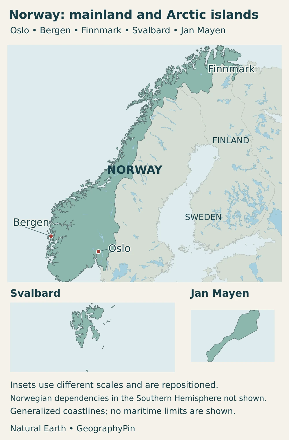
Svalbard is an archipelago far north of the mainland. It is part of Norway, with Norwegian sovereignty recognized by the Svalbard Treaty and a distinct legal framework. It is not a separate country or a territory jointly owned by the treaty’s signatories. Jan Mayen, a separate volcanic island west of mainland Norway, is also included in the kingdom.
Norway belongs to both Scandinavia and the wider Nordic region. Those regional terms are not synonyms for the European Union or for the Scandinavian Peninsula alone. The separate guide to Scandinavia versus the Nordic countries explains their different uses.
2. Country facts with dates and definitions
| Item | Figure or description |
|---|---|
| Capital | Oslo |
| Population | 5,636,904 at the end of the second quarter of 2026, Statistics Norway’s register-based population series |
| Kingdom area, land and fresh water | About 148,450 square miles (384,483 km²), Statistics Norway 2026; includes mainland Norway, Svalbard and Jan Mayen |
| Mainland area, land and fresh water | About 125,023 square miles (323,807 km²), Statistics Norway 2026; excludes Svalbard and Jan Mayen |
| Land-only area of the kingdom | About 140,636 square miles (364,246 km²), excluding the fresh-water area in the same statistical table |
| Language framework | Norwegian is the national main language; Bokmål and Nynorsk are equal written forms, with separate recognition for Sámi languages and other protected languages |
| Currency | Norwegian krone (NOK) |
| Political system | Constitutional monarchy with parliamentary government |
| Mainland administrative structure | 15 counties and 357 municipalities, checked against government information in November 2026 |
“Mainland” in this area series includes the associated coastal islands, not merely land physically attached to the Scandinavian Peninsula. The kingdom total adds Svalbard and Jan Mayen; it does not add Norway’s territorial sea or other maritime zones. Land plus fresh water and land alone are different measurements.
The population figure is tied to registration rules rather than a count of everyone physically present anywhere in the kingdom on one day. People who move to Svalbard or Jan Mayen while remaining registered in a mainland municipality can still be counted there. Adding a separate Svalbard population figure to this total without checking definitions could double-count residents.
3. Fjords, mountains and settlement corridors
Why the coast reaches so far inland
A fjord is a marine inlet occupying a valley strongly shaped by glacial erosion. Moving ice deepened and widened valleys; after the ice withdrew, the sea occupied the low-lying parts. The resulting combination of deep water and steep valley sides is very different from an ordinary river winding across a flat plain.
Geirangerfjord and Nærøyfjord are well-known examples in western Norway. Their protected landscapes include steep rock walls, waterfalls and connections with upland rivers and glaciers. They illustrate a wider coastal pattern rather than accounting for all Norwegian fjords.
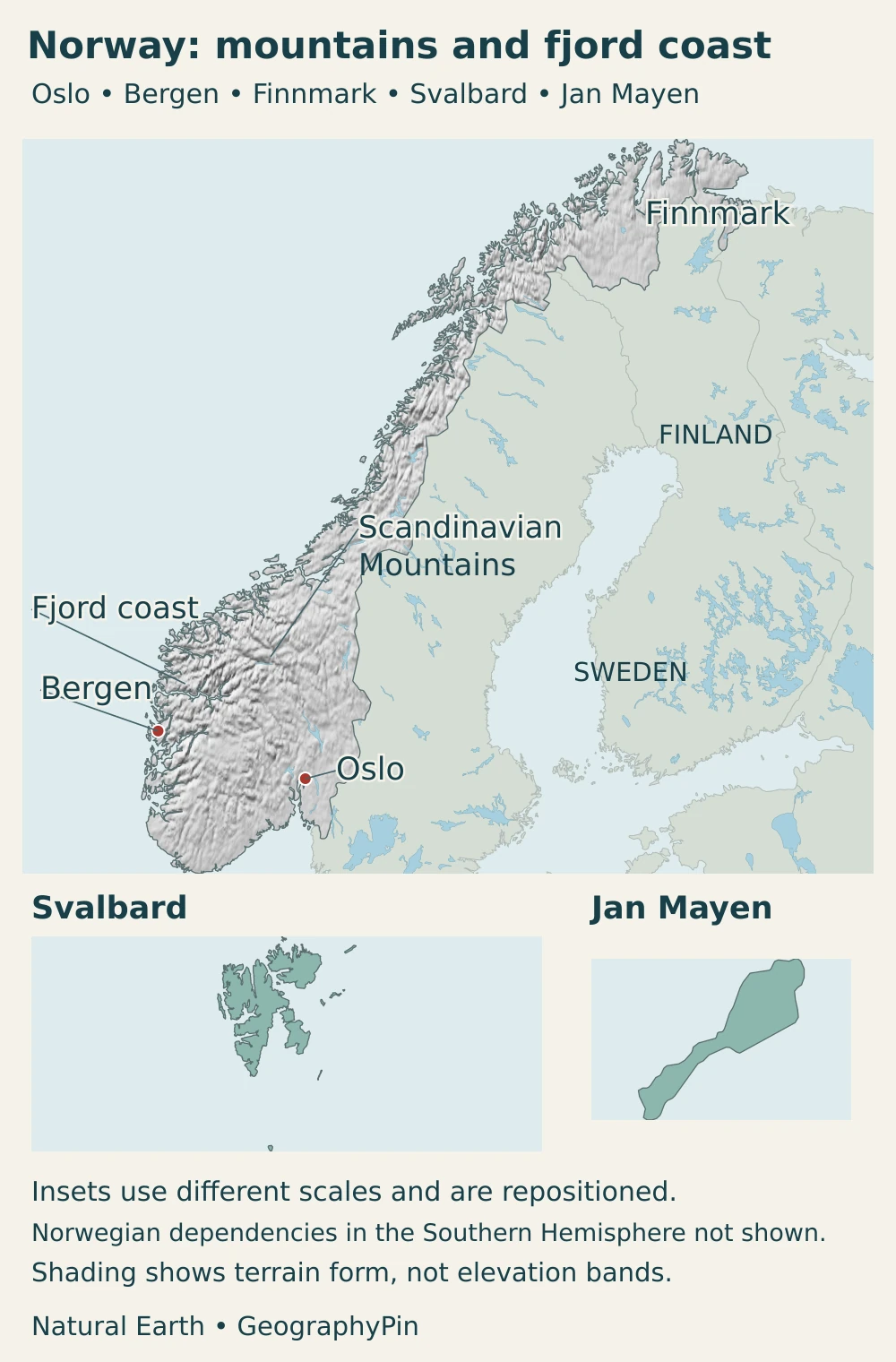
The main landscapes and their practical differences
| Landscape | Where to look | Why it matters |
|---|---|---|
| Western fjord coast | Coastal western Norway, including Bergen’s wider region | Deep inlets, islands and steep slopes create maritime connections but interrupt direct overland routes |
| Scandinavian mountains and plateaus | Interior uplands extending along the peninsula | High terrain influences drainage, snow storage, climate and routes between valleys |
| Southeastern lowlands and valleys | Oslofjord and connected inland corridors | A major concentration of settlement, transport and cultivated land |
| Northern coast and Finnmark | Northern mainland, including its interior plateau country | Coastal maritime settings contrast with colder inland environments; distance and seasonal daylight are important |
| Svalbard and Jan Mayen | Separate Arctic island settings | Different landforms and administrative conditions from the mainland; Jan Mayen is volcanic |
The mountain belt does not mean that every inland location is a sharp summit. Plateaus, broad valleys and basins are part of the same country. Likewise, Finnmark includes both coast and interior: a northern label alone does not describe local climate or accessibility.
Norway’s coastline is exceptionally irregular, but a single length needs a definition. Tracing fjords and islands produces a different measurement from following only the outer mainland shore, and the detail of the map matters. For understanding settlement, the important feature is the relationship between sheltered water, usable shoreland and routes through the surrounding terrain, not a coastline ranking.
4. Climate, rivers and environmental contrasts
Ocean influence and mountain barriers
The North Atlantic moderates much of Norway’s coast, producing milder winters than latitude alone might suggest. Conditions inland and at higher elevations can be much colder. The distinction is especially clear when comparing coastal northern Norway with the Finnmark Plateau: “far north” does not describe one uniform climate.
Moist air arriving from the ocean releases abundant precipitation on exposed western slopes. Sheltered locations on the leeward side of mountain ranges can be considerably drier. Elevation, exposure and distance from the sea therefore help explain why Bergen’s coastal setting differs from an inland valley even at a similar latitude.
Seasonal daylight changes become more pronounced toward the north. Far-northern places such as Tromsø and Longyearbyen experience summer periods when the sun remains above the horizon and winter periods when it does not rise. The duration varies with latitude: Oslo does not experience either midnight sun or polar night. Even locations near the Arctic Circle differ, so these phenomena should not be applied to every part of Norway.
Water links mountains, valleys and the sea
Rivers carry water from these uplands toward fjords and coastal lowlands. The Glomma provides a major southeastern example, draining an extensive inland valley system and reaching the sea at Fredrikstad. Its catchment is a connected drainage area, not a straight route across the country.
Rainfall and melting snow affect river flows, while lakes and reservoirs can store water. In regulated hydropower systems, storage allows some generation to be shifted between wetter and drier periods. That does not eliminate drought or flood risks, and an attractive river landscape does not tell a reader whether a particular reach is regulated.
Ice-age landforms are not current glacier boundaries
The fjords record former glaciation, but Norway also has glaciers today. NVE monitors changes in glacier mass and the position of glacier fronts. Those measurements answer different questions: a glacier can lose mass without its outline changing uniformly, and an older inventory is not a survey of this year’s ice margin.
Svalbard needs particular care in comparisons with the mainland. Its Arctic island environment is not simply a colder version of Bergen or Oslo, while Jan Mayen has a distinct volcanic landscape and an Arctic-maritime climate. Conditions and risks on these islands should not be inferred from a national average.
5. People, cities and languages
A sparsely settled territory with concentrated urban populations
Large upland and northern areas do not imply that most Norwegians live in isolated settlements. Statistics Norway reports that 83.45% of residents lived in statistically defined urban settlements on January 1, 2026. These are settlement areas, not the same thing as municipalities with a city name.
The Oslo urban settlement had 1,119,478 residents on that date and extended across several municipalities. That is not the population of Oslo municipality alone. Bergen, Stavanger/Sandnes and Trondheim form other major urban concentrations, showing how Norway’s population is distributed among several coastal and valley-linked centers rather than one continuous urban strip.
Fjords can provide sheltered maritime access while making nearby places far apart by road. Norway’s transport system combines roads, tunnels, bridges, ferries, railways and air links to serve that fragmented geography. A short straight-line distance across a map can therefore hide a much longer or more complicated journey.
Norwegian, Sámi and other protected languages
Bokmål and Nynorsk are equal written forms of Norwegian, not two separate countries’ languages or a simple division between northern and southern speech. Norway also has diverse spoken dialects. The language framework recognizes Sámi languages as Indigenous languages, alongside separate protection for national minority languages and Norwegian Sign Language.
Sámi identity and language are not confined to one county boundary. The presence of Sámi place names, institutions and communities adds an important Indigenous dimension to the human geography of Norway, particularly in the north, without making every northern resident Sámi or every Sámi person a reindeer herder.
6. Government and economy in their geographic setting
Norway is a constitutional monarchy with parliamentary government. National institutions operate alongside county and municipal government; the Storting is the national parliament. Svalbard’s legal and administrative arrangements are distinct from the ordinary mainland county structure.
The sea is central to the economy through offshore petroleum production, maritime activity, fisheries and aquaculture. Oil and gas are major export commodities, while towns and cities also depend on services, public institutions and other industries. A petroleum export statistic is not the same as oil’s share of all employment or of the entire economy.
There is an important energy distinction: Norway’s domestic electricity system is strongly hydropower-based, while its export economy includes substantial oil and gas. Reservoirs and mountain catchments help explain the former; offshore resources explain the latter. Renewable electricity does not mean that every form of Norwegian energy production or consumption is renewable.
Norway is not an EU member, but participates in the European Economic Area; Svalbard is excluded from the EEA Agreement’s territorial scope. That relationship connects it to the European internal market without making EU membership, Nordic cooperation and physical geography the same thing. For a separate discussion of economic labels and institutions, see whether Norway is socialist.
Frequently Asked Questions
Is a fjord a lake?
No. In the classic landform sense, a fjord is an inlet of the sea occupying a glacially shaped valley. A lake is inland water; both can occur in landscapes shaped by glaciers.
Does Norway’s country area include Svalbard?
It depends on the stated scope. Statistics Norway’s kingdom total includes Svalbard and Jan Mayen, while its mainland total excludes them. Both totals also distinguish land alone from land plus fresh water; neither is a total of Norway’s maritime zones.
What Did We Learn Today?
Norway’s geography combines a glacially shaped fjord coast, extensive mountains and a network of populated lowlands and coastal corridors. Ocean influence and mountain barriers create strong local contrasts, while rivers connect uplands with settlements and energy production. Understanding the country also requires distinguishing the mainland from the wider kingdom, and an urban settlement from a municipality.
Sources & Data Notes
- Statistics Norway, population: End-Q2 2026 register-based population, released August 19; registration scope matters for Svalbard and Jan Mayen.
- Statistics Norway, land and fresh-water area: 2026 table, released January 26; consistent kingdom/mainland and land/fresh-water definitions.
- Statistics Norway, urban settlements: January 1, 2026 figures; Oslo urban settlement is not Oslo municipality.
- Norwegian Government, municipal structure: Current county and municipality counts.
- Språkrådet, Language Act: Norwegian written forms and the distinct status of Sámi, minority and sign languages.
- Storting, Constitution: National constitutional framework.
- Norwegian Government, Svalbard white paper: Sovereignty and the distinct legal framework, not shared sovereignty.
- Directorate for Cultural Heritage, West Norwegian Fjords: Fjord definition and glacial landscape.
- UNESCO, West Norwegian Fjords: Geirangerfjord and Nærøyfjord examples.
- Geological Survey of Norway, fjord geology: Glacial shaping and the broader geological setting.
- Norwegian Government, national climate communication: Ocean influence, mountain barriers and regional climate contrasts; older statistical totals are not used as current facts.
- NVE, Glomma drainage report: Stable river geography and outlet location only; historic flow figures and county names are not reused as current data.
- NVE, glacier monitoring: Distinction between mass-balance measurements, front observations and inventories.
- Norwegian Polar Institute, Jan Mayen: Island location, volcanic setting and climate.
- Institute of Marine Research, coast and fjords: Coastal environments and settlement; older coastline totals are not presented as a current ranking.
- National Transport Plan 2025–2036: Transport modes and terrain context, not a live service or road-status guide.
- Energy Facts Norway, electricity production: Hydropower and reservoir operation; no historical production share is relabeled as current.
- Norwegian Petroleum, oil and gas exports: Offshore export economy and distinction from domestic electricity.
- Storting, EU/EEA work: EU non-membership and EEA participation.
- Yr, polar nights and midnight sun: Latitude-dependent seasonal daylight across northern locations.
Map sources and scope: Original GeographyPin compositions use public-domain Natural Earth country outlines, lakes and populated places, plus its georeferenced shaded-relief raster. Mainland terrain is shown in a Lambert azimuthal equal-area projection; Svalbard and Jan Mayen have their own separately scaled, repositioned panels. These insets include Bjørnøya within the Svalbard group but do not preserve relative distances or areas. Southern Hemisphere dependencies are excluded, and no maritime jurisdiction boundaries are drawn.
Coasts and lakes are generalized. City dots mark locations rather than municipal or urban-area boundaries. Mountain, fjord-coast and Finnmark labels orient the reader without defining precise regional boundaries. Mainland shading represents terrain form, not elevation classes. Arctic insets show outlines, not terrain or current glacier or sea-ice limits. The mapped silhouette is not the measurement surface for the dated Statistics Norway area figures.
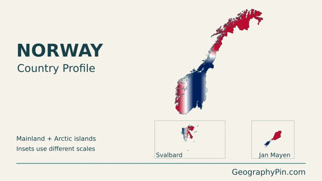
The cover uses a public-domain Norwegian flag motif, preserving its proportions before clipping it to the country outline. The result is a branded geographic illustration, not a complete rectangular flag or an official government map.