Maligne Lake is best understood as part of a valley rather than as a single famous island view. Its long glacial basin, neighboring rockslide terrain and downstream underground drainage connect several distinctive places in Jasper National Park.
Maligne Lake is a glacier-fed lake in Jasper National Park, Alberta, Canada. Parks Canada lists a length of 13.9 miles (22.3 kilometers) and maximum depth of 315 feet (96 meters). It is distinct from downstream Medicine Lake and Maligne Canyon, whose drainage and access conditions must be considered separately.
How to use this article: Separate the three named places, understand glaciers and the rockslide, follow Medicine Lake’s drainage, and check the canyon access distinction.
1. Where Is Maligne Lake?
Maligne Lake lies in Jasper National Park, Alberta, in the Canadian Rockies. Its developed northern shore is southeast of the town of Jasper, at the far end of the road through the Maligne Valley. Long mountain slopes frame the lake, which extends well beyond the shore reached by road.
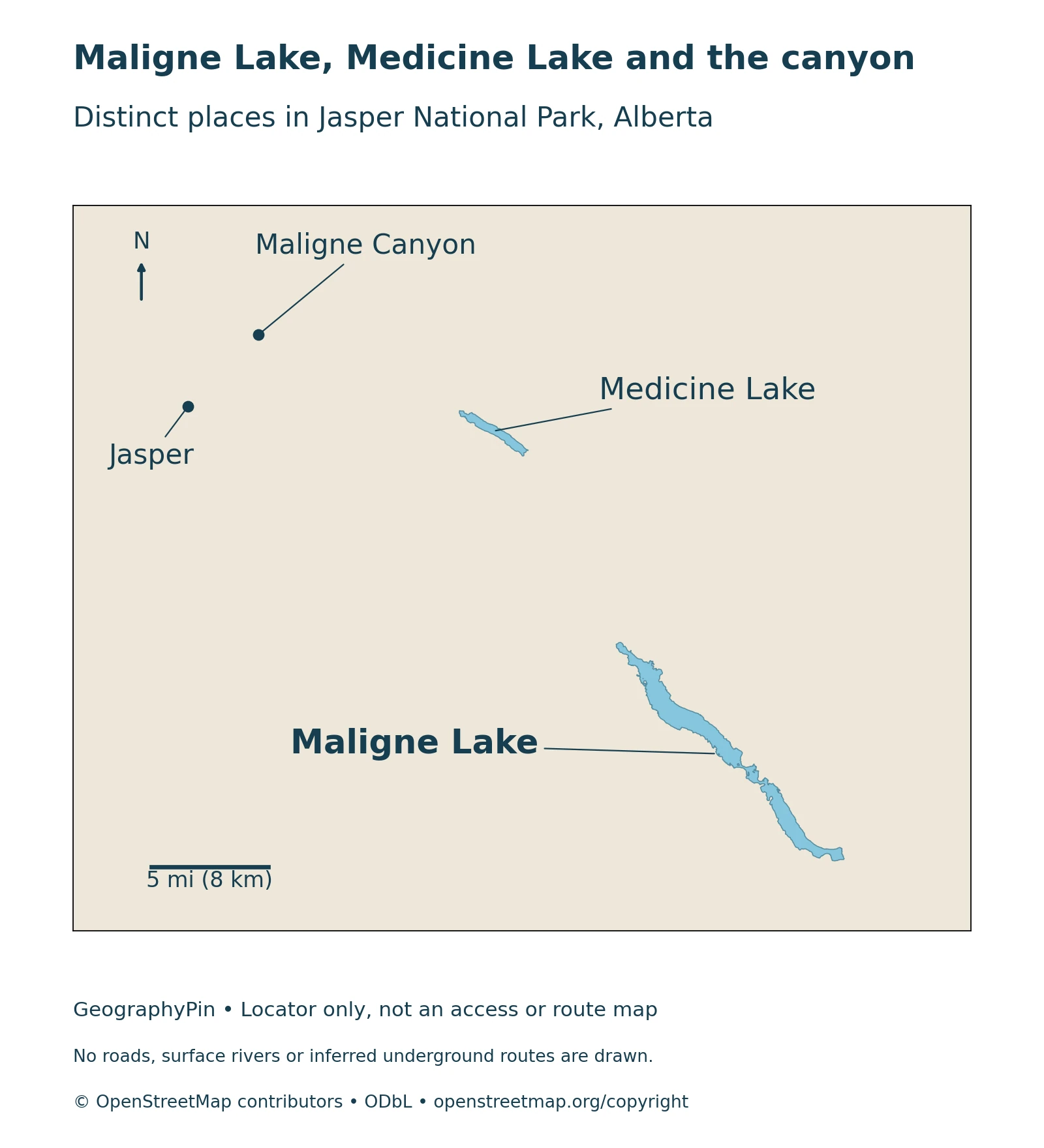
Maligne Lake, Medicine Lake and Maligne Canyon
These are three different places in one connected landscape. Maligne Lake is the long upper lake containing the famous Spirit Island view. Medicine Lake lies downstream and has a striking seasonal water-level cycle. Maligne Canyon is farther downstream again, closer to Jasper.
A map that labels them separately prevents a common planning mistake: information about the canyon is not automatically information about the lake. They also represent different geological processes. Glacial excavation helped shape Maligne Lake’s valley, while water moving through soluble limestone is essential to understanding Medicine Lake and the canyon area.
2. How Long and Deep Is the Lake?
Parks Canada’s lake-map fact sheet lists Maligne Lake as 13.9 miles (22.3 kilometers) long and 315 feet (96 meters) deep at its deepest point. These are reference dimensions, not a report of a new survey conducted when the web page was last updated.
Reading the published dimensions
| Measure | Reference value | How to interpret it |
|---|---|---|
| Length | 13.9 miles (22.3 km) | Lake length, not a walking distance around the shore |
| Published width range | About 330 feet to 1.2 miles (100 m to 2 km) | A narrow, irregular mountain lake rather than a uniform rectangle |
| Maximum depth | 315 feet (96 m) | Deepest reference measurement, not average depth |
| Published water volume | About 0.190 cubic miles (0.7922 km³) | Reference storage, not a current daily gauge reading |
The fact-sheet page was modified in April 2024, but it does not identify that date as a bathymetric survey. The locator in this article shows geographical relationships, not underwater contours. Neither a dark patch in a photograph nor a narrow section on a map reliably reveals the depth beneath it.
3. A Glacial Valley Modified by a Rockslide
The long basin sits in a valley strongly shaped by glaciers. The Alberta Geological Survey’s Maligne Valley report describes the broad U-shaped profile produced by valley ice and the contrast between the rock formations on opposite sides. The valley’s form is therefore part of a much larger mountain landscape, not simply a hollow matching today’s shoreline.
Excavation and blockage are different processes
Moving ice can erode and deepen a valley; material deposited or fallen across it can obstruct drainage. Parks Canada’s account of the Moose Lake area explains that an ancient major rockslide blocked the valley and enlarged Maligne Lake. Glacial shaping and later slope failure are complementary parts of the story.
The older 1964 geological report described an end-moraine dam at the north end, whereas Parks Canada’s modern interpretation emphasizes the rockslide’s role in enlargement. It is more useful to distinguish the glacier-carved valley from later changes to its drainage than to reduce the whole lake to a single simple label.
The hills and hollows around nearby Moose Lake provide a smaller-scale expression of the rockslide terrain. They should not be confused with evidence that every island or mountain around Maligne Lake was formed by the same event. For a broader comparison of how basins form, see our guide to lakes and their origins.
4. Where the Water Goes after Leaving Maligne Lake
Water leaves Maligne Lake at its northern end through the Maligne River and travels toward Medicine Lake. The downstream system does not behave like one uninterrupted visible river channel. Medicine Lake’s limestone drainage creates an important break between what can be seen at the surface and where water is moving underground.
Why Medicine Lake changes so dramatically
Parks Canada explains that summer meltwater can enter Medicine Lake faster than its bottom sinkholes can drain it. As inflow diminishes later in the year, underground drainage can outpace incoming water, exposing much of the basin. Water passes through a limestone cave system and emerges again in the Maligne Canyon area, about 10 miles (16 kilometers) downstream.
This seasonal behavior belongs to Medicine Lake, not to Maligne Lake as a whole. It is also not a reason to draw a guessed tunnel on a map. The known drainage relationship does not establish a single surveyed underground passage following a neat line between two labels.
A low-water view of Medicine Lake can therefore look very different from a summer photograph without requiring an explanation that the entire Maligne watershed has disappeared. The separate lake names matter because they identify different parts of the same water system.
5. Spirit Island and the Human History of the Lake
Spirit Island is about 8.7 miles (14 kilometers) up-lake from the northern visitor area. Parks Canada states that there is no road or trail access to it. The well-known view is therefore not a roadside stop simply reached by driving farther along the shore.
A cultural landscape, not an undiscovered wilderness
Parks Canada recognizes the lake’s cultural and spiritual importance to Indigenous peoples with ties to Jasper. Its account of Mary Schäffer’s journeys also acknowledges the map supplied by Samson Beaver. Schäffer’s published account helped bring the lake to a wider tourist audience; it should not be described as the discovery of a place previously unknown to people.
The north-shore chalet and guest house tell a later chapter of tourism history. Built for outfitter Fred Brewster in the early twentieth century, their rustic log architecture is protected as the Maligne Lake Chalet and Guest House National Historic Site. The designation covers the buildings and their immediate surroundings, not the entire lake under that site name.
These histories give the landscape more depth than the familiar island photograph alone. Respect posted restrictions and cultural guidance, and do not assume that reaching a viewpoint grants permission to enter every feature visible from it.
6. Access, Closures and Protecting the Water
Lake access, canyon access and commercial boat operation are separate questions. A description of a summer boat journey is not a year-round timetable, and a geographical locator is not proof that every labeled destination is currently open.
The canyon closure does not mean the lake is closed
For the 2026 season, Parks Canada states that Maligne Canyon remains closed until further notice, while rehabilitation is assessed and planned. That notice concerns the canyon; it should not be rewritten as a closure of Maligne Lake. Check the current park bulletins, road reports and trail conditions for the particular place you intend to visit.
Parks Canada’s aquatic-invasive-species guidance also applies to equipment taken into the water. Clean, drain and dry boats and other water-use gear, and check the current water-activity zone rules before moving between lakes or rivers. A recreational activity being allowed under one rule does not cancel a separate closure, permit condition or weather-related hazard.
In winter, snow-covered water is not automatically safe travel terrain. Parks Canada warns that not every signed destination is suitable for winter travel and that avalanche terrain can be encountered without going far from developed areas. Use current official advice rather than treating an archival lake photograph as a condition report.
What Did We Learn Today?
Maligne Lake occupies a glacier-shaped valley later modified by a major rockslide. Its water flows toward Medicine Lake, where seasonal underground drainage becomes important, and then the canyon area. The lake, island, historic buildings and canyon have different meanings and access requirements; one name or photograph cannot stand in for all of them.
Sources & Data Notes
Dimensions are reproduced from Parks Canada’s lake-map fact sheet with rounded U.S. conversions; its April 2024 page-modification date is not identified as a survey date. The 1964 geological description and modern park interpretation are distinguished rather than combined into an invented single formation event. Access notices were checked November 13, 2026 and can change; use official current reports before travel.
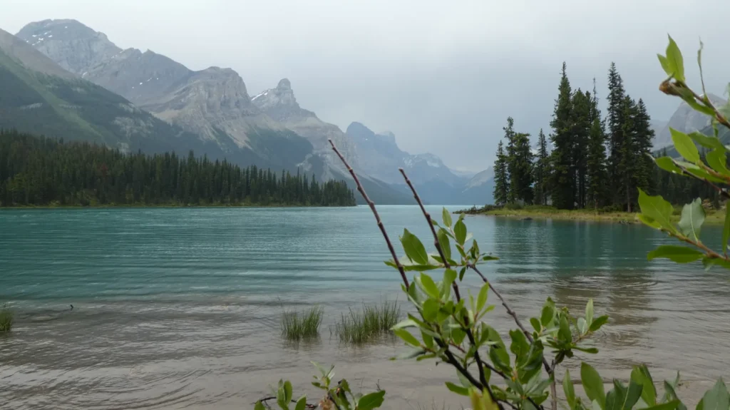
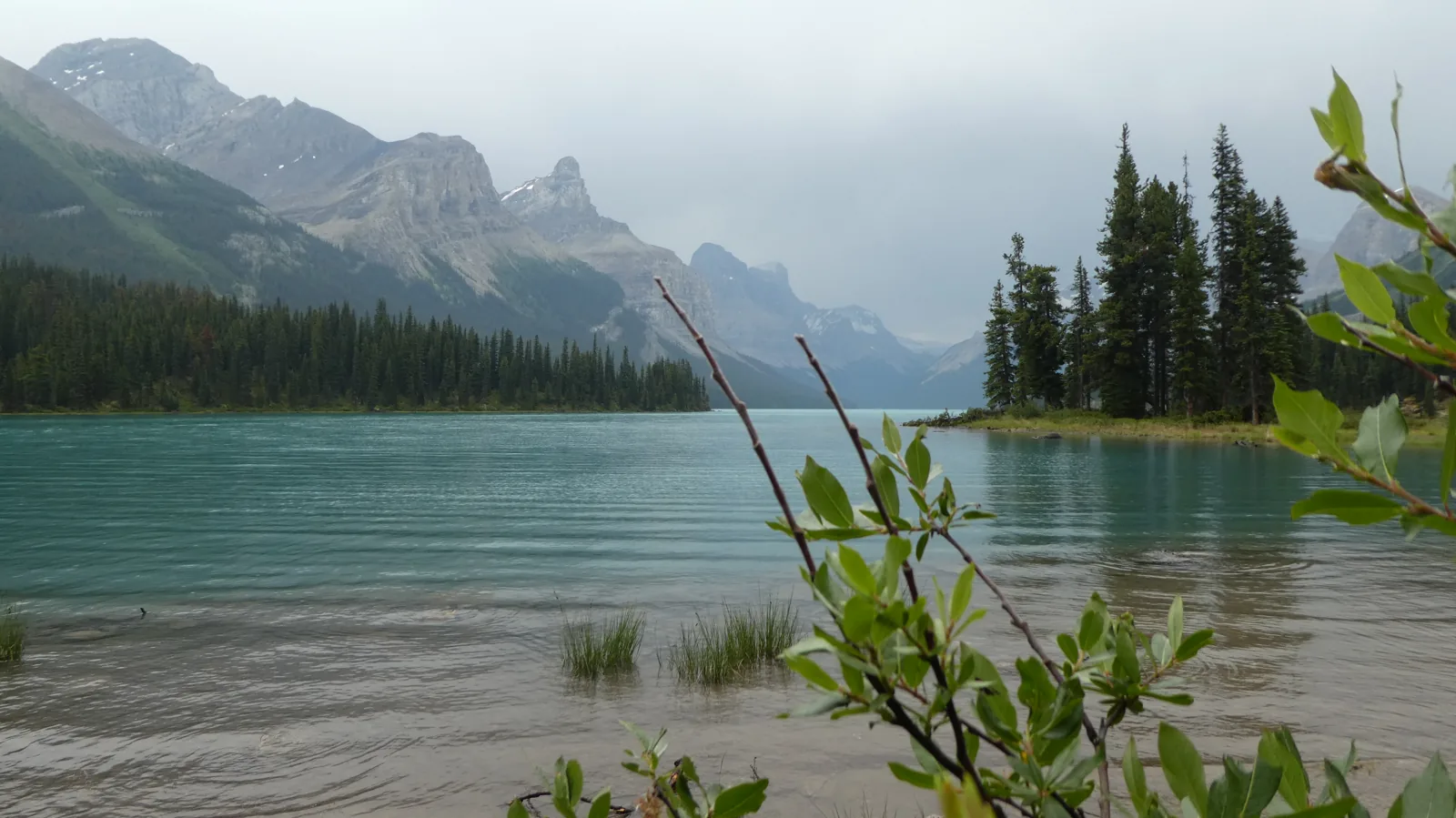
The locator uses actual OpenStreetMap lake outlines and reference points for the canyon and Jasper. Its leaders are labels, not routes. It does not delineate the canyon’s extent or an underground channel. The photograph is a genuine July 2018 image by Serge Cousineau, reused under CC BY-SA 4.0; no geographic retouching or watermark has been added.
- Parks Canada: Maligne Lake and Spirit Island orientation
- Parks Canada lake-map fact sheet: reference dimensions
- Roed, 1964, Alberta Geological Survey: glaciated Maligne Valley
- Parks Canada: Maligne Lake area and rockslide enlargement
- Parks Canada: Medicine Lake seasonal underground drainage
- Parks Canada, 2020: chalet and guest house management statement
- Parks Canada: current Maligne Canyon closure notice
- Parks Canada: aquatic-invasive-species prevention and water activity zones
- Parks Canada: winter conditions and safety context