Lake Tahoe’s geography involves three different boundaries: the shoreline, the California–Nevada state line and the high ground separating its drainage basin from neighboring valleys. Understanding the difference explains why this deep mountain lake is both a natural landscape and a shared water-management system.
Lake Tahoe is a freshwater lake on the California–Nevada border in the Sierra Nevada. Its fault-formed basin reaches about 1,645 feet (501 meters) deep. The Upper Truckee River flows into its southern end, while the Truckee River leaves at Tahoe City and continues toward Pyramid Lake.
How to use this article: Find the main shoreline communities, see how the basin formed, or follow the two Truckee River connections.
1. Where Is Lake Tahoe?
Lake Tahoe lies in the Sierra Nevada, on the boundary between California and Nevada in the western United States. Mountains surround the lake, with the main Sierra Nevada range to the west and the Carson Range to the east. The water surface is roughly 6,225 feet (1,897 meters) above sea level, but the actual level changes.
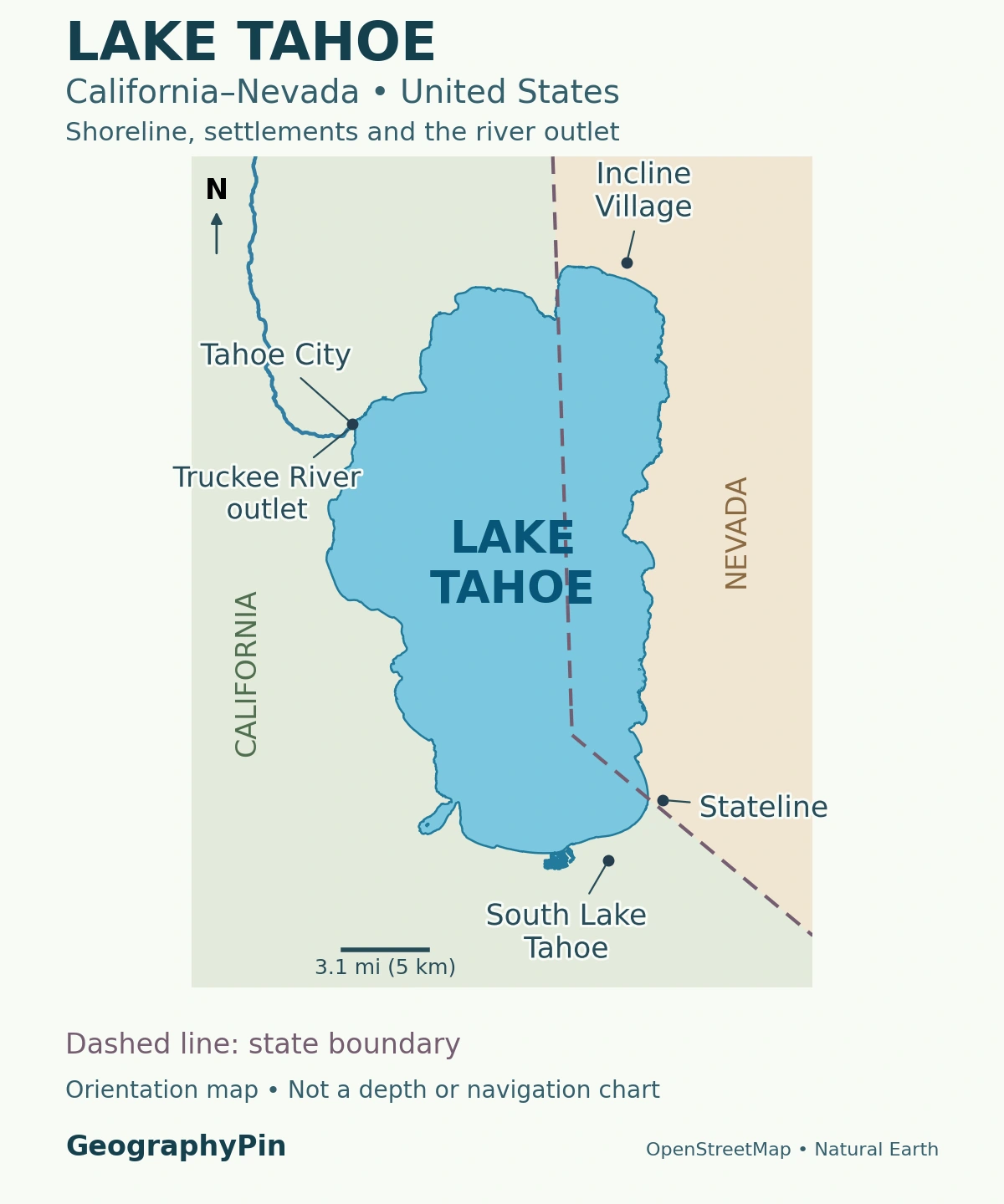
“Tahoe” can mean the lake, the surrounding drainage basin or a broad tourism region. Those are different things. South Lake Tahoe is a city on the California shore; Tahoe City is a separate community near the lake’s northwestern outlet. Neither name describes the entire lake.
Four places that help orient the shoreline
Start at Tahoe City, where the Truckee River leaves the lake. Follow the northern shore toward Incline Village in Nevada, then look south along the eastern shoreline. At the southern end, South Lake Tahoe in California adjoins Stateline in Nevada. The state boundary crosses the water as well as the shore; it is not a river or a visible line dividing the lake’s colors.
The most useful distinction is between a place and its position around the water. A destination described simply as “Lake Tahoe” may be on a different shore from another stop. Use the named community or park, not just the lake name, when checking an address or planning a route.
2. Depth, Elevation and Area Measure Different Things
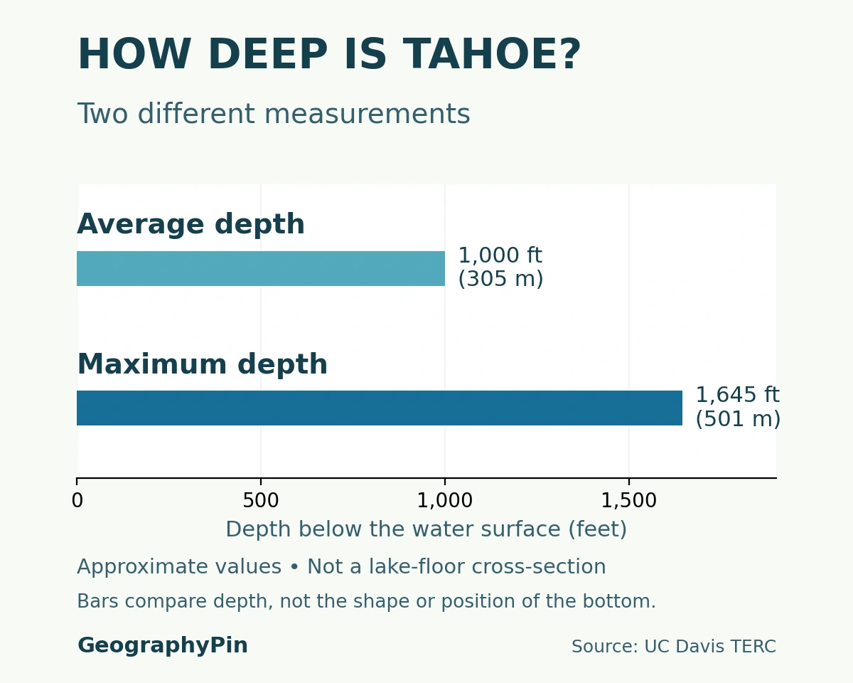
Lake Tahoe’s maximum depth is about 1,645 feet (501 meters), making it the second-deepest lake in the United States after Crater Lake. Its average depth is about 1,000 feet (305 meters). These are vertical distances below the water surface, not elevations above sea level.
| Measure | Approximate value | Meaning |
|---|---|---|
| Maximum depth | 1,645 ft (501 m) | Deepest measured part, not the depth everywhere |
| Average depth | 1,000 ft (305 m) | Whole-lake average |
| Lake surface area | 191 sq mi (495 km²) | Water surface, not the surrounding catchment |
| Reference surface elevation | 6,225 ft (1,897 m) | Rounded typical elevation; not a current gauge reading |
These rounded reference values follow UC Davis’s Tahoe Environmental Research Center. Other agency summaries round the water area to 192 square miles. Neither value should be confused with the much larger area draining toward the lake.
Why the bottom is not a simple bowl
USGS multibeam mapping revealed steep margins on the northern, eastern and western sides, with a gentler southern margin. Broad underwater shelves occur near the northwestern shore. Slopes, shelves, sediment deposits and displaced blocks make the floor more complicated than a smooth cone.
The comparison above shows two lake-wide measurements, not a slice through the lake floor. Average depth describes the lake as a whole; maximum depth describes its deepest point. Neither bar locates a particular underwater feature.
3. How Faulting, Lava and Ice Shaped Tahoe
Lake Tahoe occupies a tectonic basin, not the crater of a single volcano. Fault movement displaced blocks of the Earth’s crust and helped create the depression. Volcanic activity, glaciers and erosion then modified the basin and its outlet over a long period.
Faulting created the framework
The California Geological Survey describes tilted blocks bounded by faults as an important part of the basin’s structure. A fault is a fracture along which rock has moved. At Tahoe, this movement helped produce the north–south-trending depression between the surrounding uplands. It was not one sudden excavation or a hole melted by lava.
Glaciers later reshaped valleys and left moraines, ridges of transported rock and sediment. The western and southwestern shore near Emerald Bay, Fallen Leaf Lake and Meeks Bay preserves such glacial landforms. That glacial influence does not mean the entire Tahoe basin was created solely by a glacier.
Lava changed the outlet without making Tahoe a crater lake
A 2018 geological study identified repeated episodes when lava blocked the Truckee River canyon and raised an earlier Lake Tahoe. The researchers documented lava dams about 2.3 million, 2.1 million and 940,000 years ago. Erosion subsequently removed those barriers, leaving evidence of former shorelines well above the present lake.
This explains why “tectonic lake” and “volcanic influence” are compatible descriptions. Faulting supplied the basin framework; lava affected how high water could stand and how the outlet eroded. Modern lake-level control is a much smaller, human-made change at the existing outlet, not the origin of the lake.
4. Where Tahoe’s Water Comes From and Goes
Snow and rain falling on the surrounding mountains feed streams, groundwater and the lake itself. The boundary of this drainage basin follows high ground, not the California–Nevada state line. Water can cross a political boundary while remaining within the same catchment.
Upper Truckee flows in; Truckee flows out
The Upper Truckee River enters the southern end of Lake Tahoe. The Truckee River leaves at Tahoe City, then continues through Truckee and Reno toward Pyramid Lake in Nevada. The similar names can make a map confusing: the southern inflow and northwestern outlet are not two labels for the same shoreline location.
Tahoe therefore has a river outlet, even though the larger river system ends inland rather than reaching the ocean. Calling Tahoe a lake with “no outlet” confuses it with the terminal destination farther downstream. Local drainage and the drainage of the wider Great Basin must be described at different scales.
The lake is only part of its drainage basin
A 2002 USGS basin study uses a total area of 506 square miles (1,311 square kilometers): 192 square miles of lake surface and 314 square miles of surrounding watershed land. This is a useful, internally consistent breakdown. Smaller figures sometimes labeled “watershed” describe the land around the water rather than the whole land-and-lake basin.
Differences between published totals can reflect rounding or different definitions, rather than a change in the physical drainage boundary. The central geographic distinction is simple: the lake is the water body, while the drainage basin includes the land whose runoff flows toward it. Shoreline development, hillslope erosion and stream conditions can therefore affect water far from a particular beach.
5. A Natural Lake with a Managed Water Level
A dam at Tahoe City regulates water leaving through the Truckee River. Lake Tahoe is natural, but part of its surface storage is managed. The distinction between a lake and a reservoir concerns origin as well as use. Calling Tahoe a reservoir describes its water-management function; it does not mean the entire deep basin was excavated or flooded into existence by the dam.
The USGS gauge record identifies the natural rim as 6,223 feet and the maximum legal level as 6,229.1 feet in the Bureau of Reclamation datum. A datum is the reference used for an elevation. These numbers are not interchangeable with a reading expressed in another vertical reference system, and neither tells you today’s lake level.
For current conditions, use the USGS Lake Tahoe monitoring station and read its units, time and datum notes. The lake level rises and falls, so a gauge reading describes a particular observation time rather than a permanent elevation. The rounded reference elevation in the table serves orientation, not flood planning or engineering.
6. Clear Water Is Not the Same as Unchanging Water
Tahoe’s clarity is measured, not just judged from photographs. Scientists lower a Secchi disk into the lake and record the depth at which it disappears from view. That visibility depth is different from the depth of the lake bottom and varies with conditions.
The EPA identifies fine sediment and phytoplankton as major influences on deep-water transparency. Nutrients also affect algae and nearshore conditions. Runoff from developed ground, forested slopes and eroding channels connects land management to water quality. A beautiful blue photograph cannot show whether clarity has improved over decades or whether a particular beach has a local water-quality problem.
Annual clarity figures belong with their observation year and monitoring method. They should not be presented as a permanent property of the whole lake, and changes near shore need not match a deep-water monitoring station.
Read the conditions, not just the color
The North Lake Tahoe Fire Protection District warns that cold water can be dangerous even on warm days and even for strong swimmers. Its guidance emphasizes a properly fitted life jacket, checking wind and water conditions, and planning with the water temperature in mind. Clear water does not remove cold-water or weather hazards.
For access, use the official page for the particular park, beach or launch rather than assuming that every stretch of shore has the same rules. This article and its locator explain the lake’s geography; they are not a boating chart, an access permit or a report of current conditions.
What Did We Learn Today?
Lake Tahoe’s shoreline, state boundary and watershed boundary answer different questions. Faulting created the basin framework, while lava, glaciers and erosion helped shape the landscape. The lake has an outlet through the Truckee River, and its modern dam manages only part of a much older natural water body. Depth, elevation and clarity are separate measurements that should never be substituted for one another.
Sources & Data Notes
Lake dimensions are rounded reference values, not current water-level readings. The basin-area breakdown follows one USGS study; it is not assembled by combining differently defined agency totals. Elevations tied to the natural rim and legal maximum use the Bureau of Reclamation datum. No current clarity, access or weather condition is implied.
- UC Davis Tahoe Environmental Research Center: reference measurements and river connections
- California Geological Survey: Lake Tahoe Basin geological summary (2005)
- Kortemeier and colleagues: Pleistocene volcanism and shifting shorelines (2018)
- Gardner and colleagues: multibeam mapping and lake-floor morphology (2000)
- USGS: Lake Tahoe Basin area and environmental setting (2002)
- USGS monitoring station 10337000: elevation and datum notes
- EPA: Lake Tahoe water quality and Secchi-depth monitoring
- North Lake Tahoe Fire Protection District: water-safety guidance
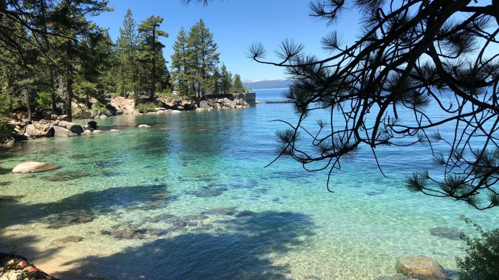
Featured photograph: Lake Tahoe’s rocky shoreline at Skunk Harbor. Photo: Tahoe Signature Properties (ElijahBizcor), via Wikimedia Commons, CC BY-SA 4.0. Photographed June 14, 2018. Cropped, resized and converted to WebP; this adapted photograph remains under CC BY-SA 4.0.
Map and chart methods: The locator uses OpenStreetMap shoreline, river and settlement geometry with Natural Earth’s generalized state boundaries, projected in WGS 84 / UTM zone 10N. It does not plot the drainage-basin boundary. Settlement markers and the river outlet indicate geographic locations, not access points. The depth chart compares rounded UC Davis reference values on one linear scale; it is not a measured bathymetric cross-section.