A winter photograph can make Lake Ladoga look like a quiet sheet of ice. Its geography tells a larger story: a very large freshwater lake, an important route toward the Baltic Sea, and a surface that does not freeze uniformly. Reading the shoreline, the river connections and the date of an observation is more useful than treating one snowy image as a picture of the whole lake.
Lake Ladoga is Europe’s largest freshwater lake by surface area, in northwestern Russia. It covers roughly 6,900 square miles (17,800 square kilometers) and drains through the Neva toward the Gulf of Finland. Its winter landscape varies across the lake and between years; seasonal ice does not mean complete or safely accessible ice cover.
1. Where is Lake Ladoga?
Lake Ladoga lies northeast of St. Petersburg, within Russia’s Republic of Karelia and Leningrad Region. It belongs to the Baltic drainage system rather than the Arctic Ocean basin. Although some of its upstream drainage reaches Finland, the lake itself is in Russia. Keeping the lake and its catchment separate prevents a common map-reading mistake: a cross-border drainage network does not make every lake within it a border lake.
Read the lake and outlet together
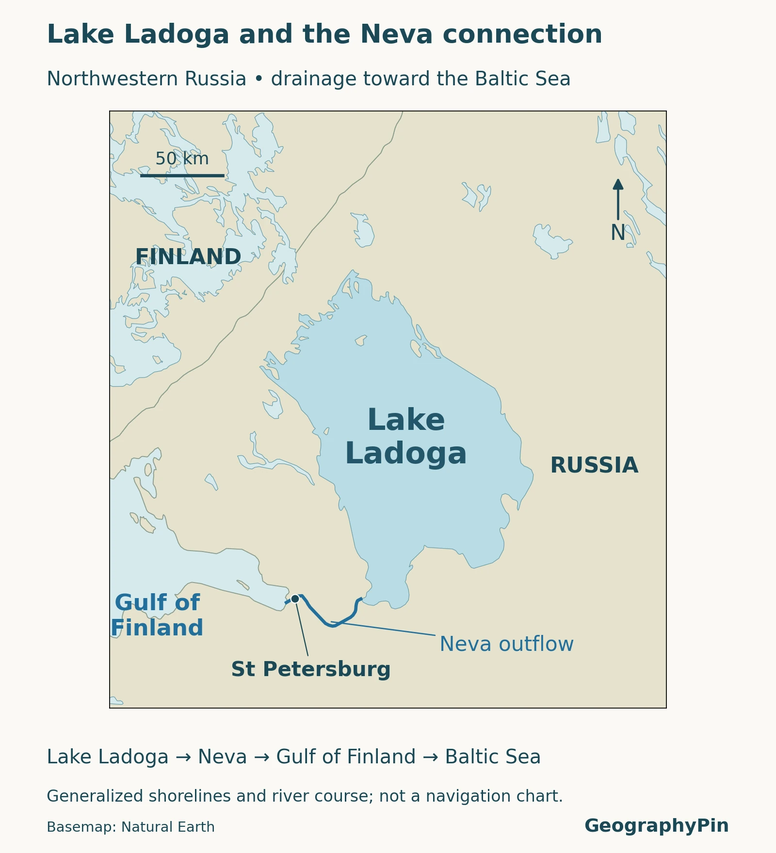
The locator places Ladoga beside the eastern Gulf of Finland and traces the Neva between them. St. Petersburg belongs on the downstream river connection, not on Ladoga’s northern shore. The outline shows the lake’s broad geographic shape, not depths, ice conditions or a navigable route.
In English, Lake Ladoga and Ladoga name the same water body. The Russian name Ladozhskoye ozero also refers to this lake. Do not confuse it with nearby Lake Onega, which is a separate lake connected to Ladoga through the Svir River. On a regional map, both names matter because the water network is larger than Ladoga’s own shoreline.
2. How large and deep is the lake?
Measurements need a definition
For scale, use approximately 6,900 square miles (17,800 square kilometers) of water surface and a maximum depth of about 755 feet (230 meters). The table identifies the publication behind each value. A publication year dates the source, not necessarily a new survey of the lake in that year.
| Measure | Reported value | Definition and source |
|---|---|---|
| Water surface area | About 6,867 sq mi (17,785 km²) | Water area reported by Naumenko and Guzivaty, 2023 |
| Maximum depth | About 755 ft (230 m) | Deepest reported measurement in the same 2023 study |
| Mean depth | About 158 ft (48.3 m) | Lake-wide average reported in the same 2023 study |
| Surface elevation | About 16 ft (5 m) above sea level | Rounded from the 4.84 m mean height cited by Kostianoy and colleagues, 2022; not a constant daily level |
| Water type | Freshwater | Distinct from the brackish Baltic receiving waters; ILEC lake record |
Published figures do not always match. The older International Lake Environment Committee record, for example, gives an area that explicitly includes islands, while the 2023 study specifies water area. Other differences reflect the underlying compilations and measurement conventions; islands alone should not be used to explain every discrepancy. Comparing water surface with water surface is more meaningful than choosing whichever number looks most precise.
Maximum depth is not typical depth. The deepest point describes one part of a basin, while mean depth summarizes the entire water body. Neither number tells a reader the depth beneath a particular beach, island or photograph. The general locator is deliberately not a substitute for a bathymetric chart.
3. How does Ladoga connect to the Baltic Sea?
Follow the Neva downstream
The Neva is Ladoga’s outflowing river, carrying water toward St. Petersburg and the Gulf of Finland. Inflow arrives through several rivers, notably the Svir, Volkhov and Vuoksa. Lake Onega feeds the Svir, which reaches Ladoga; the direction is not reversed. This chain links a large inland freshwater network to the Baltic coast.
A drainage map and a shoreline map answer different questions. The shoreline encloses the lake; a catchment boundary identifies land from which water reaches it. An upstream lake can therefore influence Ladoga even though it is separated from Ladoga by a substantial stretch of river. For a broader explanation of these distinctions, see what makes a lake a lake.
The low surface elevation also needs care. A lake can be deep while its surface lies only a little above sea level: depth is measured down from the water surface, whereas elevation refers to the surface’s height relative to a vertical datum. These measurements are not competing descriptions of the same thing.
4. Ice sheets and changing outlets shaped the basin
The modern outlet is part of a longer history
Ladoga’s landscape developed through glaciation, retreating ice and subsequent changes in drainage. After the ice load diminished, the land did not rebound evenly. Differential uplift could change the relative height of outlets and redirect water. The present river arrangement is therefore not a timeless feature of the basin.
A 2024 study of sediments and diatoms in the northern Karelian Isthmus found evidence for a former northern outlet, the Heinjoki Strait. Its reconstruction links the end of that connection with the establishment of the modern southern outlet through the Neva. This is evidence about a changing drainage system, not a claim that no water ever followed an earlier route through the Neva lowland.
The useful geographic lesson is that a lake’s history involves more than the excavation of a depression. Its outlet, water level and connected basins can change as surrounding land rises. Modern shorelines should not simply be drawn backward onto an ancient map. Here, the locator represents present-day geography, not a reconstruction of an ice-age shoreline.
5. What does winter look like on Lake Ladoga?
Three different meanings of an icy lake
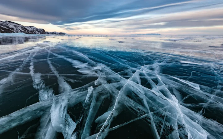
Ice present means that ice occurs somewhere on the lake. Complete ice cover describes coverage of the whole surface. Fast ice is ice attached to the shore rather than freely drifting. These are different observations: an attractive frozen bay cannot establish that the open lake is covered, and a fast-ice percentage is not the same as total ice coverage.
Karetnikov’s 2021 study compared ice patterns for 1964–1994 and 1993–2019. It documented shorter ice seasons and more winters with incomplete freeze-up in the later period. Those dated findings describe a changing historical record, not the condition on a particular morning now. They also explain why a single fixed “frozen season” is a poor description of Ladoga.
A photograph provides a place and moment; a satellite image provides a broader surface view; a long observational series supports a climate comparison. None of those products, on its own, certifies ice thickness or a safe crossing. Ice appearance must not be treated as permission to walk or drive onto the lake.
Why winter sunrise looks different
At Ladoga’s northerly latitude, winter brings shorter days and a lower Sun than summer. The cause is Earth’s axial tilt, not a special property of the lake. Low light can emphasize the texture of snow, exposed rock and ice, but it does not guarantee a colorful sunrise. Clouds, the viewing direction and the actual condition of the shore still matter.
There is no single sunrise time for “winter at Lake Ladoga.” The date and position around this large lake must be specified. A winter-light photograph should therefore be captioned with its verified location and date when known, rather than used as evidence that every shore looks the same throughout the season.
6. Access context before planning a visit
This profile explains a landscape; it is not a current itinerary or an ice-access guide. Weather, transport and international travel conditions require separate checks. As of November 2026, the UK Foreign, Commonwealth & Development Office advised against all travel to Russia. Readers should consult their own government’s current advice and relevant local restrictions before making plans.
A useful next step is to identify the particular shore or island under discussion, rather than treating Ladoga as a single destination. A lake-wide overview helps with that orientation, but current transport arrangements and local access rules must come from the responsible operators and authorities.
What Did We Learn Today?
Lake Ladoga is best understood as both a freshwater basin and part of a larger drainage network. Its Neva outlet connects it to the Baltic, while glaciation and changing land levels help explain its history. Size, depth and ice statistics need clear definitions: one photograph or one maximum measurement cannot describe the whole lake.
Sources & Data Notes
Measurements are rounded where appropriate and linked to their published source, not presented as a new survey. Water surface and island-inclusive area are different conventions; other differences between compilations also occur. Historical ice studies are not current forecasts or access advice. The locator uses Natural Earth 1:10-million geographic data and excludes the dataset’s artificial river centerline through the open lake; its Neva line represents the mapped river course.
- Naumenko and Guzivaty (2023), Seasonal Evolution of Stable Thermal Stratification in Central Area of Lake Ladoga. Water-area and depth figures.
- Kostianoy and colleagues (2022), Interannual Variability of Water Level in Two Largest Lakes of Europe. Regional drainage and surface-elevation context.
- International Lake Environment Committee: Lake Ladoga. Older lake compilation, including an explicitly island-inclusive area; its historical environmental observations are not treated as current conditions.
- Ludikova and colleagues (2024), Northern Paleo-Outlet from Lake Ladoga to the Baltic Sea. Sedimentary evidence and postglacial drainage changes.
- Karetnikov (2021), Manifestation of Climatic Change in the Ice Phenology of Lake Ladoga over the Past 55 Years. Dated ice-cover comparisons.
- National Weather Service: What Causes the Seasons?. Axial tilt, winter daylight and low Sun angle.
- UK FCDO: Russia travel advice. Travel warning; consult the live advice before making plans.
- Natural Earth. Public-domain map data.
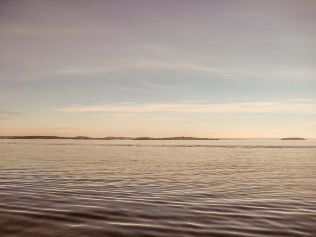
Featured photograph: northern Lake Ladoga in August 2020, by Александровы АГ / Wikimedia Commons, CC BY 4.0. Resized and converted to WebP. This open-water photograph is not a winter scene.