Hanoi’s geography is easier to understand when three things stay separate: the city center, the wider municipality and the Red River landscape. Each describes a different scale, and each explains something a skyline photograph cannot.
Hanoi is Vietnam’s capital in the north, beside the Red River and within the wider Red River Delta setting. It is inland rather than coastal. Its central urban landscape is predominantly lowland, while the larger administrative municipality includes uplands. Rivers, lakes, dikes and seasonal rainfall are central to understanding the city.
Start here: Locate the river setting, compare plain and uplands, or clarify the city boundary.
1. Where is Hanoi?
An inland capital in northern Vietnam
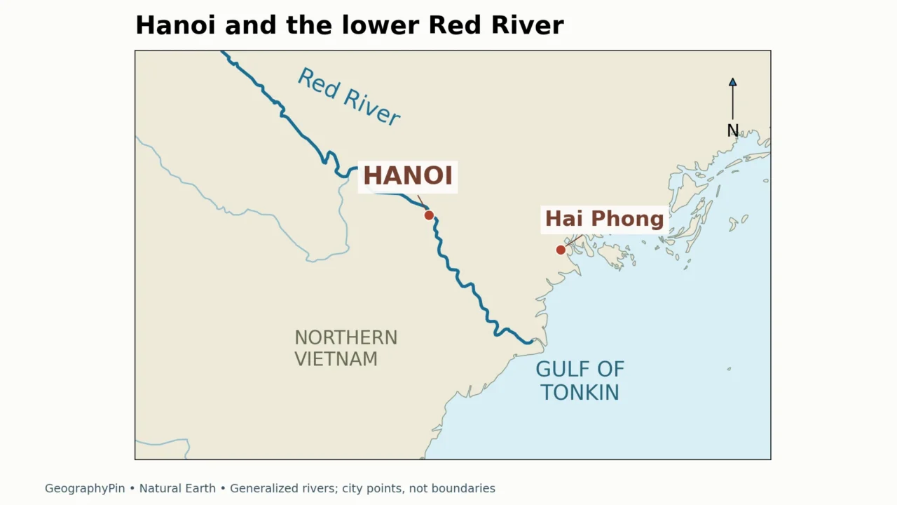
Hanoi is Vietnam’s capital, in the country’s north beside the Red River. Its position connects the city to the Red River Delta, the lowland region leading toward the Gulf of Tonkin. Hanoi is inland: a regional map should not place its city center on the coast or confuse it with the port city of Hai Phong farther east.
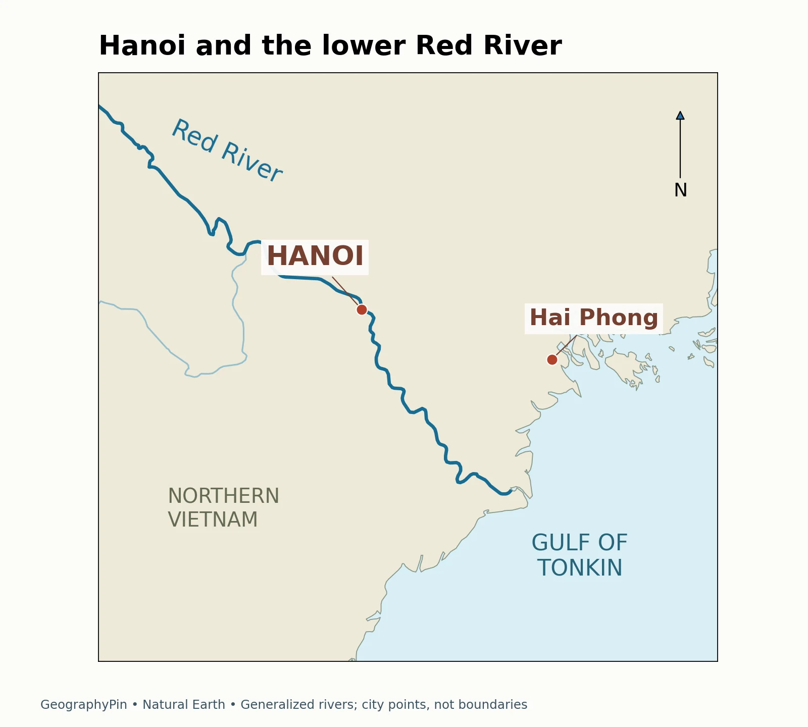
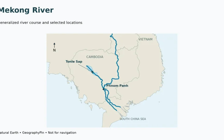
Follow the main river southeastward through the map rather than treating the capital as an isolated dot. The relationship between upstream water, a lowland city and the downstream coast is the basic geographic framework. The map shows selected river lines, not every canal or distributary.
The Red River is also called the Hong River. Hanoi and Ha Noi are common English renderings of Hà Nội. These names can vary between maps without referring to different cities or river systems. For the wider vocabulary of channels, tributaries and drainage basins, see what a river is and how its system works.
2. A delta landscape, but not uniformly flat
Read the central plain separately from the wider territory
The lowland setting explains why Hanoi is associated with alluvial land: material carried and deposited by rivers contributes to the delta landscape. The city’s administrative territory, however, extends beyond its dense center. Northern and western uplands, including the Ba Vi area, make a blanket description of all Hanoi as a level plain misleading.
This distinction changes how an elevation statement should be read. A value for an inner-city site cannot describe a mountain landscape elsewhere in the municipality. Equally, a mountain summit is not “Hanoi’s elevation” in the sense a reader normally means when asking about the city center. A useful description names the place or terrain unit instead of averaging away the difference.
The 2007 JICA–Hanoi planning study describes low-lying urban terrain and delta sediments. It predates Hanoi’s major administrative expansion in 2008, so its old municipal dimensions should not be copied into a current city fact box. Its physical observations are useful when their study area and date remain clear.
3. Rivers, lakes and drainage shape the city
Water is part of the urban structure
West Lake and Hoan Kiem Lake are familiar examples of Hanoi’s lake landscape. They are distinct water bodies, not alternative names for the Red River. A photograph taken beside a lake therefore tells a different geographic story from a view of the main river channel.
Vietnam National University’s assessment describes a landscape modified by dikes and embankments. It distinguishes river-side deposition from lower land protected behind dikes, and discusses the role of lakes in water regulation. The important idea is that the urban surface is neither an untouched floodplain nor a landscape disconnected from the river.
River flooding and rainwater drainage are related but different problems. High water in a major river concerns the channel and adjacent floodplain; intense rain falling within a built-up area must also find its way through the local drainage system. A riverbank barrier does not by itself answer every question about water accumulating in streets.
For a reader, the practical geographic distinction is between the main river, urban lakes and local drainage routes. A blue area on a small-scale map does not reveal its water quality, depth or present flood condition. Those questions require more specific, current information.
4. Hanoi city and Hanoi municipality are different scales
Why population and area figures can appear to disagree
“Hanoi” can mean the recognizable urban place or the much broader centrally governed municipality. The continuous built-up area is another possible unit, defined by settlement rather than simply by a government boundary. These meanings overlap, but they are not interchangeable.
| Meaning | What it describes | Best use |
|---|---|---|
| Central urban Hanoi | The dense city and its established urban neighborhoods | Understanding the city-center landscape |
| Built-up urban area | Land occupied by connected urban development | Comparing settlement patterns |
| Administrative Hanoi | The centrally governed municipality | Reading official territorial statistics |
The government’s 2025 provincial-level reorganization retained Hanoi as a centrally run city. That status should not be confused with the footprint of its buildings or with older district arrangements. This profile does not use district counts as a shorthand for the city’s geography.
When comparing two population figures, first check the boundary, then the reference year and whether the figure is a census count or an estimate. A larger number need not indicate an error if it covers a larger territory. The same principle applies to area: changing the boundary changes the denominator in a density calculation. Our explanation of geographical areas explores these distinctions.
5. Thang Long connects the delta to the city’s history
A specific heritage site, not a label for all Hanoi
The Central Sector of the Imperial Citadel of Thang Long is a UNESCO World Heritage property in Hanoi. UNESCO describes the citadel as having been built on drained land reclaimed from the Red River Delta, over the remains of an earlier fortress. Its setting links political history to the management and occupation of lowland terrain.
The property’s buildings and archaeology also reflect cultural connections between influences from the north and south. That gives the site more geographic meaning than a monument considered in isolation: it belongs to the long-settled lower Red River Valley.
The World Heritage designation applies to the named property, not to every part of the modern municipality. Keep that scale distinction when looking at a city map. A single heritage marker can locate a site, but it cannot stand in for the full extent of urban Hanoi or the delta around it.
6. Seasonal water, not one unchanging tropical climate
Hotter, wetter summers and cooler winters
Hanoi’s northern location matters for climate. Local geographic descriptions characterize its monsoon pattern as hot and wet in summer, with a cooler and generally less rainy winter. “Tropical” does not mean every month feels the same, and a description borrowed from southern Vietnam may miss the contrast.
The seasonal pattern helps explain why rainfall and drainage belong in a geography profile rather than only in a packing list. Long-term climate describes recurring conditions; weather describes a particular day or event. Neither a rainy-season label nor a dry-season label guarantees what will happen during a specific visit.
The clearest overall picture is a northern inland capital shaped by a major river, a lowland settlement history, urban lakes and a wider territory containing different terrain. The city’s physical setting and its administrative scale need to be read together, not collapsed into one number.
Frequently Asked Questions
Is Hanoi on the coast?
No. Hanoi is inland beside the Red River. Hai Phong is a separate city nearer the coast, and the Red River Delta extends beyond Hanoi toward the Gulf of Tonkin.
Is all of Hanoi flat?
No. The central city has a lowland setting, but the wider administrative territory includes hills and mountains. An inner-city elevation is not a description of the entire municipality.
Are West Lake and the Red River the same water body?
No. West Lake is a lake within the urban landscape; the Red River is the major river passing through Hanoi. They should be identified separately on a map.
Why do sources give different populations for Hanoi?
They may describe different boundaries or years. Compare the municipality, built-up area and central city separately, and check whether the number is a census result or an estimate.
Is all of Hanoi a UNESCO World Heritage site?
No. UNESCO’s designation is for the Central Sector of the Imperial Citadel of Thang Long, not the whole modern city.
What Did We Learn Today?
Hanoi is best read as a river-shaped city within a larger administrative territory. Separating urban lowlands from uplands, lakes from the main river, and settlement from government boundaries makes maps and statistics more useful. Its delta history also explains why water management and seasonal rainfall remain part of its geographic identity.
Sources & Data Notes
The maps are original GeographyPin compositions using Natural Earth land, river centerlines and populated-place points. They are regional locators, not administrative or flood-risk maps. Historical planning sources are used for physical context, not current population, area or infrastructure totals. Climate descriptions are qualitative rather than a station-normal dataset.
- UNESCO: Central Sector of the Imperial Citadel of Thang Long
- JICA and Hanoi People’s Committee: HAIDEP summary report, 2007
- Vietnam National University: natural conditions and resources of Hanoi
- My Hanoi: geographic introduction
- Vietnam Government News: 2025 provincial-level reorganization
- Natural Earth: public-domain geographic data