A river flowing through Georgia does not necessarily head toward its Black Sea coast. Some rivers cross the country on their way to the Caspian, while northern mountain valleys carry water into Russia. This map concerns Georgia the country, not the U.S. state.
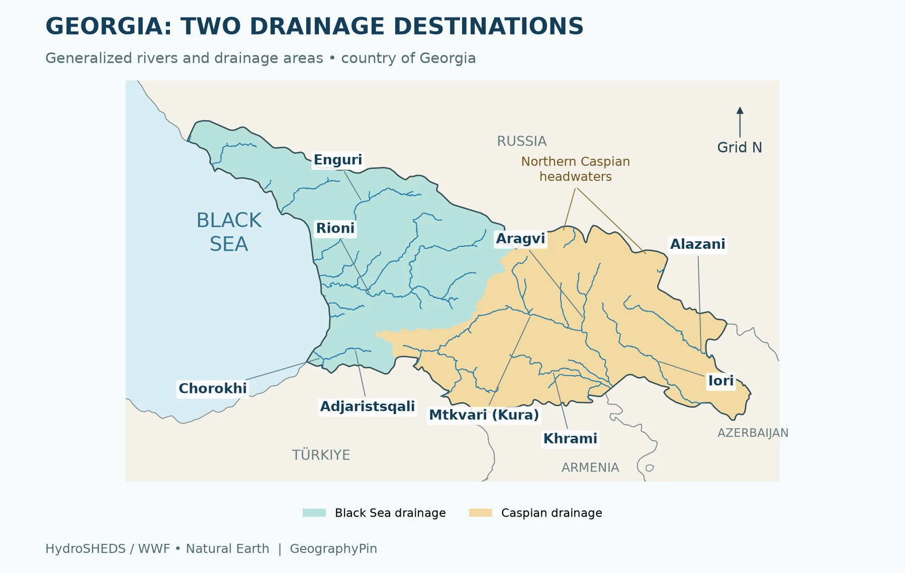
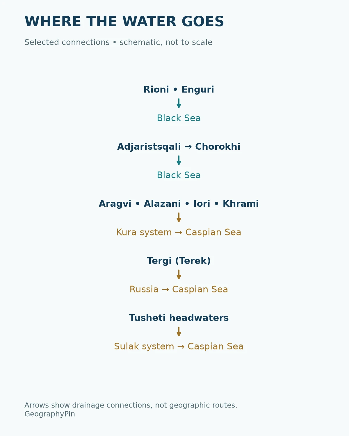
Georgia’s rivers belong to two major drainage destinations: the Black Sea and the Caspian Sea. Western rivers such as the Rioni and Enguri reach the Black Sea; the Mtkvari, or Kura, carries much of eastern Georgia’s runoff toward the Caspian. Northern rivers, including the Tergi, reach the Caspian by different routes.
How to use this article: Follow the river key, understand the Likhi divide, or compare whole-river and Georgian lengths.
1. Georgia rivers map: two drainage destinations

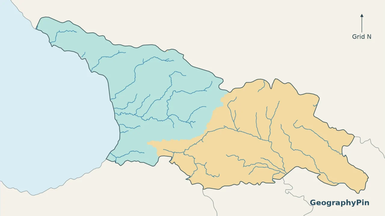
Read the colors as the eventual destination of runoff, not the immediate direction of every river bend. A stream can turn north or south locally while remaining part of a much larger drainage system. Tributaries carry water into other rivers before it reaches a sea; they are not separate coastal outlets.
The map uses HydroBASINS and HydroRIVERS, global hydrographic datasets derived from elevation data. River lines are generalized and selected for legibility; small tributaries are omitted. Minor coastline and border-edge mismatches reflect the different source resolutions. The outline represents Georgia within its internationally recognized borders; it is not a map of present-day administrative control.
For the country’s broader setting, see our Georgia country guide. The Black Sea location guide shows how the western drainage destination fits into the wider region.
2. Which rivers reach which sea?
A practical river key
The rivers below provide a useful starting network, not a complete inventory of Georgian watercourses. “Via” indicates a downstream connection: the river named in the first column need not reach the sea under its own name.
| River | Eventual destination | How to read the connection |
|---|---|---|
| Rioni | Black Sea | A principal western Georgian river with its own route to the coast. |
| Enguri | Black Sea | A separate western drainage system, not a tributary of the Rioni. |
| Chorokhi (Çoruh) | Black Sea | A transboundary river arriving from Turkey before reaching the Georgian coast. |
| Adjaristsqali | Black Sea via Chorokhi | A tributary connection within the Chorokhi system. |
| Mtkvari (Kura) | Caspian Sea | The main river linking much of eastern Georgia to Azerbaijan. |
| Aragvi | Caspian Sea via Mtkvari | Joins the Mtkvari at Mtskheta. |
| Alazani | Caspian Sea via the Kura system | An eastern transboundary river; not an independent Caspian outlet. |
| Iori | Caspian Sea via the Kura system | Another eastern river connected to the wider Kura drainage. |
| Ktsia–Khrami | Caspian Sea via Mtkvari | Ktsia is the name of its upper course; downstream, the Khrami joins the Mtkvari. |
| Tergi (Terek) | Caspian Sea via Russia | A northern route distinct from the Mtkvari/Kura system. |
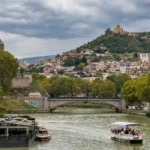
This distinction is particularly useful around Tbilisi and Mtskheta. The river through Tbilisi is the Mtkvari, also widely known as the Kura. At Mtskheta, the Aragvi contributes water to that same system. Our Mtkvari or Kura article explains the river’s names in more detail.
The northern routes are easy to miss
The Tergi rises in Georgia’s northern mountain country and flows into Russia. Its eventual destination is the Caspian, but it does not first join the Mtkvari. Other northern catchments include the Asa and Argun connections within the Terek system, and Georgian headwaters within the Sulak basin, as documented in UNECE’s assessment of transboundary waters. The map shows selected river channels rather than every stream, so some northern catchments are represented by basin shading without a labeled river line. A map that labels every Caspian-draining part of Georgia “Kura basin” would therefore be misleading.
3. Why the Likhi Range matters
The Likhi divide separates drainage, not countries
The Likhi Range is an important watershed between western Black Sea drainage and eastern Caspian drainage. A watershed divide is the higher ground separating neighboring catchments: runoff on opposite sides enters different river systems. It is not a river channel, and it is not a political border.
That broad west–east pattern is a useful first explanation, but not a rule that can be drawn as a straight line through Georgia. The divide follows the landscape. The northern valleys described above show why the full national drainage picture also depends on the Greater Caucasus and its headwaters, not just the Likhi Range.
Two nearby locations can therefore send water toward different seas, while distant locations can share the same downstream river. To identify the destination of a particular tributary, follow its connections rather than guessing from its longitude. The basin shading helps at national scale; it should not be used as a surveyed property boundary or a detailed flood-risk assessment.
4. Rivers that cross national borders
National borders divide jurisdictions, not complete drainage systems. The Mtkvari begins in Turkey, crosses Georgia and continues through Azerbaijan to the Caspian. The Chorokhi also begins in Turkey, but its downstream destination is the Black Sea. These two rivers make a useful contrast: the same neighboring country can supply headwaters to different sea basins.
The Alazani and Iori link eastern Georgia with Azerbaijan, while the Tergi connects Georgian headwaters with Russia. Such connections mean an upstream and a downstream country can be concerned with the same river even when most of its course lies outside one of them. A national map is only one window onto that larger network.
Keep the distinction between a river and its basin in mind. A basin includes the land drained by the river and its tributaries. Naming the countries crossed by a main channel does not necessarily list every country contributing water to its entire basin. Equally, a line drawn along a river is not automatically an international boundary: only some river reaches serve that role.
5. River length is not river flow
Whole-river length and length within Georgia
A transboundary river can have a long total course but a much shorter Georgian segment. Those are different measurements, not competing answers to the same question. The 2017 NVE–National Environmental Agency report gives the Mtkvari/Kura a total length of about 860 miles (1,384 km), including about 218 miles (351 km) in Georgia. Both figures belong to that report’s description; the longer one must not be labeled “length in Georgia.”
Even official publications do not always agree. Geostat’s 2015 environmental publication gives the Mtkvari a length of about 203 miles (326 km) in a table explicitly limited to Georgian territory. That differs from the 2017 report’s Georgian segment. These sources do not establish a single reconciled figure, so this guide does not combine them into a supposedly definitive longest-river ranking.
When comparing river lengths, first check whether the source measures the entire international river, only the part within Georgia, or a particular named reach. Then compare figures using the same scope. A table heading or footnote can matter as much as the number itself. The mile equivalents here are rounded conversions of the published kilometer figures, not additional measurements.
Discharge answers a different question
Length measures distance along a river. Discharge measures the volume of water passing a point per unit of time, commonly expressed in cubic feet or cubic meters per second. A longer river is not automatically the river carrying the most water, and a single discharge measurement does not describe every season.
A meaningful flow comparison needs a location and a time basis, such as an average for a stated period at a particular gauging station. A value near a river’s source cannot be compared casually with one near another river’s mouth. For that reason, this map is a drainage reference rather than a ranking of river size, water availability or flood danger.
Frequently Asked Questions
Which river flows through Tbilisi?
The Mtkvari flows through Tbilisi. It is also known internationally as the Kura and continues through Azerbaijan toward the Caspian Sea.
Do all Georgian rivers flow into the Black Sea?
No. Rioni and Enguri reach the Black Sea, but much of eastern Georgia drains through the Kura to the Caspian. Northern rivers such as the Tergi reach the Caspian by a different route through Russia.
Which two rivers meet at Mtskheta?
The Aragvi joins the Mtkvari at Mtskheta. Water from both continues downstream in the Mtkvari–Kura system.
What Did We Learn Today?
Georgia’s rivers are best understood as connected drainage networks rather than isolated lines. The Likhi Range helps explain the broad Black Sea–Caspian split, but northern catchments prevent a simple west-versus-east rule. Following tributaries reveals the destination of the water; checking the scope of a measurement prevents whole-river lengths, Georgian segments and river discharge from being confused.
Sources & Data Notes
The GeographyPin map uses HydroBASINS version 1c level-3 polygons and HydroRIVERS version 1.0 from the Europe and Middle East region, projected to UTM zone 38N, with Natural Earth country outlines. River reaches are filtered for legibility and clipped to Georgia; the source threshold is not a ranking of importance. Northern Caspian areas are not labeled as Kura drainage. The mobile image divides the same geography into western and eastern panels. This is a generalized reference, not a navigation or flood-hazard map. The river-length example identifies its source and territorial scope rather than calculating lengths from the mapped lines.
- NVE and National Environmental Agency: Runoff map of Georgia (2017)
- Geostat: Natural Resources of Georgia and Environmental Protection 2015, table 4.1
- UNDP Georgia: flood protection and the Likhi watershed
- Georgia Travel: the Aragvi–Mtkvari confluence at Mtskheta
- Georgia Travel: Truso Valley and the Tergi headwaters
- HydroBASINS: basin data, methodology and use terms
- HydroRIVERS: river network, methodology and use terms
- Lehner and Grill (2013): Global river hydrography and network routing
- Natural Earth: public-domain basemap data and terms
Map data attribution and license
This product, GeographyPin Georgia Rivers Map, incorporates data from the HydroSHEDS version 1 database which is © World Wildlife Fund, Inc. (2006–2022) and has been used herein under license. WWF has not evaluated the data as altered and incorporated within GeographyPin Georgia Rivers Map, and therefore gives no warranty regarding its accuracy, completeness, currency or suitability for any particular purpose. Portions of the HydroSHEDS v1 database incorporate data which are the intellectual property rights of © USGS (2006–2008), NASA (2000–2005), ESRI (1992–1998), CIAT (2004–2006), UNEP-WCMC (1993), WWF (2004), Commonwealth of Australia (2007), and Her Royal Majesty and the British Crown and are used under license. The HydroSHEDS v1 database and more information are available at HydroSHEDS. See the data license and attribution terms. This article provides derived map images, not a standalone distribution of the source datasets. Scientific citation: Lehner, B., Verdin, K., Jarvis, A. (2008), New global hydrography derived from spaceborne elevation data, Eos, Transactions, AGU, 89(10), 93–94.