Two coastal inlets can both be long, narrow and scenic yet have different histories. To distinguish a fjord from a ria, ask what shaped the valley before seawater occupied it.
A fjord is a coastal inlet occupying a valley deeply shaped by glacier ice. A ria is a drowned river valley. Fjords commonly have steep walls and a broad glacial trough; rias often preserve branching river-valley patterns. These are useful clues, not absolute shape tests: both can branch, and geological history is the stronger distinction.
Choose your view: compare the valley cross-sections, check why branching is not proof, or read how “estuary” fits.
1. Fjord vs Ria: The Main Difference
Both terms describe sea-filled valleys, but the dominant valley-forming process differs. Moving glacier ice can widen and deepen a valley into a trough. Rivers cut drainage networks through the landscape; when the sea occupies their lower valleys, those drowned reaches can form a ria.
| Feature | Fjord | Ria |
|---|---|---|
| Dominant valley origin | Glacial erosion | River erosion |
| Typical cross-section | Steep-sided glacial trough, often broadly U-shaped | Drowned river valley, often retaining a more V-shaped underlying profile |
| Plan-view clue | A main trough with possible side branches | A flooded network of river valleys and tributaries |
| Evidence to seek | Glacial geology, inland troughs and associated ice-carved features | River-valley history and drowned tributary valleys |
| Example used here | Glacier Bay, Alaska | Carrick Roads, Cornwall |
“Drowned” means submerged by the sea, not destroyed. The change is relative sea level: the sea stands higher relative to the valley floor than before. Sea-level rise and land movement can both affect that relationship. A description of a particular coast should identify its actual geological history rather than assume one universal sequence.
A modern stream at the head of an inlet does not settle its origin. Rivers can flow into former glacial valleys too. For the wider group of ice-carved features, see our guide to glacial erosion landforms.
2. What the Diagrams Can and Cannot Tell You
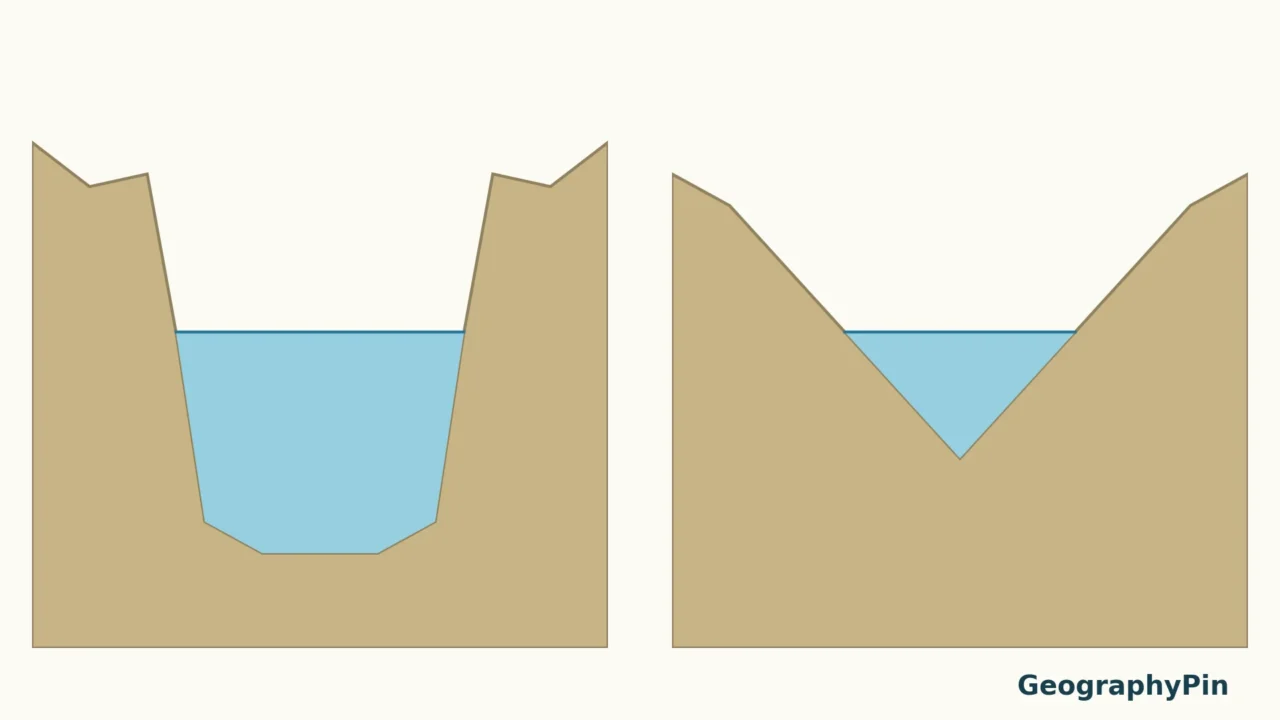
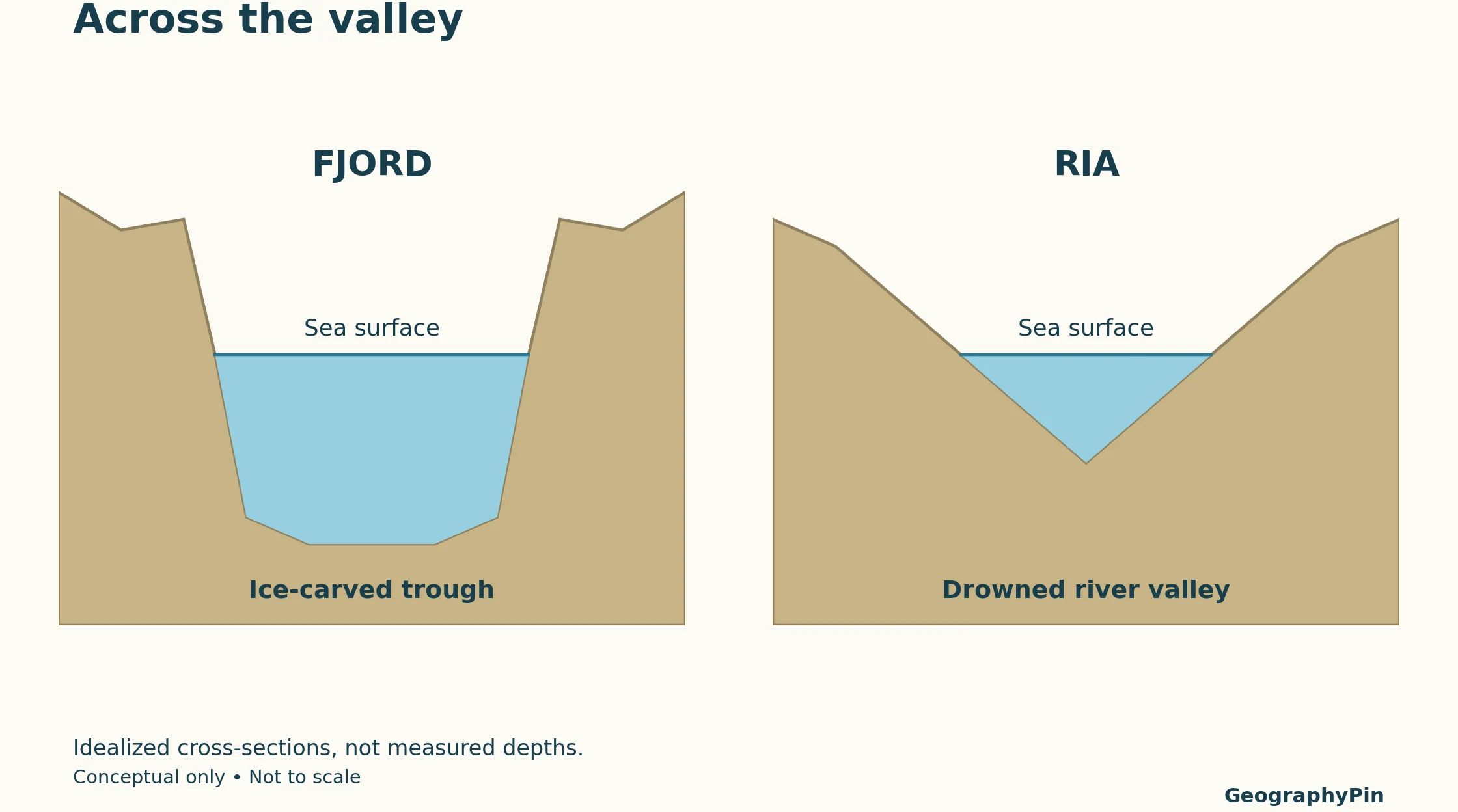
A cross-section looks across the valley
The first illustration cuts across two idealized valleys. It contrasts a broad glacial trough with a river-cut valley now partly filled by seawater. These are teaching shapes, not surveyed profiles or a statement that every fjord is deeper than every ria.
Open the larger comparison · Download the printable comparison (PDF)
Do not confuse this view with a profile along the length of an inlet. A fjord may have a deep basin and a shallower threshold, or sill, toward its entrance. That is a different dimension from the U-shaped cross-section shown here. Sills can restrict deep-water exchange, but their presence and effects vary; “every fjord has stagnant bottom water” is not a safe general rule.
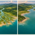
A plan view looks down from above
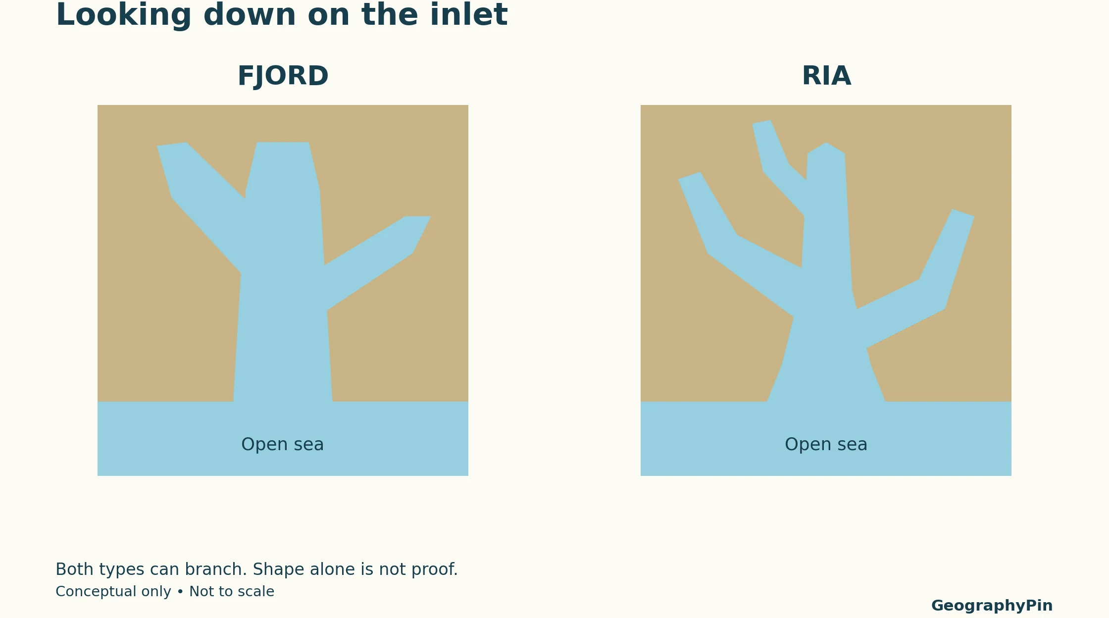
A coastline on a map shows where land meets water today. It does not reveal the complete submerged valley floor or the process that excavated it. Bathymetry, geological mapping and the inland landscape provide evidence that a shoreline outline cannot.
Steep shores are not an exclusive fjord feature either. The British Geological Survey describes steep-sided wooded valleys around the Carrick Roads ria. Use several lines of evidence instead of treating one dramatic cliff as a diagnosis.
3. Real Examples: Glacier Bay and Carrick Roads
Glacier Bay, Alaska: a branching fjord system
The U.S. National Park Service describes Glacier Bay as a network of large U-shaped valleys formerly filled by glaciers and now flooded by the ocean. Streams and rivers feed those marine waters. It is a concrete example of why freshwater inflow does not make an inlet a ria.
NOAA’s description also identifies a Y-shaped bay with finger-like inlets. Its branching outline is therefore not evidence against glacial origin. The geological setting and carved valleys explain the classification, not the number of arms visible on a map.
Carrick Roads, Cornwall: a drowned river-valley network
Near Falmouth in southwest England, Carrick Roads is part of an extensive ria system. The British Geological Survey identifies its tidal creeks as submerged lower reaches of branching valley networks. Farther inland, small streams occupy the upper parts of those valleys.
This connects the modern inlet with its earlier drainage pattern. The creeks are not simply random indentations in the coast; they occupy former valley routes. The example also avoids a common oversimplification: a ria can have steep wooded sides without being a glacier-carved fjord.
4. Fjords, Rias, Estuaries and Sounds
“Estuary” answers a different question
For the coastal systems discussed here, an estuary is a partly enclosed body of water connected to the sea, where freshwater from land mixes with seawater. Fjord and drowned-river-valley are geological categories within estuary classifications. An inlet can therefore be both a fjord and an estuary; the terms are not competing answers.
Water circulation is another layer of description. Freshwater input, tides, wind, basin shape and entrance restrictions influence how water mixes. Knowing that an inlet is glacial does not tell you its salinity or oxygen concentration on a particular day.
A place called a “sound” can be a fjord
Place names do not always provide a precise geological classification. New Zealand’s Department of Conservation notes that many of its fiords are named sounds, including Milford Sound/Piopiotahi and Doubtful Sound. Their names do not erase their glacial history.
The spellings “fjord” and “fiord” refer to the same landform term. When identifying a real inlet, use the local geological description rather than assuming that a particular word in its name proves how it formed.
Frequently Asked Questions
Does a fjord need an active glacier at its head?
No. The term describes an ice-carved valley occupied by seawater. A glacier may have retreated from the inlet; the valley’s glacial origin remains.
Can I identify a ria from a satellite image alone?
You can recognize a possible drowned branching valley, but an overhead image cannot reliably establish the full geological history. Check a geological survey or another authoritative local description, especially where glacial, river and tectonic processes overlap.
What Did We Learn Today?
A fjord and a ria are distinguished chiefly by the origin of their valleys, not by scenery, branching or a place name. Cross-sections help explain glacial and river-shaped profiles, while plan views show the coastal pattern without proving its history. Glacier Bay and Carrick Roads illustrate why several kinds of evidence work better than one simple visual rule.
Sources & Data Notes
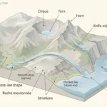
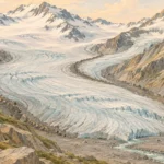
GeographyPin created the conceptual diagrams to compare valley origins and viewing directions. They are not photographs, maps, bathymetric surveys or cross-sections of the named examples. No dimensions, depths or universal shape thresholds are inferred from them. Real inlets can preserve mixed geological histories and later sedimentation; local survey descriptions take precedence over a simple diagram.
- National Park Service: U-Shaped Valleys, Fjords, and Hanging Valleys — glacial troughs and seawater flooding.
- British Geological Survey: Geology of the Country Around Falmouth — Carrick Roads ria and drowned tributary valleys.
- National Park Service: The Glacier Bay Marine Environment — glacial valleys now occupied by the sea.
- NOAA: About Glacier Bay — branching geography and variable estuarine conditions.
- NOAA: Classifying Estuaries by Geology — drowned valleys, fjords and entrance sills.
- NOAA: Estuary Glossary — coastal estuary and glacial-inlet definitions.
- New Zealand Department of Conservation: Southern Fiords — glacial origin and sound/fiord place names.