“The deep sea” can mean dark water far below a ship, the seabed beneath it, or both. A useful depth diagram keeps those meanings separate instead of putting every ocean label into one stack.
The deep sea generally begins below about 660 feet (200 meters). Its water-column zones include the mesopelagic, bathypelagic, abyssopelagic, and hadopelagic. Seafloor zones use a separate classification. Depth provides a useful framework, but light penetration varies, pressure rises continuously, and food can arrive from above or be produced through chemical-energy pathways.
How to use this article: Begin with the depth diagram, check why classifications differ, or follow food production without sunlight.
1. Where the deep sea begins
The deep sea generally begins below about 660 feet (200 meters), according to NOAA Ocean Exploration: What Is the Deep Ocean?. This is a practical convention, not a sharp boundary that can be seen everywhere in the water.
The number marks a transition away from the well-lit upper ocean. It does not mean the seabed begins there. Over a deep basin, a very large volume of water remains beneath that level; over a continental shelf, the bottom may lie much closer to the surface.
Depth below the surface or position on the bottom?
Two questions need different answers. “How far down is this water?” concerns the water column. “What kind of seabed is here?” concerns the bottom. A fish swimming above an abyssal plain and an animal living in its sediment can share a depth without sharing the same habitat.
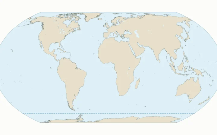
Likewise, “deep sea” is not the name of a separate ocean. The five-ocean map shows the named ocean regions horizontally. Depth zones divide their waters vertically.
2. The five water-column depth zones
Pelagic means the water-column environment rather than the seabed. The table uses the common divisions presented by NOAA and the World Register of Marine Species. Feet are rounded; the underlying classification boundaries are expressed in meters.
| Zone | Approximate depth | Common descriptive name |
|---|---|---|
| Epipelagic | 0–660 ft (0–200 m) | Sunlight zone |
| Mesopelagic | 660–3,300 ft (200–1,000 m) | Twilight zone |
| Bathypelagic | 3,300–13,100 ft (1,000–4,000 m) | Midnight zone |
| Abyssopelagic | 13,100–19,700 ft (4,000–6,000 m) | Abyssal waters |
| Hadopelagic | Below 19,700 ft (6,000 m) | Hadal waters, in deep trenches |
Hadalpelagic is another spelling encountered in educational sources. The named zones describe depth ranges; they do not imply that every place in the ocean contains all five layers. A water column ends wherever it meets the bottom.
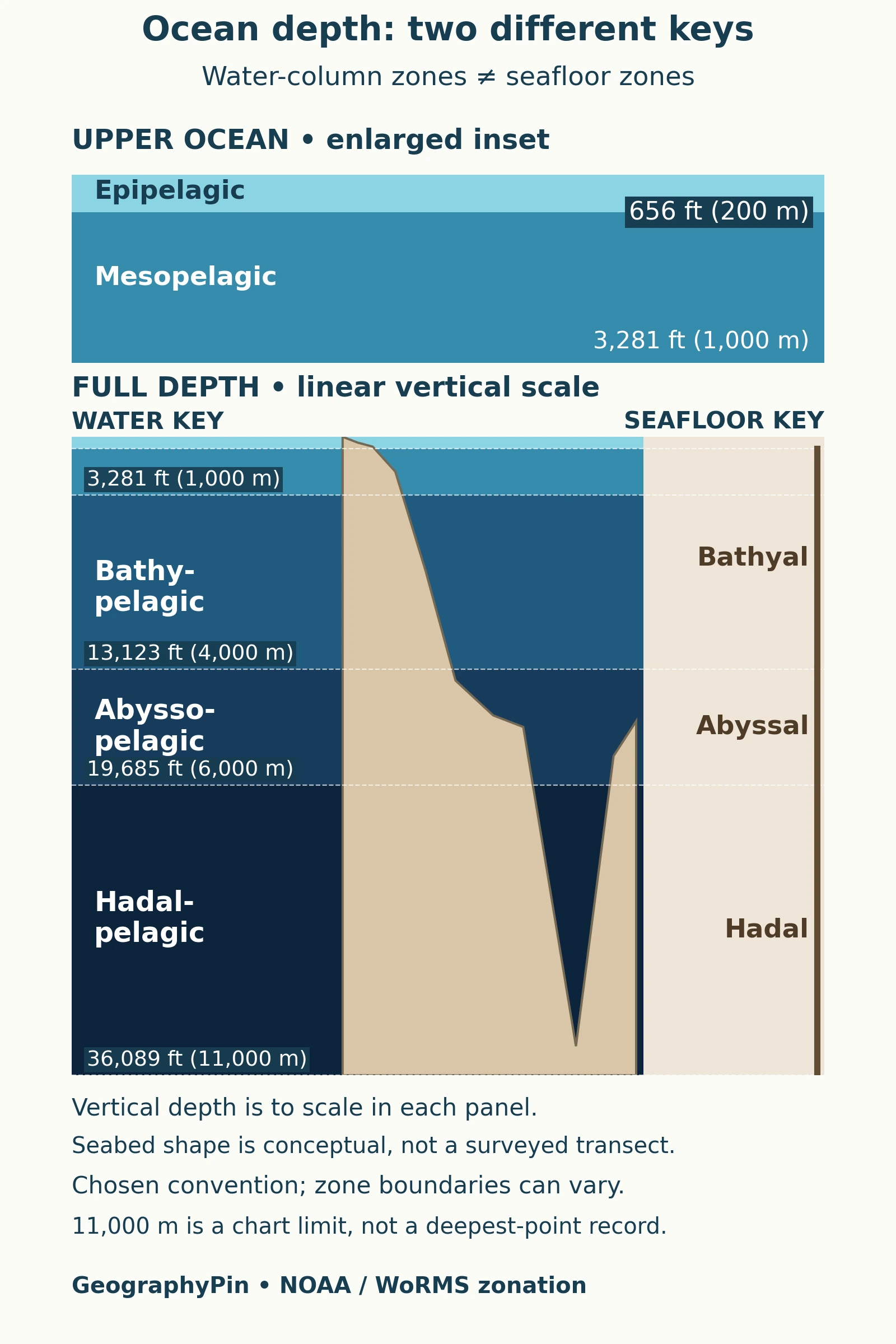
The NOAA JetStream: Layers of the Ocean supplies the familiar depth sequence. Actual temperature, light, and animal communities do not change instantaneously at a line drawn across a diagram.
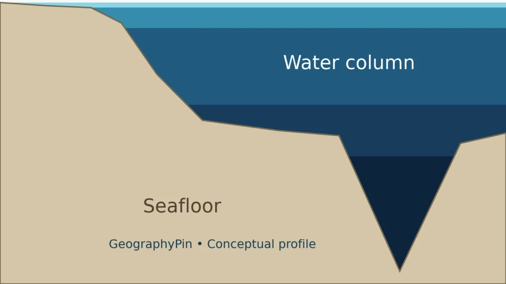
How to read the depth diagram
Use the vertical scale to compare depth. The shallow surface layer occupies only a small fraction of the full descent. A separate, clearly labeled inset enlarges the upper ocean; do not compare its band heights directly with those in the full-depth panel. The seafloor shape is conceptual, not a measured route across a particular ocean.
3. Seafloor zones are a separate classification
Benthic refers to the bottom environment. In the WoRMS zonation convention used here, bathyal seabed lies at about 660–13,100 feet (200–4,000 meters), abyssal seabed at 13,100–19,700 feet (4,000–6,000 meters), and hadal seabed below 19,700 feet (6,000 meters).
Compare the two keys: the bathyal bottom range spans depths occupied by both mesopelagic and bathypelagic water. “Bathyal” and “bathypelagic” are therefore not simply interchangeable words.
The continental slope, abyssal plain, and trench are landform descriptions. Bathyal, abyssal, and hadal are depth-zone terms. They often correspond broadly, but a landform is not defined solely by crossing one of the diagram’s depth lines. The WoRMS zonation definitions, displayed through URMO make the water-column and seabed categories explicit.
Why some references give different boundaries
These categories are conventions rather than universal physical walls. For example, WHOI describes the abyssal region more broadly, from about 9,800 to 21,300 feet (3,000–6,500 meters). That is not the same interval as the 4,000–6,000-meter abyssopelagic band used in this table.
When comparing sources, check whether “abyssal” refers to water, seabed, or a broader ecological region. Woods Hole Oceanographic Institution: Ocean Zones illustrates why a familiar label should not be separated from its definition. A classification can be useful without being the only one in use.
4. Light fades, but its boundary is not a fixed depth
NOAA’s broad light-based explanation separates a sunlight zone, a dim twilight zone, and deeper waters beyond the reach of sunlight. Under suitable conditions, a faint solar signal can reach roughly 3,300 feet (1,000 meters), long after useful illumination has become scarce.
“No sunlight” does not mean no light of any kind. Living organisms can produce bioluminescence. A glowing animal in deep water is not evidence that sunlight has reached that depth. NOAA: How Far Does Light Travel in the Ocean? describes the broad light-zone convention.
Euphotic depth depends on water clarity
For measurement, euphotic depth is often identified where photosynthetically available radiation falls to 1% of its surface value. Dissolved material and suspended particles affect how quickly light is absorbed or scattered, so this depth changes between places and seasons.
The NOAA NCEI: Euphotic Depth and Photic Quality explains that approach. A standard depth-zone diagram cannot replace an actual light profile. In clear shallow water, sufficient light may reach the bottom; in murkier water, the productive illuminated layer can be much shallower.
That distinction prevents a common mistake: treating the illustrative 660-foot (200-meter) division as a worldwide measurement of the lower limit of photosynthesis.
5. Pressure increases continuously with depth
Water pressure rises by roughly one atmosphere for every 33 feet (10 meters) of descent. The weight of the air already contributes approximately one atmosphere at the sea surface. Total pressure at depth therefore includes both air pressure and the added pressure of the water above.
For a simple estimate at 3,300 feet (1,000 meters), the water contributes roughly 100 additional atmospheres. This is an approximate rule of thumb, not a precision calculation for a particular water column. NOAA: Pressure and Ocean Depth explains the depth–pressure relationship.
Unlike a named zone, pressure does not wait until a boundary is crossed before changing. An instrument descending through the mesopelagic–bathypelagic division experiences a continuing increase, not a sudden pressure step at exactly 1,000 meters.
Depth is therefore useful context for a habitat, but a zone name alone is not a complete environmental description. Light conditions, food supply, and the relation to the seabed still matter.
6. How life gets food without sunlight
Dark water is connected to the surface food web. Organic particles, waste, and remains of organisms sink from upper waters as marine snow. Despite the name, this is not frozen snow falling through the ocean.
Animals can collect particles from the water or feed on material reaching the seabed. Much is consumed or decomposed during the descent, so not everything leaving the surface arrives at the bottom unchanged. NOAA: What Is Marine Snow? describes this downward food supply.
Chemical energy supports some deep-sea communities
At hydrothermal vents and cold seeps, microbes can use energy from chemical reactions to make organic matter through chemosynthesis. Those microbes support local food webs, including animals that host them within their tissues.
This does not mean every deep-sea animal makes its own food from chemicals, or that heat itself is food. The microbes perform the chemical-energy conversion; other organisms can obtain nourishment through feeding or symbiosis. The NOAA Ocean Exploration: Chemosynthesis Fact Sheet distinguishes this process from photosynthesis.
Marine snow and chemosynthetic production explain different routes into deep-sea food webs. The absence of sunlight at a particular location does not require the absence of life, nor does it imply that all dark habitats work in the same way.
What Did We Learn Today?
The ocean’s vertical geography needs more than one set of labels. Water-column zones, seabed zones, and landforms answer different questions. Their boundaries are useful conventions, while light, pressure, and food supply follow physical and biological processes. Reading the classification and scale together prevents a depth diagram from becoming a misleading picture of identical layers everywhere.
Sources & Data Notes
The table uses NOAA’s common pelagic ranges and the WoRMS zonation convention for the seabed. Alternative abyssal definitions are identified separately. Feet are rounded from meter-based boundaries. The vertical diagram is a classification guide, not surveyed bathymetry or a global measurement of sunlight penetration.
- NOAA Ocean Exploration: What Is the Deep Ocean?
- NOAA JetStream: Layers of the Ocean
- NOAA: How Far Does Light Travel in the Ocean?
- NOAA NCEI: Euphotic Depth and Photic Quality
- WoRMS zonation definitions, displayed through URMO
- Woods Hole Oceanographic Institution: Ocean Zones
- NOAA: Pressure and Ocean Depth
- NOAA: What Is Marine Snow?
- NOAA Ocean Exploration: Chemosynthesis Fact Sheet