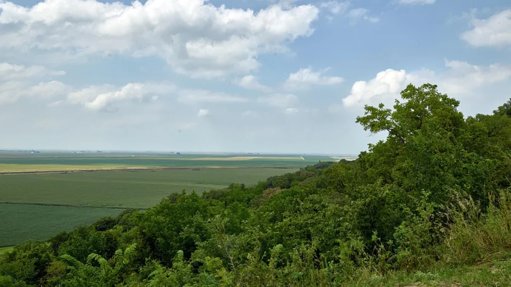
The low fields of the Missouri River valley meet steep, irregular ridges in western Iowa. Wind brought much of the material that builds those hills, but it did not carve all the shapes you see today.
Loess deposits are blankets of mostly silt laid down by wind. The grains can blow beyond the floodplains or dry ground where the wind picked them up and settle across existing hills and valleys. In western Iowa, thick loess built up over many episodes. Water and gravity then helped carve ravines and steep faces into the deposit.
1. How the Missouri Valley Supplied Silt
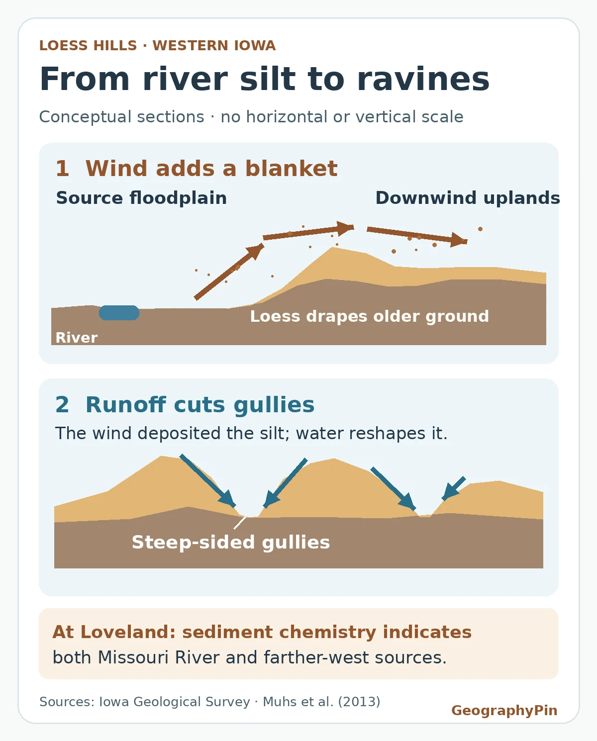
During the last glacial period, meltwater streams carried fine sediment from the ice sheet into the Missouri Valley. As floodwaters receded, they left sediment exposed on parts of the floodplain. Once the surface dried, strong winds could lift some of the silt. That is a two-stage journey: water brings sediment to a place where wind can pick it up, then wind takes it beyond the river valley.
The source need not be a glacial floodplain. Any suitable exposed source with fine grains can contribute dust; studies identify a farther-west nonglacial contribution even at Loveland, Iowa, beside the Missouri Valley. The diagram follows one river-fed pathway, not every route to the deposit.
2. How a Loess Blanket Differs From a Dune
Sand and silt travel differently. Sand grains commonly bounce close to the ground, piling up into dune ridges or mounds. Finer silt can spend more time suspended in moving air. When it settles, it can drape the landscape rather than simply build a mound where the sand stops. A loess blanket can be much thicker on one side of a valley and get thinner farther downwind.
Look for a broad cover of mostly silt that crosses older features, not just a hill that happens to look like a dune. Loess can itself contain fine sand and clay, and some deposits preserve wind ripples, so “smooth versus ridged” on its own is a poor test. A cutbank or road cut can reveal the blanket lying over older materials; grain-size measurements provide a stronger check than shape alone.
3. Why Water Cuts Steep Gullies in Loess
Once a thick deposit is in place, rain running downhill can cut narrow channels. In western Iowa many of those channels have steep sides. The silt can stand in a near-vertical face when dry, but wetting can weaken it and allow slabs or blocks to slump. The present ridges and ravines therefore record both how silt arrived and how it was later removed or moved downhill.
One storm can deepen a gully without laying down a new loess blanket. Likewise, one dusty afternoon shows that grains are moving, not that a thick durable deposit is accumulating. What matters over many episodes is whether layers of settled dust remain after erosion, reworking and pauses in deposition.
4. How We Know Where the Loveland Silt Came From
At the Loveland section, researchers dated the last-glacial Peoria Loess, a named unit distinct from the older unit called Loveland Loess. Their luminescence ages place the local Peoria accumulation after roughly 27,000 years ago and continuing until about 17,000 years ago. These ages estimate when mineral grains were buried. They do not date every Loess Hills layer or imply a steady buildup across that interval.
The team also compared ratios of potassium to rubidium and barium to rubidium in the deposit with possible source material. Those fingerprints support both glacially influenced Missouri River sediment and dust from nonglacial sources farther west in Nebraska. A nearby river is a good source candidate, but its proximity alone cannot explain the chemical signal.
The source comparisons tell us that more than one pathway supplied the deposit. They do not trace each grain’s route or give a universal split between river and western sources. If you look at another loess section, use its own dated layers, mineral evidence and thickness patterns rather than carrying over the Loveland dates or source mixture.
Frequently Asked Questions
Is loess the same thing as loess soil?
Loess is the deposited sediment. A soil can develop in it as roots, organisms, water and weathering alter the upper material. An exposed silt layer does not all belong to the modern surface soil.
Can loess build up without a nearby glacier?
Yes. The immediate requirement is exposed fine sediment that wind can move. Glaciers supply silt in some regions, but the chemical evidence at Loveland also points to dust from nonglacial sources.
What Did We Learn Today?
Read a loess landscape in two steps. First look for the blanket of fine sediment deposited by wind; then look for the gullies and slopes carved into it. At Loveland, dating and chemistry show why neither the shape of the hills nor a nearby river can tell the whole story.
Sources & Data Notes
The drawing is original and conceptual, not a measured geologic section. The approximate dates and source conclusions describe the studied Peoria Loess at Loveland, Iowa, not the older Loveland Loess or every site in the region.
- Muhs et al. (2013), Chronology and provenance of last-glacial (Peoria) loess in western Iowa, for site-specific luminescence ages and comparisons of sediment chemistry.
- Muhs and Bettis (2000), Geochemical variations in Peoria Loess of western Iowa, earlier particle-size and geochemical evidence for two broad source areas.
- Iowa Geological Survey, Loess Hills, for floodplain sediment, loess geometry, slope behavior and gully erosion.
- Murray Hill Overlook over the adjacent farmlands, Harrison County, Iowa, August 4, 2016. Library of Congress, Prints & Photographs Division, photograph by Carol M. Highsmith, LC-DIG-highsm-39300. Public-domain collection guidance; cropped and converted to WebP. The photo shows the regional landscape, not the sampled Loveland section.