Two dunes can both look like crescents and point in opposite directions in the same wind. The difference is what moves first: the tips of an unanchored crescent, or the middle of a dune whose arms are held back by plants.
Barchan dunes are crescent-shaped dunes whose horns extend downwind. They usually form where sand is limited, vegetation is sparse and winds that move sand come mostly from one direction. A parabolic dune has a similar outline, but vegetation can hold back its arms while the middle advances downwind.
How to use this article: See how sand moves, work through the opposite crescent tips, or check the evidence from repeat surveys.
How wind moves a dune
Start with grain movement, not the outline
Once near-surface wind is strong enough, sand grains can begin to bounce. Their impacts dislodge other grains. On a typical migrating dune, this process moves sand up the gentler windward slope toward the crest. On the sheltered side, deposited sand can slide down the steeper slip face. Repeated movement shifts the dune even though individual grains may move in short bursts.
Wind direction is only part of the explanation. The amount of available sand and the presence of plants or moisture can change which parts move. A calm-day breeze is not a reliable substitute for the history of winds strong enough to transport sand.

Two crescents, opposite tips
Distinguish a barchan from a parabolic dune
Imagine walking around a barchan. The outer, convex side faces into the dominant sand-moving wind. The steep slip face curves around the sheltered interior. Its thinner outer tips advance ahead of the central part and form the downwind horns. Late in the process, neighboring forms may connect into a wavy ridge rather than remain isolated crescents.
A parabolic dune works differently. Wind can excavate a depression, called a blowout, in a vegetated sand surface and deposit sand beyond it. The nose advances away from the blowout. Plants slow movement along the arms, which remain on the upwind side. Vegetation at the tips and a blowout behind the nose give you a better identification than the crescent shape alone.
At Great Sand Dunes National Park and Preserve in Colorado, the National Park Service identifies barchans near the base of the tall dunes across from the main parking area. The grassy sand sheet southwest of the main field has parabolic dunes whose arms are held by vegetation. The two forms can occur in the same landscape without implying opposite regional winds.
What long ridges and star dunes reveal
Use crest shape as a clue, not a wind compass
Linear dunes form long ridges instead of isolated crescents. The National Park Service monitoring guide illustrates simple linear dunes in the Kalahari and more complex ones in the Namib Sand Sea. Winds arriving from more than one direction can help build a long ridge, but a ridge alignment alone does not tell you the individual wind directions or which winds are strongest. Long straight crests can also belong to other dune types.
A star dune has three or more ridges that descend from a summit. Several sand-moving wind directions can feed it from different sides and build it upward. In Colorado, the named Star Dune is an isolated example; the park also identifies a separate complex at the northwest end of the dunefield, where nearby mountains influence wind directions. Do not mistake the individual dune for that entire complex.
Reversing dunes are another reason to be cautious. Much of Colorado’s main dunefield has elongated crests that can flip in opposing winds. A long crest in a photograph is not enough to call it a linear dune in the geomorphic sense.
Which side has the slip face?
Start with the steep slope, then check for movement
Look for the steep slope just below the crest, where sand can slide. On a barchan it curves around the inner face between the horns. On a parabolic dune, check the downwind nose and look behind it for a blowout and plants along the arms. Shade in a single photo can make a slope hard to read; use elevation data or a second view to check which side is steep. Then compare dated images or surveys from the same orientation. Even measured movement over one interval can reflect a single windy season, not the dune’s full history.
Research at White Sands in New Mexico provides a stronger test. Researchers used differences between annual lidar elevation surveys to estimate where sand was gained and lost. The National Park Service account describes linked changes in wind, vegetation and groundwater around a barchan-to-parabolic transition. The resulting pattern is evidence from repeated measurement, not a direction guessed from one crescent.
For an old or stabilized dune, look for buried layers that record the former slip face, and compare those layers with other observations from the site. A later wind may reshape the surface or plants may preserve an older outline. A single image can suggest an interpretation; it cannot by itself establish a unique wind history.
Frequently Asked Questions
How can I distinguish a linear dune from an elongated barchan ridge in an overhead image?
Follow the crest across the image. Several long, nearly parallel ridges suggest linear dunes. An elongated barchan ridge may retain a scalloped crest made of joined crescents. A single segment can look like either. Check slope orientation in an elevation model, then compare dated images or local records of winds strong enough to move sand.
Can a dune move even if the sand grains never travel very far?
Yes. Many short movements can transfer sand from the windward side to the sheltered side. Over repeated events the position of the whole dune changes.
Does a star dune tell you how many winds built it?
Not exactly. Several crest arms are evidence of complex sand transport, but you cannot count wind directions by counting ridges. Check local wind measurements and dated changes.
What Did We Learn Today?
Compare the dune’s tips with the slip face, vegetation and signs of movement. The same wind can produce opposite-looking crescents when plant cover changes, while longer or more branched ridges require other evidence to explain their history.
Sources & Data Notes
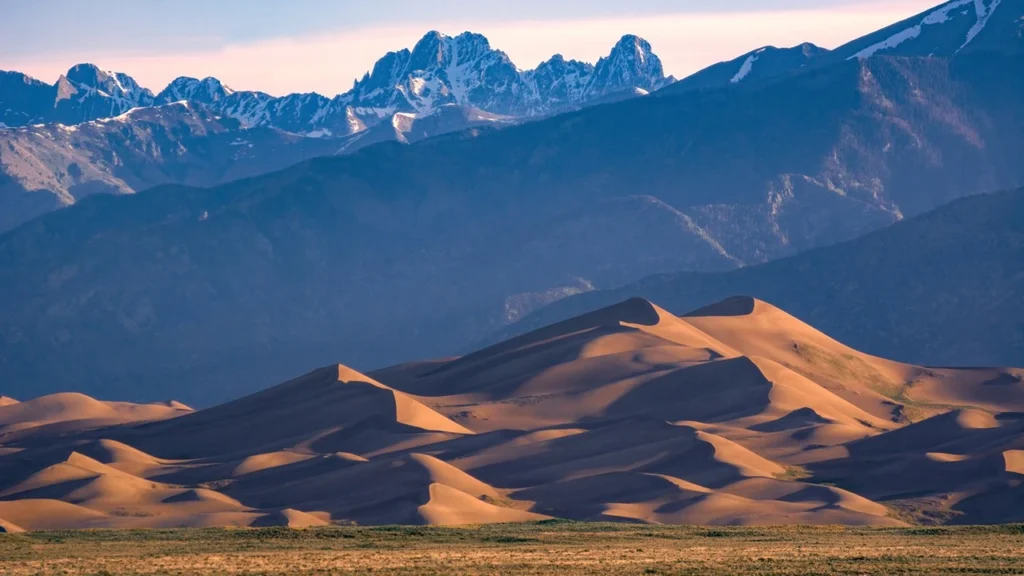
Original four-type shape key by GeographyPin, based on the NPS dune descriptions and Lancaster’s geological monitoring chapter; conceptual views, not a map of any site. Featured image shows Star Dune and the Crestone Peaks at Great Sand Dunes National Park and Preserve, photographed by NPS/Patrick Myers and cropped for the featured format. The White Sands evidence describes annual topographic comparisons; no universal dune migration speed is assumed.
- National Park Service: Dune Types at Great Sand Dunes and NPS/Patrick Myers featured image
- National Park Service: Monitoring Aeolian Features and Processes (Kalahari and Namib examples)
- U.S. Geological Survey: sand transport and dune models
- National Park Service: Linking Dune Formation with Atmospheric Processes at White Sands