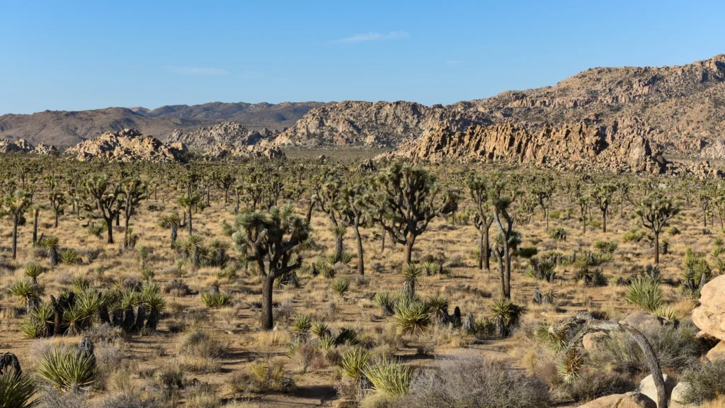
A drive into Joshua Tree can start among boulders and Joshua trees or in a much lower basin of creosote and cactus. The entrance you choose changes which landscape you see first and how much driving you need to do.
Use the West Entrance from Joshua Tree village for the rock-and-Joshua-tree stops near Hidden Valley. The North Entrance from Twentynine Palms reaches Skull Rock and the Pinto Basin Road junction. Enter from Interstate 10 at Cottonwood if you want to start in the lower Colorado Desert and drive toward the higher Mojave landscape.
How to use this article: Find the three gates on the map, use the entrance-by-entrance comparison, then check the drive time and return route.
How the three entrances connect
Park Boulevard across the north, Pinto Basin Road to the south
| Entrance | Useful first stops | What the route changes |
|---|---|---|
| West, from Joshua Tree village | Hidden Valley, Barker Dam area, turnoff for Keys View | Start among higher-country Joshua trees and boulders; usually the busiest gate. |
| North, from Twentynine Palms | Skull Rock or the Pinto Basin Road junction | Choose west for the boulders or south for Cholla Cactus Garden and Cottonwood. |
| South, from I-10 | Bajada, Cottonwood and the lower desert | Drive uphill toward Pinto Basin and the higher north-side landscapes; allow longer for western stops. |
Park Boulevard connects the West and North entrances. Pinto Basin Road meets it inside the park and continues south through the transition zone toward Cottonwood. If you are coming from Joshua Tree village or Twentynine Palms, approach from California Highway 62. If you start near the Interstate 10 corridor, exit at Cottonwood Springs Road, exit 168, for the South Entrance.
The map highlights the main through roads, rather than every dirt track. You do not need a backcountry route to connect the three gates. The NPS warns that car navigation can suggest rough or sandy roads that are not suitable alternatives.
Indian Cove has its own road from Highway 62 and no connection to the main paved park drive. Keys View Road instead branches from Park Boulevard near Cap Rock and returns to the same junction.
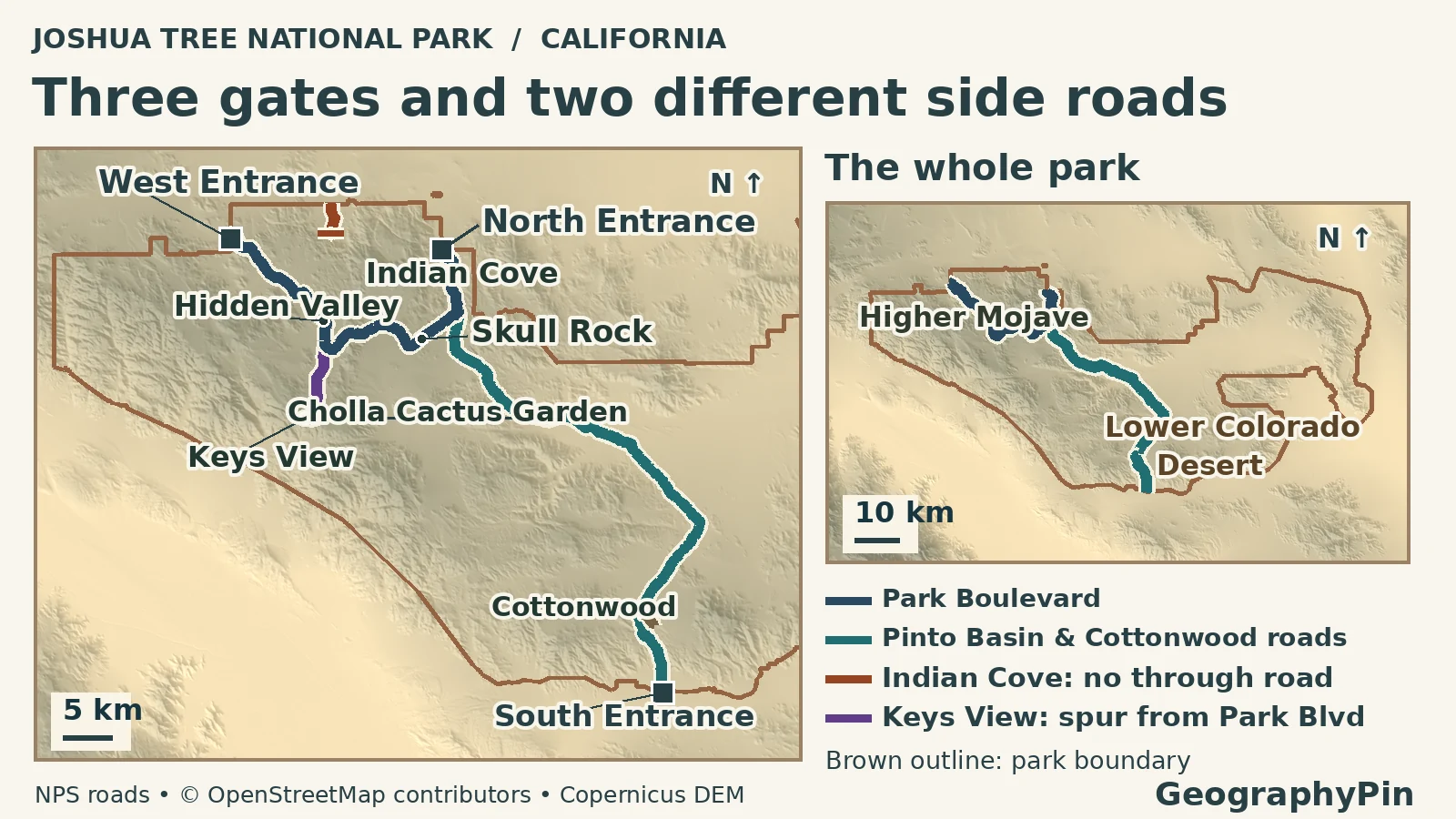
Which gate serves each set of stops
Decide by your first stop and where you need to finish
For an outing centered on the rock formations, the West Entrance puts Hidden Valley first. That is useful if you want its one-mile (1.6 km) loop, but if the West queue is backed up, going in from Twentynine Palms can be a better choice even if you then drive west inside the park. From Twentynine Palms, use the North Entrance for Skull Rock. At the Pinto Basin junction, the southbound road leads toward Cholla Cactus Garden.
Where the Mojave gives way to the Colorado Desert
The Mojave country in the higher western and northern part of the park is generally cooler and slightly moister. That is where stands of Joshua trees are characteristic. The lower Colorado Desert is part of the Sonoran Desert, not a desert in the state of Colorado. The hotter, drier basins support broad areas of creosote bush with pockets of ocotillo and cholla.
The change is not a line you cross at a gate. On Pinto Basin Road, the Cholla Cactus Garden sits in the transition zone; the NPS describes it as roughly 12 miles (20 km) south of the North Entrance. Continue toward Cottonwood and the route leads into a lower-desert setting. Cottonwood Spring is a localized oasis, not an example of what all the surrounding desert looks like.
Plan the drive before adding hikes
A gate-to-gate drive is only the starting point
NPS estimates about 45 minutes from the West to the North entrance, an hour from North to South, and 90 minutes from West to South. These are different through-routes. Do not add the first two times to estimate West to South unless you plan to detour all the way out to the North Entrance. They are not estimates for a visit with parking, walks or a return to the original gate.
If you have a short visit, pick the higher country or the low desert first. If you want to compare both, enter through one side, make a stop in each landscape and leave through the opposite side if your route allows it. A short drive to a parking lot is not the same as the walk: Hidden Valley is a one-mile loop, whereas the Cholla Cactus Garden loop is about a quarter-mile (0.4 km) when the trail is open.
Check closures and supplies before driving in
Practical information checked: November 21, 2026.
The National Park Service reports that construction of the replacement West Entrance Station is complete. Temporary notices for the January 2026 work are historical, not a reason to avoid the West Entrance now. Crowds can still build up there, and weather and repairs can affect a road or trail on their own. Check the park’s current closure map and alerts before choosing a route.
Take water and fuel in from outside the park. The NPS lists no gas stations or restaurants inside Joshua Tree. A visitor center or water fill station is not a substitute for carrying what you need between stops, especially along the lower, hotter approach on a warm day.
Frequently Asked Questions
Can I enter at Indian Cove and continue to Hidden Valley by car?
No. Indian Cove is reached by its own road off the Highway 62 side. It does not connect to the main paved park drive, so return toward Highway 62 and use a through entrance for Hidden Valley.
Is Joshua Tree Visitor Center at the West Entrance gate?
No. The Joshua Tree Visitor Center is in the village, before the drive south to the gate. The West Entrance Station is a separate place on Park Boulevard.
Which entrance gets me to Cholla Cactus Garden if I’m coming from I-10?
Use the South Entrance off I-10 at Cottonwood Springs Road, then continue north on Pinto Basin Road. The driving approach and the garden’s short walking loop have separate access conditions; check the park’s current alerts before leaving.
What Did We Learn Today?
The entrances connect the park’s higher terrain and lower basins, but they are not boundaries between deserts. Pick a route by the stops and landscapes you want, then allow time for parking, walking and an exit that fits the rest of your journey.
Sources & Data Notes
Driving estimates are NPS standard gate-to-gate estimates; actual delays and closures vary. The map shows selected paved roads and generalized terrain, not an ecological survey or road status map.
- National Park Service: three entrance approaches, drive times, water and fuel, busy-season gate advice and West Entrance project completion.
- NPS: Resource Stewardship Strategy, major desert environments, Cholla Cactus Garden and transition zone, and named stops and Indian Cove access. See also Indian Cove’s separate approach, Indian Cove access by Highway 62, Keys View Road and the park map and brochure.
- NPS: trail lengths, visitor-center locations and current conditions.
- GeographyPin map from NPS Public Roads GIS, © OpenStreetMap contributors, generalized park boundary (ODbL), and modified Copernicus DEM data (accessed 2026). Featured photograph: NPS/Bill Bjornstad, Lost Horse Valley, cropped and converted to WebP.