Torch Lake sits close to Lake Michigan, but its water does not reach the Great Lake by taking the shortest line on the map. The outlet is at the opposite end from the narrow land beside Grand Traverse Bay. Follow it south and then west through two more inland lakes.
Torch Lake reaches Lake Michigan through two more lakes
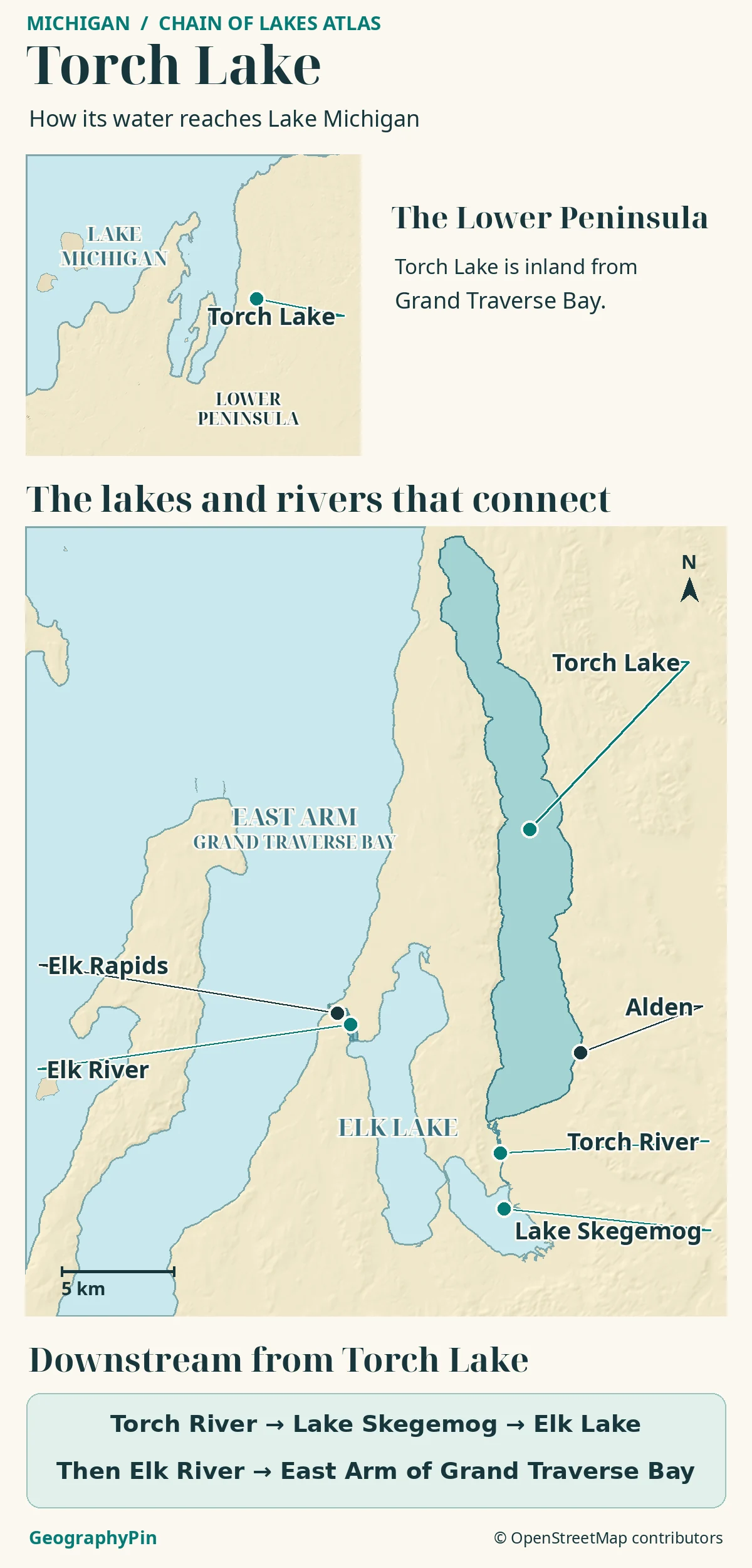
Torch Lake is a long inland lake in Michigan’s northwestern Lower Peninsula. Its outlet, Torch River, leaves the south end and flows into Lake Skegemog.
Water then passes through Elk Lake and down the Elk River at Elk Rapids, entering Lake Michigan through the East Arm of Grand Traverse Bay.
How to use this article: Start with the locator map, then follow the first downstream connection and the East Arm outlet.
Which Torch Lake is this?
Find Grand Traverse Bay in northwestern Lower Michigan, then look inland on its eastern side. Torch Lake is the long, narrow water body in the Antrim County area, with Eastport near its north end and Alden on the southeastern shore. Michigan DNR lists it separately from Elk Lake and Skegemog Lake, which appear farther west and southwest.
Find Alden and the lake’s south end
Use Torch Lake, Antrim County, Michigan to find the right lake. The Torch Lake in Houghton County, on the Upper Peninsula, is a separate water body associated with the Keweenaw Waterway and Lake Superior. It is not part of the drainage chain on this map. Torch Lake Township is also a local government name in Antrim County, not a label for the whole lake.
The Elk River watershed feeds the lake
The Elk River Chain of Lakes watershed is the land and water that drain through these connected streams and lakes. Torch Lake is one part of that watershed. The Tip of the Mitt Watershed Council gives the lake’s surface area as about 18,473 acres (74.8 km²) in its shoreline survey. That is the area of the lake, not all the land that contributes water to it.
Water arrives in Torch Lake from other parts of the chain. The council identifies Clam River as the main inlet, from Clam Lake on the east side of Torch Lake. Spencer Creek enters at Alden. Those inflows matter because the direction of a small stream cannot be inferred from how close it appears to the bay.
Torch River takes water out at the south end
Follow Torch River into Lake Skegemog
Torch River leaves the south end of the lake and flows to Lake Skegemog. The watershed management plan lists that river reach at roughly 2.3 miles (3.7 km). This is a river length and not a road distance, travel time or connection for every type of boat.
From Lake Skegemog, water continues toward Elk Lake through the narrow opening between them. The watershed council reports that both lakes sit at the same elevation. The narrow opening is still a connection, not another large drop or a reason to treat the two named lakes as one.
From Elk Rapids into Grand Traverse Bay
Trace the final leg to Lake Michigan
Elk Lake drains north to the Elk River at Elk Rapids. The river reaches the East Arm of Grand Traverse Bay, which is part of Lake Michigan. The bay is the receiving arm of the Great Lake, not another inland lake between the river and Lake Michigan.
Downstream sequence: Torch Lake → Torch River → Lake Skegemog → Elk Lake → Elk River → Grand Traverse Bay (Lake Michigan). The first leg goes south even though the Great Lake lies to the west. This is the water’s route, not a suggested through-paddle. Michigan DNR identifies a power dam at Elk Rapids, so a continuous blue line on an atlas does not establish a navigable passage.
Why the shoreline can mislead
The local watershed council describes Torch Lake as a former deep bay of ancestral Lake Michigan, later separated by a sand barrier near the northwest end. That history helps explain why the two waters look so close at that end. The old location of a bay mouth is not the modern outlet; look for Torch River at the south end instead.
Shallow shelves and sand can make parts of Torch Lake look much brighter than the deep central basin. A pale strip on a photograph or relief map does not show how much water lies over the sand or where it is safe to cross. For underwater shape, look for an official lake-depth map rather than trying to infer depth from color.
Frequently Asked Questions
What does “Round Lake” mean on an old map of this chain?
The Tip of the Mitt Watershed Council identifies Round Lake as a former name for what it now calls Skegemog Lake. Michigan DNR also uses Lake Skegemog in its river listings. Either modern word order points to the lake between Torch River and Elk Lake.
Does “Torch Lake sandbar” mean the whole lake?
No. The name usually refers to a shallow sandy area at the south end near the river outlet. It does not describe the deep central basin or the old barrier at the northwest end that helped separate the lake from ancestral Lake Michigan.
Does the Rapid River flow through Torch Lake first?
No. The watershed management plan lists Rapid River as a tributary of Torch River. It joins the downstream connection after Torch River has left the lake. A tributary can belong to the same chain without flowing through every lake in it.
What Did We Learn Today?
Torch Lake belongs to the Elk River Chain of Lakes. Its water leaves from the south, passes through Skegemog and Elk lakes, and enters the East Arm of Grand Traverse Bay at Elk Rapids. The close northwest shore and the sandbar are not substitutes for tracing the modern river connections.
Sources & Data Notes
See Michigan DNR’s Antrim County lakes and Michigan EGLE’s Upper Peninsula namesake. The 2017 shoreline survey, 2021 plant survey and 2022 watershed plan support the rounded measurements, barrier history and current drainage connections. See the Skegemog Lake profile, Spencer Creek profile, Grand Traverse watershed summary and Federal Energy Regulatory Commission analysis for the individual water features and the bay outlet.
Map: GeographyPin; water outlines and place points from OpenStreetMap contributors (ODbL) and Mapzen/AWS relief, checked November 20, 2026. Arrows show downstream order, not boating routes, lengths or current conditions.
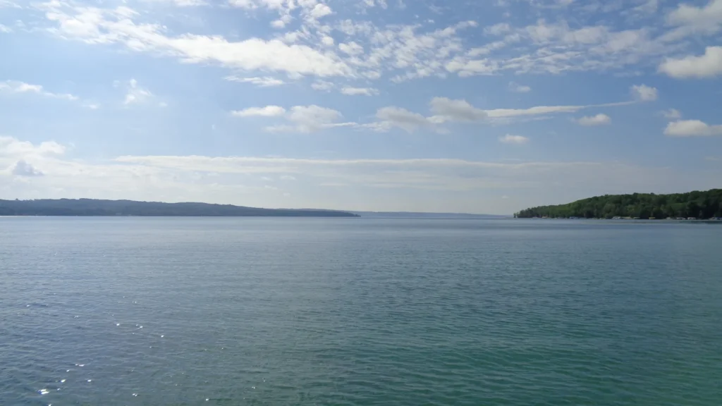
July 2019 photograph by Notorious4life, CC0 1.0, resized and converted to WebP. Editorial responsibility: Zurab Koniashvili (Z.K. Atlas); AI tools assisted in preparation.