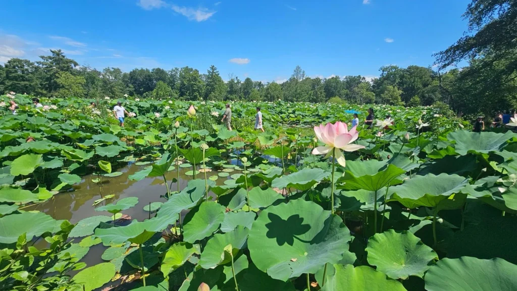
A garden pond, a beaver pond and a woodland pool that dries in summer can look very different. Understanding what makes each a pond starts with the basin and its water supply, rather than a single size limit.
A pond is a relatively small body of standing or slow-moving water, usually shallower than a lake. It can form naturally or be constructed, and it may hold water year-round or seasonally. There is no universally accepted size or depth cutoff separating every pond from every lake.
How to use this article: Start with the definition, follow the water connections, or compare origins and seasonal behavior.
1. What Counts as a Pond?
A useful definition, not a universal size limit
A pond is a relatively small body of standing or slow-moving water held in a basin. Small and shallow are useful descriptions, but neither supplies a worldwide boundary. Scientific studies, mapping systems and everyday place names do not all classify water bodies in the same way.
The U.S. Geological Survey explains that its geographic-names framework does not set official definitions separating generic terms such as lake and pond. A name on a map therefore cannot tell you the water body’s depth, origin or ecological behavior.
What about the 5-hectare definition?
A 2022 study proposed a functional definition using a maximum area of about 12.4 acres (5 hectares), maximum depth of about 16.4 feet (5 meters), and less than 30% cover by emergent vegetation, meaning plants that rise above the water surface. The National Science Foundation described this as a research-based proposal and noted that boundary cases need more study.
Those numbers are useful when discussing that particular framework. They are not a rule requiring every historically named pond to be renamed if it is larger or deeper.
2. How a Pond Gets and Loses Water
Follow the water into and out of the basin
The basin is the hollow holding the water. Its watershed is the surrounding land that drains toward it. Water can arrive as rain on the surface, runoff from nearby slopes, stream inflow, or groundwater emerging through springs and seeps. A pond may rely heavily on one source or combine several.
Water leaves through evaporation, seepage into the ground, a surface outlet or human withdrawal. Not every pond has a visible inlet or outlet, and groundwater can supply a pond in one location while water seeps out elsewhere.
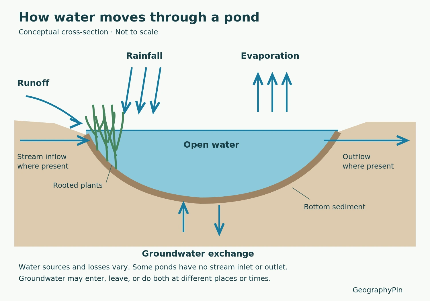
Change in stored water = water entering − water leaving. When inputs exceed losses, the level rises; when losses dominate, it falls. This simple balance explains why a runoff-fed pond can shrink during dry weather even when its banks and basin remain intact.
The surrounding land is part of the explanation
Runoff can carry sediment, nutrients and pollutants as well as water. That is why two nearby ponds can look very different: their water supplies, soils and land uses differ. A photograph of the water alone leaves out much of the system.
3. Natural, Constructed and Seasonal Ponds
Origin and permanence are separate questions
One label rarely describes everything. A natural pond can be seasonal, and a constructed pond can hold water throughout the year. Classify the origin first, then ask how long water remains.
| Description | What it tells you | Example |
|---|---|---|
| Natural basin | How the hollow developed | A depression left after buried glacial ice melted |
| Naturally dammed | What holds back the water | A pond upstream of a beaver dam |
| Constructed | People created or enclosed the basin | A farm pond or garden pond |
| Seasonal | Water is present for only part of the year | A vernal pool that dries during summer |
| Permanent | Water normally persists year-round | A pond with a sustained water supply |
Natural pond basins can result from glacial processes or the dissolution of soluble bedrock. Beaver dams create another route by backing water into a stream valley. People also create ponds by excavation or impoundment. “Permanent” describes the usual water regime, not a promise that drought can never empty the basin.
Volcanic debris can also dam a river. Taishō Pond in Kamikochi, Japan formed after Yakedake’s 1915 eruption blocked the Azusa River, showing how a naturally formed pond can later become a managed water body.
Some constructed ponds manage stormwater. The retention pond versus detention pond comparison explains permanent pools, temporary storage and the different names used for these facilities.
Dry ground can still be a seasonal pond habitat
Vernal pools illustrate why a dry-season visit can be misleading. These shallow seasonal wetlands fill during wetter periods and may dry completely later in the year. EPA describes pools that can fill and dry several times in one season, or fail to fill during drought.
The dry phase is part of the habitat, not necessarily evidence that it is damaged. Some plants and animals survive it as seeds, eggs or cysts, resuming their life cycles when water returns.
4. Read the Shore, Water and Bottom Together
A simple cross-section is more helpful than imagining a pond as a blue surface. It separates three connected parts:
- The shallow margin: where the bank meets the water and rooted or emergent plants may grow.
- The water column: the water between the surface and bottom, including any open water beyond the plants.
- The bottom: sediment and other material beneath the water, where some plants root and organic material accumulates.
These are not fixed-width rings. In a clear, shallow pond, light may reach much of the bottom; in muddy or densely shaded water, plant growth can be restricted even at modest depths. Do not assume every pond is uniformly lit, fully mixed or carpeted with aquatic plants.
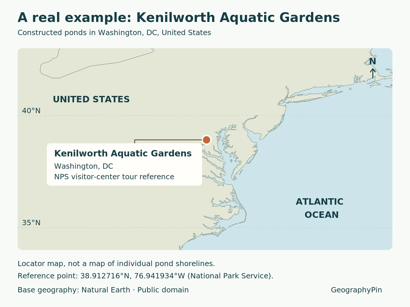
For a real constructed example, Kenilworth Park & Aquatic Gardens in Washington, D.C., has ponds enclosed by earthen dykes within an existing wetland. The National Park Service describes pipes connecting them to one another and the surrounding wetland. Their planted edges and open water belong to a connected, managed system, not a set of sealed bowls.
5. How Is a Pond Different from a Lake?
In ordinary usage, ponds are usually smaller and shallower than lakes. That helps describe the typical case, but size alone does not settle every example. Water clarity, depth, plant cover and the classification being used all matter.
The common classroom explanation that sunlight reaches a pond’s entire bottom is a useful picture of a shallow, clear pond, not a universal test. A muddy pond can have little light at depth, while a clear lake can support plants in its shallows.
Use the lake definition and water-body comparison for the broader distinctions among lakes, ponds, reservoirs and wetlands. Here, the key question is how a small basin holds water and connects with the land around it.
Frequently Asked Questions
Does a pond have to contain fish?
No. Fish are not part of the definition. Some seasonal ponds are important breeding habitat for frogs and salamanders without supporting a permanent fish population.
Are lily ponds and duck ponds different geographic types?
These everyday names emphasize a plant, an animal or a use. They do not, by themselves, tell you whether the pond is natural, constructed, seasonal or connected to a stream.
What Did We Learn Today?
A pond is best understood as a basin connected to a water supply and surrounding land. Its origin, seasonal behavior and physical parts explain more than its name alone. Small and shallow describe the usual pond, but any precise boundary with lakes must be tied to a stated classification.
Sources & Data Notes
The definition here is geographic and educational, not a legal test. The area, depth and vegetation thresholds belong to a 2022 research proposal summarized by NSF; they are not presented as a worldwide standard. Unit conversions are rounded. Seasonal-pool examples follow U.S. agency descriptions, and their timing is not assumed to apply to every climate.
- USGS: geographic names and the lake–pond distinction
- National Science Foundation: the 2022 proposed functional pond definition
- USGS Water Science School: basins and water balance
- Penn State Extension: pond watersheds, water sources and sediment
- National Park Service: natural processes that form ponds and wetlands
- EPA: seasonal vernal pools and their habitats
- Missouri Department of Conservation: ponds, plants and water-body characteristics
- National Park Service: Kenilworth pond connections
Visual credits: Featured photo: NPS / Christal Tongish, Kenilworth Aquatic Gardens. Public domain; no claim to original U.S. Government works. NPS reuse terms. Original conceptual diagram: GeographyPin, based on the USGS water-balance explanation. Locator: GeographyPin using Natural Earth public-domain geography and the NPS visitor-center tour reference coordinates. The locator does not depict individual pond shorelines.