On September 4, 2026, the UN General Assembly adopted the “Correct the Map” text by 164 votes to one, with six abstentions. It encourages Equal Earth and other equal-area projections when comparative landmass size matters, but it neither bans Mercator nor creates a compulsory official UN world map.
- Decision-making body: United Nations General Assembly
- Vote date: September 4, 2026
- Adopted draft symbol: A/80/L.104
- Final resolution symbol: A/RES/80/307
- Vote: 164 in favor, 1 against, 6 abstentions
- Lead sponsor: Togo, on behalf of the African Group
- Legal effect: Non-binding
- Recommended approach: Equal Earth and other equal-area projections where comparative landmass size matters
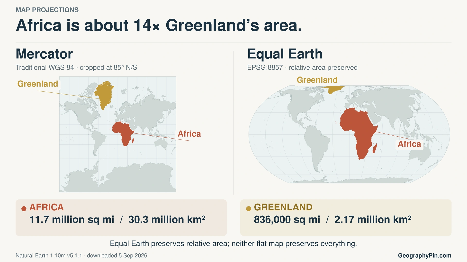
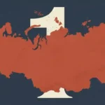
How to read the comparison: Compare Africa with Greenland within each panel. The two projections are fitted independently to their panels, so panel dimensions are not a common measurement scale. Mercator is cropped at 85° north and south because it cannot show the poles.
How to use this article: Go straight to what the resolution changes, the 14-to-1 calculation, the projection comparison, or the national explanations of vote.
What the UN did—and did not—do
The Assembly adopted a policy text, not a single world-map image. Paragraph 3 of the adopted draft calls Equal Earth “a relevant option,” while paragraph 5 encourages Equal Earth and equal-area projection methods where comparative landmass size matters. That wording leaves room for other projections and other map purposes.
The resolution’s actual scope
- It endorses wider, purpose-appropriate use of equal-area world maps.
- It identifies Equal Earth as one relevant option, not the only acceptable projection.
- It does not establish Equal Earth as the sole official UN projection.
- It does not prohibit or abolish Mercator.
- It does not compel countries, schools, publishers or technology companies to switch.
- It does not alter sovereignty, territorial status, border delimitation or the legal status of any territory.
- It does not endorse the political maps published on equal-earth.com.
Projection mathematics and boundary data are separate. Applying Equal Earth equations to a map with disputed or inaccurate borders does not make those borders UN-approved.
A/80/L.104 and A/RES/80/307 are different symbols
A/80/L.104 identifies the draft that the Assembly adopted. The UN Digital Library voting record lists A/RES/80/307 as the final resolution symbol. These identify different stages of the same decision: the draft put to a vote and the resulting resolution.
The UN did not have one projection to replace
The UN Geospatial FAQ, checked the day after the vote, said the Secretariat prescribes no single projection. It listed Robinson, Winkel Tripel and Eckert IV among projections commonly used for world maps, with other choices for regional, national and operational work. The resolution does not instantly redraw those maps or redesign the UN emblem.
Why Mercator changes apparent area
A globe is curved; a screen, wall map or printed page is flat. Moving the entire surface of Earth onto a flat rectangle must change area, shape, distance, direction or some combination of them. No flat world projection preserves every property, so a projection should be judged against the job the map is meant to do.
What Mercator preserves
Gerardus Mercator introduced his cylindrical projection in 1569. It is conformal: local angles and the shapes of very small features are preserved. Courses of constant compass bearing, called rhumb lines, appear straight. Those properties made it valuable for marine navigation, as ArcGIS’s Mercator documentation explains.
The trade-off is scale. On a world map, Mercator scale grows rapidly with latitude and tends toward infinity at the poles, which cannot be displayed. Greenland, northern Canada, Russia and northern Europe therefore appear disproportionately large compared with equatorial regions.
With Mercator’s standard equatorial scale, Africa is not shrunk below that scale. The projection enlarges places away from the equator, including northern and southern parts of Africa, but it enlarges high-latitude Greenland much more. Africa consequently looks too small in the comparison.
Is Mercator wrong?
No. It is poorly suited to comparing continental areas across the whole world, but useful for constant-bearing navigation and some regional maps. Its related Web Mercator implementation also serves many digital maps. A projection can be appropriate for one task and misleading for another without being inherently wrong.
Traditional Mercator is not Web Mercator
Web Mercator, commonly identified as EPSG:3857, uses spherical projection equations and appears in many tiled maps that users can pan and zoom. It is related to, but not identical with, ellipsoidal Mercator. Typical global tile coverage stops near 85.06° north and south, and its world view has the same high-latitude area problem. Not every interactive map uses this implementation, and the resolution does not require street maps to switch to Equal Earth.
What “Africa’s true size” means
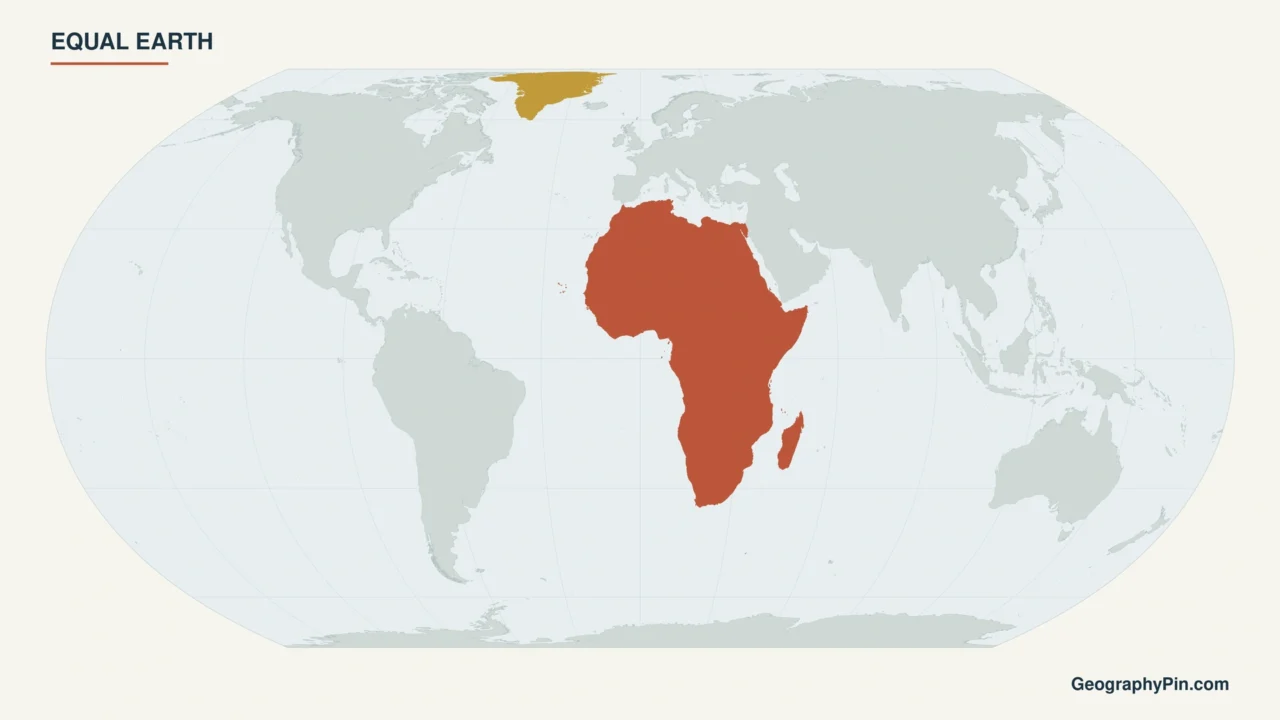
Equal Earth is an equal-area world projection created by Bojan Šavrič, Tom Patterson and Bernhard Jenny and introduced in 2018. It is pseudocylindrical: latitude lines are straight and parallel, while most longitude lines curve. Its appearance was inspired by Robinson, but unlike Robinson it preserves proportional surface area.
That makes Equal Earth well suited to thematic and general world maps where geographic area matters. It does not make the flat map distortion-free: country shapes, angles, directions and distances still change.
Africa is about 14 times Greenland’s area
For a like-for-like comparison, the figures below use the 2017 total-surface-area entries published in the UN Statistical Yearbook’s 2020 edition. These are reference figures, not new measurements made for the UN vote.
| Region | Approx. square miles | Approx. square kilometers | Relative area |
|---|---|---|---|
| Africa | 11.7 million | 30.3 million | About 14× Greenland |
| Greenland | 836,000 | 2.17 million | 1 |
The source table reports area in thousands of square kilometers: 30,311 for Africa and 2,166 for Greenland. Dividing 30,311 by 2,166 gives approximately 13.994, or about 14 to one. The source figures are already rounded; the simpler labels above are rounded further. The ratio comes from statistics, not map pixels.
Total surface area includes land and inland water. Africa’s UN regional aggregate includes island countries and areas assigned to Africa, rather than the mainland alone; it does not include surrounding seas. Greenland’s figure includes its ice-covered land, not just its ice-free portion. These statistical totals are not measurements of the generalized coastlines used in the illustration.
In this precise sense, Equal Earth shows Africa’s “true size”: Africa occupies the correct area proportion relative to Greenland and other regions. It does not show Africa’s shape, width, height, distances or directions without distortion.
That distinction also matters when readers view continents ranked by land area or compare countries by measured area. Statistical area should come from a consistent dataset, not from apparent size on a wall map.
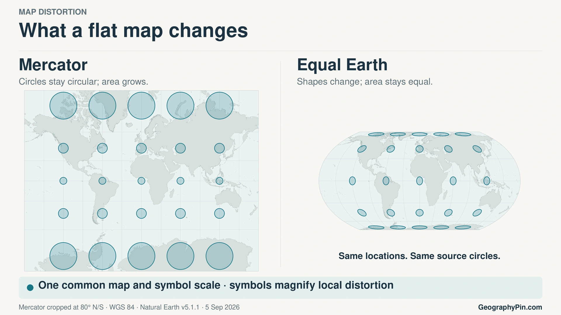
Mercator, Equal Earth, Gall–Peters and Robinson compared
No row in this table is a universal winner. The useful question is which geographic property a particular map needs to preserve.
Fast projection comparison
| Projection | Class | Preserves | Distorts | Most appropriate use |
|---|---|---|---|---|
| Mercator | Conformal cylindrical | Local angles and small shapes; rhumb lines are straight | Area and distance increasingly toward the poles | Constant-bearing navigation and some regional maps |
| Equal Earth | Equal-area pseudocylindrical | Relative surface area | Shape, angles, direction and distance | Thematic and general world maps where area matters |
| Gall–Peters | Cylindrical equal-area | Relative surface area | Shape, angles, direction and distance; strong stretching | Rectangular equal-area thematic comparison |
| Robinson | Compromise pseudocylindrical; not equal-area | Neither relative area nor local angles consistently | Area, shape, angles, direction and distance in moderated ways | Visually balanced general-reference world maps |
Table downloads (2)
- Africa and Greenland: rounded total surface areas, UN 2017 reference figures (3 × 4)View tableDownload CSV
- What four widely discussed world-map projections preserve and distort (5 × 5)View tableDownload CSV
Why Equal Earth may be preferred to Gall–Peters
Equal Earth and Gall–Peters both preserve relative area. Equal Earth’s creators designed it with more familiar, Robinson-like continental outlines, avoiding some of Gall–Peters’ pronounced stretching. That can make Equal Earth easier to read as a general world map without giving up area equivalence.
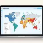
Test the projections: Use GeographyPin’s World Map Maker to try the Equal Earth projection. Choose “Equal Earth” from the projection selector, then compare it with Mercator and Robinson using the same highlighted countries.
How the initiative reached the United Nations
- August 2018: Šavrič, Patterson and Jenny introduced Equal Earth in a paper published online; the paper later appeared in a 2019 journal issue.
- April 7, 2025: Africa No Filter and Speak Up Africa publicly launched the Correct the Map campaign.
- February 14–15, 2026: The African Union Assembly formally backed Equal Earth in decision Assembly/AU/Dec.959(XXXIX) at its summit.
- 2026: Togo advanced the proposal at the United Nations and introduced the draft on behalf of the Group of African States.
- September 4, 2026: The General Assembly adopted the text, now recorded as resolution A/RES/80/307.
Why supporters want the change
The campaign organizers and African Union connect Africa’s apparent size on maps to its perceived global importance and to colonial legacies. The resolution also frames better representation in terms of cognitive justice. These are educational and representational arguments: the projection mathematics establishes the area distortion, but cannot by itself prove how a particular map changes people’s attitudes or opportunities.
Mercator’s established original purpose was navigation. Campaign criticism of its later cultural role is not evidence that the projection was invented as colonial propaganda.
Why the vote was not unanimous
The official roll call records the United States as the sole opposing vote. Estonia, Georgia, Lithuania, the Republic of Moldova, Serbia and Ukraine abstained.
What national statements said
The explanations recorded in the General Assembly’s 114th plenary meeting distinguish objections to the political framing from objections to third-party map content.
- United States: Its representative described the resolution as an inappropriate use of General Assembly attention and objected to what the United States viewed as a broader ideological agenda connected by proponents to reparations and cognitive justice.
- Ukraine: Ukraine supported scientifically accurate area representation but objected to political-boundary depictions associated with third-party Equal Earth maps, particularly their treatment of Ukrainian territory occupied by Russia. Its concern was map content, not equal-area mathematics.
- Serbia: Serbia supported the central cartographic objective but said political maps associated with Equal Earth were inconsistent with international law and UN standards. Its statement did not identify a particular territory.
- Other abstentions: Estonia, Georgia, Lithuania and the Republic of Moldova did not give individual explanations in the meeting. Their votes alone do not establish that they shared Ukraine’s or Serbia’s reasoning.
The EU’s separate explanation supported accurate area comparisons but stressed that the resolution neither changes borders nor endorses the political maps on equal-earth.com. Projection choice does not replace the UN’s existing boundary policies.
What could change after the vote
The resolution can add political weight to choices that mapmakers, educators and institutions already make. Plausible voluntary changes include:
- more equal-area maps in classrooms, publications and public communication;
- greater scrutiny of default projections in institutional and technology products;
- clearer projection labels and explanations of what each map preserves;
- voluntary adoption by governments, international organizations and publishers.
None of those outcomes happens automatically. The resolution supplies no universal enforcement mechanism, compulsory deadline or requirement for a particular company or school system. It invites dialogue with technology platforms and asks the Secretary-General to report implementation information through the eighty-third session, but it does not order a global software change.
Nor will every existing UN map be redrawn at once. The Secretariat already uses several projections according to purpose. A change by a particular institution, school system or company would require a separate decision; the General Assembly vote is not evidence that such a change has already happened.
Frequently Asked Questions
Did the UN adopt a new official world map?
No. It adopted a non-binding resolution encouraging Equal Earth and other equal-area methods where relative landmass size matters. The UN Secretariat has historically prescribed no single projection.
Is Equal Earth now mandatory?
No. The resolution encourages use; it does not impose a legal requirement, enforcement system or deadline.
Did the UN ban the Mercator projection?
No. The adopted text leaves Mercator available for navigation and other purposes for which its angle-preserving properties are useful.
Why does Africa look small on Mercator maps?
Mercator scale increases sharply with latitude. Greenland and other high-latitude regions are enlarged far more than Africa, making Africa look too small relative to them.
Is Africa really 14 times larger than Greenland?
Yes—about 14 times as large in area. Dividing the matched UN surface-area figures gives approximately 13.994 to one, not an exact 14-to-1 ratio.
Does Equal Earth show the completely accurate shape of every country?
No. It preserves relative area, but shapes, angles, distances and directions remain distorted.
Is Equal Earth better than Mercator?
For comparing land area on a world map, yes. For constant-bearing navigation or some tiled web-map uses, Mercator or Web Mercator may be more appropriate. “Better” depends on purpose.
Who voted against the resolution?
The United States cast the only opposing vote. Six states—Estonia, Georgia, Lithuania, the Republic of Moldova, Serbia and Ukraine—abstained.
Will Google Maps or school maps change?
The resolution does not require either to change. A school, publisher or technology company may choose to use more equal-area maps, but the vote itself is not an announcement of a Google Maps change or a worldwide school-map replacement.
Where can I try the Equal Earth projection?
Use the GeographyPin World Map Maker linked above and choose “Equal Earth” from its projection selector. Compare the same highlighted places under another projection to see the trade-off.
What Did We Learn Today?
The UN General Assembly backed equal-area maps for appropriate uses without banning Mercator or imposing one world map. Equal Earth preserves Africa’s roughly 14-to-1 area proportion relative to Greenland, but still distorts shapes, distances and other properties. Measured area, projection choice and political boundaries answer different questions; a useful map makes those distinctions clear.
Sources & Data Notes
The September 4, 2026 decision and its final symbol, A/RES/80/307, were checked against UN records on September 5; the text was consulted in adopted draft A/80/L.104. Official records establish the vote and scope, while campaign sources document advocacy and its timeline. Projection properties are stable technical facts. Area labels use the same 2017 total-surface-area column in the UN Statistical Yearbook’s 2020 edition, including inland water and the island areas in its regional grouping. Source values are rounded to thousands of square kilometers; 30,311 ÷ 2,166 ≈ 13.994. The illustration’s Natural Earth coastlines are generalized, public-domain data, not the source of that calculation.
- UN Digital Library voting record for A/RES/80/307, adopted draft A/80/L.104, and General Assembly 114th plenary meeting video
- UN Geospatial: Frequently asked questions about projections
- EU explanation of vote on “Correct the Map”
- United States explanation of vote on the resolution and Ukraine explanation of vote on A/80/L.104
- African Union Assembly decisions from the thirty-ninth ordinary session
- Africa No Filter: Correct the Map campaign launch and Speak Up Africa campaign page
- Šavrič, Patterson and Jenny: “The Equal Earth Map Projection”, ArcGIS Pro: Equal Earth projection properties, and EPSG:8857 — WGS 84 / Equal Earth Greenwich
- USGS: How different map projections are used and PROJ: Web Mercator documentation
- Natural Earth 1:10m land data and Natural Earth terms of use
- UN Statistical Yearbook, sixty-third issue: population, surface area and density, UNSD total-surface-area methodology, and Nordic Co-operation: facts about Greenland’s total area