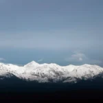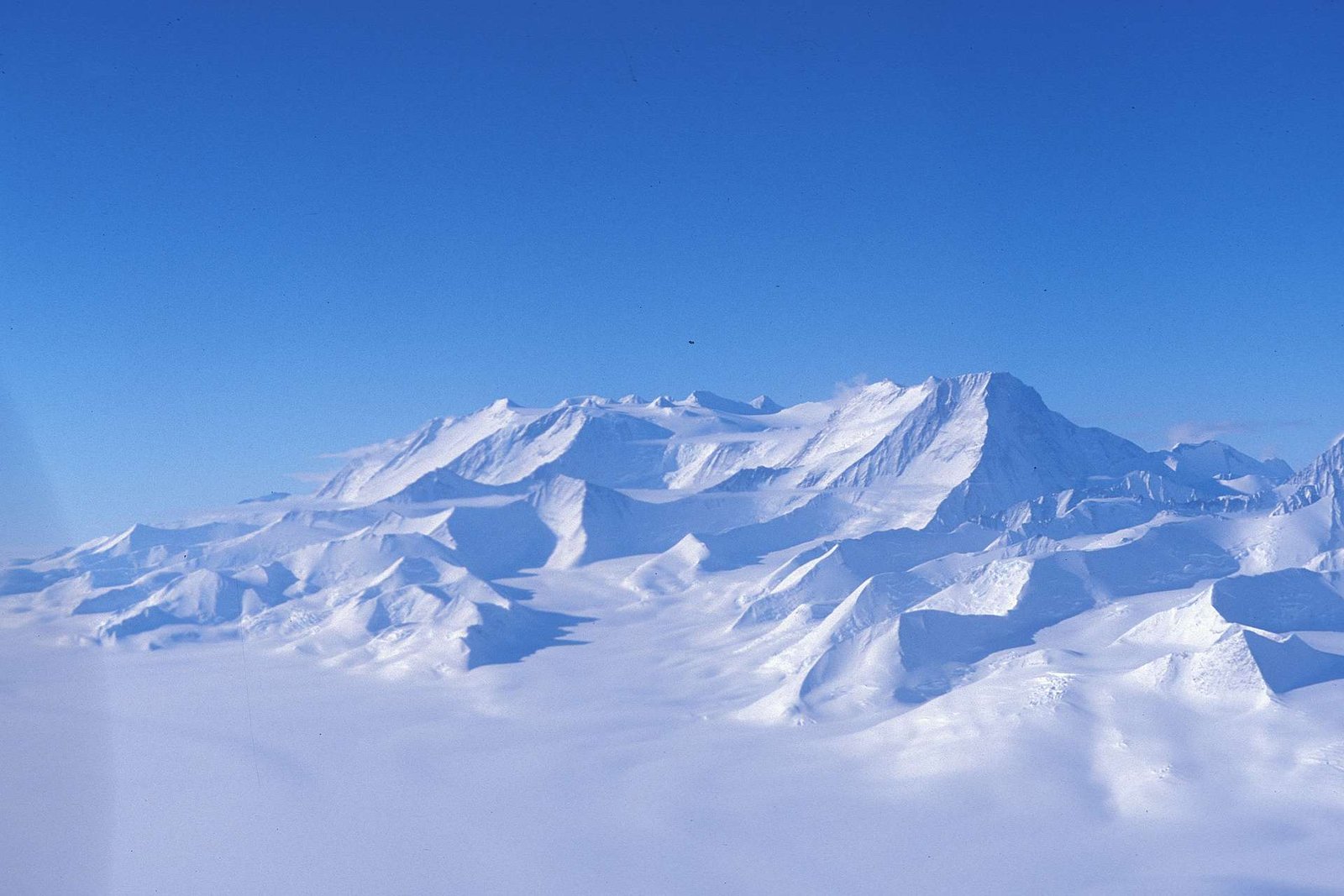
Mount Vinson is Antarctica’s highest mountain, reaching 16,050 feet (4,892 meters) above sea level. It stands in the Vinson Massif of the Sentinel Range, part of the Ellsworth Mountains in West Antarctica, roughly 790 miles (1,275 kilometers) from the Geographic South Pole, and belongs to the Seven Summits.
How to use this article: Check the essential facts, place it among nearby features, separate the summit from the massif, or follow the standard climbing route.
Where Is Mount Vinson? Antarctica’s High Point in Context
Mount Vinson crowns the southern part of the Sentinel Range within the Ellsworth Mountains of West Antarctica. The massif rises west of the Ronne Ice Shelf in the interior of Antarctica, far from any city, road, seaport, or permanent settlement.
The SCAR Composite Gazetteer places the summit at approximately 78°31′31″S, 85°37′02″W. Measuring north from 90°S gives a straight-line distance of about 790 miles (1,275 kilometers) to the Geographic South Pole; general references often round this more broadly to about 750 miles (1,200 kilometers).
Map Context & Nearby Features
The Sentinel Range forms the northern division of the Ellsworth Mountains; the Heritage Range lies to the south, beyond Minnesota Glacier. Around Vinson, the high plateau includes Mount Shinn, Hollister Peak, Branscomb Peak, and several other summits, while Roché and Jacobsen glaciers drain toward Branscomb Glacier.
Union Glacier Camp, in the southern Ellsworth Mountains, serves as the main aviation and logistics hub for private expeditions. Ski-equipped aircraft carry climbers from Union Glacier to the seasonal Vinson Base Camp on Branscomb Glacier. The absence of roads means every person, tent, fuel load, and piece of emergency equipment must arrive by air.
Mount Vinson at a Glance
| Metric | Value |
|---|---|
| Elevation | 16,050 ft (4,892 m) |
| Topographic prominence | About 16,050 ft (4,892 m) |
| Topographic isolation | About 3,051 mi (4,911 km) |
| Coordinates | 78°31′31″S, 85°37′02″W |
| Approximate distance from Geographic South Pole | About 790 mi (1,275 km) |
| Mountain range | Sentinel Range, Ellsworth Mountains |
| First summit party | December 18, 1966, during the Nicholas Clinch-led American expedition |
Elevation, coordinates, and official feature naming follow the SCAR Composite Gazetteer and U.S. Antarctic names record. Prominence and isolation are mountaineering dataset values; the pole distance is a rounded calculation from the listed latitude.
For a concise general reference, see National Geographic’s Mount Vinson overview.
Landscape & Geology of the Vinson Massif
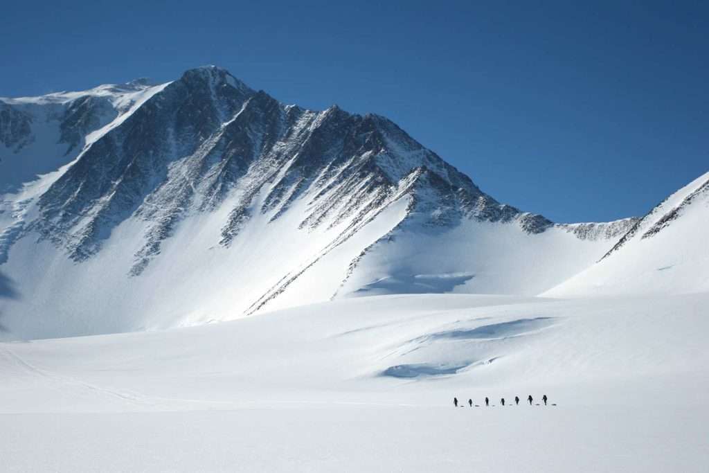
Mount Vinson rises from the ice-covered Vinson Plateau. The plateau extends about 5.6 miles (9 kilometers) from north to south and is about 2.8 miles (4.5 kilometers) wide, with much of its surface between roughly 13,100 and 15,100 feet (4,000 and 4,600 meters). Several high summits rise above that surface, but Mount Vinson is the highest.
The Sentinel Range is built largely from resistant rocks of the Crashsite Group. It is dominated by hard, quartz-rich sandstone commonly described as Crashsite quartzite, alongside argillite and other sedimentary beds. These layers were folded and tilted during later tectonic deformation, and the resistant bedrock helps the range retain steep ridges and large rock faces despite prolonged glacial erosion.
How Old Are Vinson’s Rocks?
The Crashsite Group records deposition from the Late Cambrian through the Devonian, spanning several hundred million years of Paleozoic time. Geological studies interpret much of the sequence as shallow-marine sand and finer sediment laid down along an ancient continental margin before later mountain-building deformed it.
Mount Vinson is therefore not a volcano. It is a summit cut from folded sedimentary rock, dominated by quartzite. A USGS survey of Vinson and neighboring peaks also explains why the resistant Crashsite quartzite is so important to the range’s form.
Climbing Mount Vinson: Route, Season & Logistics
Most expeditions begin in Punta Arenas, Chile, with an intercontinental flight to Union Glacier. From there, a ski aircraft carries climbers to Vinson Base Camp on Branscomb Glacier. The commercial climbing season generally runs from late November through January, when the interior has continuous daylight, but flight and climbing schedules remain dependent on weather.
Antarctic Logistics & Expeditions currently publishes a 12-day core itinerary, although delays can extend the trip. Its Vinson Base Camp information describes the seasonal camp, communications, waste handling, and field support available at the start of the route.
Standard Branscomb Shoulder Route
The normal route is commonly divided into three major stages. Exact tracks, camp positions, and day plans may change with snow, crevasses, wind, and operator decisions.
- Base Camp to Low Camp: Rope teams travel up Branscomb Glacier, usually pulling sleds and managing crevasse exposure. Low Camp is near 9,000 feet (2,750 meters).
- Low Camp to High Camp: Climbers gain about 3,281 feet (1,000 meters), use fixed ropes on snow slopes reaching roughly 45°, and continue to High Camp near 12,400 feet (3,780 meters).
- High Camp to the summit: Summit day gains about 3,650 feet (1,110 meters) across cold, exposed terrain before the team returns to High Camp.
How Difficult Is the Normal Route?
The standard route is not usually described as highly technical by expedition-mountaineering standards, but it is not a trek. Climbers need strong fitness, cold-weather systems, roped glacier travel, crampon and fixed-line competence, crevasse awareness, and the ability to carry a heavy backpack for several hours.
Altitude is lower than on Everest, Denali, or Aconcagua, yet cold injury, dehydration, exhaustion, and delayed evacuation remain serious concerns. Commercial operators set their own experience requirements, so an itinerary’s published difficulty label should not replace an individual skills assessment.
Weather, Safety & Environmental Rules
Interior Antarctica is extremely cold, dry, and exposed even during summer. ALE gives a seasonal range of about −12°F to 30°F (−24°C to −1°C) for Union Glacier, not for Vinson’s higher camps, and warns Vinson climbers to be prepared for temperatures around −40°F (−40°C) and severe storms higher on the mountain.
Why Clear Weather Can Still Be Dangerous
Continuous summer sunlight does not guarantee warmth. Wind can rapidly increase heat loss, exposed skin can freeze, and the cold dry air encourages dehydration. Crevasses, hard snow, icy fixed-line sections, whiteout conditions, and weather-dependent aircraft access add risks that may persist even when the route is technically straightforward.
Safe decisions depend on conservative turnaround times, layered clothing, protected hands and face, reliable communication, and enough schedule flexibility to wait at camp rather than force a summit attempt.
What Environmental Rules Apply?
Antarctic travel operates under national authorizations that implement the Protocol on Environmental Protection to the Antarctic Treaty. Expedition organizers, rather than individual visitors, normally arrange the required advance notification and environmental assessment; each visitor must then follow the authorized plan and field instructions.
- Carry out litter, equipment, and solid human waste according to the expedition’s waste plan.
- Clean clothing and equipment to reduce the risk of introducing non-native material.
- Do not collect rocks, fossils, biological material, or historic objects as souvenirs.
- Do not interfere with scientific equipment, field camps, markers, or protected sites.
ALE’s Vinson procedures require trash and solid human waste to be carried back to Base Camp and removed from Antarctica. IAATO visitor guidance adds practical biosecurity and conduct standards for member-operated travel; it supports the treaty framework but is not itself the treaty law.
History, Naming & Exploration
Lincoln Ellsworth sighted the mountain range during his 1935 trans-Antarctic flight and called its peaks the Sentinel Mountains. U.S. Navy reconnaissance flights photographed the high southern peaks in 1958, helping identify the massif that would later be recognized as the continent’s highest mountain block.
In 1961, the U.S. Advisory Committee on Antarctic Names named Vinson Massif for Carl G. Vinson, a longtime U.S. congressman from Georgia who supported American Antarctic exploration.
The First Ascent in 1966
The American Antarctic Mountaineering Expedition was led by Nicholas Clinch. Pete Schoening, John Evans, Barry Corbet, and Bill Long formed the first party to reach the summit on December 18, 1966. The expedition’s six other members followed in two groups on December 19 and 20, so all ten climbers stood on the summit within three consecutive days.
That sequence, recorded in the American Alpine Journal expedition account, is more precise than saying only that a Clinch-led team made the first ascent.
Mount Vinson or Vinson Massif?
Mount Vinson is the single highest summit. Vinson Massif is the larger mountain block containing that summit, the Vinson Plateau, and neighboring peaks. In 2006, US-ACAN formally approved Mount Vinson as the summit’s name in association with the already named massif.
A GPS survey in 2004 measured the summit at 16,050 feet (4,892 meters), and the result was published by the USGS in 2007. This replaced older estimates above 16,800 feet (5,100 meters) and explains why historical expedition reports use a higher elevation.
How Vinson Compares to the Seven Summits
Mount Vinson represents Antarctica in the Seven Summits challenge, which assigns one high point to each continent in a seven-continent model. Vinson appears in both major versions of the list; the disagreement concerns whether Australia/Oceania is represented by Mount Kosciuszko or Puncak Jaya.
By elevation, Vinson is the sixth-highest of the seven in either version. Its normal route does not reach the extreme altitude of Everest, but its remoteness, polar cold, glaciated terrain, fixed ropes, limited evacuation options, and dependence on specialist aircraft make it a serious expedition.
Why Vinson Feels Harder Than Its Elevation Suggests
| Factor | Mount Vinson | Comparison takeaway |
|---|---|---|
| Elevation | 16,050 ft (4,892 m) | Lower than five Seven Summits; higher only than Puncak Jaya or Kosciuszko, depending on the list. |
| Normal-route terrain | Glacier travel, crevasse exposure, fixed ropes, and slopes up to about 45° | Less technical than some major alpine routes, but still requires real mountaineering skills. |
| Access | Intercontinental flight, Union Glacier hub, then ski aircraft to Base Camp | Weather can delay both arrival and departure; there is no road alternative. |
| Cost | Published 2026–27 guided prices commonly exceed US$50,000 before some personal expenses | Aircraft, fuel, seasonal camps, guides, communications, and contingency support dominate the price. |
Table downloads (2)
- Key geographic and historical facts about Mount Vinson (8 × 2)View tableDownload CSV
- Vinson’s main challenges in Seven Summits context (5 × 3)View tableDownload CSV
Commercial prices and inclusions change by operator and season. A quoted expedition fee may exclude personal flights to Chile, equipment, insurance, medical checks, and weather-related contingencies.
Frequently Asked Questions
Is Mount Vinson the same as Vinson Massif?
No. Mount Vinson is the 16,050-foot (4,892-meter) summit; Vinson Massif is the larger block of mountains and plateau around it. The summit received its separate official name in 2006.
Can a beginner climb Mount Vinson?
It should not be treated as a first mountain. The normal route is not among the world’s most technical climbs, but participants need strong fitness, glacier-travel competence, fixed-line skills, cold-weather experience, and sound expedition judgment. Operator prerequisites vary.
How long does a Mount Vinson expedition take?
A commercial core itinerary is often about 12 days from the flight to Antarctica through the planned return, but a complete international trip takes longer. Weather can delay flights or hold a team at camp for days.
Is there a permanent base camp on Mount Vinson?
No permanent settlement exists at Mount Vinson. Expedition facilities are seasonal, and Vinson Base Camp operates during the austral summer climbing period with aviation, communications, and field support tied to Union Glacier.
What Did We Learn Today?
Mount Vinson is Antarctica’s 16,050-foot (4,892-meter) high point, standing on the Vinson Plateau in the Sentinel Range about 790 miles from the Geographic South Pole. The normal route combines glacier travel and fixed ropes with polar cold and aircraft-dependent logistics, while the name Mount Vinson refers specifically to the summit rather than the wider Vinson Massif.
Sources & Data Notes
Elevation, coordinates, and naming follow the SCAR Composite Gazetteer and U.S. Antarctic names record; the modern GPS elevation and resistant-quartzite description were checked against U.S. Geological Survey publications, while broader rock-age interpretation was checked against peer-reviewed Ellsworth Mountains geology. The first-ascent sequence comes from the American Alpine Journal, route and seasonal logistics from Antarctic Logistics & Expeditions, environmental requirements from the Antarctic Treaty Secretariat, and practical visitor guidance from IAATO. Prominence and isolation use Peakbagger’s dataset-derived measures, the South Pole distance is rounded from the listed coordinates, and the broad cost statement reflects current commercial operator listings whose prices can change. This article was prepared and editorially reviewed by Zurab Koniashvili (Z.K. Atlas), who completed the final factual checks and publication approval and accepts responsibility for the published version. AI tools may have assisted during the editorial process, including with language refinement and the creation or editing of visual materials.