A city name can describe a skyline, a government area or a much wider region. Sarajevo makes that distinction especially important. Its river valley gives the urban landscape a recognizable shape, while several different administrative units share the Sarajevo name. Reading the geography first makes the maps and population figures much less confusing.
Sarajevo is the capital of Bosnia and Herzegovina, in southeastern Europe. Its central urban corridor follows the Miljacka River in a mountain-framed valley. The administrative City of Sarajevo contains four municipalities within Sarajevo Canton. East Sarajevo is a separate city in Republika Srpska, not another name for the capital’s eastern neighborhoods.
Find your way around: Start with the locator, then compare the three administrative meanings, read the dated census figure, and follow the river connection beyond the city.
1. Where is Sarajevo?
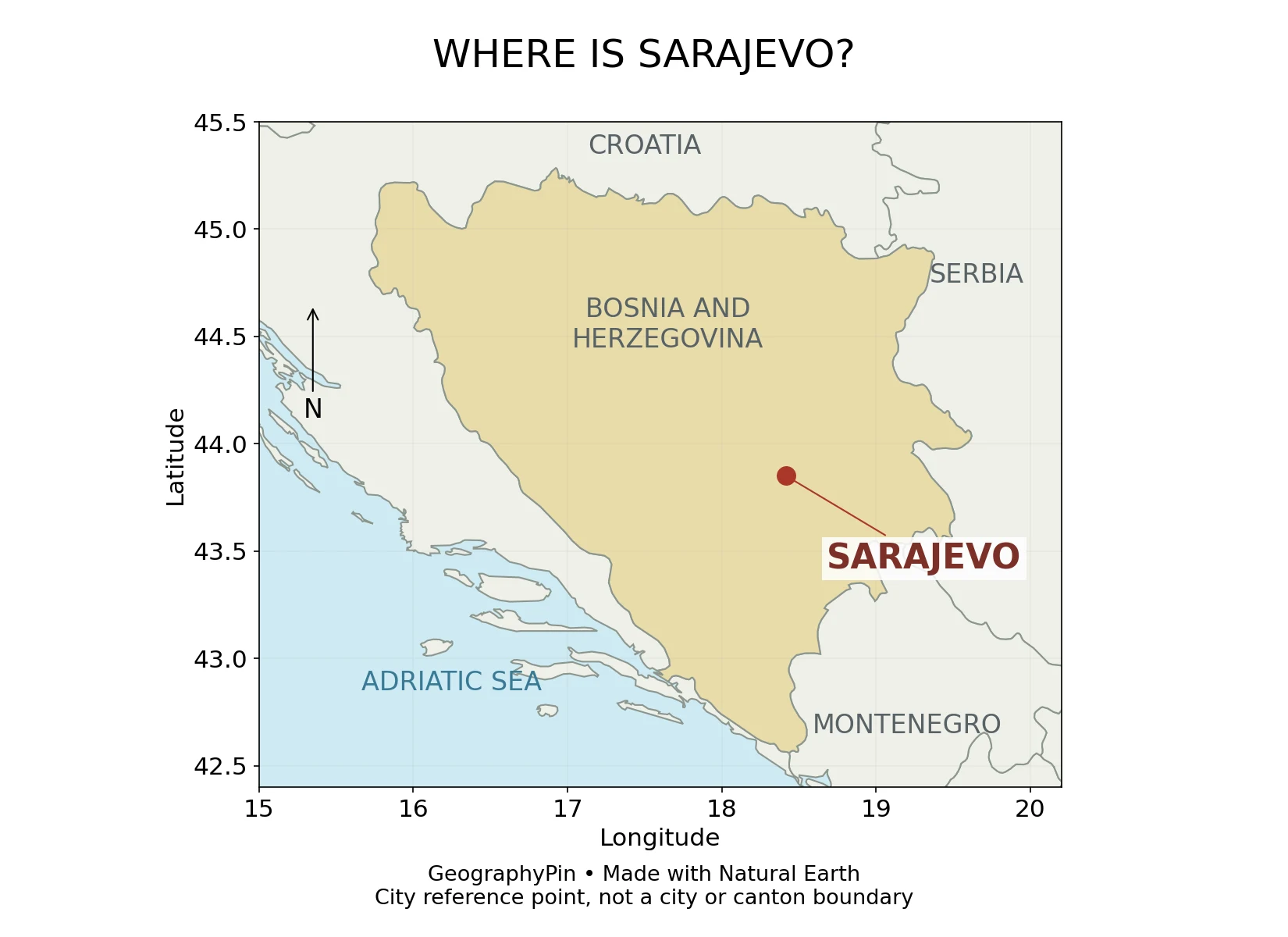
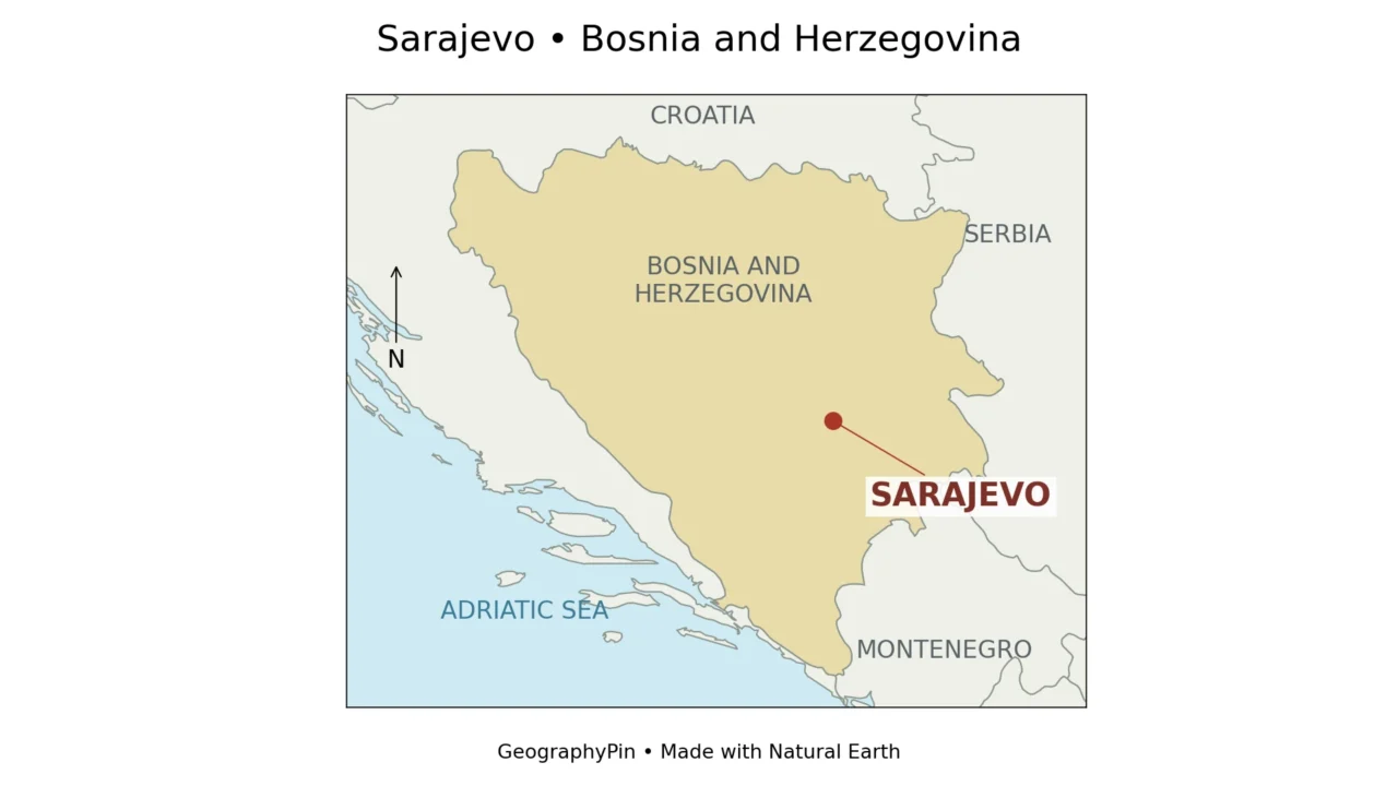
Find Bosnia and Herzegovina between Croatia, Serbia and Montenegro, then look inland for Sarajevo. The capital is not on the Adriatic coast.
The surrounding mountain landscape belongs to the broader Dinaric setting of the western Balkans. For continental context, the physical map of Europe is a useful companion.
2. A valley city in a mountain landscape
The narrow valley opens into a broader plain
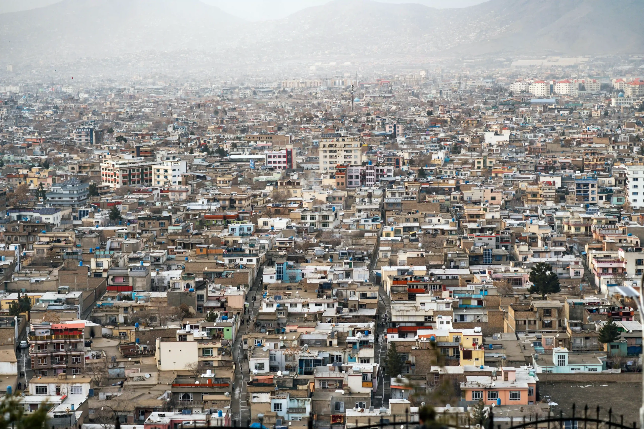
The University of Sarajevo’s geography department describes the city’s development along the Miljacka, from the narrow Bentbaša sector toward the wider Sarajevo plain. The landscape therefore is not one uniform bowl: the narrow river corridor, broader flat ground and adjoining slopes offer different amounts of space for buildings and movement.
The department places the central city at roughly 1,770–1,800 feet (540–550 m) above sea level. Higher hillside neighborhoods and lower western ground make a single elevation unsuitable for every address.
Trebević rises close to the central city; Igman, Bjelašnica and Jahorina belong to its wider mountain setting, beyond the four-municipality city.
3. Which Sarajevo: city, canton or East Sarajevo?
Three names, three different administrative meanings
The City of Sarajevo identifies its four constituent municipalities as Stari Grad, Centar, Novo Sarajevo and Novi Grad. They form a local-government city within the Federation of Bosnia and Herzegovina. The wider canton includes these four and five additional municipalities.
| Name | What it means | Common mistake to avoid |
|---|---|---|
| City of Sarajevo | A local-government unit made up of four municipalities. | Assuming it includes every settlement described informally as Sarajevo. |
| Sarajevo Canton | One of the Federation’s ten cantons, containing the city and five other municipalities. | Using its population as the population of the four-municipality city. |
| East Sarajevo / Istočno Sarajevo | A separate city in Republika Srpska, made up of six municipalities. | Treating it as simply the eastern half of the City of Sarajevo. |
| Sarajevo urban or metropolitan area | A description whose extent depends on the statistical or functional definition used. | Assuming there is one automatic boundary shared by all sources. |
The cantonal authority describes Sarajevo Canton as the city plus five neighboring municipalities. The additional municipalities are Ilidža, Hadžići, Ilijaš, Vogošća and Trnovo. They should not disappear from a regional explanation merely because they sit outside the city’s four-municipality definition.
The Republika Srpska Institute of Statistics lists East Sarajevo’s six municipalities as Istočna Ilidža, Istočni Stari Grad, Istočno Novo Sarajevo, Pale, Sokolac and Trnovo. Similar names are not identical places: Ilidža and Istočna Ilidža are different municipalities, and “Trnovo” needs its entity context.
This is a distinction between administrative units within Bosnia and Herzegovina, not a claim that they are separate countries. It is also why a photograph of continuous buildings cannot establish where an administrative boundary runs. Our guide to geographical areas and their different boundaries explains the wider principle.
4. How many people live in Sarajevo?
275,524 in the 2013 census, for the City of Sarajevo
The Federal Institute for Statistics’ final 2013 census presentation reports 275,524 residents for Grad Sarajevo, the administrative City of Sarajevo. This is a historical census result, not a current population estimate.
The boundary is as important as the number. The figure does not describe the whole canton, East Sarajevo or an independently defined metropolitan region. A larger number in another source is not necessarily wrong; it may count a larger area or refer to a different year.
Do not subtract a prewar population from this census total and call the result a population decline without first reconciling territorial coverage. Historical Sarajevo definitions changed. Likewise, a modern estimate and a census count use different reference dates and may use different methods. This profile retains the clearly identified census benchmark rather than presenting an undated number as “today.”
5. The Miljacka connects Sarajevo to a larger river system
Miljacka → Bosna → Sava → Danube → Black Sea
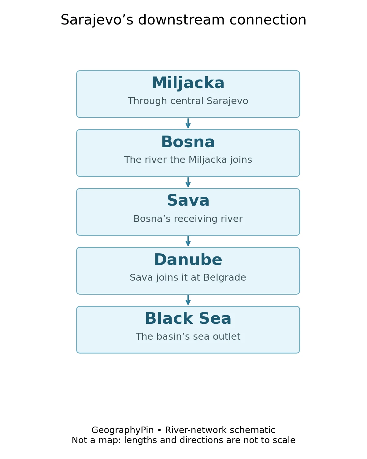
The Miljacka is the river through central Sarajevo. It is a tributary of the Bosna, which belongs to the Sava system. The Sava joins the Danube at Belgrade, and the Danube reaches the Black Sea. Sarajevo’s central river therefore belongs to a much larger international drainage network.
The International Sava River Basin Commission identifies the Miljacka among the Bosna’s right-bank tributaries. “Right bank” is determined while looking downstream, not by the right side of a page. That convention is useful whenever a map is rotated or a river bends.
Vrelo Bosne, near Ilidža, is associated with the Bosna’s springs. It is not the source of the Miljacka. Sharing a drainage system does not make the two rivers interchangeable: one joins the other, while their headwaters and courses remain distinct.
6. Why the valley matters to everyday life
Terrain can restrict air movement, but it does not create emissions
Mountain-framed valleys can experience temperature inversions, when colder air near the ground lies beneath warmer air above. Under stable conditions, vertical mixing weakens and pollutants can accumulate close to the surface. The World Bank’s air-quality work identifies this as an important issue for Sarajevo and other valley settlements.
The distinction between emissions and dispersion matters. Heating, vehicles and other activities release pollutants; terrain and weather influence how readily those pollutants disperse. “The mountains cause pollution” is therefore an incomplete explanation. A day’s actual air quality still requires current measurements, not an inference from a map.
The city also has roles that cannot be reduced to its relief. It is a national administrative and cultural center, and UNESCO designated Sarajevo a Creative City of Film in 2019. That designation concerns creative activity and urban development; it does not mean the entire city is a UNESCO World Heritage property.
Frequently Asked Questions
What country is Sarajevo in?
Sarajevo is the capital of Bosnia and Herzegovina, in southeastern Europe. It is inland, not on the Adriatic coast.
What river runs through Sarajevo?
The Miljacka flows through central Sarajevo and joins the Bosna. Through the Sava and Danube, this river system drains toward the Black Sea.
Are Sarajevo and East Sarajevo the same city?
No. The City of Sarajevo comprises four municipalities within Sarajevo Canton in the Federation of Bosnia and Herzegovina. East Sarajevo is a separate six-municipality city in Republika Srpska. Both are within Bosnia and Herzegovina.
What is Sarajevo’s population?
The final 2013 census reported 275,524 for the four-municipality City of Sarajevo. That dated census figure is not a current estimate and should not be substituted for the canton or a wider metropolitan area.
What Did We Learn Today?
Sarajevo is a mountain-valley capital whose central river connects to the Black Sea through the Bosna, Sava and Danube. Its physical urban landscape is not identical to its administrative city, its canton or neighboring East Sarajevo. Keeping location, boundary and date together makes population figures and maps easier to interpret, while separating emissions from weather explains why the valley’s air-quality challenges need more than a topographic explanation.
Sources & Data Notes
The population benchmark is the final 2013 census for Grad Sarajevo, not a 2026 estimate. No metropolitan population is inferred. The elevation range describes the central city; customary-unit equivalents are approximate and rounded.
The locator and featured map were created by GeographyPin from Natural Earth country geometry and a rounded city-center coordinate given by the University of Sarajevo. They omit municipal and entity boundaries and are not street or terrain maps. The drainage figure is an original relationship diagram, not measured river geometry or a navigation guide.
- City of Sarajevo: four constituent municipalities
- University of Sarajevo, Geography Department: physical setting and elevation
- Sarajevo Canton Ministry of Interior: territorial jurisdiction
- Visit Sarajevo: canton and city administrative information
- Republika Srpska Institute of Statistics: Cities and Municipalities 2024, page 10
- Federal Institute for Statistics: final 2013 census presentation, city chart on PDF page 6
- International Sava River Basin Commission: Sava River Basin Analysis 2009
- World Bank: air-quality improvement project appraisal, 2023
- World Bank: cleaner air in the Western Balkans
- UNESCO: 2019 Creative Cities designation
- Natural Earth: public-domain map data