On a map of southwest Florida, follow the barrier islands south from Captiva and watch the coast turn toward the mainland. That bend is Sanibel Island. It explains why a place off Florida’s west coast has long beaches that look south across the Gulf.
Sanibel bends across the mouth of the estuary
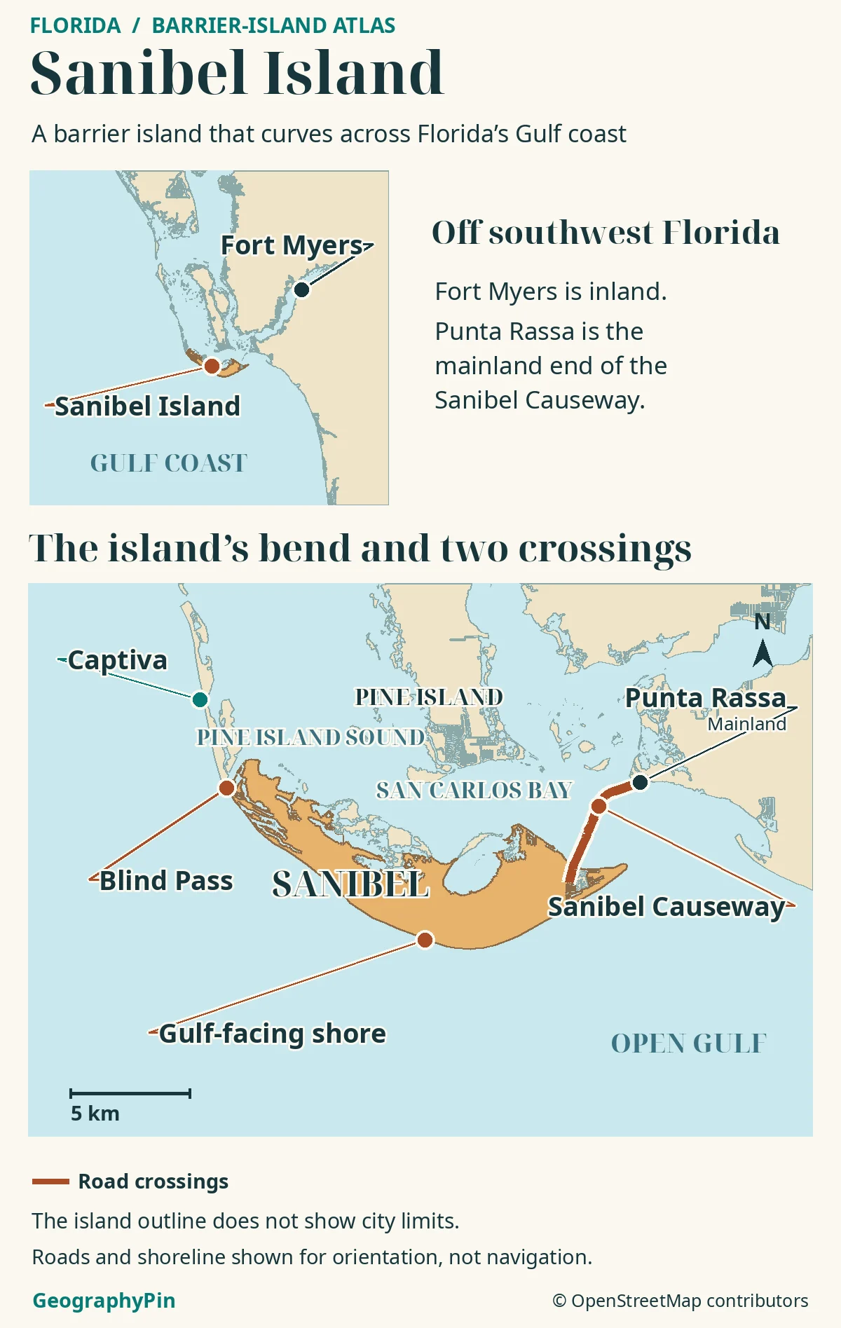
Sanibel Island is a barrier island southwest of Fort Myers, Florida.
Its curved outline puts the Gulf along its south and southwest shores and more sheltered waters behind it. The Sanibel Causeway reaches it from the mainland at Punta Rassa, and a smaller bridge crosses Blind Pass to neighboring Captiva.
How to use this article: Start with the regional map, then see why the beach faces south and locate the crossing to Captiva.
Where Sanibel sits on Florida’s Gulf coast
Sanibel forms the southern bend of the barrier chain that shelters Pine Island Sound. A barrier island is a strip of sediment that stands between open water and a quieter bay or sound. The island does not close off the whole estuary: the breaks in the chain and the wide opening around its eastern end still let water move in and out.
Find Sanibel west of Fort Myers
Fort Myers gives you the broad regional reference. Zoom in to Punta Rassa at the mainland end of the causeway, and then follow the bridges across San Carlos Bay. Fort Myers Beach is a different place, on Estero Island across the bay entrance from Sanibel’s lighthouse end. Pine Island, on the inland side of the sound, is another island entirely.
Across San Carlos Bay from Punta Rassa
San Carlos Bay lies toward the eastern end of Sanibel, between the island and the mainland approach. The causeway is the island’s principal mainland connection. Its bridges and intervening causeway islands are built crossings, not a natural continuation of Sanibel’s barrier ridge.
From the eastern tip, the lighthouse looks toward the open entrance to the bay rather than the narrow gap at Captiva. The city’s recovery plan notes that the lighthouse originally helped ships find the entrance on their way to Punta Rassa. It is a useful landmark for telling the broad bay entrance from Blind Pass, two openings at nearly opposite ends of the island.
Why Sanibel’s Gulf beaches face south
Read the shoreline from Captiva to the lighthouse
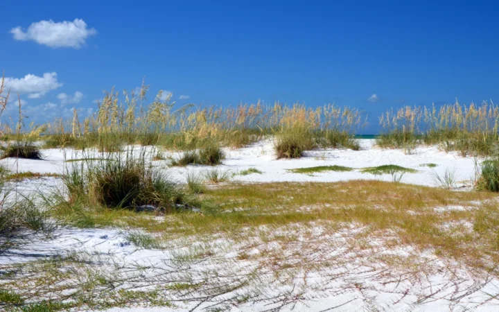
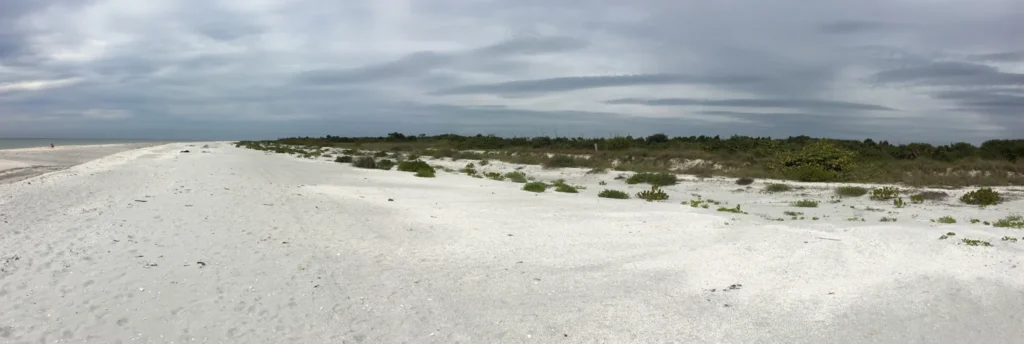
North of Blind Pass, Captiva is a relatively narrow island with much of its beach facing west. South of the pass, Sanibel’s outer coast sweeps southeast and then turns east toward the lighthouse. The middle of that arc looks out to the south or southwest. On the city’s beach map, the shore near Bowman’s Beach turns toward the southwest. Farther east at Gulfside City Beach Park (Algiers), the open water lies more nearly due south. A shoreline faces across the water from its own local edge, not in the direction of the coast of Florida as a whole.
Seismic surveys cited by the Florida Museum’s Randell Research Center suggest that differences in the underlying bedrock helped set Sanibel’s unusual alignment. That is not the same as saying the beaches are made of exposed bedrock. Waves and currents built and reworked the sand and shell material above it, and the island retains older beach ridges inland. Those ridges record former shores as sand accumulated seaward in parts of the island.
The contrast is visible on opposite sides of the island. Bowman’s Beach stands on the outer Gulf shore; near the refuge, the inner shore has shallow water and mangroves. Both shores can change, but the one exposed to the open Gulf receives a different mix of waves and sediment from the more sheltered side.
Blind Pass between Sanibel and Captiva
The short bridge at Blind Pass
Blind Pass is the tidal inlet between the northwestern tip of Sanibel and southern Captiva. A short bridge carries the road between the two islands. That crossing is distinct from the Sanibel Causeway: the first goes from island to island, while the second connects the barrier chain with the mainland.
The inlet can show up differently on maps taken at different times. Florida’s Department of Environmental Protection documents long periods of shoaling, when sand makes the channel shallower or obstructs it, and dredging to restore tidal exchange with inland channels. So a blue gap is a useful place marker, not proof of present water depth or a navigable passage. The City of Sanibel also prohibits swimming at Blind Pass Beach Park because of dangerous currents in the inlet.
One island, different kinds of boundaries
Sanibel Island names the physical barrier, while the City of Sanibel is its municipality in Lee County. The name is not limited to a downtown or a single neighborhood. Captiva, on the other side of Blind Pass, remains a separate island and is outside Sanibel’s municipal limits.
The J.N. “Ding” Darling National Wildlife Refuge is another kind of place on the map. The U.S. Fish and Wildlife Service manages the refuge, which protects mangrove and other habitat on and around Sanibel. Its protected lands are not another name for the whole island or for the city. A coastline shows where land meets water; it cannot tell you which agency manages a beach, island road or refuge area.
Frequently Asked Questions
Why does a photograph of Sanibel’s Gulf shore sometimes show land across the water?
Check where the photographer was standing. The view near the lighthouse takes in the entrance to San Carlos Bay and can look toward Estero Island. Farther along the south-facing shore, the view opens onto the Gulf. Two photos of Sanibel need not face the same body of water.
Is the causeway visible from the Gulf beaches?
Not from all of them. The causeway approaches on the mainland-facing side near the eastern end. A beach farther along the outer curve, such as Bowman’s Beach, is on the opposite side of the island.
Is Blind Pass Beach Park the same place as Turner Beach?
They face the same inlet from opposite sides. Blind Pass Beach Park is on Sanibel’s side; Turner Beach is on the Captiva side. Use the island name with either landmark when comparing maps.
What Did We Learn Today?
Sanibel Island curves across the south end of Pine Island Sound, with south- and southwest-facing Gulf beaches and the entrance to San Carlos Bay near the lighthouse. Use the causeway to locate the mainland connection and Blind Pass to find Captiva. The shape of the barrier explains the coast, not the extent of a city or refuge.
Sources & Data Notes
Island and crossings: City of Sanibel recovery plan, Lee County’s 2025 bridge inspection, and the city’s Blind Pass information and swimming warning checked November 20, 2026.
Science and protection: Florida Museum geological interpretation, Florida DEP barrier and inlet plan (2020), and U.S. Fish and Wildlife Service refuge description.
Atlas: GeographyPin cartography with OSM land polygons and OpenStreetMap data (ODbL), accessed November 20, 2026. Cross-checked against the Florida DEP regional coastal map. It does not show legal limits, navigation, service or water depth.
Photo: Bowman’s Beach by Fredlyfish4 / Wikimedia Commons (January 2016), CC BY-SA 4.0, resized and converted to WebP under same license. AI tools assisted in preparing the article.